Podcast
Questions and Answers
Which type of map would be most useful for identifying the different types of rocks in a specific region?
Which type of map would be most useful for identifying the different types of rocks in a specific region?
- Geological map (correct)
- Street map
- Topographical map
- Political map
A map with a smaller scale shows more details, such as buildings and roads, compared to a map with a larger scale.
A map with a smaller scale shows more details, such as buildings and roads, compared to a map with a larger scale.
False (B)
Why is it important to consider the scale of a map before using it for navigation or analysis?
Why is it important to consider the scale of a map before using it for navigation or analysis?
to understand the level of detail and area represented
The proportion by which a map has been reduced is known as its ______.
The proportion by which a map has been reduced is known as its ______.
What is the purpose of a map legend?
What is the purpose of a map legend?
Match the type of map with its primary use
Match the type of map with its primary use
Which of the following best describes the use of shading on a map?
Which of the following best describes the use of shading on a map?
Give three reasons why maps are valuable tools for geographers and other professionals?
Give three reasons why maps are valuable tools for geographers and other professionals?
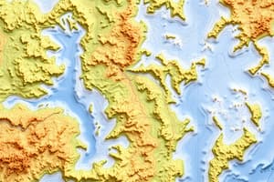
What does the proximity of contour lines on a map indicate?
What does the proximity of contour lines on a map indicate?
Vertical grid lines on a map, known as northings, increase in value as you move eastwards.
Vertical grid lines on a map, known as northings, increase in value as you move eastwards.
If a topographical map lacks a north line or compass rose, what assumption should be made to determine direction?
If a topographical map lacks a north line or compass rose, what assumption should be made to determine direction?
On a map, the four-figure grid reference is used to identify the ______ location of a feature.
On a map, the four-figure grid reference is used to identify the ______ location of a feature.
Match the colors to the typical features they represent on a map:
Match the colors to the typical features they represent on a map:
If you are standing at a location with a latitude of 45°N, which of the following is true?
If you are standing at a location with a latitude of 45°N, which of the following is true?
Longitude lines converge at the poles while latitude lines remain parallel.
Longitude lines converge at the poles while latitude lines remain parallel.
What is the significance of the Prime Meridian in measuring global locations?
What is the significance of the Prime Meridian in measuring global locations?
The Tropic of Cancer is located at approximately ______ degrees North latitude.
The Tropic of Cancer is located at approximately ______ degrees North latitude.
Match the map symbol with its typical real-world representation:
Match the map symbol with its typical real-world representation:
What type of information can be gathered from topographical maps?
What type of information can be gathered from topographical maps?
Zealandia is a small island nation in the Pacific Ocean.
Zealandia is a small island nation in the Pacific Ocean.
Which of the following best describes the relationship between latitude and longitude?
Which of the following best describes the relationship between latitude and longitude?
Flashcards
Uses of Maps
Uses of Maps
Maps provide information, aid planning, decision-making, and record landscape changes.
Types of Maps
Types of Maps
Examples include digital (Google Maps), geological (rock types), street, rainfall, topographical, and political maps.
Geological Map
Geological Map
A map showing the types of rocks in an area.
Street Map
Street Map
Signup and view all the flashcards
Topographical Map
Topographical Map
Signup and view all the flashcards
Political Map
Political Map
Signup and view all the flashcards
Map Scale
Map Scale
Signup and view all the flashcards
Large Scale Maps
Large Scale Maps
Signup and view all the flashcards
Map Symbols
Map Symbols
Signup and view all the flashcards
Height Symbol
Height Symbol
Signup and view all the flashcards
Contour Lines
Contour Lines
Signup and view all the flashcards
Four-Figure Grid Reference
Four-Figure Grid Reference
Signup and view all the flashcards
Cardinal Points
Cardinal Points
Signup and view all the flashcards
Latitude
Latitude
Signup and view all the flashcards
Equator
Equator
Signup and view all the flashcards
Longitude
Longitude
Signup and view all the flashcards
Prime Meridian
Prime Meridian
Signup and view all the flashcards
Tropic of Cancer
Tropic of Cancer
Signup and view all the flashcards
Tropic of Capricorn
Tropic of Capricorn
Signup and view all the flashcards
Line Symbol
Line Symbol
Signup and view all the flashcards