Podcast
Questions and Answers
What is the typical altitude range for Class A airspace?
What is the typical altitude range for Class A airspace?
- From the surface to 10,000 feet MSL
- From 18,000 feet MSL up to and including FL 600 (correct)
- From 10,000 feet MSL up to 24,000 feet MSL
- From 1,200 feet AGL to 18,000 feet MSL
Class A airspace is specifically charted on aviation maps.
Class A airspace is specifically charted on aviation maps.
False (B)
What was the original purpose for the creation of jet advisory areas?
What was the original purpose for the creation of jet advisory areas?
To provide advisory services to civilian and military turbojet aircraft operating at high altitudes.
Class A airspace evolved from the jet advisory areas that were created in the 1960s to provide advisory services to civilian and military turbojet aircraft operating at _______ altitudes.
Class A airspace evolved from the jet advisory areas that were created in the 1960s to provide advisory services to civilian and military turbojet aircraft operating at _______ altitudes.
Match the descriptions to the airspace class:
Match the descriptions to the airspace class:
What action was required of air traffic controllers within jet advisory areas to ensure separation of IFR aircraft?
What action was required of air traffic controllers within jet advisory areas to ensure separation of IFR aircraft?
Air traffic controllers were usually in radio contact with VFR aircraft within jet advisory areas.
Air traffic controllers were usually in radio contact with VFR aircraft within jet advisory areas.
Why were controllers forced to issue numerous unnecessary vectors to IFR aircraft within the jet advisory areas?
Why were controllers forced to issue numerous unnecessary vectors to IFR aircraft within the jet advisory areas?
What is the primary purpose of Class E airspace?
What is the primary purpose of Class E airspace?
Class E airspace has a defined vertical limit.
Class E airspace has a defined vertical limit.
What is the purpose of 'catch' points in air travel?
What is the purpose of 'catch' points in air travel?
Pilots will use victor airways and jet routes to define their route of flight in the redesigned high-altitude environment.
Pilots will use victor airways and jet routes to define their route of flight in the redesigned high-altitude environment.
Name one type of Class E airspace that begins at 700 or 1,200 feet AGL.
Name one type of Class E airspace that begins at 700 or 1,200 feet AGL.
What designation character is assigned to all waypoints within the contiguous forty-eight U.S. states?
What designation character is assigned to all waypoints within the contiguous forty-eight U.S. states?
Most of the airspace east of the Rocky Mountains and above __________ feet AGL is designated as Class E airspace.
Most of the airspace east of the Rocky Mountains and above __________ feet AGL is designated as Class E airspace.
Which of the following best describes airspace used for transitions?
Which of the following best describes airspace used for transitions?
NRS waypoints will eventually have a grid resolution of _____ minutes of latitude by _____ degree of longitude.
NRS waypoints will eventually have a grid resolution of _____ minutes of latitude by _____ degree of longitude.
Match the following terms with their definitions:
Match the following terms with their definitions:
Class E airspace automatically requires communication between pilots and ATC.
Class E airspace automatically requires communication between pilots and ATC.
What will pilots use for navigation around areas of special use airspace?
What will pilots use for navigation around areas of special use airspace?
What is the maximum altitude for offshore airspace areas in Class E?
What is the maximum altitude for offshore airspace areas in Class E?
How often will NRS waypoints be established for latitude and longitude upon initial implementation?
How often will NRS waypoints be established for latitude and longitude upon initial implementation?
Class E surface area extensions provide __________ airspace to contain standard instrument approach procedures.
Class E surface area extensions provide __________ airspace to contain standard instrument approach procedures.
Match the following forms of Class E airspace with their descriptions:
Match the following forms of Class E airspace with their descriptions:
Class E airspace includes areas that serve as extensions to Class B, C, and D surface areas designated for an airport.
Class E airspace includes areas that serve as extensions to Class B, C, and D surface areas designated for an airport.
What is the maximum altitude of Class D airspace above the airport elevation?
What is the maximum altitude of Class D airspace above the airport elevation?
Pilots must establish two-way radio communication with the air traffic control tower before entering Class D airspace.
Pilots must establish two-way radio communication with the air traffic control tower before entering Class D airspace.
What colors are used to depict Class D airspace on sectional and terminal charts?
What colors are used to depict Class D airspace on sectional and terminal charts?
Class D airspace generally contains the published _______ procedures.
Class D airspace generally contains the published _______ procedures.
Match the following airspace terms with their respective descriptions:
Match the following airspace terms with their respective descriptions:
What happens to Class D airspace extensions that exceed 2 miles in length?
What happens to Class D airspace extensions that exceed 2 miles in length?
Aircraft operating within Class D airspace may exceed indicated airspeeds of 200 knots without ATC authorization.
Aircraft operating within Class D airspace may exceed indicated airspeeds of 200 knots without ATC authorization.
What is required for VFR pilots to fly through Class D airspace?
What is required for VFR pilots to fly through Class D airspace?
During hours when the control tower is not in operation, Class E _______ area rules are applicable.
During hours when the control tower is not in operation, Class E _______ area rules are applicable.
What is the primary reason for the restrictions on airspeed in Class D airspace?
What is the primary reason for the restrictions on airspeed in Class D airspace?
What is the standard altimeter setting pilots should use when operating at or above 18,000 feet MSL?
What is the standard altimeter setting pilots should use when operating at or above 18,000 feet MSL?
Pilots operating at high altitudes are more concerned about actual altitude above ground than low-altitude pilots.
Pilots operating at high altitudes are more concerned about actual altitude above ground than low-altitude pilots.
What term is used to describe a cruising altitude at or above 18,000 feet MSL?
What term is used to describe a cruising altitude at or above 18,000 feet MSL?
When operating at or above the transition level, pilots must reset their altimeters to _____ inches of mercury.
When operating at or above the transition level, pilots must reset their altimeters to _____ inches of mercury.
Match the following terms with their correct definitions:
Match the following terms with their correct definitions:
At what feet is the transition level?
At what feet is the transition level?
FL 250 indicates a barometric altimeter indication of 25,000 feet.
FL 250 indicates a barometric altimeter indication of 25,000 feet.
What is the main benefit of pilots resetting their altimeters to a standard setting at high altitudes?
What is the main benefit of pilots resetting their altimeters to a standard setting at high altitudes?
As aircraft descend through FL 180, pilots reset their altimeter to the local _____ pressure.
As aircraft descend through FL 180, pilots reset their altimeter to the local _____ pressure.
What is the primary concern of the ATC system regarding aircraft separation?
What is the primary concern of the ATC system regarding aircraft separation?
Flashcards
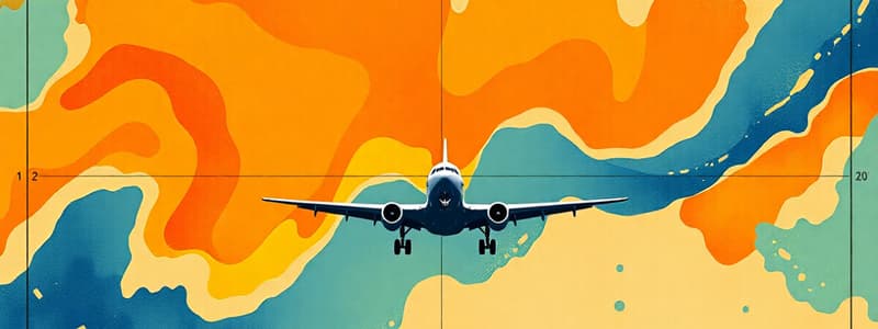
Class A Airspace
Class A Airspace
Airspace extending from 18,000 feet MSL up to and including FL 600. This is the most restrictive class of airspace.
Jet Advisory Areas
Jet Advisory Areas
Created in the 1960s to provide advisory services to high-altitude aircraft, particularly turbojets. They evolved into today's Class A airspace.
Vectors
Vectors
Changes in heading issued by ATC to ensure separation between aircraft. They're used to keep aircraft safely apart in the airspace.
VFR Aircraft
VFR Aircraft
Signup and view all the flashcards
IFR Aircraft
IFR Aircraft
Signup and view all the flashcards
Separation
Separation
Signup and view all the flashcards
Radar Monitoring
Radar Monitoring
Signup and view all the flashcards
Limited VFR Communication
Limited VFR Communication
Signup and view all the flashcards
Class D Airspace Configuration
Class D Airspace Configuration
Signup and view all the flashcards
Communication Requirement in Class D
Communication Requirement in Class D
Signup and view all the flashcards
Control Tower Operating Hours
Control Tower Operating Hours
Signup and view all the flashcards
Class D Airspace When Towers Closed
Class D Airspace When Towers Closed
Signup and view all the flashcards
Class D Airspace Depiction
Class D Airspace Depiction
Signup and view all the flashcards
Class D/E Approach Extensions
Class D/E Approach Extensions
Signup and view all the flashcards
Airspeed Limit in Class D
Airspeed Limit in Class D
Signup and view all the flashcards
IFR and VFR Operations in Class D
IFR and VFR Operations in Class D
Signup and view all the flashcards
Class D Airspace Summary
Class D Airspace Summary
Signup and view all the flashcards
Class E Transition Airspace
Class E Transition Airspace
Signup and view all the flashcards
Class E En Route Domestic Airspace
Class E En Route Domestic Airspace
Signup and view all the flashcards
Class E Airspace above 1,200 feet AGL
Class E Airspace above 1,200 feet AGL
Signup and view all the flashcards
Class E Surface Area
Class E Surface Area
Signup and view all the flashcards
Class E Surface Area Extensions
Class E Surface Area Extensions
Signup and view all the flashcards
Class E Offshore Airspace
Class E Offshore Airspace
Signup and view all the flashcards
Class E Airspace General Definition
Class E Airspace General Definition
Signup and view all the flashcards
Class E Airspace below 14,500 feet MSL
Class E Airspace below 14,500 feet MSL
Signup and view all the flashcards
SVFR Restricted Class E Airspace
SVFR Restricted Class E Airspace
Signup and view all the flashcards
Purpose of Class E Airspace
Purpose of Class E Airspace
Signup and view all the flashcards
Transition Level
Transition Level
Signup and view all the flashcards
Standard Atmospheric Pressure
Standard Atmospheric Pressure
Signup and view all the flashcards
Flight Level (FL)
Flight Level (FL)
Signup and view all the flashcards
Constant Atmospheric Pressure Level
Constant Atmospheric Pressure Level
Signup and view all the flashcards
Altimeter Setting at Transition Level
Altimeter Setting at Transition Level
Signup and view all the flashcards
Catch Point
Catch Point
Signup and view all the flashcards
Navigation Reference System (NRS)
Navigation Reference System (NRS)
Signup and view all the flashcards
Pitch Point
Pitch Point
Signup and view all the flashcards
Waypoints
Waypoints
Signup and view all the flashcards
NRS Waypoint Designator
NRS Waypoint Designator
Signup and view all the flashcards
NRS Grid Resolution
NRS Grid Resolution
Signup and view all the flashcards
Study Notes
Airspace Classifications
- Airspace is categorized into different classes (A-G) based on restrictions and control.
- Class A is most restrictive, Class G is least.
- Class A airspace extends from 18,000 feet MSL to FL 600. It includes airspace over waters within 12 nautical miles of the US coast and designated international airspace.
- Air traffic control provides separation services in Class A airspace.
- Pilots operating within Class A airspace must comply with instrument flight rules (IFR) and receive clearance from air traffic control (ATC).
Class B Airspace
- Class B airspace is the airspace surrounding a country's busiest airports in terms of IFR operations and passenger enplanements.
- It extends from the surface to 10,000 feet MSL.
- Pilots must operate under Instrument Flight Rules (IFR) and obtain specific clearances before entering.
Class C Airspace
- It encircles medium-activity airports with an operational control tower.
- It extends from the surface up to 4,000 feet above the airport's elevation.
- It has two parts, a core surface area and a shelf area.
- All pilots, whether flying under instrument (IFR) or visual flight rules (VFR), must follow instructions from air traffic control (ATC) within the airspace.
Class D Airspace
- It surrounds airports with operational control towers.
- It extends from the surface to 2,500 feet above the airport elevation.
- Pilots need ATC clearance before operating within the airspace.
Class E Airspace
- It's uncontrolled airspace that extends upward to adjacent controlled airspace.
- It's charted on sectional, terminal, and en-route charts.
- It often serves as a transition area between controlled and uncontrolled airspace.
- In Class E airspace there are no defined vertical limits
- It is utilized above Class D airspace.
Class G Airspace
- It's uncontrolled airspace.
- ATC does not provide separation services.
- Pilots operate under Visual Flight Rules (VFR).
Special Use Airspace
- It contains prohibited and restricted areas.
- Prohibited areas require absolute avoidance of the airspace.
- Restricted areas apply specific restrictions.
- Temporary flight restrictions (TFRs) are imposed to deal with emergencies or events.
Studying That Suits You
Use AI to generate personalized quizzes and flashcards to suit your learning preferences.