Analyze and compare the maps by Al-Idrisi and the French cartographer, focusing on how the Indian subcontinent is depicted and how place names are marked.
Understand the Problem
The image contains text and maps related to historical cartography. It mentions maps created by Al-Idrisi in 1154 CE and a French cartographer in the 1720s, focusing on the Indian subcontinent. The exercise involves tracing changes in mapping and geographical understanding over time. This looks like a homework question related to history.
Answer
Al-Idrisi's map reverses India's orientation and uses Arabic place names, while the French map is more accurately oriented.
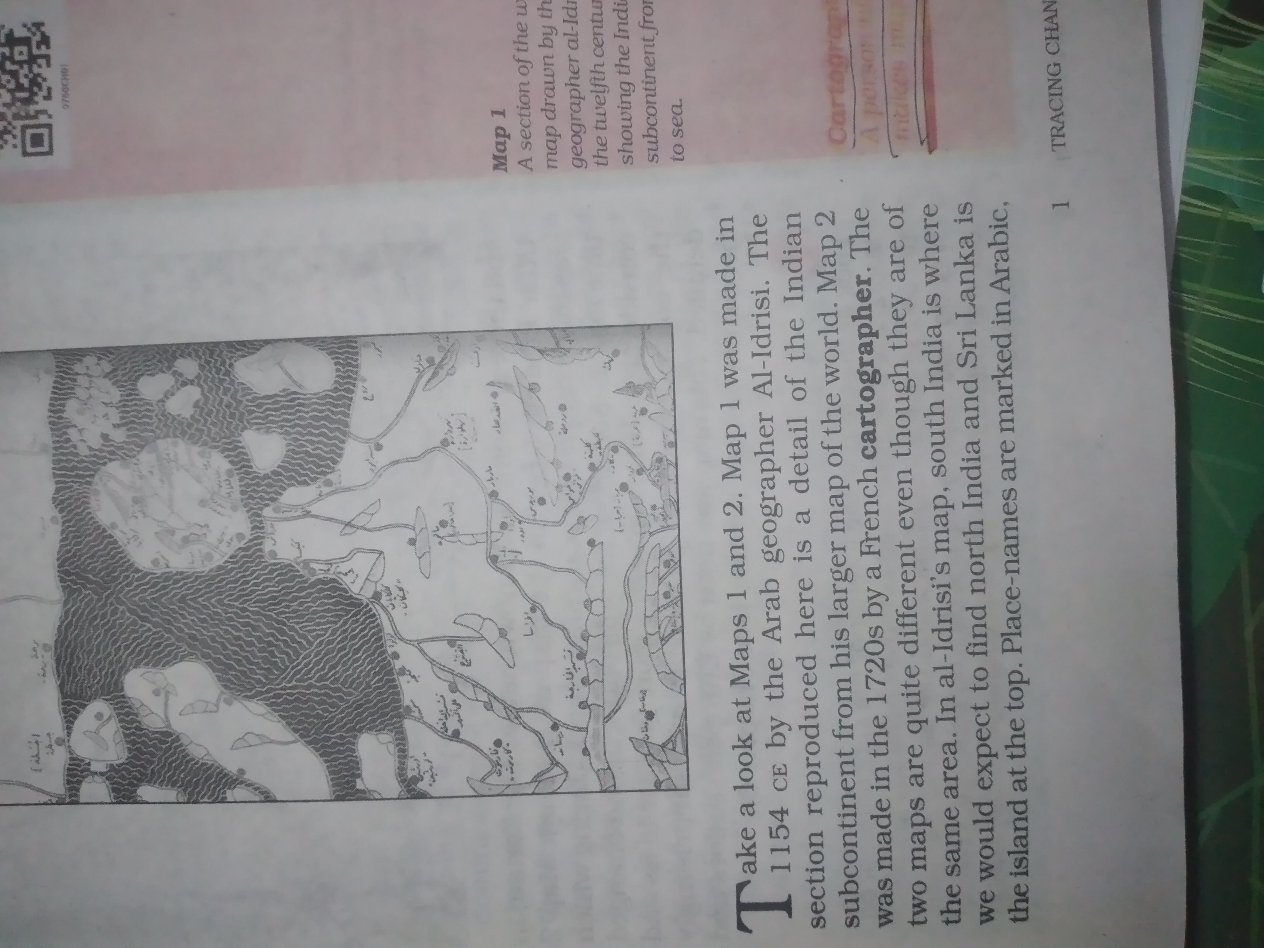
Al-Idrisi's map (1154 CE) reverses the orientation of the Indian subcontinent, placing South India where North India is typically located, and marks place names in Arabic. A French cartographer's map from the 1720s shows a more accurate orientation. Both maps depict the same geographic area but differ significantly in their representation and labeling.
Answer for screen readers
Al-Idrisi's map (1154 CE) reverses the orientation of the Indian subcontinent, placing South India where North India is typically located, and marks place names in Arabic. A French cartographer's map from the 1720s shows a more accurate orientation. Both maps depict the same geographic area but differ significantly in their representation and labeling.
More Information
Al-Idrisi's map was created in 1154 CE, while advancements in cartography occurred by the 1720s when the French cartographer created their map, leading to increased accuracy.
Tips
Pay close attention to the orientation of the maps and the language used for place names.
Sources
AI-generated content may contain errors. Please verify critical information