Podcast
Questions and Answers
Which explorer is credited with establishing the first direct sea route from Europe to India?
Which explorer is credited with establishing the first direct sea route from Europe to India?
- Ferdinand Magellan
- Christopher Columbus
- Vasco da Gama (correct)
- Vasco Núñez de Balboa
What was the primary significance of Christopher Columbus's voyages in 1492?
What was the primary significance of Christopher Columbus's voyages in 1492?
- He claimed Australia for Spain and established a colony there.
- He discovered a westward route to Asia and established trade relations.
- He initiated the first contact between Europe and the Americas. (correct)
- He proved the earth was round by circumnavigating it.
Vasco Núñez de Balboa is best known for which accomplishment?
Vasco Núñez de Balboa is best known for which accomplishment?
- Circumnavigating the globe and proving it was round.
- Establishing the first permanent English colony in North America.
- Discovering the Pacific Ocean from the Americas. (correct)
- Finding a new route to India by sailing west around Africa.
What was a major driving force that propelled European exploration during the Age of Exploration?
What was a major driving force that propelled European exploration during the Age of Exploration?
How did the wealth acquired from colonies in the Americas primarily affect Europe?
How did the wealth acquired from colonies in the Americas primarily affect Europe?
What significant health challenge did Vasco da Gama's crew encounter during their voyage to India?
What significant health challenge did Vasco da Gama's crew encounter during their voyage to India?
What is the approximate longitude of the International Date Line?
What is the approximate longitude of the International Date Line?
Which of the following is NOT identified as a factor influencing climate?
Which of the following is NOT identified as a factor influencing climate?
Which imaginary line of latitude is located approximately 23 degrees south of the equator?
Which imaginary line of latitude is located approximately 23 degrees south of the equator?
The North Atlantic Drift is best described as:
The North Atlantic Drift is best described as:
During the Age of Exploration, the 'three Gs' motivating European explorers primarily included:
During the Age of Exploration, the 'three Gs' motivating European explorers primarily included:
Prior to discovering the Americas, European trade networks were primarily focused on:
Prior to discovering the Americas, European trade networks were primarily focused on:
Which European countries were among the first to initiate major explorations starting 500 years ago?
Which European countries were among the first to initiate major explorations starting 500 years ago?
Which explorer is credited with leading the first expedition to circumnavigate the Earth?
Which explorer is credited with leading the first expedition to circumnavigate the Earth?
Which of the following is NOT listed as one of the five main types of climate?
Which of the following is NOT listed as one of the five main types of climate?
Coordinates used to locate places on Earth are measured in:
Coordinates used to locate places on Earth are measured in:
Which tool found on world maps is specifically designed to indicate directions such as north, south, east, and west?
Which tool found on world maps is specifically designed to indicate directions such as north, south, east, and west?
Approximately what percentage of the Earth's surface is covered by oceans?
Approximately what percentage of the Earth's surface is covered by oceans?
Which set of map projections are primarily utilized by cartographers to create different map representations?
Which set of map projections are primarily utilized by cartographers to create different map representations?
What is a key characteristic of distortion in Gnomonic map projections?
What is a key characteristic of distortion in Gnomonic map projections?
What is considered the primary disadvantage of the Mercator map projection?
What is considered the primary disadvantage of the Mercator map projection?
For which of the following applications is the Mercator map projection most suitable?
For which of the following applications is the Mercator map projection most suitable?
What is the main limitation of a Conic map projection concerning distortion?
What is the main limitation of a Conic map projection concerning distortion?
What is the fundamental reason for the existence of different time zones across the Earth?
What is the fundamental reason for the existence of different time zones across the Earth?
What primary concept does the International Date Line represent in relation to global timekeeping?
What primary concept does the International Date Line represent in relation to global timekeeping?
Flashcards
Continents
Continents
Surrounded by water and cover a large portion of the Earth's surface.
World Map
World Map
A visual representation of the Earth's surface, showing locations, features, and distances.
Compass Rose
Compass Rose
A tool on a map that shows the four cardinal directions: North, South, East, and West.
Mercator Projection
Mercator Projection
Signup and view all the flashcards
Time Zone
Time Zone
Signup and view all the flashcards
Conic Projection
Conic Projection
Signup and view all the flashcards
International Date Line
International Date Line
Signup and view all the flashcards
Gnomonic Projection
Gnomonic Projection
Signup and view all the flashcards
Cartographer
Cartographer
Signup and view all the flashcards
Monsoon
Monsoon
Signup and view all the flashcards
Scurvy
Scurvy
Signup and view all the flashcards
Conquistador
Conquistador
Signup and view all the flashcards
Isthmus
Isthmus
Signup and view all the flashcards
Settle
Settle
Signup and view all the flashcards
Patron
Patron
Signup and view all the flashcards
What is the International Date Line?
What is the International Date Line?
Signup and view all the flashcards
What is climate?
What is climate?
Signup and view all the flashcards
What are latitude and longitude lines?
What are latitude and longitude lines?
Signup and view all the flashcards
What are the equator, Tropic of Cancer, and Tropic of Capricorn?
What are the equator, Tropic of Cancer, and Tropic of Capricorn?
Signup and view all the flashcards
What is the Gulf Stream?
What is the Gulf Stream?
Signup and view all the flashcards
What were the main motivations for European exploration?
What were the main motivations for European exploration?
Signup and view all the flashcards
What was the Silk Road?
What was the Silk Road?
Signup and view all the flashcards
What are cash crops?
What are cash crops?
Signup and view all the flashcards
What is colonization?
What is colonization?
Signup and view all the flashcards
Who were Marco Polo, Christopher Columbus, and Ferdinand Magellan?
Who were Marco Polo, Christopher Columbus, and Ferdinand Magellan?
Signup and view all the flashcards
Study Notes
World Maps and Projections
- Maps show Earth's surface, with tools like compass roses for directions (north, south, east, west).
- Oceans cover about 70% of Earth's surface.
- Continents are surrounded by oceans.
- Map projections (Gnomonic, Mercator, Conic) display Earth's features.
- Gnomonic projects from a point, distorting more as distance grows.
- Mercator preserves angles, but distorts sizes, especially near poles.
- Conic projects onto a cone, distorting more away from the standard parallel.
Time Zones and the International Date Line
- Time zones are areas with a unified time.
- Earth's round shape causes different locations to have different times.
- Time zones are 15 degrees wide.
- The International Date Line is a 180-degree imaginary line representing the day change.
- It's a recent invention (around 1900).
- The Date Line helps to ensure no overlap in the day's marking.
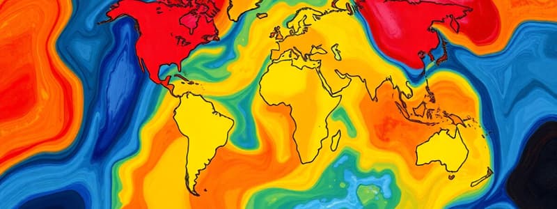
Climate
- Climate is a region's weather pattern over a long time.
- Factors impacting climate include temperature, humidity, distance from water, wind, precipitation, topography, latitude, and elevation.
- Five main climate types: tropical, dry, mild, continental, and polar.
Latitude and Longitude
- Latitude lines circle Earth horizontally.
- Longitude lines run vertically.
- The equator is a key horizontal line dividing the Earth into Northern & Southern Hemispheres.
- The Tropic of Cancer and Tropic of Capricorn are latitudes dividing the globe into regions.
- Coordinates (latitude and longitude) define locations on Earth.
Gulf Stream
- The Gulf Stream is a warm ocean current.
- Originating in the southeastern tip of Florida.
- Flows north along the eastern US coast and across the Atlantic.
- Impacts European climate greatly.
- Part of a global deep-sea current system.
- The Gulf Stream can potentially affect sustainable energy production but is threatened by climate change.
European Exploration
- European exploration (1400s-1500s).
- Motives: gold, God, glory.
- Exploration related to a need for new trade routes and wealth, including the Silk Road.
- Led to the colonization of the Americas, Asia, and Africa.
- Exploration stemmed from various reasons including the Protestant Reformation, royal disputes, and economic pursuits.
- European exploration led to the development and existence of the (United States).
Famous Explorers
- Marco Polo (China)
- Christopher Columbus (Americas)
- Ferdinand Magellan (circumnavigated the globe)
- Lewis and Clark (crossed North America)
- Vasco da Gama (direct route to India by water)
- Vasco Nunez De Balboa (found the Pacific Ocean)
- Columbus's Voyage: A voyage from Europe to North America, leading to interactions, claims, and empire building.
Impact of Exploration
- Early Spanish and Portuguese expeditions created a large colonial empire and wealth in the early stages.
- Northern European nations joined in, boosting their economies.
- Wealth created through exploitation led to Europe's global dominance and trade.
- The Columbian Exchange transferred goods and ideas between the Old and New Worlds.
Studying That Suits You
Use AI to generate personalized quizzes and flashcards to suit your learning preferences.


