Podcast
Questions and Answers
How are relative location and place related?
How are relative location and place related?
Relative location describes a place in relation to another place around it.
How do thematic maps help geographers understand the five elements of geography?
How do thematic maps help geographers understand the five elements of geography?
They help explain each one to the geographers with specific information.
How is absolute location different from relative location?
How is absolute location different from relative location?
Absolute location is the exact place, while relative location describes a place in relation to another place.
What are some examples of information that would be included in a place description?
What are some examples of information that would be included in a place description?
How is place different from region?
How is place different from region?
Why do geographers study movement?
Why do geographers study movement?
What is the purpose of a map?
What is the purpose of a map?
Why is GIS a valuable tool for examining the geography of a place?
Why is GIS a valuable tool for examining the geography of a place?
How is the use of a small scale map different from the use of a large scale map?
How is the use of a small scale map different from the use of a large scale map?
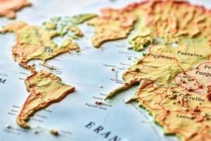
In what ways may relief be shown on a map?
In what ways may relief be shown on a map?
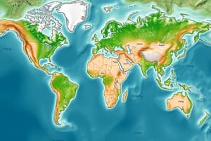
What are the three types of thematic maps?
What are the three types of thematic maps?
What layers are found in the Earth's interior?
What layers are found in the Earth's interior?
What is the continental drift theory?
What is the continental drift theory?
How does water reach a drainage basin?
How does water reach a drainage basin?
What is topography?
What is topography?
What are the three types of plate boundaries?
What are the three types of plate boundaries?
How are the Richter scale and a seismograph used?
How are the Richter scale and a seismograph used?
What is the Ring of Fire?
What is the Ring of Fire?
What is the difference between weathering and erosion?
What is the difference between weathering and erosion?
What are the three transporting agents of erosion?
What are the three transporting agents of erosion?
Why are there many different types of soil?
Why are there many different types of soil?
What causes the changing seasons on Earth?
What causes the changing seasons on Earth?
Flashcards are hidden until you start studying
Study Notes
Geography Concepts and Definitions
- Relative Location vs. Absolute Location: Relative location describes a place in relation to another, while absolute location provides the exact coordinates of a place.
- Thematic Maps: These maps assist geographers by presenting specific information relevant to geographic elements, enhancing understanding of spatial patterns.
- Place vs. Region: A place refers to a specific location with distinct characteristics, whereas a region is a broader area characterized by similarities.
- Movement in Geography: Geographers study how people, goods, and ideas transfer from one location to another, highlighting connectivity and flow.
Mapping and Representations
- Purpose of Maps: Maps serve to visually display data and geographical information in various readable formats for analysis.
- Geographical Information Systems (GIS): GIS tools compile and manage geographic data in digital formats, facilitating in-depth geographic analysis.
- Scale in Maps: Small scale maps cover larger areas with less detail, whereas large scale maps focus on smaller areas but provide intricate details suitable for precise navigation.
Physical Geography
- Relief Representation on Maps: Relief features can be displayed through color gradients, shading techniques, and contour lines, illustrating elevation differences.
- Types of Thematic Maps:
- Qualitative Maps utilize colors and symbols to represent ideas.
- Cartograms present data in a distorted way based on statistical information.
- Flow Lines Maps track and illustrate movement trends using arrows.
- Earth’s Interior Layers: Composed of the mantle, outer core, and inner core, they form the planet's structure and influence geological activity.
Geological Processes
- Continental Drift Theory: Suggests that Earth's continents were once joined as a single supercontinent and drifted apart over millions of years.
- Drainage Basin Mechanism: Water is directed into a drainage basin through the network of rivers and streams acting as branches directing flow.
- Topography Definition: Refers to the physical features and composition of landforms in a given area, including their shapes and distributions.
Tectonics and Natural Phenomena
- Types of Plate Boundaries: Includes divergent (moving apart), convergent (colliding), and transform (sliding past) boundaries that shape Earth’s surface.
- Richter Scale and Seismograph: A seismograph detects earthquake waves, while the Richter scale quantifies their strength, providing a standardized measure of seismic events.
- Ring of Fire: A seismically active zone bordering the Pacific Ocean, known for its frequent earthquakes and volcanic eruptions.
Weathering, Erosion, and Soil
- Weathering vs. Erosion: Weathering alters rocks through chemical or physical processes, while erosion involves the movement of these weathered materials to new locations.
- Agents of Erosion: Wind, water, ice, and gravity are natural forces that transport weathered materials across different terrains.
- Soil Diversity: Varied soils arise from a multitude of environmental conditions and needs across the globe, affecting agriculture and ecosystem health.
Seasonal Changes
- Causes of Seasonal Changes: The tilt of Earth's axis relative to its orbit around the Sun is responsible for the seasonal variations experienced on the planet.
Studying That Suits You
Use AI to generate personalized quizzes and flashcards to suit your learning preferences.