Podcast
Questions and Answers
The Five Themes of Geography were developed in 2004 to assist in geographical studies.
The Five Themes of Geography were developed in 2004 to assist in geographical studies.
False (B)
Relative location is not considered a component of the theme of Location in geography.
Relative location is not considered a component of the theme of Location in geography.
False (B)
The theme of Place in geography strictly examines the geological characteristics of a location, disregarding human aspects.
The theme of Place in geography strictly examines the geological characteristics of a location, disregarding human aspects.
False (B)
Human Environment Isolation studies how humans detach themselves from their surroundings.
Human Environment Isolation studies how humans detach themselves from their surroundings.
The theme of Movement in geography is limited to the migration of people only.
The theme of Movement in geography is limited to the migration of people only.
The concept of Region aims to divide the earth into unmanageable sections for geographical study.
The concept of Region aims to divide the earth into unmanageable sections for geographical study.
Metageography is a term that was first introduced by Martin Luther in 1997.
Metageography is a term that was first introduced by Martin Luther in 1997.
According to metageography, geographical notions are primarily shaped by objective geographical facts, not cultural perspectives.
According to metageography, geographical notions are primarily shaped by objective geographical facts, not cultural perspectives.
Cartogram maps are designed to represent physical space with high accuracy and precision.
Cartogram maps are designed to represent physical space with high accuracy and precision.
Isoline maps use colors and shades to represent data amounts over geographical areas.
Isoline maps use colors and shades to represent data amounts over geographical areas.
Heat maps utilize directional lines to represent density across typical borders.
Heat maps utilize directional lines to represent density across typical borders.
Dot distribution maps are designed to represent density using tiny dots.
Dot distribution maps are designed to represent density using tiny dots.
Flow-line maps employ directional lines that are proportionally sized to represent data.
Flow-line maps employ directional lines that are proportionally sized to represent data.
A continent is defined as a nation possessing its own government and occupying a specific territory.
A continent is defined as a nation possessing its own government and occupying a specific territory.
Longitude measures the distance of a position north or south relative to the equator.
Longitude measures the distance of a position north or south relative to the equator.
The prime meridian is a line of longitude that passes through Paris, France.
The prime meridian is a line of longitude that passes through Paris, France.
Contour lines on a topographic map are capable of intersecting each other.
Contour lines on a topographic map are capable of intersecting each other.
Hachures on contour lines indicate hills on a topographic map.
Hachures on contour lines indicate hills on a topographic map.
Jupiter is classified as a terrestrial planet within our solar system.
Jupiter is classified as a terrestrial planet within our solar system.
Comets are celestial bodies that orbit planets rather than the sun.
Comets are celestial bodies that orbit planets rather than the sun.
Flashcards
Heat Map
Heat Map
A map using shaded areas to represent density, like a weather map showing areas of high and low pressure.
Dot Distribution Map
Dot Distribution Map
A map using small dots to represent individual data points, such as disease cases in a neighborhood.
Flow-Line Map
Flow-Line Map
A map using directional lines to show movement, like a line showing the shipment of goods from one city to another.
Geographical Coordinates
Geographical Coordinates
Signup and view all the flashcards
Prime Meridian
Prime Meridian
Signup and view all the flashcards
Equator
Equator
Signup and view all the flashcards
Topographic Map
Topographic Map
Signup and view all the flashcards
Geologic Map
Geologic Map
Signup and view all the flashcards
Planet
Planet
Signup and view all the flashcards
Moon
Moon
Signup and view all the flashcards
Five Themes of Geography
Five Themes of Geography
Signup and view all the flashcards
Absolute Location
Absolute Location
Signup and view all the flashcards
Relative Location
Relative Location
Signup and view all the flashcards
Human-Environment Interaction
Human-Environment Interaction
Signup and view all the flashcards
Movement
Movement
Signup and view all the flashcards
Region
Region
Signup and view all the flashcards
Metageography
Metageography
Signup and view all the flashcards
Thematic Map
Thematic Map
Signup and view all the flashcards
Cartography
Cartography
Signup and view all the flashcards
Study Notes
Five Themes of Geography
- Developed in 1984 to simplify geography study
- Five themes: Location (absolute and relative), Place (physical and human characteristics), Human-Environment Interaction, Movement (people, goods, info), Region (formal, functional, vernacular)
- Themes work best together to understand the world and human impact
Metageography
- Concept of East/West and other geographical ideas influenced more by culture and location than pure geography
- Coined by Martin Lewis in 1997
- Perspective of East/West depends on viewpoint (e.g., Asia is East from Americas, but Americas are East from Asia)
Thematic Maps
- Thematic maps display data about a phenomenon in a specific location
- Cartography is the art of mapmaking (including thematic maps)
- Uses geospatial data to illustrate relationships between a topic and location
- Seven common types:
- Isoline map: continuous lines for data (e.g., elevation)
- Cartogram map: distorts space to show data (e.g., population size)
- Choropleth map: uses color/shade to show data amounts (e.g., political affiliation)
- Graduated symbol map: uses size/shape to show data (e.g., city size)
- Heat map: shaded areas represent density (e.g., weather)
- Dot distribution map: uses dots for data points (e.g., disease incidents)
- Flow-line map: directional lines show quantity of movement (e.g., goods shipment)
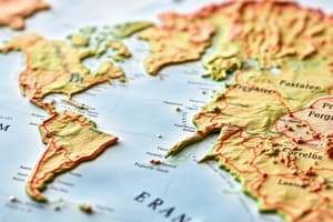
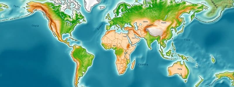
Locating Places on a Map
- World maps are structured by continents, countries, states/counties, and cities
- Continent: large landmass, usually separated by oceans
- Country: nation with self-governance and territory
- State/county: administrative/political regions within a country
- Locating a place: start with continent, then country, then state/county, then precise location
Geographical Coordinates
- Geographical coordinates are numerical values based on angles in relation to meridian lines
- Define location on Earth's surface via the Geographical Coordinates System (GCS)
- Longitude: east/west position relative to the Prime Meridian (Greenwich, England)
- Latitude: north/south position relative to the Equator (0° latitude)
Topographic Maps
- Topographic maps show elevation using contour lines
- Contour lines connect points of equal elevation
- Index contours: lines with elevation values
- Contour interval: fixed elevation change between lines
- Contour lines never cross; form circles around hills and depressions
- Hachures: contour lines denoting depressions
Geologic Maps
- Geologic maps show topography and rock types/ages
- Different rock types are often represented by colors
- Map key provides information on rock types/colors
Earth's Solar System
- Earth's solar system includes the sun and eight planets
- Planets:
- Must have sufficient gravity to form a sphere and clear orbital path
- Must orbit the sun
- Moons: orbit planets
- Asteroids: rock/metal bodies orbiting the sun (minor planets, planetoids)
- Comets: icy bodies orbiting the sun (gas tail near sun)
- Meteoroids: objects floating in space
- Meteors: meteoroids entering Earth's atmosphere
- Meteorites: meteors that reach Earth's surface
- Two planet categories:
- Terrestrial planets (solid surface, smaller, metal core): Mercury, Venus, Earth, Mars
- Jovian planets (gas giants, no solid surface): Jupiter, Saturn, Uranus, Neptune
Studying That Suits You
Use AI to generate personalized quizzes and flashcards to suit your learning preferences.