Podcast
Questions and Answers
What defines the boundary between two drainage basins?
What defines the boundary between two drainage basins?
- The downstream flow of water
- The area of land that prevents runoff
- A local topographic high point (correct)
- The mouth of the stream
Where is the headwater of a stream located?
Where is the headwater of a stream located?
- In the largest lake feeding the stream
- At the beginning of the stream (correct)
- At the point where the stream meets the ocean
- At the confluence of multiple tributaries
Which of the following statements about drainage basins is true?
Which of the following statements about drainage basins is true?
- Every stream, tributary, and streamlet possesses its own distinct drainage basin. (correct)
- The mouth of a stream refers to its tributary source.
- All drainage basins are easily identified in flat terrain.
- Drainage basins can only exist in coastal regions.
What role does water play in the lithification process?
What role does water play in the lithification process?
Which of the following constitutes a significant aspect of karst topography?
Which of the following constitutes a significant aspect of karst topography?
What is the significance of the mouth of a stream?
What is the significance of the mouth of a stream?
Which aspect is NOT a part of the water cycle?
Which aspect is NOT a part of the water cycle?
In areas with flat topography, how are drainage divides characterized?
In areas with flat topography, how are drainage divides characterized?
In the context of water laws in the western U.S., what is one primary reason for their establishment?
In the context of water laws in the western U.S., what is one primary reason for their establishment?
Which of the following sediment landforms is formed by the process of deposition?
Which of the following sediment landforms is formed by the process of deposition?
What characterizes an endorheic basin?
What characterizes an endorheic basin?
In which type of climate would you likely find perennial streams?
In which type of climate would you likely find perennial streams?
What is a likely consequence of ephemeral streams in arid climates?
What is a likely consequence of ephemeral streams in arid climates?
What type of restrictions might be imposed in watershed protection areas?
What type of restrictions might be imposed in watershed protection areas?
How does the water cycle relate to a personal budget, according to the provided information?
How does the water cycle relate to a personal budget, according to the provided information?
Flashcards
Hydrosphere
Hydrosphere
Earth's water, an important agent of geological change.
Water Cycle Processes
Water Cycle Processes
Processes like evaporation, precipitation, and runoff that move water around the planet.
Drainage Basins
Drainage Basins
Areas of land that drain water into a common outlet, like a river or lake.
Watershed Protection
Watershed Protection
Signup and view all the flashcards
Water Budget
Water Budget
Signup and view all the flashcards
Water Laws
Water Laws
Signup and view all the flashcards
Zone of Transport
Zone of Transport
Signup and view all the flashcards
Zone of Sediment Production
Zone of Sediment Production
Signup and view all the flashcards
Zone of Deposition
Zone of Deposition
Signup and view all the flashcards
Equilibrium
Equilibrium
Signup and view all the flashcards
Aquifer
Aquifer
Signup and view all the flashcards
Confining Layer
Confining Layer
Signup and view all the flashcards
Water Table
Water Table
Signup and view all the flashcards
Water Contamination
Water Contamination
Signup and view all the flashcards
Water Remediation
Water Remediation
Signup and view all the flashcards
Karst Topography
Karst Topography
Signup and view all the flashcards
Drainage Basin
Drainage Basin
Signup and view all the flashcards
Catchment
Catchment
Signup and view all the flashcards
Watershed
Watershed
Signup and view all the flashcards
Drainage Divide
Drainage Divide
Signup and view all the flashcards
Headwater
Headwater
Signup and view all the flashcards
Tributary
Tributary
Signup and view all the flashcards
Trunk Stream
Trunk Stream
Signup and view all the flashcards
Mouth of a stream
Mouth of a stream
Signup and view all the flashcards
Endorheic Basin
Endorheic Basin
Signup and view all the flashcards
Perennial Stream
Perennial Stream
Signup and view all the flashcards
Ephemeral Stream
Ephemeral Stream
Signup and view all the flashcards
Great Basin
Great Basin
Signup and view all the flashcards
Drainage Basin
Drainage Basin
Signup and view all the flashcards
Watershed Protection Area
Watershed Protection Area
Signup and view all the flashcards
Water Cycle (Analogy)
Water Cycle (Analogy)
Signup and view all the flashcards
Water budget analogy
Water budget analogy
Signup and view all the flashcards
Study Notes
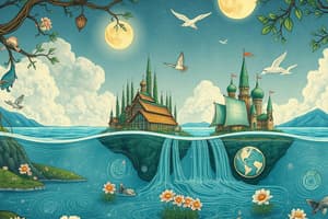
Water Cycle
- Water continuously circulates in the Earth's atmosphere, changing states (solid, liquid, gas) and location.
- Evaporation: Liquid water turns to gas (water vapor) when heated by solar energy.
- Transpiration: Plants release water vapor as a byproduct of photosynthesis.
- Evapotranspiration: Combined process of evaporation and transpiration.
- Condensation: Water vapor cools or air masses mix, converting water vapor back to liquid.
- Precipitation: Water falls to Earth as rain, snow, hail, or sleet.
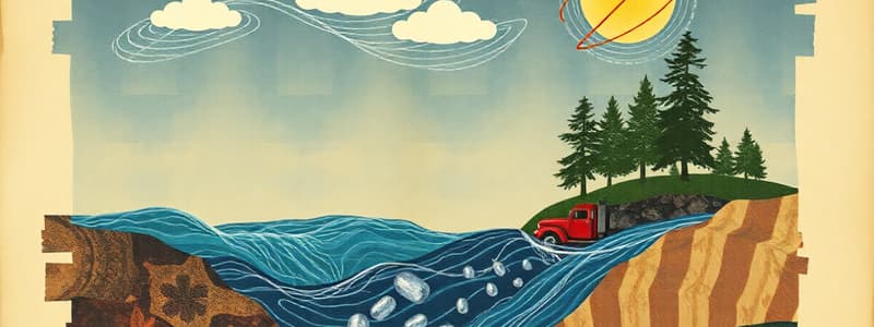
- Runoff: Precipitation flows over the land surface into streams, lakes, and eventually back to the oceans.
- Infiltration: Precipitation soaks into the ground, becoming groundwater.
- Surface water and groundwater systems are connected. Water can move between surface and groundwater.
Water Basins and Budgets
- Drainage basin (watershed): Area that collects precipitation and contributes runoff to a particular stream.
- Drainage divides: High points that separate one drainage basin from another.
- Water from one side of the divide goes to one stream, while water on other side goes to different stream.
- Perennial streams: Flow year-round due to sufficient rainfall and low evaporation.
- Ephemeral streams: Flow only during rain events or wet season; common in arid climates.
- Water sheds are designated as watershed protection areas to limit use in specific areas to protect their water source.
Water Use and Distribution
- The United States uses about 1,344 billion liters of ground and surface water daily.
- Agricultural use is a significant consumer of water.
- California uses about 16% of the nation's freshwater groundwater.
- Utah and Nevada are at risk for water shortages.
Water Quality and Protection
- Federal laws, like the Clean Water Act and the Safe Drinking Water Act, protect water quality.
- The Clean Water Act protects navigable waters, preventing pollution by industries.
- The Safe Drinking Water Act ensures that public water supplies are safe for drinking.
- The Superfund program addresses hazardous contamination.
Surface Water
- Streams are bodies of flowing surface water confined to channels.
- Stream factors influencing erosion and sediment transport include gradient (slope) and velocity.
- Discharge (volume of water flowing past a point per unit of time) increases downstream.
- Stream channels can be straight, braided, meandering, or entrenched, depending on various factors.
- Floodplains: Flat areas alongside streams, where floodwaters periodically spread.
- Stream terraces: Remnants of older floodplains from uplift or base level change.
Drainage Patterns
- Drainage pattern: Pattern of tributaries (smaller streams) within a region.
- Patterns depend on the bedrock type and structures.
- Common patterns include dendritic (like tree branches), trellis, rectangular, radial, and deranged.
Fluvial Processes
- Fluvial processes include sediment production, transport, and deposition.
- Sediment production happens mainly in the headwaters (upper reaches) of a stream where erosion is prominent.
- Transportation: Sediments are transported as bedload (large, coarse material along the streambed), suspended load (finer particles carried within the water column), and dissolved load (chemical components in solution).
- Deposition: Sediments settle out of transport in quieter areas (lower reaches), forming landforms like floodplains, deltas, and alluvial fans.
- Equilibrium and base level of a stream influence its shape and behavior.
Water Rights
- States manage water rights, with federal regulations for specific situations like national parks and Native American tribes.
- Prior appropriation (first in time, first in right): Senior water rights holders get priority use during shortages.
- The Colorado River Compact outlines water sharing agreements between states in the Colorado River basin which has become an important topic in modern times.
Studying That Suits You
Use AI to generate personalized quizzes and flashcards to suit your learning preferences.