Podcast
Questions and Answers
Which of the following is a type of optical instrument that measures the angular distance of celestial objects?
Which of the following is a type of optical instrument that measures the angular distance of celestial objects?
- Telescopic Alidade
- Bearing Circle
- Stadimeter
- Sextant (correct)
What is the term used for a vessel that is unable to move or function, also known as a 'crippled ship'?
What is the term used for a vessel that is unable to move or function, also known as a 'crippled ship'?
- Aground
- Dead in Water (correct)
- Giveway Vessel
- Overtaking
What is the term for a vessel passing another vessel?
What is the term for a vessel passing another vessel?
- Giveway Vessel
- Crossing
- Heading On
- Overtaking (correct)
What is the name of a ring designed to fit on a compass to provide bearings?
What is the name of a ring designed to fit on a compass to provide bearings?
A vessel that must take action to avoid collision is called a:
A vessel that must take action to avoid collision is called a:
What is a DFGMC?
What is a DFGMC?
What is the True Bearing?
What is the True Bearing?
What is the difference between a Stadimeter and a Sextant?
What is the difference between a Stadimeter and a Sextant?
Which of the following individuals is directly responsible for the safe navigation of the ship and its general operation?
Which of the following individuals is directly responsible for the safe navigation of the ship and its general operation?
Which of the following represents the rate at which a ship speeds up or slows down after an engine order?
Which of the following represents the rate at which a ship speeds up or slows down after an engine order?
In the IALA A Buoyage System, what color are buoys on the starboard side as the ship is leaving port?
In the IALA A Buoyage System, what color are buoys on the starboard side as the ship is leaving port?
What is the purpose of Range/Channel Markings?
What is the purpose of Range/Channel Markings?
What does the term 'Set' refer to in navigation?
What does the term 'Set' refer to in navigation?
What is the relationship between the Conning Officer and the Helm/Lee Helm?
What is the relationship between the Conning Officer and the Helm/Lee Helm?
Which of these individuals is directly responsible for the safe navigation of the ship?
Which of these individuals is directly responsible for the safe navigation of the ship?
What is the purpose of the Cardinal System in buoyage?
What is the purpose of the Cardinal System in buoyage?
What is the primary function of a Gyrocompass?
What is the primary function of a Gyrocompass?
Which light configuration is displayed by a vessel engaged in restricted maneuvering?
Which light configuration is displayed by a vessel engaged in restricted maneuvering?
What does the acronym RADAR stand for?
What does the acronym RADAR stand for?
What does the signal 'Ball over Ball' signify?
What does the signal 'Ball over Ball' signify?
What is the purpose of 'Waterline Lights' on a vessel in port?
What is the purpose of 'Waterline Lights' on a vessel in port?
A vessel displaying 'Ball, Ball, Ball' is considered to be:
A vessel displaying 'Ball, Ball, Ball' is considered to be:
How many satellites are typically used by GPS to determine a vessel's position?
How many satellites are typically used by GPS to determine a vessel's position?
What is the purpose of the 'Absence of an Embarked Flag Officer or Unit Commander' flag?
What is the purpose of the 'Absence of an Embarked Flag Officer or Unit Commander' flag?
What does a steady light indicate on a telltale panel?
What does a steady light indicate on a telltale panel?
What is the purpose of the Voyage Management System (VMS)?
What is the purpose of the Voyage Management System (VMS)?
What is the purpose of the Guide Ship during a UNREP evolution?
What is the purpose of the Guide Ship during a UNREP evolution?
What is the difference between a one-prolonged blast and a rapid ringing of the bell as low visibility sound signals?
What is the difference between a one-prolonged blast and a rapid ringing of the bell as low visibility sound signals?
What does the term 'At the Dip' signify in the context of refueling?
What does the term 'At the Dip' signify in the context of refueling?
What does the absence of the Commanding Officer for a period of 72 hours or more indicate on a ship's yardarm?
What does the absence of the Commanding Officer for a period of 72 hours or more indicate on a ship's yardarm?
What is a psychrometer used for?
What is a psychrometer used for?
Which of these is NOT a source of input for the Voyage Management System (VMS)?
Which of these is NOT a source of input for the Voyage Management System (VMS)?
Flashcards
Officer of the Deck
Officer of the Deck
The direct representative of the Commanding Officer for navigation and operation of the ship.
Conning Officer
Conning Officer
Directs the movement of the ship by giving orders to the Helm and Lee Helm.
Lookouts
Lookouts
Provide visual and audible watch for all surface, subsurface, and air contacts to CIC.
Latitude
Latitude
Signup and view all the flashcards
Longitude
Longitude
Signup and view all the flashcards
IAMLA Buoyage System
IAMLA Buoyage System
Signup and view all the flashcards
Advance
Advance
Signup and view all the flashcards
Pivot Point
Pivot Point
Signup and view all the flashcards
Turning Circle
Turning Circle
Signup and view all the flashcards
True Bearing
True Bearing
Signup and view all the flashcards
Relative Bearing
Relative Bearing
Signup and view all the flashcards
DIW (Dead in Water)
DIW (Dead in Water)
Signup and view all the flashcards
Giveway Vessel
Giveway Vessel
Signup and view all the flashcards
Collision
Collision
Signup and view all the flashcards
Stadimeter
Stadimeter
Signup and view all the flashcards
Magnetic Compass
Magnetic Compass
Signup and view all the flashcards
Gyrocompass
Gyrocompass
Signup and view all the flashcards
RADAR
RADAR
Signup and view all the flashcards
Fathometer
Fathometer
Signup and view all the flashcards
GPS
GPS
Signup and view all the flashcards
Restricted Maneuvering Lights
Restricted Maneuvering Lights
Signup and view all the flashcards
Vessel at Anchor
Vessel at Anchor
Signup and view all the flashcards
Man Overboard Indicator
Man Overboard Indicator
Signup and view all the flashcards
Constrained by Draft
Constrained by Draft
Signup and view all the flashcards
Yardarm Flags
Yardarm Flags
Signup and view all the flashcards
Low Visibility Sound Signals
Low Visibility Sound Signals
Signup and view all the flashcards
Barometer
Barometer
Signup and view all the flashcards
Psychrometer
Psychrometer
Signup and view all the flashcards
Communication Circuits
Communication Circuits
Signup and view all the flashcards
Telltale Panel
Telltale Panel
Signup and view all the flashcards
Voyage Management System (VMS)
Voyage Management System (VMS)
Signup and view all the flashcards
Guide Ship
Guide Ship
Signup and view all the flashcards
Study Notes
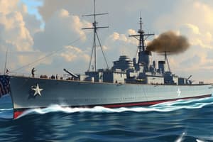
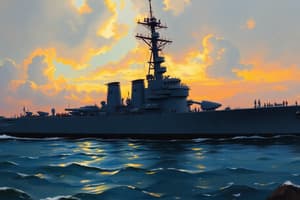
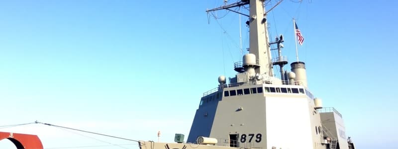
USS Ralph Johnson Navigation Common Core
- The document contains information about navigation procedures for the USS Ralph Johnson (DDG 114).
- It covers various aspects of ship navigation, including duties of key personnel and procedures for different situations.
- Different methods for determining a ship's position are discussed.
- Various rules of the road for different scenarios are described, including navigation markings.
- Guidance on visual and electronic aids for navigation is given.
- Operational procedures such as refueling, anchors, and maneuvers are outlined.
- Procedures and communication protocols for different situations such as personnel recall, divers, anchoring, and close-up navigation are included.
Navigation 106.1
- Officer of the Deck (OOD): Direct representative of the Commanding Officer, responsible for the safe navigation and general operation of the ship.
- Conning Officer: Directs the movement of the ship by giving orders to Helm/Lee Helm.
- Barges and mooring: The daily routine of the ship is maintained. Manning, routine, behavior, and appearance of the watch are responsibilities of the BMOW.
- Helm/Lee Helm: Helm controls ship's course, Lee Helm controls ship's speed.
- Lookouts: Provide visual and audible watch for surface, subsurface, and air contacts to the Combat Information Center (CIC).
- QMOW (Quartermaster of the Watch): Direct representative of the Navigator, responsible for safe navigation and other ship duties.
Navigation 106.2
- Latitude: Measurement in degrees of arc from 0 to 90, either North or South from the Equator.
- Longitude: Measurement in degrees of arc from 0 to 180, either East or West of the Greenwich meridian.
- Set: Direction the ship is moving, measured from DR to fix.
- Drift: Speed the ship is moving, measured from DR to fix.
- GMT/ Universal Standard Time (Greenwich Mean Time): The local time of the sun's meridian passage at Greenwich, England. Based on the Earth's rotation (24 hours).
- Time Zones: Measured from East and West of Greenwich, England in 15-degree increments for a total of 24 time zones.
- Variation: Angular distance measured from Magnetic North.
Navigation 106.2-106.4
- IALA Buoyage System: Buoyage systems for ships entering and leaving harbors have red buoys on different sides of the vessel for appropriate navigation.
- Cardinal System: Compass direction related to cardinal directions.
- Methods of Determining Ship's Position: Visually, Radar Lines, Soundings, Electronic, Celestial.
- Purpose of Range/Channel Markings: Used to determine if the ship is to the right or left of a track.
Navigation 106.5
- Advance: Distance gained in the direction of original course until the ship is on its final course.
- Transfer: Distance gained at right angles to original course.
- Pivot Point: Ship's rotation center
- Acceleration/Deceleration: Rate of change in ship's speed after an engine order. Crucial for station keeping.
- Turning Circle (Final Diameter): Diameter of the circle traversed while maintaining speed and rudder angle while turning.
Navigation 106.6
- True Bearing: Direction measured from 000-359 degrees in relation to True North.
- Relative Bearing: Direction measured from 000-359 degrees in relation to Ship's heading.
- DIW (Dead in Water): Ship is not moving or is inoperable.
- Head On: Two power-driven vessels on reciprocal courses at risk of collision.
- Crossing: Two power-driven vessels crossing, resulting in possible collision.
- Overtaking: When one vessel passes another vessel. Giveway vessel must take action to avoid the collision.
Navigation 106.7
- Collision: Two vessels striking each other.
- Aground: Vessel on or onto the bottom of shallow water.
Navigation 106.8
- Stadimeter: Optical instrument for determining distance of a known object.
- Sextant: Optical instrument for measuring angular distance of celestial objects.
- Binoculars: Optical instrument for viewing distant objects.
- Telescopic Alidade: Optical instrument that fits on a compass to determine bearings of distant objects.
- Azimuth Circle: Ring designed to fit on a compass that includes a mirror and prism to take bearings of celestial objects such as the sun.
- Bearing Circle: A ring designed to fit on a compass, used to provide bearings.
- Magnetic Compass: DFMC. type of magnetometer that senses magnetic field changes around two electrified coils. Delivers a precise magnetic heading.
- Chart: Map that shows shoreline and sea floor configurations.
- Gyrocompass: Electronic compass constantly seeking and displaying true north. Provides pitch, roll, position, time, velocities, and altitude rates.
Navigation 106.8 (continued)
- Radar: Radio Detection and Ranging. Used for navigation, locating aids, and tracking other vessels to avoid collisions.
- Fathometer: Type of echo sounder used to determine water depth.
- Global Positioning System (GPS): Satellite system used to determine position, using 4 out of 26 satellites at any given time, three for position, one for altitude.
- Laser Range Finder: Uses a laser beam to determine distance.
- Integrated Bridge System (IBS): Combination of systems monitored and interconnected to monitor various navigational systems.
Navigation 106.9
- Underway Lights: Mast lights, port/starboard running lights, stern light.
- In-Port/Moored Lights: Air craft warning lights, anchor lights, waterline lights, deck lights.
- Special Operations: Restricted maneuvers lights (red-white-red).
- Man Overboard: Red over Red- flashing, port/starboard running lights and stern light.
- Not Under Command: Red over Red- steady, port/starboard running lights and stern light
- Anchored Lights: Same as in-port
- Aground Lights: Red over Red- Steady. Deck lights, all around white lights Fore and Aft.
- Towing Lights: Underway lights +2 mast lights, or 3 mast lights for vessels greater than 200 meters.
Navigation 106.10
- Vessel at Anchor: One ball.
- Vessel Not Under Command: Ball over Ball.
- Restricted Maneuvering: Ball, Diamond, Ball.
- Vessel Aground: Ball, Ball, Ball.
- Constrained by Draft: Cylinder.
- Towing: One Diamond.
Navigation 106.11
- Personnel Recall: PAPA.
- Boat Recall: QUEBEC.
- Divers: ALFA
- Refueling/Ammo: Bravo.
- Aloft/Over the Side: KILO.
- HERO Cond: HERO Cond.
- Anchoring: UNIFORM.
- Man Overboard: OSCAR
- Receive Along Side: LIMA
- Staging: INDIA
- Departure: FIVE
Navigation 106.11 (continued)
-
Embark Flag Officer/Unit Commander Absent: Blue flag on the starboard yardarm (outboard).
-
Embarked Civil or Military Official Absent: Blue flag on the port yardarm (inboard).
-
Chief of Staff/Chief Staff Officer Absent: Blue flag on the port yardarm (inboard).
-
Commanding Officer Absent (more than 72 hours): Blue flag on the port yardarm (outboard).
Navigation 106.12
- Underway (Low Visibility): One prolonged blast every two minutes.
- Anchored (Low Visibility): Rapid ringing of the bell from the forecastle for five seconds every minute.
- Large Vessels Anchored (Low Visibility): Rapid ringing of the bell and ships gong every minute.
Navigation 106.14
- Barometer: Measures atmospheric pressure in inches of mercury; Predicts changes in weather.
- Psychrometer: Air temperature and dew point. Tool used to predict fog.
- Communication Circuits: Relay important navigation information to the Bridge and Combat Information Center (CIC).
- Telltale Panel: Indicate whether navigation lights are working; if light is out, light is steady; if both filaments are out, there's buzz.
Navigation 106.15
- Voyage Management System (VMS): Electronic system that continuously updates ship's position on a digital chart and incorporates data from various devices.
- Sources for VMS data: Fathometer, GPS, wind readings, INS, gyroscopes.
Navigation 106.16
- Guide Ship: Controls events for ships in formation. Often the replenishment ship during UNREP operations.
- Close up: Refueling in progress. Temporarily ceasing refueling, ensuring all communication is complete for docking, and securing lines before a vessel completes docking procedures. Provides critical time and detail for different phases of the process.
- Time Protocol: 15 minutes for standby refueling till it is complete; all lines clear form the vessel after docking.
Navigation 106.17
-
Swing Circle: Circle drawn from the anchor location with a radius equal to the length of the anchor chain veered plus the ship's total length.
-
Drag Circle: Circle drawn from the anchor location with a radius equal to the length of the anchor chain veered plus distance from the haws pipe to the pelorus.
Studying That Suits You
Use AI to generate personalized quizzes and flashcards to suit your learning preferences.