Podcast
Questions and Answers
What device uses satellite technology to determine exact locations on Earth?
What device uses satellite technology to determine exact locations on Earth?
- GIS
- Atlas
- Compass
- GPS (correct)
The hydrosphere includes only the oceans and seas of the Earth.
The hydrosphere includes only the oceans and seas of the Earth.
False (B)
What does GIS stand for?
What does GIS stand for?
Geographic Information System
What is the capital of the Northwest Territories?
What is the capital of the Northwest Territories?
The Equator divides the Earth into Eastern and Western Hemispheres.
The Equator divides the Earth into Eastern and Western Hemispheres.
Approximately _____% of the Earth's surface is covered in water.
Approximately _____% of the Earth's surface is covered in water.
Match the following parts of the Earth with their definitions:
Match the following parts of the Earth with their definitions:
What are the four principal points of a compass?
What are the four principal points of a compass?
The __________ is the starting point for measuring distance both east and west around the earth.
The __________ is the starting point for measuring distance both east and west around the earth.
Match the geographic concepts with their definitions:
Match the geographic concepts with their definitions:
What is the primary focus of human geography?
What is the primary focus of human geography?
Ottawa is the largest city in Canada.
Ottawa is the largest city in Canada.
What is the approximate area of Canada in square kilometers?
What is the approximate area of Canada in square kilometers?
The capital city of Ontario is _______.
The capital city of Ontario is _______.
Which of the following is NOT a part of a map?
Which of the following is NOT a part of a map?
Match the provinces of Canada with their capitals:
Match the provinces of Canada with their capitals:
A thematic map shows the distribution of natural features only.
A thematic map shows the distribution of natural features only.
The national symbol of Canada is the _______ leaf.
The national symbol of Canada is the _______ leaf.
Flashcards
Equator
Equator
A circle of latitude that divides the Earth into the Northern and Southern Hemispheres
Prime Meridian
Prime Meridian
The starting point (0 degrees) for measuring distance east and west around the Earth.
Cardinal Points
Cardinal Points
The four main directions on a compass: North, South, East, and West.
Ordinal Points
Ordinal Points
Signup and view all the flashcards
Grid System
Grid System
Signup and view all the flashcards
What is GPS?
What is GPS?
Signup and view all the flashcards
What is GIS?
What is GIS?
Signup and view all the flashcards
Geographic Thinking
Geographic Thinking
Signup and view all the flashcards
What is the Atmosphere?
What is the Atmosphere?
Signup and view all the flashcards
What is the Hydrosphere?
What is the Hydrosphere?
Signup and view all the flashcards
Physical Geography
Physical Geography
Signup and view all the flashcards
Human Geography
Human Geography
Signup and view all the flashcards
Map
Map
Signup and view all the flashcards
Thematic Map
Thematic Map
Signup and view all the flashcards
Topographic Map
Topographic Map
Signup and view all the flashcards
General Purpose Map
General Purpose Map
Signup and view all the flashcards
Large Scale Map
Large Scale Map
Signup and view all the flashcards
Small Scale Map
Small Scale Map
Signup and view all the flashcards
Study Notes
Unit 1: Geography
- Geography studies Earth, its people, landscapes, places, and environment.
- It teaches skills like statistical analysis, map interpretation, and critical thinking.
- Spatial analysis focuses on measuring and evaluating spatial data locations.
- Physical geography examines forces shaping Earth, often causing damage.
- Human geography explores people, their distribution, cultures, and lifestyles. It includes immigration studies and demographic patterns.
Getting to Know Canada
- Approximate area: 9,984,670 km² (10 million km²)
- Approximate population: 37 million
- Capital city: Ottawa
- Largest city: Toronto
- Ontario's capital: Toronto
- Largest province: Quebec
- Smallest province: PEI
- 10 provinces, 3 territories
- National symbols: Maple leaf, beaver
- Toronto coordinates: 44°N, 79°W
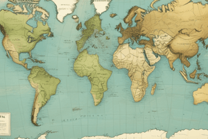
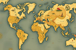
What is a Map?
- Maps help study the world and understand relationships between places.
- Thematic maps show the distribution of specific data themes to highlight patterns.
Unit 1: Topographic Maps and Scale
- Topographic maps: Detailed and accurate representations of land, showing elevation.
- General purpose maps display both natural and human-made features.
- Large-scale maps: Show smaller areas in detail.
- Small-scale maps: Cover large regions (e.g., world maps).
Unit 1: Parts of a Map
- Title, scale, legend, date of publication, direction, border
Unit 1: Map of Canada (Provinces and Territories)
- Includes a list of provinces and territories and their capitals.
Unit 1: Principles of Latitude and Longitude
- Latitude: Measures location north or south of the equator.
- Longitude: Measures location east or west of the prime meridian.
- Equator: Divides Earth into Northern and Southern hemispheres.
- Prime Meridian: Starting point for measuring east and west.
- North Pole: Northernmost point on Earth's surface.
- South Pole: Southernmost point on Earth's surface.
Unit 1: Pros of Technology in Mapping
- Search box
- Variable scale (zoom in/out)
- Street view (virtual tour)
- Cardinal points (N, S, E, W)
- Ordinal points (NW, NE, SW, SE)
- Grid systems (alphanumeric and map grids)
- Latitude and longitude (angular measurements)
- GPS (global positioning)
- GIS (geographic information systems)
Unit 2: Spheres of the Earth
-
Atmosphere (air): Mixture of gases surrounding Earth.
-
Hydrosphere (water): Water on Earth (including clouds, oceans, etc.).
-
Lithosphere (Earth): Solid outer crust, mantle, and core.
-
Biosphere (life): Living organisms and organic matter
-
Cryosphere (ice): Ice on Earth
-
Encompasses hydrological cycle (precipitation, runoff, groundwater, evaporation, transpiration, condensation)
-
71% of Earth's surface is covered by water (97% saltwater, 3% freshwater)
-
Fresh water distribution (ice ~77%, groundwater ~22%, surface water ~<1%)
-
Includes relevant concepts like plate tectonics, the structure of the Earth, and the rock cycle.
Unit 2: Geologic History
- Pangaea: A supercontinent that existed approximately 225 million years ago.
- Major plates: Explains the movement of the Earth's surface.
- Divergent plate boundary: Describes extension; spreading of plates.
- Convergent plate boundary: Plates crash and go up to form trenches, island arcs and fold mountains.
- Transform plate boundary: Plates brush against each other.
- Subduction: Oceanic plate runs into a continental plate and slides under it
Unit 2: Landforms
- Forces of Mountain Building: Folding (stress creates bending), Faulting (cracks in earth's crust), Volcanism (molten material).
- Forces of Erosion: Weathering (rocks disintegrate), Erosion (materials worn away by natural forces), Deposition (eroded materials to a new location)
- Types of Landforms : Volcanoes, Hills, Plains, Canyons, Escarpments/Bluffs, Peninsulas, Rocky/Sandy Shorelines, Fjords, Rock Columns
Unit 2: Climate-Vegetation Regions of Canada
- Temperature and precipitation variations, impacting vegetation types.
- Describes various vegetation regions (Boreal Forest, Grasslands, Tundra, Deciduous Forest).
- Emphasis on how climate and relief affect the distribution of different ecosystems.
Unit 2: Natural Disasters, and their effects
- Natural disasters define any event with damage to property or lives caused by natural forces.
- Effects may be economic (impact on economic activity) or Political (effect on systems).
Unit 2: Earthquakes, Volcanoes, and Tropical Storms
- Earthquakes and volcanic activity are discussed in terms of waves, scales, measurements (Richter, Modified Mercalli), locations, and formation methods
- Tropical storms (e.g. Hurricanes) are explored from their formation and categories
Unit 3: Population
- Birth rate: Number of live births per 1000 people.
- Death rate: Number of deaths per 1000 people.
- Demography: Study of human populations, focusing on factors like birth rates, death rates, age, and migration.
- Natural increase rate: Difference between birth and death rates
- Total fertility rate: Average number of children per woman during childbearing years.
- Immigration rate: Number of people entering a country per 1,000 people.
- Emigration rate: Number of people leaving a country per 1,000 people.
- Net migration rate: Difference between immigration and emigration rates.
- Population growth rate: Rate at which population is growing, considering birth, death and migration.
- Dependency rate: Ratio of working-age population (15–64) to non-working-age population.
- Population density: Number of people per unit area.
- Population distribution: How people are dispersed across a geographic area.
Unit 3: Canada's Role and Factors Influencing Population Distribution
- Canada's population density, growth rate, and how climate, natural resources (water, minerals, fertile land) soil, relief, transportation networks, are significant factors.
- Types of population distribution: Dispersed, linear, concentrated; factors influencing them (e.g., climate, resources, transportation).
Unit 3: Canadian Immigration History
- Push and pull factors: Reasons people leave and move to Canada.
- Routes of immigration: Details of immigration to Canada.
Unit 3: Urban Land Use and Liveability
- Liveable cities: Meeting needs for comfort, security, opportunity, and well-being.
- Mixed-use development: Designing neighbourhoods with multiple uses.
- Compact cities: Creating high-density development.
- Green infrastructure: Incorporating green spaces to deal with stormwater, heat islands and biodiversity.
- Sprawl: Uncontrolled or poorly planned urban growth.
- Greenbelts: Areas to prevent sprawl and preserve farmland.
Unit 3: Industries
- Primary industries: Raw material extraction from the ground.
- Secondary industries:Processing raw materials to manufacturing process
- Tertiary industries: Service-oriented work; offering essential services.
- Quaternary industries: Information industries.
- Quintary industries: Decision making industries, management activities in government and industry.
- Specific examples of Canadian industries (e.g., forestry, oil)
Unit 3: Non-Renewable/Flow Resources
- Non-renewable resources: Resources that cannot be replaced once used up (e.g., oil, gold).
- Flow resources: Resources that are replenished by natural processes (e.g., sunlight, river flow)
Studying That Suits You
Use AI to generate personalized quizzes and flashcards to suit your learning preferences.