Podcast
Questions and Answers
On maps, the color green typically represents ______, such as forests and plantations.
On maps, the color green typically represents ______, such as forests and plantations.
vegetation
A height symbol on a map indicates the ______ of a particular location.
A height symbol on a map indicates the ______ of a particular location.
elevation
Contour lines that are closely spaced together indicate a ______ gradient, showing a rapid change in elevation.
Contour lines that are closely spaced together indicate a ______ gradient, showing a rapid change in elevation.
steep
When using four-figure grid references, ______ grid lines increase in value as you move eastwards.
When using four-figure grid references, ______ grid lines increase in value as you move eastwards.
The four main compass points, also known as ______ points, are north, south, east, and west.
The four main compass points, also known as ______ points, are north, south, east, and west.
Maps are crucial for planning, decision-making, and maintaining records of ______ changes over time.
Maps are crucial for planning, decision-making, and maintaining records of ______ changes over time.
A ______ map is useful for identifying different rock types in a specific area.
A ______ map is useful for identifying different rock types in a specific area.
When using a map, always remember to check the ______, which indicates the proportion by which the actual area has been reduced.
When using a map, always remember to check the ______, which indicates the proportion by which the actual area has been reduced.
A map with a larger scale displays a smaller amount of area but with a ______ amount of detail.
A map with a larger scale displays a smaller amount of area but with a ______ amount of detail.
The height of the land and depth of the sea are typically shown on maps using ______.
The height of the land and depth of the sea are typically shown on maps using ______.
______ are lines on a map used to represent locations on Earth.
______ are lines on a map used to represent locations on Earth.
The area between the Tropic of Cancer (23.5°N) and the Tropic of Capricorn (23.5°S) is known as the ______.
The area between the Tropic of Cancer (23.5°N) and the Tropic of Capricorn (23.5°S) is known as the ______.
Unlike physical maps, ______ maps focus on the boundaries between entities, such as countries, states, or provinces.
Unlike physical maps, ______ maps focus on the boundaries between entities, such as countries, states, or provinces.
Lines of ______ run horizontally and are measured from 0° to 90° north and south.
Lines of ______ run horizontally and are measured from 0° to 90° north and south.
The ______ is at 0° latitude and divides the Earth into the Northern and Southern Hemispheres.
The ______ is at 0° latitude and divides the Earth into the Northern and Southern Hemispheres.
Lines of ______ run vertically and are measured from 0° to 180° east and west.
Lines of ______ run vertically and are measured from 0° to 180° east and west.
The ______ is at 0° longitude and passes through Greenwich, England.
The ______ is at 0° longitude and passes through Greenwich, England.
Topographical maps use ______ lines to represent elevation and the shape of the land.
Topographical maps use ______ lines to represent elevation and the shape of the land.
The Tropic of ______ is located at 23.5° North latitude.
The Tropic of ______ is located at 23.5° North latitude.
[Blank] symbols on maps are used to represent features that cover a large area, such as forests or bodies of water.
[Blank] symbols on maps are used to represent features that cover a large area, such as forests or bodies of water.
Flashcards
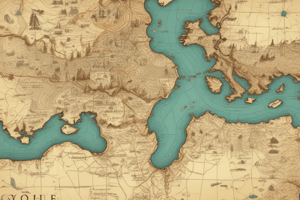
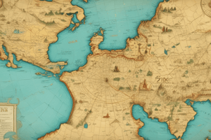
Uses of Maps
Uses of Maps
Maps are valuable sources of information for planning, decision-making and tracking landscape changes.
Types of Maps
Types of Maps
Examples include Google Maps, geological maps (showing rock types), street maps, rainfall maps, topographical maps and political maps.
Scale (Map)
Scale (Map)
Proportion by which the size of an area is reduced on a map.
Large Scale Map
Large Scale Map
Signup and view all the flashcards
Physical Features on Maps
Physical Features on Maps
Signup and view all the flashcards
Equator (0°)
Equator (0°)
Signup and view all the flashcards
Tropic of Cancer (23.5°N)
Tropic of Cancer (23.5°N)
Signup and view all the flashcards
Tropic of Capricorn (23.5°S)
Tropic of Capricorn (23.5°S)
Signup and view all the flashcards
Map Vegetation Color
Map Vegetation Color
Signup and view all the flashcards
Height Symbol
Height Symbol
Signup and view all the flashcards
Contour Lines
Contour Lines
Signup and view all the flashcards
Four-Figure Grid Reference
Four-Figure Grid Reference
Signup and view all the flashcards
Cardinal Directions
Cardinal Directions
Signup and view all the flashcards
Latitude
Latitude
Signup and view all the flashcards
Equator
Equator
Signup and view all the flashcards
Longitude
Longitude
Signup and view all the flashcards
Prime Meridian
Prime Meridian
Signup and view all the flashcards
Topographical Map
Topographical Map
Signup and view all the flashcards
Line Symbol (Maps)
Line Symbol (Maps)
Signup and view all the flashcards
Area Symbol (Maps)
Area Symbol (Maps)
Signup and view all the flashcards