Podcast
Questions and Answers
What is the primary purpose of political maps?
What is the primary purpose of political maps?
- To display climate zones
- To indicate population density
- To illustrate boundaries between countries and major cities (correct)
- To show natural landforms and features
Which type of map would be most suitable for a hiker navigating mountainous terrain?
Which type of map would be most suitable for a hiker navigating mountainous terrain?
- Resource map
- Physical map
- Topographic map (correct)
- Road map
Climate maps are specifically designed to illustrate which of the following?
Climate maps are specifically designed to illustrate which of the following?
- Roads and highways
- Natural resources and their locations
- Major cities and their boundaries
- Temperature, precipitation, and weather patterns (correct)
Resource maps primarily help in understanding the distribution of which elements?
Resource maps primarily help in understanding the distribution of which elements?
Population density maps show the comparative density of people in which settings?
Population density maps show the comparative density of people in which settings?
What distinguishes topographic maps from physical maps?
What distinguishes topographic maps from physical maps?
Historical maps are valuable for studying which aspect?
Historical maps are valuable for studying which aspect?
Which type of map is primarily used for navigation through streets and highways?
Which type of map is primarily used for navigation through streets and highways?
Flashcards are hidden until you start studying
Study Notes
Types of Maps
- Maps are visual representations of geographical areas, essential tools for understanding spatial relationships and features.
- Each type of map serves a different purpose and provides unique information about regions.
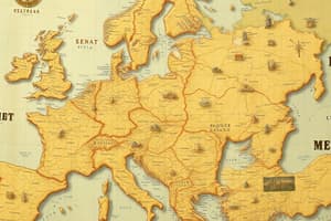
Political Maps
- Show boundaries between countries, states, regions, and major cities.
- Useful for understanding political landscapes and determining geographical limits.
- May also display roads, waterways, and other significant features.
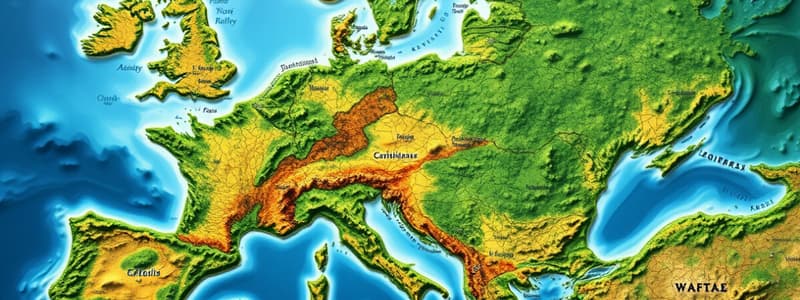
Physical Maps
- Illustrate natural landforms like mountains, deserts, rivers, oceans, and lakes.
- Employ symbols or colors to identify various geographical features.
- Aid in grasping the overall geography and physical characteristics of a region.
Topographic Maps
- Similar to physical maps but focus on land elevation and terrain shape.
- Frequently used by hikers for navigating diverse landscapes, including hills and valleys.
Climate Maps
- Depict different climate zones and provide data on temperature, precipitation, and weather patterns.
- Help understand the environmental conditions of specific regions.
Road Maps
- Highlight streets and highways, assisting in navigation through unfamiliar areas.
- Essential for planning journeys and identifying routes to destinations.
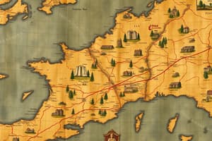
Resource Maps
- Display locations of natural resources such as forests, water bodies, fish, oil, coal, and minerals.
- Crucial for understanding the distribution of resources used for producing various goods.
Population Density Maps
- Indicate the density of people living in specific areas, comparing urban and rural populations.
- A city typically has a higher population density than a sparsely populated rural area.
Historical Maps
- Represent historical events, ancient civilizations, and boundaries that have changed over time.
- Useful for studying past geographical and cultural developments.
Conclusion
- Various map types are pivotal in accessing valuable information and enhancing our understanding of the world.
- Familiarity with maps is a vital skill for aspiring geographers and anyone interested in spatial dynamics.
Types of Maps
- Maps serve as visual tools to comprehend geographical areas, highlighting spatial relationships and features.
Political Maps
- Display boundaries among countries, states, regions, and prominent cities.
- Aid in grasping political landscapes and geographical limits.
- Often include significant features like roads and waterways.
Physical Maps
- Depict natural features such as mountains, deserts, rivers, and lakes.
- Utilize colors and symbols to represent geographical characteristics.
- Facilitate understanding of regional geography and physical traits.
Topographic Maps
- Focus on land elevation and shape, outlining terrain characteristics.
- Commonly used by hikers and outdoor enthusiasts for navigation.
Climate Maps
- Present various climate zones along with data on temperature and precipitation.
- Assist in understanding environmental conditions across regions.
Road Maps
- Highlight streets and highways for navigation and trip planning.
- Essential for route identification and traveling through unfamiliar areas.
Resource Maps
- Indicate locations of natural resources like forests, water bodies, and minerals.
- Vital for understanding the distribution of resources linked to production activities.
Population Density Maps
- Illustrate the density of populations in specific areas, contrasting urban and rural regions.
- Urban areas typically exhibit higher population density compared to rural areas.
Historical Maps
- Represent historical occurrences, ancient civilizations, and evolving boundaries.
- Useful for analyzing geographical and cultural developments over time.
Conclusion
- Diverse map types are critical for accessing information and enhancing geographical comprehension.
- Familiarity with various maps is essential for aspiring geographers and those interested in spatial dynamics.
Studying That Suits You
Use AI to generate personalized quizzes and flashcards to suit your learning preferences.