Podcast
Questions and Answers
What event marks the beginning of winter in the northern hemisphere?
What event marks the beginning of winter in the northern hemisphere?
- Winter Solstice (correct)
- Autumnal Equinox
- Vernal Equinox
- Summer Solstice
The Autumnal Equinox occurs on March 21.
The Autumnal Equinox occurs on March 21.
False (B)
What is the primary cause of a solar eclipse?
What is the primary cause of a solar eclipse?
The moon is directly in between the Earth and the sun.
The _______ includes all living things on Earth.
The _______ includes all living things on Earth.
Match the following physical subsystems of Earth with their descriptions:
Match the following physical subsystems of Earth with their descriptions:
Which geological process involves the movement of soil and rocks from one place to another?
Which geological process involves the movement of soil and rocks from one place to another?
Volcanic mountains are formed from the accumulation of sediment over time.
Volcanic mountains are formed from the accumulation of sediment over time.
What features are typically found at the lower course of a river system?
What features are typically found at the lower course of a river system?
Population density refers to the number of people per _______.
Population density refers to the number of people per _______.
Which type of mountain is formed through tectonic forces?
Which type of mountain is formed through tectonic forces?
What is primarily shown on climate maps?
What is primarily shown on climate maps?
Nautical charts are designed for navigation on land.
Nautical charts are designed for navigation on land.
How long does it take for the Earth to complete one revolution around the Sun?
How long does it take for the Earth to complete one revolution around the Sun?
The Earth's axis is tilted at _____ degrees, which influences the seasons.
The Earth's axis is tilted at _____ degrees, which influences the seasons.
Match the following terms with their definitions:
Match the following terms with their definitions:
What phenomenon occurs on June 21 in the Northern Hemisphere?
What phenomenon occurs on June 21 in the Northern Hemisphere?
Earth takes 24 hours to complete one revolution.
Earth takes 24 hours to complete one revolution.
What causes a leap year?
What causes a leap year?
Political maps show the boundaries of _____, states, and other political divisions.
Political maps show the boundaries of _____, states, and other political divisions.
What is analyzed when mapping urban growth?
What is analyzed when mapping urban growth?
Which of the following is a feature of the lower course river system?
Which of the following is a feature of the lower course river system?
Life expectancy is higher in LEDCs compared to MEDCs.
Life expectancy is higher in LEDCs compared to MEDCs.
What is the process called when water vapor changes into water droplets?
What is the process called when water vapor changes into water droplets?
A factor that causes people to leave their homes is called a ______.
A factor that causes people to leave their homes is called a ______.
Match the following landforms with their definitions:
Match the following landforms with their definitions:
Which of the following is considered a pull factor?
Which of the following is considered a pull factor?
Tropical regions typically experience low temperatures and low rainfall.
Tropical regions typically experience low temperatures and low rainfall.
What is the primary factor in calculating population density?
What is the primary factor in calculating population density?
The vernal equinox marks the beginning of winter in the southern hemisphere.
The vernal equinox marks the beginning of winter in the southern hemisphere.
Name one constructive process in geology.
Name one constructive process in geology.
The Earth's rotation takes approximately ______ hours to complete one full turn.
The Earth's rotation takes approximately ______ hours to complete one full turn.
What are renewable resources?
What are renewable resources?
Which of the following lines of the Earth is located at 23.5 degrees north latitude?
Which of the following lines of the Earth is located at 23.5 degrees north latitude?
A solar eclipse occurs when the moon is directly in between the earth and the ______.
A solar eclipse occurs when the moon is directly in between the earth and the ______.
Which factors affect population density?
Which factors affect population density?
How are volcanic mountains formed?
How are volcanic mountains formed?
Erosion is when wind, water, or ice move soil and rocks, while weathering is the process of ______ rocks and minerals.
Erosion is when wind, water, or ice move soil and rocks, while weathering is the process of ______ rocks and minerals.
Folded mountains form when two tectonic plates collide and crumple the Earth's crust.
Folded mountains form when two tectonic plates collide and crumple the Earth's crust.
Match the following phenomena with their descriptions:
Match the following phenomena with their descriptions:
Which of the following is NOT considered a human factor affecting population density?
Which of the following is NOT considered a human factor affecting population density?
Flashcards
Political Maps
Political Maps
Maps that show the boundaries of countries, states, and other political divisions.
Climate Maps
Climate Maps
Maps that show average weather conditions, such as temperature and precipitation, in different regions.
Nautical Charts
Nautical Charts
Specialized maps used for navigation on water, showing depths, currents, hazards, and other crucial information.
Relief/Topographic Maps
Relief/Topographic Maps
Signup and view all the flashcards
Earth's Rotation
Earth's Rotation
Signup and view all the flashcards
Earth's Revolution
Earth's Revolution
Signup and view all the flashcards
Earth's Axis Tilt
Earth's Axis Tilt
Signup and view all the flashcards
Summer Solstice
Summer Solstice
Signup and view all the flashcards
Winter Solstice
Winter Solstice
Signup and view all the flashcards
Leap Year
Leap Year
Signup and view all the flashcards
Vernal Equinox
Vernal Equinox
Signup and view all the flashcards
Autumnal Equinox
Autumnal Equinox
Signup and view all the flashcards
Solar Eclipse
Solar Eclipse
Signup and view all the flashcards
Atmosphere
Atmosphere
Signup and view all the flashcards
Biosphere
Biosphere
Signup and view all the flashcards
Lithosphere
Lithosphere
Signup and view all the flashcards
Hydrosphere
Hydrosphere
Signup and view all the flashcards
Weathering
Weathering
Signup and view all the flashcards
Erosion
Erosion
Signup and view all the flashcards
Population Density
Population Density
Signup and view all the flashcards
Renewable Resources
Renewable Resources
Signup and view all the flashcards
Non-Renewable Resources
Non-Renewable Resources
Signup and view all the flashcards
How do volcanic mountains form?
How do volcanic mountains form?
Signup and view all the flashcards
How do folded mountains form?
How do folded mountains form?
Signup and view all the flashcards
What is the water cycle?
What is the water cycle?
Signup and view all the flashcards
What is Evaporation?
What is Evaporation?
Signup and view all the flashcards
What is Transpiration?
What is Transpiration?
Signup and view all the flashcards
What is Condensation?
What is Condensation?
Signup and view all the flashcards
What is Precipitation?
What is Precipitation?
Signup and view all the flashcards
What is a push factor?
What is a push factor?
Signup and view all the flashcards
What is a pull factor?
What is a pull factor?
Signup and view all the flashcards
What is a landform?
What is a landform?
Signup and view all the flashcards
What are constructive processes?
What are constructive processes?
Signup and view all the flashcards
What is a mitigation strategy?
What is a mitigation strategy?
Signup and view all the flashcards
Study Notes
Types of Maps
- Climate maps show average weather conditions like temperature and precipitation in different regions.
- Nautical charts are specialized maps for water navigation. They display depths, currents, hazards, and other essential information.
- Relief/topographic maps show elevation and landforms.
- Political maps show country, state, and other political boundaries. They might also indicate capital cities and significant places.
How Geospatial Mapping Tools Are Used in Social Studies
- Mapping historical events and migrations.
- Analyzing the geographic context of historical events.
- Mapping cultural regions and language distribution.
- Analyzing the diffusion of cultures and ideas.
- Mapping economic activities and trade routes.
- Analyzing patterns of economic development and inequality.
- Mapping natural resources and environmental hazards.
- Analyzing the impact of human activities on the environment.
- Mapping urban growth and development patterns.
- Analyzing the impact of urban sprawl and transportation infrastructure.
Earth's Movement
- Rotation: Earth spins on its axis, causing day and night. This takes 24 hours.
- Revolution: Earth orbits the Sun, causing seasons. It takes approximately 365 ¼ days.
- Tilt of the Earth's axis: Earth's axis is tilted at 23.5 degrees, influencing the intensity of sunlight and seasons.
Earth Movement: Revolution and Rotation
- Revolution takes 365 ¼ days, causes seasons.
- Rotation takes 24 hours, causes day and night.
Why do we have a leap year?
- Earth takes slightly more than 365 days to orbit the sun, so every four years an extra day is added.
Vernal Equinox
- Equal day and night, marks the start of spring (Northern Hemisphere) and autumn (Southern Hemisphere). Occurs around March 21.
Autumnal Equinox
- Equal day and night, marks the start of autumn (Northern Hemisphere) and spring (Southern Hemisphere). Occurs around September 22.
Solar Eclipse
- The Moon passes directly between Earth and the Sun, blocking sunlight.
Earth's Four Major Physical Subsystems
- Hydrosphere: all Earth's water (oceans, rivers, lakes, groundwater, ice).
- Lithosphere: Earth's land (mountains, plains, plateaus).
- Biosphere: all living things on Earth (animals, plants, people).
- Atmosphere: the layer of gases surrounding Earth.
Landform Formation
- Constructive processes shape landforms (e.g., volcanic activity, tectonic deformation).
- Destructive processes also shape landforms (e.g., erosion, weathering).
Volcanic Mountains
- Formed by the eruption of molten rock from Earth's interior.
Folded Mountains
- Formed when tectonic plates collide, causing the Earth's crust to fold.
Weathering vs. Erosion
- Weathering is the breakdown of rocks and minerals.
- Erosion is the movement of soil and rock from one place to another.
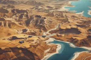
Lower Course River System
- Meander, oxbow lake, floodplain, delta, estuary, river mouth.
Population Distribution
- Population density is the number of people per unit area.
- It's affected by physical factors (climate, water supply, resources, soil quality) and human factors.
Impacts of Low Population Density
- Difficulty accessing services (healthcare, education).
- Limited market access and trade.
- Low economic activities.
- Increased rural-urban migration.
Renewable Resources
- Resources that can be replenished naturally (e.g., solar energy, wind energy, timber).
Non-renewable Resources
- Resources that exist in limited quantities and cannot be replenished quickly (e.g., oil, coal, natural gas, minerals).
Summer Solstice
- Longest day of the year in the Northern Hemisphere (shortest in the Southern Hemisphere). Occurs around June 21.
Difference between Voluntary and Involuntary Migration
- Voluntary migration: People leave of their own accord.
- Involuntary migration: People are forced to leave.
Push and Pull Factors
- Push factors: Reasons to leave a place (e.g., lack of jobs, poor healthcare).
- Pull factors: Reasons to move to a place (e.g., better job opportunities, good healthcare).
Water Cycle Processes
- Evaporation: Water turns to gas.
- Transpiration: Water released from plants and soil.
- Condensation: Water vapor turns to liquid water (clouds).
- Precipitation: Water falls to Earth (rain, snow).
Factors Affecting Climate
- Elevation, latitude, proximity to water.
Tropical vs. Polar Regions
- Tropical regions have high rainfall and temperatures, while polar regions have low rainfall and temperatures.
Earth Lines
- Arctic circle, tropic of cancer, equator, tropic of capricorn, antarctic circle, prime meridian.
Mitigation Strategies
- Reforestation, forestation.
Studying That Suits You
Use AI to generate personalized quizzes and flashcards to suit your learning preferences.