Podcast
Questions and Answers
What is a hill?
What is a hill?
- A major area of high ground (correct)
- A dip or low point between two areas of higher ground
- An area of low ground
- A continuous set of hills
What defines a ridge?
What defines a ridge?
- A low point in the ground
- A vertical feature
- A major sloping line of high ground (correct)
- A stretched-out groove in the land
What is a valley?
What is a valley?
- A man-made feature usually at least 10 feet high
- A short, continuous sloping line of higher ground
- A low point surrounded by higher ground
- A stretched-out groove in the land usually formed by streams (correct)
What does a saddle refer to in terrain features?
What does a saddle refer to in terrain features?
What is a depression?
What is a depression?
What is the symbol for a spur in terrain features?
What is the symbol for a spur in terrain features?
In land features, what constitutes a draw?
In land features, what constitutes a draw?
What does a cliff represent?
What does a cliff represent?
What is a cut in terms of terrain features?
What is a cut in terms of terrain features?
What does fill refer to?
What does fill refer to?
What color indicates cultural (man-made) features such as buildings and roads on maps?
What color indicates cultural (man-made) features such as buildings and roads on maps?
What color identifies hydrography or water features?
What color identifies hydrography or water features?
What are the 5 major terrain features?
What are the 5 major terrain features?
What are the 3 minor terrain features?
What are the 3 minor terrain features?
What are the 2 supplemental terrain features?
What are the 2 supplemental terrain features?
Flashcards
Hill
Hill
Elevated area shown on maps with concentric contour lines.
Ridge
Ridge
Continuous series of hills forming a sloping line of high ground.
Valley
Valley
Low area formed by streams/rivers with high ground on three sides.
Saddle
Saddle
Signup and view all the flashcards
Depression
Depression
Signup and view all the flashcards
Spur
Spur
Signup and view all the flashcards
Draw
Draw
Signup and view all the flashcards
Cliff
Cliff
Signup and view all the flashcards
Cut
Cut
Signup and view all the flashcards
Fill
Fill
Signup and view all the flashcards
Black Lines (Maps)
Black Lines (Maps)
Signup and view all the flashcards
Red-Brown Lines (Maps)
Red-Brown Lines (Maps)
Signup and view all the flashcards
Blue Lines (Maps)
Blue Lines (Maps)
Signup and view all the flashcards
Green Lines (Maps)
Green Lines (Maps)
Signup and view all the flashcards
Study Notes
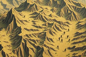
Major Terrain Features
- Hill: Elevated area shown on maps with contour lines that create concentric circles.
- Ridge: Continuous series of hills creating a sloping line of high ground.
- Valley: Low area formed by streams/rivers, surrounded by high ground on three sides, typically contains running water.
- Saddle: Dip between two higher areas, characterized by high ground in opposite directions and lower ground in the other two, visually represented as an hourglass.
- Depression: Low-lying area or sinkhole, surrounded by higher ground, can be simply described as a hole in the ground.
Minor Terrain Features
- Spur: Short line of elevated ground that protrudes from the side of a ridge.
- Draw: Less developed stream course found between two spurs, representing a transitional terrain.
- Cliff: Steep, vertical land feature where contour lines converge sharply, indicating a significant land elevation change.
Supplemental Terrain Features
- Cut: Man-made feature created from cutting through elevated ground, often for roads or railroads, represented on maps if at least 10 feet high.
- Fill: Man-made feature formed by filling low areas to establish roads or railroads, also shown on maps when at least 10 feet high.
Map Indicators
- Black Lines: Symbols for cultural features like buildings and roads, and surveyed elevations.
- Red-Brown Lines: Denote various cultural and relief features, as well as non-surveyed spot elevations.
- Blue Lines: Represent water features, including lakes, swamps, rivers, and drainage areas.
- Green Lines: Indicate vegetation important in military contexts, such as woods and orchards.
- Brown Lines: Show cultivated lands on specific maps, older maps denote relief features.
- Red Lines: Found on older maps to classify cultural features like populated areas and main roads.
Summary of Terrain Features
- 5 Major Terrain Features: Hill, Valley, Ridge, Saddle, Depression.
- 3 Minor Terrain Features: Spur, Draw, Cliff.
- 2 Supplemental Terrain Features: Cut, Fill.
Studying That Suits You
Use AI to generate personalized quizzes and flashcards to suit your learning preferences.