Podcast
Questions and Answers
What is primarily measured in hydrographic surveying?
What is primarily measured in hydrographic surveying?
- Bodies of water (correct)
- Land boundaries
- Animal habitats
- Urban features
Which type of surveying is most concerned with property lines and land features?
Which type of surveying is most concerned with property lines and land features?
- Topographic Surveying
- Land Surveying (correct)
- Geodetic Surveying
- Construction Surveying
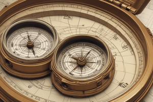
Which instrument is used to measure angles in surveying?
Which instrument is used to measure angles in surveying?
- Theodolite (correct)
- GPS
- Dumpy Level
- Total Station
What is the main purpose of triangulation in surveying?
What is the main purpose of triangulation in surveying?
Which type of surveying involves leveling techniques?
Which type of surveying involves leveling techniques?
What aspect of surveying is crucial for legal disputes over property lines?
What aspect of surveying is crucial for legal disputes over property lines?
What is an essential requirement for a career in surveying?
What is an essential requirement for a career in surveying?
What technique is used in photogrammetry for surveying?
What technique is used in photogrammetry for surveying?
Flashcards are hidden until you start studying
Study Notes
Definition of Surveying
- The science and art of measuring distances, angles, and elevations.
- Used to determine the relative positions of points on the Earth's surface.
Types of Surveying
-
Geodetic Surveying
- Measures large areas of the Earth.
- Considers the curvature of the Earth.
-
Land Surveying
- Focuses on measuring and mapping land boundaries.
- Typically involves property lines and land features.
-
Construction Surveying
- Provides measurements for construction projects.
- Ensures structures are built in the correct position and orientation.
-
Topographic Surveying
- Maps the contours and features of the land.
- Includes natural and man-made features.
-
Hydrographic Surveying
- Measures and describes bodies of water.
- Useful for navigation, dredging, and flood control.
Instruments Used in Surveying
-
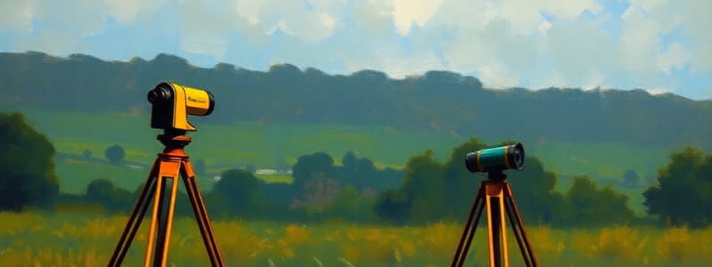
Total Station
- Combines electronic theodolite and EDM (Electronic Distance Measurement).
- Measures angles and distances simultaneously.
-
Theodolite
- Used for measuring horizontal and vertical angles.
-
Levels
- Instruments for determining the height difference between points.
- Types include dumpy levels and automatic levels.
-
GPS (Global Positioning System)
- Provides precise location data using satellite signals.
Surveying Techniques
-
Triangulation
- Uses the geometry of triangles to determine distances and positions.
-
Traversing
- Involves a series of connected lines to outline a specific area.
-
Leveling
- Determines the elevation of points relative to a datum.
-
Photogrammetry
- Uses photographs to obtain measurements and create maps.
Importance of Surveying
- Essential for land development and urban planning.
- Ensures accurate property boundaries and land ownership.
- Facilitates construction projects by providing precise site information.
- Aids in environmental studies and resource management.
Legal Aspects
- Surveyors must adhere to local laws and regulations.
- Surveys can be used in legal disputes over property lines.
Career in Surveying
- Requires a degree in surveying or a related field.
- May require licensure depending on jurisdiction.
- Opportunities in government, construction, and private consulting.
Definition of Surveying
- A discipline that blends science and art for measuring distances, angles, and elevations.
- Essential for establishing the relative positions of points on Earth's surface.
Types of Surveying
- Geodetic Surveying
- Measures expansive areas, accounting for Earth's curvature.
- Land Surveying
- Focuses on mapping land boundaries, property lines, and land features.
- Construction Surveying
- Supplies vital measurements for construction projects, ensuring accuracy in structure positioning and orientation.
- Topographic Surveying
- Creates maps showcasing the contours and features of the land, including both natural and man-made elements.
- Hydrographic Surveying
- Engages in measuring and describing water bodies, essential for navigation and flood control efforts.
Instruments Used in Surveying
- Total Station
- Integrates electronic theodolite with Electronic Distance Measurement (EDM) capabilities for simultaneous angle and distance measurement.
- Theodolite
- Primarily measures horizontal and vertical angles.
- Levels
- Instruments designed to establish height differences between points, including dumpy and automatic levels.
- GPS (Global Positioning System)
- Offers accurate location data through satellite signals.
Surveying Techniques
- Triangulation
- Employs the geometric properties of triangles for determining distances and positions.
- Traversing
- Connects a series of lines to outline and determine a specific area.
- Leveling
- Assesses elevation differences in relation to a designated datum.
- Photogrammetry
- Utilizes photographic images to gather measurements and create detailed maps.
Importance of Surveying
- Crucial for land development and efficient urban planning.
- Guarantees accurate property boundaries, promoting clear land ownership.
- Facilitates construction efforts by providing precise site data.
- Supports environmental studies and effective resource management.
Legal Aspects
- Surveyors must comply with local regulations and laws.
- Surveys can be pivotal in resolving legal disputes over property lines.
Career in Surveying
- Requires a degree in surveying or a cognate discipline.
- Licensure may be necessary depending on local jurisdiction.
- Employment opportunities span government sectors, construction companies, and private consulting firms.
Studying That Suits You
Use AI to generate personalized quizzes and flashcards to suit your learning preferences.