Podcast
Questions and Answers
What is the principle behind chain surveying?
What is the principle behind chain surveying?
- Principle of intersecting
- Principle of leveling
- Principle of trilateration
- Principle of triangulation (correct)
What is the primary instrument used to measure distances in chain surveying?
What is the primary instrument used to measure distances in chain surveying?
- Chain or tape (correct)
- Compass
- Theodolite
- GPS device
What is the first step in the procedure of chain surveying?
What is the first step in the procedure of chain surveying?
- Measuring distances
- Calculating coordinates
- Measuring angles
- Setting up the survey (correct)
What is the main limitation of chain surveying?
What is the main limitation of chain surveying?
What is one of the advantages of chain surveying?
What is one of the advantages of chain surveying?
What is one of the applications of chain surveying?
What is one of the applications of chain surveying?
What is used to measure directions and angles in chain surveying?
What is used to measure directions and angles in chain surveying?
What is calculated in the final step of chain surveying?
What is calculated in the final step of chain surveying?
Who is known as the father of soil mechanics?
Who is known as the father of soil mechanics?
What is soil comprised of?
What is soil comprised of?
What is the process of formation of soil known as?
What is the process of formation of soil known as?
What type of soil is formed by non-marine surface waters?
What type of soil is formed by non-marine surface waters?
What type of soil is found in mountain valleys?
What type of soil is found in mountain valleys?
What type of soil is formed by weathering action of glaciers?
What type of soil is formed by weathering action of glaciers?
What type of soil is formed by deposits of sea waters?
What type of soil is formed by deposits of sea waters?
What type of soil is formed of fine-grained CaCo3?
What type of soil is formed of fine-grained CaCo3?
What is Eoline soil formed by?
What is Eoline soil formed by?
Which type of soil is Loess an example of?
Which type of soil is Loess an example of?
What is the main characteristic of Loam?
What is the main characteristic of Loam?
What type of soil is formed due to accumulation of vegetative matter?
What type of soil is formed due to accumulation of vegetative matter?
Which type of soil is highly sticky, plastic, and dark colored?
Which type of soil is highly sticky, plastic, and dark colored?
What is the characteristic of Black cotton Soil?
What is the characteristic of Black cotton Soil?
What type of water is held by the soil between its pores through capillary action?
What type of water is held by the soil between its pores through capillary action?
What type of water is held as a very thin film on soil particles?
What type of water is held as a very thin film on soil particles?
What is the type of soil formed due to weathering action of wind?
What is the type of soil formed due to weathering action of wind?
What type of soil is characterized by being highly sticky, plastic, and dark colored?
What type of soil is characterized by being highly sticky, plastic, and dark colored?
What type of water is held by the soil between its pores through capillary action?
What type of water is held by the soil between its pores through capillary action?
What type of soil is formed by accumulation of vegetative matter?
What type of soil is formed by accumulation of vegetative matter?
What type of soil is inorganic and possesses high compressibility and shrinkage?
What type of soil is inorganic and possesses high compressibility and shrinkage?
Who is credited as the father of soil mechanics?
Who is credited as the father of soil mechanics?
What is soil comprised of?
What is soil comprised of?
What type of soil is formed from volcanic ash and has high compressibility and plasticity?
What type of soil is formed from volcanic ash and has high compressibility and plasticity?
What is the process of formation of soil known as?
What is the process of formation of soil known as?
What type of soil is a mixture of sand, silt, and clay which may consist of organic matter?
What type of soil is a mixture of sand, silt, and clay which may consist of organic matter?
What type of soil is formed by non-marine surface waters?
What type of soil is formed by non-marine surface waters?
What type of water is held as a very thin film on soil particles?
What type of water is held as a very thin film on soil particles?
What type of soil is formed by gravity forces in mountain valleys?
What type of soil is formed by gravity forces in mountain valleys?
What type of soil is uniformly graded silt-sized?
What type of soil is uniformly graded silt-sized?
What type of soil is formed by weathering action of glaciers?
What type of soil is formed by weathering action of glaciers?
What type of soil is formed from small grained slightly cementous volcanic ash?
What type of soil is formed from small grained slightly cementous volcanic ash?
What type of soil is formed by deposits of sea waters?
What type of soil is formed by deposits of sea waters?
What type of soil is formed of fine-grained CaCo3 of marine origin?
What type of soil is formed of fine-grained CaCo3 of marine origin?
What is the primary composition of Alluvial Soil?
What is the primary composition of Alluvial Soil?
What is a characteristic of Marine soil?
What is a characteristic of Marine soil?
Flashcards are hidden until you start studying
Study Notes
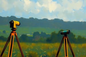
Chain Surveying
Definition
- A method of surveying that uses a chain or tape to measure distances and angles between reference points.
Principles
- Based on the principle of triangulation, where the length of a side of a triangle can be calculated using the lengths of the other two sides and the angles between them.
- Uses a chain or tape to measure the length of a side, and a compass or theodolite to measure the angles.
Instruments Used
- Chain or tape: a measuring tape or chain made of metal or fiberglass, used to measure distances.
- Compass: a device used to measure directions and angles.
- Theodolite: a precision instrument used to measure angles and distances.
Procedure
- Setting up the survey: Identify the reference points and establish a datum line.
- Measuring distances: Use the chain or tape to measure the distances between reference points.
- Measuring angles: Use the compass or theodolite to measure the angles between the lines.
- Calculating coordinates: Use the measured distances and angles to calculate the coordinates of the reference points.
Advantages
- Simple and cost-effective: Chain surveying is a relatively simple and inexpensive method of surveying.
- Quick and accurate: Can be used to quickly and accurately measure distances and angles.
Limitations
- Limited to small areas: Chain surveying is best suited for small areas, such as building sites or small plots of land.
- Not suitable for large areas: Not suitable for large areas, such as country boundaries or large tracts of land.
Applications
- Building construction: Chain surveying is often used in building construction to measure distances and angles between reference points.
- Land surveying: Used in land surveying to measure boundaries and distances between reference points.
- Topographic mapping: Used in topographic mapping to create detailed maps of an area.
Chain Surveying
Definition and Principles
- Chain surveying is a method that uses a chain or tape to measure distances and angles between reference points, based on the principle of triangulation.
Instruments and Procedure
- Chain or tape: a measuring tape or chain made of metal or fiberglass, used to measure distances.
- Compass: a device used to measure directions and angles.
- Theodolite: a precision instrument used to measure angles and distances.
- Procedure:
- Set up the survey: identify reference points and establish a datum line.
- Measure distances using the chain or tape.
- Measure angles using the compass or theodolite.
- Calculate coordinates using the measured distances and angles.
Advantages and Limitations
- Advantages:
- Simple and cost-effective method.
- Quick and accurate measurement.
- Limitations:
- Limited to small areas, such as building sites or small plots of land.
- Not suitable for large areas, such as country boundaries or large tracts of land.
Applications
- Building construction: used to measure distances and angles between reference points.
- Land surveying: used to measure boundaries and distances between reference points.
- Topographic mapping: used to create detailed maps of an area.
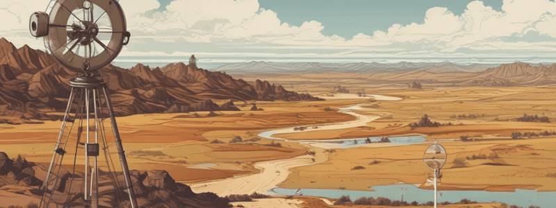
Introduction to Soil Mechanics
- Soil Mechanics is a field of study founded by Karl von Terzaghi, also known as the father of soil mechanics.
- Soil is an unconsolidated material comprised of air, water, or both, derived from the disintegration of rocks through weathering.
- Weathering is the process of rock disintegration caused by natural forces like wind, water, and organisms.
- Soil formation, also known as pedogenesis, can result in transported soil (when the weathered product is displaced) or residual soil (when not displaced).
Types of Soil
- Alluvial Soil: formed by deposits created by non-marine surface waters, found in flood plains, and can contain sand, silt, gravels, and clay.
- Colluvial Soil (Talus): formed by gravity forces, found in mountain valleys.
- Lacustrine Soil: uniformly graded clay deposits formed by non-marine still waters (lakes).
- Glacial till/Glacial Drift: formed by physical changes in glaciers and icebergs, can contain a mixture of gravel, sand, silt, and clay, making them well-graded soils.
- Marine Soil: mostly saline sand, silt, and clay deposited by sea waters, characterized by low shear strength and high compressibility.
- Marl: fine-grained CaCo3 of marine origin.
- Eoline Soil: formed by wind erosion, a wide spectrum term including all soils formed due to wind erosion.
- Loess: an example of Eoline soil, uniformly graded silt-sized soil.
- Loam: a mixture of sand, silt, and clay, possibly containing organic matter.
- Cumulose Soil (Peat/Muck): formed by the accumulation of vegetative matter, characterized as sticky, dark-colored, plastic clays.
- Gumbo: highly sticky, plastic, dark-colored clays.
- Black Cotton Soil: inorganic soil possessing high compressibility and shrinkage.
- Tuff: small-grained, slightly cementous volcanic ash.
- Bentonite: volcanic ash of high compressibility and plasticity, often used for lubrication in drilling.
Points to Remember
- Soils 1-4 are formed by fresh surface water weathering.
- Soils 5 and 6 are of marine origin and contain substantial amounts of salts.
- Soils 7 and 8 are formed by wind weathering action.
- Soils 9-11 are organic soils.
- Soils 13 and 14 are of volcanic origins.
Types of Water in Soil
- Gravity Water: freely available water in soil that drains freely in the direction of gravity.
- Capillary Water: water held by the soil between its pores through capillary action, available for plants for growth.
- Hygroscopic Water: water held as a very thin film on soil particles, absorbed from the atmosphere immediately after oven drying.
Studying That Suits You
Use AI to generate personalized quizzes and flashcards to suit your learning preferences.