Podcast
Questions and Answers
The "divide" between rich and poor countries has narrowed since the Industrial Revolution.
The "divide" between rich and poor countries has narrowed since the Industrial Revolution.
False (B)
Settler colonies, like the United States, Australia, and Canada, were initially established to explore resources and remained focused on that purpose.
Settler colonies, like the United States, Australia, and Canada, were initially established to explore resources and remained focused on that purpose.
False (B)
The fuelwood crisis is solely a result of deforestation in developing countries.
The fuelwood crisis is solely a result of deforestation in developing countries.
True (A)
The "birth rate-death rate" formula is not a valid representation of population change (growth rate).
The "birth rate-death rate" formula is not a valid representation of population change (growth rate).
Education and healthcare have a significant impact on birth rates, causing them to increase.
Education and healthcare have a significant impact on birth rates, causing them to increase.
The Malthusian Theory states that population growth will eventually outpace food production, leading to widespread famine.
The Malthusian Theory states that population growth will eventually outpace food production, leading to widespread famine.
Population pyramids for developed countries (MDCs) and developing countries (LDCs) typically have the same shape due to similar birth and death rates.
Population pyramids for developed countries (MDCs) and developing countries (LDCs) typically have the same shape due to similar birth and death rates.
Push-Pull Factors refer to the economic and social forces that encourage people to migrate to another country. Push Factors compel people to leave their home countries, while Pull Factors attract people to a new destination.
Push-Pull Factors refer to the economic and social forces that encourage people to migrate to another country. Push Factors compel people to leave their home countries, while Pull Factors attract people to a new destination.
A warm air mass rising over a cold air mass is one way precipitation occurs.
A warm air mass rising over a cold air mass is one way precipitation occurs.
Low-pressure air systems are characterized by descending air, causing dry conditions.
Low-pressure air systems are characterized by descending air, causing dry conditions.
The equator experiences high pressure conditions due to the convergence of warm air.
The equator experiences high pressure conditions due to the convergence of warm air.
The Tropic of Capricorn is where the direct rays of the sun hit during the Northern Hemisphere's summer solstice.
The Tropic of Capricorn is where the direct rays of the sun hit during the Northern Hemisphere's summer solstice.
The term "biome" refers to a specific plant community, regardless of climate or geographical location.
The term "biome" refers to a specific plant community, regardless of climate or geographical location.
The "Greenhouse Effect" is a natural process responsible for warming the Earth's atmosphere, but human activities can exacerbate this effect.
The "Greenhouse Effect" is a natural process responsible for warming the Earth's atmosphere, but human activities can exacerbate this effect.
The Industrial Revolution caused a shift from an agrarian society to a more urban, industrialized society.
The Industrial Revolution caused a shift from an agrarian society to a more urban, industrialized society.
A Less Developed Country (LDC) typically experiences low literacy rates, high infant mortality, and low per capita income.
A Less Developed Country (LDC) typically experiences low literacy rates, high infant mortality, and low per capita income.
The Dependency Theory suggests that Less Developed Countries can achieve economic growth by adopting the economic systems of More Developed Countries.
The Dependency Theory suggests that Less Developed Countries can achieve economic growth by adopting the economic systems of More Developed Countries.
A settler colony was established primarily for the purpose of extracting resources and wealth, while a mercantile colony focused on establishing permanent settlements and creating a new society.
A settler colony was established primarily for the purpose of extracting resources and wealth, while a mercantile colony focused on establishing permanent settlements and creating a new society.
The Sahara Desert, located between $20^\circ$ and $30^\circ$ North Latitude, is a region known for its high precipitation and dense vegetation.
The Sahara Desert, located between $20^\circ$ and $30^\circ$ North Latitude, is a region known for its high precipitation and dense vegetation.
The direct rays of the sun hit the equator during the equinoxes in March and September.
The direct rays of the sun hit the equator during the equinoxes in March and September.
Orographic precipitation occurs when rising air cools and condenses as it moves up mountain slopes.
Orographic precipitation occurs when rising air cools and condenses as it moves up mountain slopes.
The Agricultural Revolution, a transition from hunting and gathering to settled agriculture, had a significant impact on population growth by providing a more reliable food source.
The Agricultural Revolution, a transition from hunting and gathering to settled agriculture, had a significant impact on population growth by providing a more reliable food source.
The Industrial Revolution was responsible for a significant decrease in the use of fossil fuels, as it led to the development of renewable energy sources.
The Industrial Revolution was responsible for a significant decrease in the use of fossil fuels, as it led to the development of renewable energy sources.
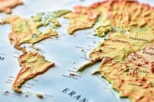
A map projection is a tool for creating a 3D representation of the Earth on a flat surface.
A map projection is a tool for creating a 3D representation of the Earth on a flat surface.
The Prime Meridian is located at $180^ heta$ longitude.
The Prime Meridian is located at $180^ heta$ longitude.
A dot map is used to illustrate the movement of people or goods from one area to another.
A dot map is used to illustrate the movement of people or goods from one area to another.
Relative location describes where something is specifically identified by its coordinates.
Relative location describes where something is specifically identified by its coordinates.
The Tropic of Cancer is located at $23.5^ heta$ South.
The Tropic of Cancer is located at $23.5^ heta$ South.
The term “spatial” refers to the distribution of places and people on the planet.
The term “spatial” refers to the distribution of places and people on the planet.
An isarithmic map uses lines to connect points of similar values, like a contour map.
An isarithmic map uses lines to connect points of similar values, like a contour map.
A scale of 1:10 indicates that one inch on a map represents ten miles on the ground.
A scale of 1:10 indicates that one inch on a map represents ten miles on the ground.
Flashcards
Spatial
Spatial
Refers to location on a map and distribution of places and people.
Map Projection
Map Projection
A method to portray Earth’s spherical surface on a flat map accurately.
Map Scale
Map Scale
The ratio showing the relationship between distances on the map and actual distances.
Absolute Location
Absolute Location
Signup and view all the flashcards
Relative Location
Relative Location
Signup and view all the flashcards
Longitude
Longitude
Signup and view all the flashcards
Choropleth Map
Choropleth Map
Signup and view all the flashcards
Weather vs. Climate
Weather vs. Climate
Signup and view all the flashcards
MDCs vs LDCs
MDCs vs LDCs
Signup and view all the flashcards
Fuelwood Crisis
Fuelwood Crisis
Signup and view all the flashcards
Population Change
Population Change
Signup and view all the flashcards
Demographic Transition Model
Demographic Transition Model
Signup and view all the flashcards
Malthusian Theory
Malthusian Theory
Signup and view all the flashcards
Push and Pull Factors
Push and Pull Factors
Signup and view all the flashcards
Population Pyramid
Population Pyramid
Signup and view all the flashcards
Overpopulation Types
Overpopulation Types
Signup and view all the flashcards
Weather
Weather
Signup and view all the flashcards
Climate
Climate
Signup and view all the flashcards
Precipitation
Precipitation
Signup and view all the flashcards
Convectional precipitation
Convectional precipitation
Signup and view all the flashcards
Orographic precipitation
Orographic precipitation
Signup and view all the flashcards
Cyclonic precipitation
Cyclonic precipitation
Signup and view all the flashcards
High pressure systems
High pressure systems
Signup and view all the flashcards
Low pressure systems
Low pressure systems
Signup and view all the flashcards
Winter Solstice
Winter Solstice
Signup and view all the flashcards
Summer Solstice
Summer Solstice
Signup and view all the flashcards
Biome
Biome
Signup and view all the flashcards
Greenhouse Effect
Greenhouse Effect
Signup and view all the flashcards
Global Warming
Global Warming
Signup and view all the flashcards
Agricultural Revolution
Agricultural Revolution
Signup and view all the flashcards
Industrial Revolution
Industrial Revolution
Signup and view all the flashcards
Study Notes
Spatial Concepts
- Spatial: Refers to location, distribution of places/people, and how things relate to each other.
- Maps: Show spatial relationships, distributions, and flows (people, goods, ideas).
- Map Projection: Transforms Earth's spherical shape onto a flat surface, aiming for accuracy.
- Map Scale: Ratio on a map representing the relationship between map distances and real-world distances (e.g., 1:10 meaning one inch equals ten miles).
- Map Symbols: Representations of spatial phenomena (e.g., cities, rivers, population).
- Absolute Location: Specific coordinates (longitude/latitude) defining a place. Example: 38°N, 86°W.
- Relative Location: Position of a place in relation to others. Example: near a river.
Longitude and Latitude
- Longitude: Measures east-west, using meridians running north-south. Prime Meridian (0°) and International Dateline (180°) are significant lines.
- Latitude: Measures north-south, using parallels running east-west, lines of the same latitude are the same distance from each other. Arctic Circle (66.5°N), Tropic of Cancer (23.5°N), Equator (0°), Tropic of Capricorn (23.5°S), Antarctic Circle (66.5°S) are significant lines.
Map Types
- Choropleth Maps: Areas filled with patterns/colors representing values (e.g., population density).
- Isarithmic Maps: Lines connect points of equal value (e.g., elevation contour maps).
- Dot Maps: Display patterns/distributions using dots (e.g., population distribution).
- Flow Maps: Show movement of people or goods between areas.
Weather and Climate
- Weather: Short-term atmospheric conditions.
- Climate: Long-term average weather patterns.
- Main Components: Precipitation and temperature.
Precipitation
- Convectional Precipitation: Warm air rising, cooling, and condensing.
- Orographic Precipitation: Air forced up a mountain, cooling, and condensing.
- Cyclonic/Frontal Precipitation: Meeting of warm and cool air masses, with warm air rising.
Air Pressure Systems
- Low Pressure: Counter-clockwise air circulation, rising air (typically associated with precipitation).
- High Pressure: Clockwise air circulation, falling air (less precipitation).
- Air Movement: High pressure to low pressure.
Global Temperature and Seasons
- Temperature Variations: Driven by sunlight angle and latitude. Hot at equator, cold at poles, seasonal at mid-latitudes.
- Seasons: Tilt of Earth's axis; changing direct sunlight leads to variations in temperature and day length.
- Solstices:
- Winter Solstice (December 22): Sun's direct rays at Tropic of Capricorn.
- Summer Solstice (June 22): Sun's direct rays at Tropic of Cancer.
- Equinoxes: Sun's direct rays hit the equator (March 20 and September 23).
Biomes
- Biome: Terrestrial ecosystem type based on dominant vegetation.
- Relationship to Climate: Climate determines biome. Biome characteristics depend on temperature and precipitation.
- Biomes:
- Polar/Subarctic (cold, dry)
- Desert (hot, dry)
- Steppe/Savanna (grassland)
- Tropical Rainforest (humid, rain)
- Oceanic (moderate temperatures, lots of precipitation, coniferous forests)
- Mediterranean (wet summers, dry winters)
- Continental (mixed forests, mid-latitudes)
Greenhouse Effect and Global Warming
- Greenhouse Effect: Greenhouse gases (CO2, water vapor, methane, CFCs, nitrous oxide) trap heat from sunlight.
- Global Warming: Increasing global temperatures due to human and environmental factors.
Agricultural Revolution/Industrial Revolution
- Agricultural Revolution: Shift from hunting and gathering to agriculture (settled farming).
- Impact: Increased population, domestication of plants/animals, and a transition from extensive to intensive land use.
- Industrial Revolution: Shift from agrarian to industrial societies, starting with steam engines, coal, gas.
- Impact: Urbanization, increased population, longer lifespans, environmental pollution, extensive resource use.
Developed and Developing Countries
- MDC (More Developed Country): Wealthy, industrialized countries.
- LDC (Less Developed Country): Poorer, agricultural-based countries.
- Measurement of Development: GDP, HDI, Gini coefficient.
- Spatial Distribution: MDCs are primarily in mid-latitudes; LDCs are closer to the equator.
Dependency Theory
- Dependency Theory: Former colonies often depend on their former colonizers.
- Mercantile Colonies: Agrarian, producing raw materials.
- Settler Colonies: Exploitation for resources; settlers stayed for longer periods.
- Geographic Factors: Affect economic success (access to water, resources, location, etc.)
Population Change and Migration
- Population Change: Based on birth rates, death rates, migration.
- Migration: Movement from one location to another.
- Birth/Death Rate Factors: Health, education, infrastructure, access to resources.
- Demographic Transition Model: Stages of population growth based on birth and death rates, changing over time, (High birth, high death-Low birth, low death-transition).
Population Pyramids
- Population Pyramid: Graphical representation of a population's age and sex distribution.
- MDC vs. LDC Pyramids: MDCs typically display older populations; LDCs have pyramids showing larger populations in younger age groups.
Studying That Suits You
Use AI to generate personalized quizzes and flashcards to suit your learning preferences.