Podcast
Questions and Answers
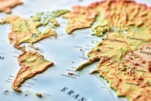
Which of the following map projections is known for preserving shape but distorting area, making it useful for navigation?
Which of the following map projections is known for preserving shape but distorting area, making it useful for navigation?
- Peters Projection
- Azimuthal Projection
- Mercator Projection (correct)
- Robinson Projection
The concept of 'distance decay' suggests that the interaction between two places increases as the distance between them increases.
The concept of 'distance decay' suggests that the interaction between two places increases as the distance between them increases.
False (B)
What type of map is specifically designed to show the distribution of a particular theme or variable across a geographic area?
What type of map is specifically designed to show the distribution of a particular theme or variable across a geographic area?
thematic map
The term referring to the degree to which a place is connected to, and accessible to other places is known as ______.
The term referring to the degree to which a place is connected to, and accessible to other places is known as ______.
Match the following terms with their correct descriptions:
Match the following terms with their correct descriptions:
Which of the following best describes 'relative location'?
Which of the following best describes 'relative location'?
A 'formal region' is defined by subjective perceptions and cultural values rather than objective characteristics.
A 'formal region' is defined by subjective perceptions and cultural values rather than objective characteristics.
What is the term for the spread of a phenomenon from one place to another through direct contact?
What is the term for the spread of a phenomenon from one place to another through direct contact?
The reduction in the time it takes for something to diffuse to other places as a result of improved transportation and communication technologies is known as ______.
The reduction in the time it takes for something to diffuse to other places as a result of improved transportation and communication technologies is known as ______.
Match the following map types with their primary characteristics:
Match the following map types with their primary characteristics:
Which concept describes how one place or location can supply the requirement or demand for something present in another place?
Which concept describes how one place or location can supply the requirement or demand for something present in another place?
'Human geography' primarily focuses on studying the physical processes that shape the distribution of landforms.
'Human geography' primarily focuses on studying the physical processes that shape the distribution of landforms.
What is the name for a system that captures, stores, analyzes, and displays geographic data?
What is the name for a system that captures, stores, analyzes, and displays geographic data?
The meridian at 0° longitude, from which all other longitudes are measured, is known as the ______.
The meridian at 0° longitude, from which all other longitudes are measured, is known as the ______.
Match the following concepts with their definitions:
Match the following concepts with their definitions:
Which type of diffusion involves the spread of an idea or innovation from persons or nodes of authority or power to other persons or places?
Which type of diffusion involves the spread of an idea or innovation from persons or nodes of authority or power to other persons or places?
'Scale of analysis' refers only to the physical size of a map, not to the level of aggregation of the data being studied.
'Scale of analysis' refers only to the physical size of a map, not to the level of aggregation of the data being studied.
What term describes the opportunities that lie between two places, reducing the likelihood of interaction between them?
What term describes the opportunities that lie between two places, reducing the likelihood of interaction between them?
The principle that describes how the attractiveness of retail locations is determined by their size and distance to consumers called the law of retail ______.
The principle that describes how the attractiveness of retail locations is determined by their size and distance to consumers called the law of retail ______.
Match each concept with its definition:
Match each concept with its definition:
Flashcards
Absolute distance
Absolute distance
The exact measurement of the physical space between two points.
Absolute location
Absolute location
A specific point on Earth's surface expressed using coordinates.
Accessibility
Accessibility
The ease with which people can reach a location.
Aggregation
Aggregation
Signup and view all the flashcards
Azimuthal Projection
Azimuthal Projection
Signup and view all the flashcards
Breaking point
Breaking point
Signup and view all the flashcards
Cartogram
Cartogram
Signup and view all the flashcards
Cartography
Cartography
Signup and view all the flashcards
Choropleth Map
Choropleth Map
Signup and view all the flashcards
Cognitive map
Cognitive map
Signup and view all the flashcards
Complementarity
Complementarity
Signup and view all the flashcards
Connectivity
Connectivity
Signup and view all the flashcards
Contagious Diffusion
Contagious Diffusion
Signup and view all the flashcards
Coordinate System
Coordinate System
Signup and view all the flashcards
Cultural Ecology
Cultural Ecology
Signup and view all the flashcards
Cultural Landscape
Cultural Landscape
Signup and view all the flashcards
Distance Decay
Distance Decay
Signup and view all the flashcards
Dot Maps
Dot Maps
Signup and view all the flashcards
Environmental Geography
Environmental Geography
Signup and view all the flashcards
Expansion Diffusion
Expansion Diffusion
Signup and view all the flashcards
Study Notes
- Absolute distance refers to the exact measurement between two points.
- Absolute location is the precise positioning of a place on the Earth's surface.
- Accessibility measures the ease with which one location can be reached from others.
- Aggregation is the process of grouping things together.
- Azimuthal projection is a map projection where directions from a central point are preserved.
- Breaking point is a boundary where the force of attraction between locations is equal.
- Cartograms are maps that distort the size of geographic regions based on statistical data.
- Cartography is the art and science of making maps.
- Choropleth map uses differences in shading, coloring, or the placing of symbols within predefined areas to indicate the average values of a property or quantity in those areas.
- Cognitive map is a mental representation of one's physical environment.
- Complementarity is when two regions, through an exchange of raw materials and/or finished products, can specifically satisfy each other's demands.
- Connectivity refers to the relationships among people and objects across the barrier of space.
- Contagious diffusion is the spread of an idea/trait/concept through a population by person to person contact.
- Coordinate system is a system that uses numbers to determine the position of a point/location.
- Cultural ecology studies the relationship between a culture group and the natural environment it occupies.
- Cultural landscape is the visible imprint of human activity and culture on the environment.
- Distance decay suggests that the intensity of activity declines as distance from its source increases.
- Dot maps use dots to represent the occurrence of some phenomenon in order to depict population distribution
- Environmental geography examines the spatial aspects of interactions between humans and the natural world.
- Expansion diffusion is the spread of a feature or trend among people from one area to another; the number of people adopting grows continuously larger.
- Formal region is an area in which everyone shares in common one or more distinctive characteristics.
- Friction of distance is the increase in time and cost that usually comes with increasing distance.
- Fuller projection is a type of map projection that maintains the accurate size and shape of landmasses.
- Functional region is an area organized around a node or focal point.
- Geographic Information Systems (GIS) integrate hardware, software, and data for capturing, managing, analyzing, and displaying all forms of geographically referenced information.
- Global Positioning System (GPS) is a satellite-based system for determining the absolute location of places or geographic features.
- Gravity model predicts the interaction between places on the basis of their population size and distance between them.
- Hierarchical diffusion is the spread of an idea from persons or nodes of authority or power to other persons or places.
- Human geography is the study of the spatial variation in the patterns and processes related to human activities.
- International Date Line is an arc that for the most part follows 180° longitude, deviations occur to include associated island groups within the same day.
- Intervening opportunity is the presence of a nearer opportunity that greatly diminishes the attractiveness of sites further away.
- Isoline is a line on a map connecting points of equal value.
- Large scale maps depict a small area with great detail.
- Latitude is the numbering system used to indicate the location of parallels drawn on a globe and measuring distance north and south of the Equator.
- Law of retail gravitation explains that larger cities attract people from a wider area.
- Location chart shows specific locations of different things.
- Longitude the numbering system used to indicate the location of meridians drawn on a globe and measuring distance east and west of the Prime Meridian (0°).
- Map projection is a way to transfer locations on Earth's surface to a flat map.
- Map scale is the relationship between the size of an object on a map and the size of the actual feature on Earth's surface.
- Mercator projection is a type of map projection that distorts the size of areas near the poles, making them appear much larger than they are.
- Meridian is an arc drawn on a map between the North and South poles.
- Natural landscape is the physical environment unaffected by human activity.
- Nature-society refers to how nature and society are connected.
- Parallel is a circle drawn around the globe parallel to the equator representing lines of latitude.
- W. D. Pattison was a geographer known for his four traditions of geography.
- Perceptual region is an area that people believe exists as part of their cultural identity.
- Peters projection is a type of map projection that accurately represents the size of landmasses, but distorts their shapes.
- Physical geography is the study of natural processes and the distribution of features in the environment.
- Preference map is a map demonstrating peoples ideas and feelings towards locations.
- Prime meridian is the meridian designated as 0° longitude that passes through Greenwich, England.
- Projection is a system used to transfer locations from Earth's surface to a flat map.
- Proportional symbols map uses symbols of different sizes to represent data associated with different areas or locations within the map.
- Ptolemy was a Greek-Egyptian writer known as the father of geography.
- Qualitative data is descriptive data.
- Quantitative data is numerical data.
- Reference map displays geographic features to show location and geographic features
- Region is an area distinguished by a unique combination of trends or features.
- Regional geography studies the unique characteristics of particular places and regions.
- Relative distance is the measure of the social, cultural and/or economic connectivity between places.
- Relative location is the position of a place relative to other places.
- Relocation diffusion is the spread of a feature or trend through bodily movement of people from one place to another.
- Remote sensing is the acquisition of data about Earth's surface from a satellite orbiting the planet or other long-distance methods.
- Resolution refers to the detail available in a map.
- Robinson projection is a compromise map projection that attempts to balance several possible projection errors, it does not maintain completely accurate area, shape, distance, or direction, but minimizes errors in each.
- Carl Sauer was a geographer known for his work on cultural landscapes and human-environment interaction.
- Scale of analysis refers to the level of aggregation used in a study.
- Sense of place is a feeling for the distinct and distinguishable attributes of a place.
- Site is the physical character of a place.
- Situation is the location of a place relative to other places.
- Small scale maps depict a large area with little detail.
- Spatial diffusion is the process by which a characteristic spreads across space from one place to another over time.
- Spatial perspective examines the arrangement of places and activities, how they are laid out, organized, and arranged on Earth, and how they emerge and change over time.
- Sustainability is the use of Earth's renewable and nonrenewable natural resources in ways that do not constrain resource use in the future.
- Thematic layers are maps portraying particular features that are overlaid on each other in a geographic information system (GIS).
- Thematic map is a map that demonstrates a particular theme/topic.
- Time-space convergence refers to the idea that places are becoming closer together in terms of travel time due to advancements in transportation and communication technologies.
- Topographic maps depict elevation, usually with contour lines.
- Transferability is the costs involved in moving goods from one place to another.
- Visualization is the use of sophisticated computer software to create dynamic computer maps; some allow geographers to investigate scenarios.
Studying That Suits You
Use AI to generate personalized quizzes and flashcards to suit your learning preferences.