Podcast
Questions and Answers
What inspired the ecological movement according to the text?
What inspired the ecological movement according to the text?
- First color images of Earth from space (correct)
- Visible imaging
- Radar imaging
- Thermal infrared imaging
Which technology aids in weather forecasting and agricultural monitoring according to the text?
Which technology aids in weather forecasting and agricultural monitoring according to the text?
- Radar imaging (correct)
- Altimetry measurements
- Visible imaging
- Thermal infrared imaging
What do altimetry measurements track according to the text?
What do altimetry measurements track according to the text?
- Weather patterns
- Satellite comparisons
- Sea level rise and ocean circulation patterns (correct)
- Agricultural productivity
Which program operates a fleet of spacecraft for monitoring Earth's changes?
Which program operates a fleet of spacecraft for monitoring Earth's changes?
Where was the new satellite Sentinel 6 Michael Freilich dedicated to measuring sea level rise calibrated?
Where was the new satellite Sentinel 6 Michael Freilich dedicated to measuring sea level rise calibrated?
Why was Gavdos chosen as the site for the new transponder system according to the text?
Why was Gavdos chosen as the site for the new transponder system according to the text?
What is the main focus of the European Copernicus program mentioned in the text?
What is the main focus of the European Copernicus program mentioned in the text?
What role does the upgraded system on Crete play in relation to satellite Sentinel 6 Michael Freilich?
What role does the upgraded system on Crete play in relation to satellite Sentinel 6 Michael Freilich?
What environmental aspect do altimetry measurements primarily focus on?
What environmental aspect do altimetry measurements primarily focus on?
Why is Gavdos considered an ideal location for the new transponder system?
Why is Gavdos considered an ideal location for the new transponder system?
What distinguishes Professor Martikas' calibration system development on Crete?
What distinguishes Professor Martikas' calibration system development on Crete?
Flashcards are hidden until you start studying
Study Notes
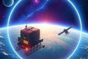
- First color images of Earth from space inspired the ecological movement, leading to satellite images becoming essential for survival.
- Satellites in space provide different views of Earth through visible, thermal infrared, and radar imaging, aiding in weather forecasting and agricultural monitoring.
- Altimetry measurements track sea level rise and ocean circulation patterns, providing crucial evidence of environmental changes.
- The European Copernicus program operates a fleet of spacecraft for monitoring Earth's changes and providing accurate data for sea level measurements.
- Professor Martikas and his team on the Greek island of Crete developed a unique calibration system for satellites, including a prototype mechanism called the transponder.
- The upgraded system on Crete now calibrates the new satellite Sentinel 6 Michael Freilich, dedicated to measuring sea level rise with improved resolution.
- Gavdos, a small island off Europe, was chosen as the site for the new transponder system due to its strategic location for satellite comparisons and calibration.
Studying That Suits You
Use AI to generate personalized quizzes and flashcards to suit your learning preferences.