Podcast
Play an AI-generated podcast conversation about this lesson
Download our mobile app to listen on the go
Get App
Questions and Answers
What is Remote Sensing?
What is Remote Sensing?
The acquisition of information about an object without being in physical contact with it.
What does the science of satellite remote sensing integrate?
What does the science of satellite remote sensing integrate?
Understanding, interpretation and establishment of relations between natural phenomena and measurements of electromagnetic energy.
Which of the following is a process involved in Remote Sensing?
Which of the following is a process involved in Remote Sensing?
- Digitizer
- Scanner
- Photogrammetry
- All of the above (correct)
What type of data does GIS integrate?
What type of data does GIS integrate?
Signup and view all the answers
What are Earth Observation Satellites used for?
What are Earth Observation Satellites used for?
Signup and view all the answers
Flashcards are hidden until you start studying
Study Notes
Remote Sensing (RS)
- Remote Sensing involves acquiring information about objects without direct physical contact.
- It utilizes measurements of electromagnetic energy emitted or reflected from the Earth's surface or atmosphere.
What is Remote Sensing
- Satellite remote sensing combines understanding, interpretation, and relations between natural phenomena and electromagnetic measurements.
- Sensors onboard satellites capture data from various Earth locations, outputting imagery for analysis.
Process of Remote Sensing
- The process includes planning, data acquisition, processing, and analysis, often using tools like digitizers and scanners.
- Techniques such as photogrammetry and GIS (Geographic Information Systems) integrate various data types for enhanced analysis.
Satellite Systems in Remote Sensing
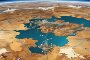
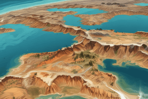
- Earth Observation Satellites help monitor environmental and land-use changes, providing crucial data.
- Communication Satellites facilitate data transmission and communication links required for remote sensing applications.
Needs for Spatial Data
- Spatial data is essential for accurate mapping, monitoring changes, and supporting various applications in environmental science, agriculture, and urban planning.
Advantages of Remote Sensing
- Offers a wide spatial coverage, enabling the collection of data over large areas in a cost-effective manner.
- Provides timely and repeatable data collection, essential for studying dynamic environmental processes.
Applications of Remote Sensing
- Widely used in agriculture for crop monitoring, yield prediction, and land-use planning.
- Applied in disaster management for damage assessment and response planning after events like floods or earthquakes.
Remote Sensing (RS)
- Remote Sensing involves acquiring information about objects without direct physical contact.
- It utilizes measurements of electromagnetic energy emitted or reflected from the Earth's surface or atmosphere.
What is Remote Sensing
- Satellite remote sensing combines understanding, interpretation, and relations between natural phenomena and electromagnetic measurements.
- Sensors onboard satellites capture data from various Earth locations, outputting imagery for analysis.
Process of Remote Sensing
- The process includes planning, data acquisition, processing, and analysis, often using tools like digitizers and scanners.
- Techniques such as photogrammetry and GIS (Geographic Information Systems) integrate various data types for enhanced analysis.
Satellite Systems in Remote Sensing
- Earth Observation Satellites help monitor environmental and land-use changes, providing crucial data.
- Communication Satellites facilitate data transmission and communication links required for remote sensing applications.
Needs for Spatial Data
- Spatial data is essential for accurate mapping, monitoring changes, and supporting various applications in environmental science, agriculture, and urban planning.
Advantages of Remote Sensing
- Offers a wide spatial coverage, enabling the collection of data over large areas in a cost-effective manner.
- Provides timely and repeatable data collection, essential for studying dynamic environmental processes.
Applications of Remote Sensing
- Widely used in agriculture for crop monitoring, yield prediction, and land-use planning.
- Applied in disaster management for damage assessment and response planning after events like floods or earthquakes.
Studying That Suits You
Use AI to generate personalized quizzes and flashcards to suit your learning preferences.