Podcast
Questions and Answers
What feature of the Ganga River Basin map is primarily highlighted by different colors?
What feature of the Ganga River Basin map is primarily highlighted by different colors?
- Rivers and tributaries (correct)
- Mountain ranges
- Forest areas
- Locations of major cities
Which of the following geographical features is NOT indicated on the Ganga River Basin map?
Which of the following geographical features is NOT indicated on the Ganga River Basin map?
- Major towns along the river
- Elevation levels of mountains (correct)
- Banks of the river
- Dams
How are the rivers labeled on the Ganga River Basin map?
How are the rivers labeled on the Ganga River Basin map?
- In Hindi (correct)
- In English
- By their geographical coordinates
- Using numerical identifiers
What is the main color used to depict the primary river in the Ganga River Basin?
What is the main color used to depict the primary river in the Ganga River Basin?
What is a primary purpose of the Ganga River Basin map in relation to its tributaries?
What is a primary purpose of the Ganga River Basin map in relation to its tributaries?
Flashcards
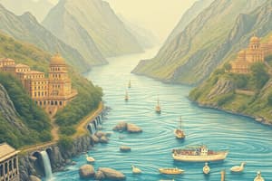
Ganga River Basin Map
Ganga River Basin Map
A hand-drawn map of the Ganga River drainage area, showing rivers, mountains, cities, and geographical areas
Rivers (labeled in Hindi)
Rivers (labeled in Hindi)
Major and tributary rivers within the Ganga River Basin, visually represented on the map.
Cities and towns
Cities and towns
Important locations marked on the map, situated along the major river or its tributaries.
Watershed
Watershed
Signup and view all the flashcards
Tributaries
Tributaries
Signup and view all the flashcards
Study Notes
River Systems and Agriculture
- Ganga River Basin: The major river system, with its tributaries, influencing agriculture and settlements.
- Tributaries: Numerous rivers like the Yamuna, Betwa, and others feed the Ganga.
- Agricultural Regions: Regions like the Doab, along the river, are known for fertile lands ideal for agriculture.
- Crops: Various crops are cultivated throughout the regions influenced by the river system. Specific examples like "Malavate-Ingori" and "Gulabpur" are shown.
- Irrigation: Irrigation plays a significant role for crop growth.
- Canal Systems: Details about irrigation systems and canals are illustrated in the map
- Mountain Ranges: The region contains mountains, impacting the river's flow and influencing farming practices in these areas.
- Waterways: Waterways are important for transportation of goods and people.
- Settlements: Important villages and settlements are located along the rivers for access to water and resources.
Geographical Features
- Rivers: Numerous rivers like the "Manasi," "Sohodara," "Kaali Sindh," "Chambal," "Betwa" are displayed.
- Mountainous Areas: "Misnanagar" and similar areas are identified as mountainous regions, contributing to the river system's features.
- Highland Regions: Specific highlands such as "Misnanagar" and "Pahaari" are indicated.
- River Banks: This highlights the importance of rivers for human settlements.
Studying That Suits You
Use AI to generate personalized quizzes and flashcards to suit your learning preferences.