Podcast
Questions and Answers
Explain the fundamental difference between active and passive remote sensing, referencing the energy source used by each.
Explain the fundamental difference between active and passive remote sensing, referencing the energy source used by each.
Active remote sensing uses a generated energy source, while passive remote sensing relies on naturally available energy sources like the sun.
Describe how remote sensing can be applied to both resource exploration and environmental studies. Provide a specific example for each.
Describe how remote sensing can be applied to both resource exploration and environmental studies. Provide a specific example for each.
For resource exploration, remote sensing can identify mineral deposits. For environmental studies, it can track cloud motion to predict rainfall.
If a researcher is studying a rapidly changing phenomenon, such as a forest fire, would active or passive remote sensing be more useful and why?
If a researcher is studying a rapidly changing phenomenon, such as a forest fire, would active or passive remote sensing be more useful and why?
Active remote sensing would be more useful because it provides its own illumination, unaffected by smoke or cloud cover, allowing for consistent data collection, regardless of environmental conditions.
Summarize the three main segments of the Global Positioning System (GPS) and briefly describe the role of each.
Summarize the three main segments of the Global Positioning System (GPS) and briefly describe the role of each.
Explain how GPS technology determines the position of a receiver in three dimensions.
Explain how GPS technology determines the position of a receiver in three dimensions.
Describe two applications of GPS technology beyond navigation, such as those integrated into cellphones or used in shipping.
Describe two applications of GPS technology beyond navigation, such as those integrated into cellphones or used in shipping.
A geologist is using remote sensing data. Explain how remote sensing could assist in identifying potential underground water storage locations.
A geologist is using remote sensing data. Explain how remote sensing could assist in identifying potential underground water storage locations.
An archaeologist wants to explore a site in a dense jungle. How could remote sensing and GPS technologies be used in conjunction to aid their investigation?
An archaeologist wants to explore a site in a dense jungle. How could remote sensing and GPS technologies be used in conjunction to aid their investigation?
Explain how the integration of GPS technology enhances logistical supply chain management.
Explain how the integration of GPS technology enhances logistical supply chain management.
Describe the primary function of the Low Noise Amplifier (LNA) in a GPS receiver and why it is essential.
Describe the primary function of the Low Noise Amplifier (LNA) in a GPS receiver and why it is essential.
Why is a circularly polarized antenna typically used in GPS receiving systems?
Why is a circularly polarized antenna typically used in GPS receiving systems?
Outline the roles of both the Down Converter and IF Amplifier in a GPS receiver system.
Outline the roles of both the Down Converter and IF Amplifier in a GPS receiver system.
What is the main task of the Digital Signal Processor (DSP) within a GPS receiver?
What is the main task of the Digital Signal Processor (DSP) within a GPS receiver?
Flashcards
Remote Sensing
Remote Sensing
Acquiring information about an object without physical contact.
Components of Remote Sensing
Components of Remote Sensing
Source of energy, radiation, target interaction, sensors, processing, interpretation, and applications.
Passive Remote Sensing
Passive Remote Sensing
Uses naturally available energy sources like the sun.
Active Remote Sensing
Active Remote Sensing
Signup and view all the flashcards
Applications of Remote Sensing
Applications of Remote Sensing
Signup and view all the flashcards
Global Positioning System (GPS)
Global Positioning System (GPS)
Signup and view all the flashcards
GPS Segments
GPS Segments
Signup and view all the flashcards
GPS Function
GPS Function
Signup and view all the flashcards
GPS
GPS
Signup and view all the flashcards
GPS Receiver
GPS Receiver
Signup and view all the flashcards
Receiving Antenna
Receiving Antenna
Signup and view all the flashcards
Low Noise Amplifier (LNA)
Low Noise Amplifier (LNA)
Signup and view all the flashcards
Down Converter
Down Converter
Signup and view all the flashcards
Study Notes
- Module 4 is about remote sensing
Remote Sensing
- It is the process of gathering information about an object or phenomenon without physical contact, unlike in situ observation.
- Used for gathering information about Earth and other planets by sensing and recording reflected or emitted energy, followed by processing, analyzing, and applying the data.
Components
- Energy source or illumination
- Radiation and the atmosphere
- Interaction with the target
- Recording the energy by the sensor
- Transmission, reception, and processing
- Interpretation and analysis
- Application
Types
- Two types of remote sensing exist: Passive and Active
Passive
- Uses naturally available energy sources, such as the sun.
- Most passive remote sensing systems work in solar energy.
Active
- Generates its energy and directs it towards a target from a sensing platform.
- Most microwave remote sensing employs active remote sensing.
Applications of Remote Sensing
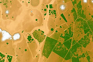
Resource Exploration
- Gathers information on sedimentary rocks and deposits of various minerals.
- Detects oil deposits
- Identifies underground storage of water fields and bodies of water.
Environmental Study
- Used to study cloud motion and predict rainfall.
Land Use
- Crucial for mapping large areas quickly.
Site Investigation
Archeological Investigation
Natural Hazard Study
Global Positioning System (GPS)
- A satellite-based investigation system composed of 24 satellites in orbit under the U.S. Department of Defense.
- Originally for military use, but the government made it available for civilian use in the 1980s.
Principles
-
Space segment
-
Control segment
-
User segment
-
The space and control segments are operated and administered by the U.S. military and the U.S. Air Force, respectively.
-
It provides specially coded satellite signals, that can be used in a GPS receiver.
-
GPS enables receivers to compute position, velocity, and time.
-
Four GPS satellite signals are used to compute a position in three dimensions.
Uses
- GPS technology is now in everything from cellphones and wristwatches, to shipping containers.
- GPS boosts productivity across a wide range of economy, including: farming, construction, monitoring, surveying, package delivery, and logistical supply chain management.
- GPS is used as a tracking device.
- Provides latitude, longitude, and altitude information.
- Aids in navigation for land vehicles, aircraft, and ships.
GPS Receiver Components
-
Receiving Antenna
- Receives satellite signals through a circularly polarized antenna
-
Low Noise Amplifier (LNA)
- Amplifies weak received signals.
-
Down Converter
- Converts the frequency of the received signal to an intermediate frequency (IF) signal.
-
IF Amplifier
- Further amplifies the intermediate frequency signal
-
ADC
- Performs the conversion of analogue signal, obtained from the IF amplifier, to digital signal using sampling and quantization blocks
-
DSP (Digital Signal Processor)
- Generates CLA codes
-
Microprocessor
- Calculates position by providing timing signals to control the operation of other digital blocks in order to display the information on the screen.
Studying That Suits You
Use AI to generate personalized quizzes and flashcards to suit your learning preferences.
Related Documents
Description
Explore remote sensing: gathering data without physical contact, using reflected or emitted energy. Learn about its components like energy sources, radiation, and sensors. Discover the two types: passive, using natural energy, and active, generating its own energy, along with various applications.