Podcast
Questions and Answers
What occurs when radiation 'bounces' off a target?
What occurs when radiation 'bounces' off a target?
- Transmission
- Reflection (correct)
- Absorption
- Refraction
Specular reflection occurs when a surface is rough and energy is reflected uniformly in all directions.
Specular reflection occurs when a surface is rough and energy is reflected uniformly in all directions.
False (B)
What type of reflection results in a bright spot in an image?
What type of reflection results in a bright spot in an image?
Specular reflection
_____ occurs when radiation is absorbed by the target.
_____ occurs when radiation is absorbed by the target.
Which of the following reflects energy almost uniformly in all directions?
Which of the following reflects energy almost uniformly in all directions?
Match the type of reflection with its description:
Match the type of reflection with its description:
What is a reflectance curve?
What is a reflectance curve?
The reflectance characteristics of vegetation depend on the properties of the _____ including the structure of the leaf canopy.
The reflectance characteristics of vegetation depend on the properties of the _____ including the structure of the leaf canopy.
What is the typical altitude range for remote sensing satellites in polar orbit?
What is the typical altitude range for remote sensing satellites in polar orbit?
An inclination angle of 60 degrees allows observation of areas above 60 degrees latitude.
An inclination angle of 60 degrees allows observation of areas above 60 degrees latitude.
What does the term 'repeat cycle' refer to?
What does the term 'repeat cycle' refer to?
A __________ orbit allows observation of the whole globe.
A __________ orbit allows observation of the whole globe.
What is the speed of a polar satellite at 800 km altitude?
What is the speed of a polar satellite at 800 km altitude?
Satellites at geo-stationary orbit are typically located at an altitude of 800 km.
Satellites at geo-stationary orbit are typically located at an altitude of 800 km.
What is the time required to complete one full orbit called?
What is the time required to complete one full orbit called?
Match the following orbit types with their characteristics:
Match the following orbit types with their characteristics:
What is the primary range of wavelengths that the human eye is sensitive to?
What is the primary range of wavelengths that the human eye is sensitive to?
Rods contribute to colour vision in low light conditions.
Rods contribute to colour vision in low light conditions.
What type of receptors in the retina are responsible for colour perception?
What type of receptors in the retina are responsible for colour perception?
Colour perception occurs in the human eye and the associated part of the __________.
Colour perception occurs in the human eye and the associated part of the __________.
Match each type of cone with the wavelength it responds to:
Match each type of cone with the wavelength it responds to:
How are colors created on screens like televisions and computer monitors?
How are colors created on screens like televisions and computer monitors?
Colour photography does not require an understanding of color perception theory.
Colour photography does not require an understanding of color perception theory.
What is the function of cones in the human eye?
What is the function of cones in the human eye?
What does the term 'parallax' refer to in the context of measuring tree height?
What does the term 'parallax' refer to in the context of measuring tree height?
Digital photogrammetric workstations (DPWs) replace analogue and analytical plotters completely.
Digital photogrammetric workstations (DPWs) replace analogue and analytical plotters completely.
Name the three steps involved in the orientation process of a stereo model.
Name the three steps involved in the orientation process of a stereo model.
The process of identifying identical points in both photographs during stereo model orientation is called __________.
The process of identifying identical points in both photographs during stereo model orientation is called __________.
Match the following types of plotters with their descriptions:
Match the following types of plotters with their descriptions:
Which of the following is NOT a step in the stereo model orientation process?
Which of the following is NOT a step in the stereo model orientation process?
Visualization plays a significant role in the information extraction stage of remote sensing.
Visualization plays a significant role in the information extraction stage of remote sensing.
What is the purpose of identifying 3D ground control points in absolute orientation?
What is the purpose of identifying 3D ground control points in absolute orientation?
What is one benefit of using radar images in forestry applications?
What is one benefit of using radar images in forestry applications?
Radar technology can operate independently of weather or daylight conditions.
Radar technology can operate independently of weather or daylight conditions.
Name two applications of radar in environmental monitoring.
Name two applications of radar in environmental monitoring.
Radar images can help differentiate various land cover types such as urban areas, agricultural fields, and __________.
Radar images can help differentiate various land cover types such as urban areas, agricultural fields, and __________.
Match the radar application with its specific use:
Match the radar application with its specific use:
Which type of radar is used in the European ERS mission and Canadian Radarsat?
Which type of radar is used in the European ERS mission and Canadian Radarsat?
Radar can only provide information related to the Earth’s surface.
Radar can only provide information related to the Earth’s surface.
What is one of the types of information that radar provides for geological mapping?
What is one of the types of information that radar provides for geological mapping?
Which element is primarily used in standard image classification?
Which element is primarily used in standard image classification?
Stereoscopic vision relies on images being viewed from the same position.
Stereoscopic vision relies on images being viewed from the same position.
What term is used for pairs of images that can be viewed stereoscopically?
What term is used for pairs of images that can be viewed stereoscopically?
The process of directing both eyes to a point of interest is known as __________.
The process of directing both eyes to a point of interest is known as __________.
Match the following tools with their primary applications:
Match the following tools with their primary applications:
What is the main reason for the limitation of automated methods in image interpretation?
What is the main reason for the limitation of automated methods in image interpretation?
Experienced individuals can achieve stereo vision by adjusting the distance of two overlapping photos without any additional equipment.
Experienced individuals can achieve stereo vision by adjusting the distance of two overlapping photos without any additional equipment.
Stereoscopic vision is important for interpreting natural and man-made __________ from image data.
Stereoscopic vision is important for interpreting natural and man-made __________ from image data.
Flashcards
Reflection
Reflection
When incoming radiation bounces off a surface, changing its direction.
Absorption
Absorption
When incoming radiation is absorbed by a surface, becoming part of the surface's energy.
Transmission
Transmission
When incoming radiation passes through a surface, continuing on the other side.
Specular Reflection
Specular Reflection
Signup and view all the flashcards
Diffuse Reflection
Diffuse Reflection
Signup and view all the flashcards
Spectral Reflectance Curve
Spectral Reflectance Curve
Signup and view all the flashcards
Spectral Signature
Spectral Signature
Signup and view all the flashcards
Spectral Library
Spectral Library
Signup and view all the flashcards
Altitude
Altitude
Signup and view all the flashcards
Inclination Angle
Inclination Angle
Signup and view all the flashcards
Period
Period
Signup and view all the flashcards
Repeat Cycle
Repeat Cycle
Signup and view all the flashcards
Polar Orbit
Polar Orbit
Signup and view all the flashcards
Geostationary Orbit
Geostationary Orbit
Signup and view all the flashcards
Pointing Capability
Pointing Capability
Signup and view all the flashcards
Ground Speed
Ground Speed
Signup and view all the flashcards
Parallax
Parallax
Signup and view all the flashcards
Stereo Model
Stereo Model
Signup and view all the flashcards
Absolute Orientation
Absolute Orientation
Signup and view all the flashcards
Inner Orientation
Inner Orientation
Signup and view all the flashcards
Relative Orientation
Relative Orientation
Signup and view all the flashcards
Analogue and Analytical Plotters
Analogue and Analytical Plotters
Signup and view all the flashcards
Digital Photogrammetric Workstations (DPWs)
Digital Photogrammetric Workstations (DPWs)
Signup and view all the flashcards
Stereovision
Stereovision
Signup and view all the flashcards
Color Perception
Color Perception
Signup and view all the flashcards
Tri-stimuli Model
Tri-stimuli Model
Signup and view all the flashcards
Spectral Sensitivity
Spectral Sensitivity
Signup and view all the flashcards
Visible Spectrum
Visible Spectrum
Signup and view all the flashcards
Cones
Cones
Signup and view all the flashcards
Rods
Rods
Signup and view all the flashcards
Additive Color Mixing
Additive Color Mixing
Signup and view all the flashcards
Subtractive Color Mixing
Subtractive Color Mixing
Signup and view all the flashcards
Stereoscopic Vision
Stereoscopic Vision
Signup and view all the flashcards
Stereograms
Stereograms
Signup and view all the flashcards
Convergence
Convergence
Signup and view all the flashcards
Image Interpretation
Image Interpretation
Signup and view all the flashcards
Tone (or Hue)
Tone (or Hue)
Signup and view all the flashcards
Texture
Texture
Signup and view all the flashcards
Anaglyph
Anaglyph
Signup and view all the flashcards
Mirror Stereoscope
Mirror Stereoscope
Signup and view all the flashcards
What is radar?
What is radar?
Signup and view all the flashcards
What are radar bands?
What are radar bands?
Signup and view all the flashcards
Can radar penetrate objects?
Can radar penetrate objects?
Signup and view all the flashcards
What are some applications of radar?
What are some applications of radar?
Signup and view all the flashcards
How is radar used in combination with other remote sensing methods?
How is radar used in combination with other remote sensing methods?
Signup and view all the flashcards
How can radar be used for soil moisture estimation?
How can radar be used for soil moisture estimation?
Signup and view all the flashcards
How is radar used in geology?
How is radar used in geology?
Signup and view all the flashcards
Can radar see below the surface?
Can radar see below the surface?
Signup and view all the flashcards
Study Notes
Remote Sensing Course Outline
- GEOL 315 covers Introduction to Remote Sensing and GIS
- Topics include Introduction to remote sensing, Electromagnetic energy and remote sensing, Sensors and platforms, Aerial cameras, Multispectral scanners, RADAR, Remote sensing below the ground surface, Radiometric aspects, Geometric aspects, Image enhancement and visualization, Visual image interpretation, and Digital image classification.
Spatial Data Acquisition
- Georeferenced data is used by many disciplines, not just geology, for collection, analysis, and decision-making. Data represents information for a computer; information is data interpreted by humans.
- Spatial data, often spatio-temporal, is crucial for applications like geological mapping.
Ground-Based and Remote Sensing Methods
- Spatial data acquisition has two main types:
- Ground-based methods utilize field observations, in-situ measurements, and land surveying in the real world.
- Remote sensing methods use image data from sensors like aerial cameras, scanners, or radar to create a representation of the real world. Remote sensing analysis is performed on the acquired image data.
Remote Sensing Definitions
- Two definitions of remote sensing include:
- The science of acquiring, processing, and interpreting images recording interactions between electromagnetic energy and matter.
- The science and art of obtaining information about an object, area, or phenomenon via analysis of data taken by a device not in contact with the object.
Application of Remote Sensing
- Remote sensing generates image data related to the Earth's electromagnetic properties, which can be linked to real-world parameters or features.
- Combining remote sensing with ground data yields the best results.
- Remote sensing provides efficient area coverage compared to ground surveys, e.g., in aeromagnetic and ground magnetic surveys.
- Remote sensing initially provides surface information with limitations, requiring additional models for subsurface characteristics.
Remote Sensing Process and Topics
- Remote sensing involves a process with image data, observations, and spatial databases.
- Key topics include electromagnetic energy, sensors and platforms, radiometric aspects, geometric aspects, image enhancement and visualization, visual image interpretation, and digital image classification.
Electromagnetic Energy and Remote Sensing
- Remote sensing relies on measuring electromagnetic (EM) energy, primarily from the sun (visible light, heat, UV).
- Some sensors detect energy emitted by the Earth itself.
- The EM spectrum encompasses various wavelengths from gamma rays (most energetic) to radio waves (least energetic).
Waves and Photons
- EM energy can be described as both waves and photons (energy particles).
- EM waves are characterized by oscillating electric and magnetic fields perpendicular to each other and the direction of travel.
- Wavelength (distance between waves) and frequency (number of cycles per unit time) are inversely related.
- Energy of a photon is proportional to its frequency (and therefore inversely to wavelength).
Sources of EM Energy
- All matter above absolute zero emits EM energy due to molecular motion.
- The amount of emitted energy depends on temperature, emissivity, and wavelength. Higher temperatures relate to greater contribution from shorter wavelengths.
Electromagnetic Spectrum
- All matter emits EM waves across a broad spectrum (range of wavelengths) from gamma rays to radio waves.
- Remote sensing utilizes specific sections of the EM spectrum to generate relevant information about the Earth's surface.
Active and Passive Remote Sensing
- Passive remote sensing relies on natural energy sources, like sunlight, and measures reflected or emitted energy.
- Active remote sensing systems provide energy, e.g., radar and lasers, and measure the energy reflected back to the sensor.
- Passive methods operate during daylight hours, while active sensors work day and night.
Energy Interaction in the Atmosphere
- EM energy interacts with the atmosphere through absorption, transmission, and scattering.
- Gas molecules in the atmosphere absorb solar radiation particularly water vapor, ozone, and carbon dioxide.
- Absorption and scattering also affect energy transmission resulting in either reflected, transmitted, or absorbed energy at surface material.
- Atmospheric transmittance describes the proportion of energy that passes through the atmosphere at specific wavelengths.
Atmospheric Scattering
- Rayleigh scattering is caused by particles smaller than the wavelength of light.
- Rayleigh scattering is more effective with short wavelengths (like blue light), making the sky appear blue.
- Mie scattering occurs when the particle size is similar to or larger than the wavelength.
- Non-selective scattering occurs when particles substantially larger than the wavelength (e.g., water droplets in clouds) interact with radiation across the whole visible spectrum, resulting in white light.
Energy Interaction in the Earth's Surface
- Reflection, absorption, and transmission processes of EM energy by surface materials are important factors for interpreting remote sensing data.
- Specular reflection is from smooth surfaces, while diffuse reflection is from rough surfaces, scattering energy uniformly.
- Characteristics of visible reflected energy (spectral reflectance curves) reveal information about material compositions, e.g., vegetation, bare soil, and water.
Sensors and Platforms
- Sensors, often mounted to static or moving platforms (aircraft or satellites), measure EM energy reflected or emitted from the Earth's surface.
- Sensor types include gamma-ray spectrometers, multispectral scanners, thermal scanners, laser scanners, and radar altimeters.
Platforms - Airborne Remote Sensing
- Airborne platforms, such as aircraft, allow data collection from various heights and are suitable for acquiring information from specific areas.
- Key factors for aerial photography missions include scale, required percentage of overlap, flight line conditions, and temporal conditions to ensure data accuracy.
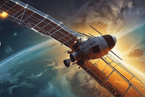
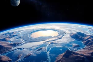
Platforms - Spaceborne Remote Sensing
- Satellites collect data from space and orbit, allowing imaging of entire regions, e.g. oceans to determine relevant details of a specific area.
- Key factors for satellite imagery missions include altitude, inclination angle, period, and repeat cycle.
- These factors affect the measurements and speed and quality of information extracted.
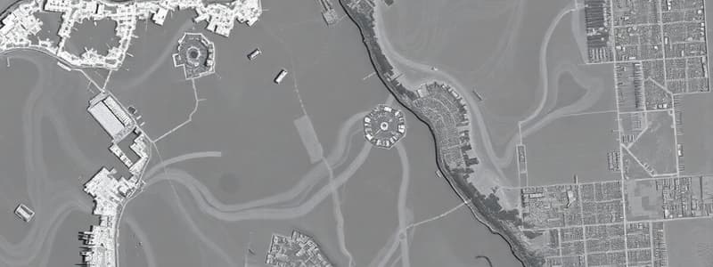
Image Data Characteristics
- Image data comprises various details that are essential for interpreting the data. These important components include image size, number of bands, quantization, spatial resolution, ground pixel size.
Visual Image Interpretation
- Visual interpretation is a key part of remote sensing data analysis, utilizing human observation.
- Key elements for interpreting images include tone, hue, texture, shape, size, pattern, and association.
Image Enhancement and Visualization
- Image enhancement methods improve the visualization of image data.
- Techniques such as histogram matching and atmospheric corrections can improve image contrast and detail.
Radiometric Aspects
- Radiometric aspects deal with image data corrections including cosmetic rectification (errors and noise) and atmospheric corrections (haze, sun angle, atmospheric effects).
Studying That Suits You
Use AI to generate personalized quizzes and flashcards to suit your learning preferences.