Podcast
Questions and Answers
Which of the following is NOT a purpose of studying remote sensing and GIS?
Which of the following is NOT a purpose of studying remote sensing and GIS?
- Understanding the principles of GPS operation.
- Applying knowledge for sustainable development.
- Mapping resources and their availability.
- Ignoring the principles of GPS operation. (correct)
Remote sensing strictly involves direct physical contact with the object being sensed.
Remote sensing strictly involves direct physical contact with the object being sensed.
False (B)
What is the significance of the International Meridian Convention in the context of coordinate systems?
What is the significance of the International Meridian Convention in the context of coordinate systems?
fixed the prime meridian
The most widely used system to define locations requires the use of both ______ and longitude.
The most widely used system to define locations requires the use of both ______ and longitude.
Match
Match
Which of the following best defines a coordinate system?
Which of the following best defines a coordinate system?
Longitudes are also known as parallels.
Longitudes are also known as parallels.
What is the primary function of the prime meridian?
What is the primary function of the prime meridian?
The angular distance from the center of the earth, measured north or south of the equator, is known as ______.
The angular distance from the center of the earth, measured north or south of the equator, is known as ______.
Match the coordinate system:
Match the coordinate system:
What is the main purpose of georeferencing?
What is the main purpose of georeferencing?
Georeferencing is only applicable to satellite imagery.
Georeferencing is only applicable to satellite imagery.
In georeferencing, what is the purpose of Ground Control Points (GCPs)?
In georeferencing, what is the purpose of Ground Control Points (GCPs)?
In the context of georeferencing, RMSE stands for Root Mean Square ______.
In the context of georeferencing, RMSE stands for Root Mean Square ______.
Match the georeferencing transformations:
Match the georeferencing transformations:
Which of the following statements best describes a Geoid?
Which of the following statements best describes a Geoid?
The geoid surface is uniform and does not vary significantly across the Earth.
The geoid surface is uniform and does not vary significantly across the Earth.
What does MSL stand for in the context of the Geoid and Earth measurements?
What does MSL stand for in the context of the Geoid and Earth measurements?
The geoid is often used as the reference for measuring ______ on Earth.
The geoid is often used as the reference for measuring ______ on Earth.
Match the following components of a coordinate system transformation to their correct description.
Match the following components of a coordinate system transformation to their correct description.
What is the name for the process of associating a geospatial image with its location in space?
What is the name for the process of associating a geospatial image with its location in space?
Georeferencing is unnecessary when spatial data are already in digital format.
Georeferencing is unnecessary when spatial data are already in digital format.
Why are Ground Control Points (GCPs) essential in the georeferencing process?
Why are Ground Control Points (GCPs) essential in the georeferencing process?
Differential correction using ______ can improve GPS accuracy.
Differential correction using ______ can improve GPS accuracy.
What distinguishes a Geoid from an Ellipsoid?
What distinguishes a Geoid from an Ellipsoid?
GPS satellites directly measure the geoid height.
GPS satellites directly measure the geoid height.
What role does gravity play in defining the geoid?
What role does gravity play in defining the geoid?
Geoid undulation refers to the difference in height between the geoid and the reference ______.
Geoid undulation refers to the difference in height between the geoid and the reference ______.
Match each:
Match each:
In map rectification, why is resampling performed?
In map rectification, why is resampling performed?
Rectification is only necessary for historical maps.
Rectification is only necessary for historical maps.
What type of transformation is applied in image rectification?
What type of transformation is applied in image rectification?
Control points in image rectification are also known as ______.
Control points in image rectification are also known as ______.
Which of the following types of Coordinate System is NOT based on the region used?
Which of the following types of Coordinate System is NOT based on the region used?
Geo Centric systems are also known as ITRF.
Geo Centric systems are also known as ITRF.
What two systems are under Based on the region used?
What two systems are under Based on the region used?
Two types of coordinate systems are Curvilinear System and ______ System.
Two types of coordinate systems are Curvilinear System and ______ System.
Flashcards
Coordinate System
Coordinate System
A system of rules specifying how coordinates are assigned to locations.
3D Coordinate Systems
3D Coordinate Systems
Locate data on Earth's surface using three dimensions.
Geographic Coordinates
Geographic Coordinates
A system using latitude and longitude to specify locations on Earth.
Parallels
Parallels
Signup and view all the flashcards
Meridians
Meridians
Signup and view all the flashcards
Latitude
Latitude
Signup and view all the flashcards
Longitude
Longitude
Signup and view all the flashcards
Geocentric Coordinates (X,Y,Z)
Geocentric Coordinates (X,Y,Z)
Signup and view all the flashcards
Polar Coordinates
Polar Coordinates
Signup and view all the flashcards
Cartesian Coordinates
Cartesian Coordinates
Signup and view all the flashcards
Map Grid
Map Grid
Signup and view all the flashcards
Graticule
Graticule
Signup and view all the flashcards
Datum
Datum
Signup and view all the flashcards
Geoid
Geoid
Signup and view all the flashcards
Mean Sea Level (MSL)
Mean Sea Level (MSL)
Signup and view all the flashcards
Geoidal height
Geoidal height
Signup and view all the flashcards
Rectification
Rectification
Signup and view all the flashcards
Georeferencing
Georeferencing
Signup and view all the flashcards
Linear Conformal Transformation
Linear Conformal Transformation
Signup and view all the flashcards
Polynomial Transformation
Polynomial Transformation
Signup and view all the flashcards
Resampling
Resampling
Signup and view all the flashcards
Nearest Neighbor
Nearest Neighbor
Signup and view all the flashcards
Bilinear Interpolation
Bilinear Interpolation
Signup and view all the flashcards
Study Notes
- Major Course MJ 7: Fundamentals of Remote Sensing & GIS covers the meaning, concept, and definition of Remote Sensing and GIS as important tools in studying and explaining geographic phenomena.
- Students will learn about satellite remote sensing, data processing, interpretation, and classification.
- The course also aims to make students aware of the use of GPS and GIS, including the principles, working mechanisms, and applications
- After completing the course, students should be able to appreciate the strength and application of remote sensing and GIS.
- Students should be able to map resources, their locations, and availability.
- Students should have the ability to apply the gained knowledge for sustainable development.
Course Content
- Unit 1 covers the meaning, definition, scope, development, components and process of remote sensing. It also addresses electromagnetic radiation (EMR) interaction with the atmosphere and Earth's surface.
- Unit 2 discusses remote sensing platforms & sensors, along with visual and digital satellite imagery interpretation techniques.
- Elements and interpretation keys for visual interpretation (shape, size, color, tone, texture, association) and image enhancement techniques are discussed.
- Applications of remote sensing are included in this unit.
- Unit 3 covers Geography & Geographic Information Systems (GIS), their definitions, development, elements, and components.
- Spatial data, including its elements & types, and raster & vector data structures, are explored.
- Unit 4 includes Coordinate Systems and Geo-Referencing of Spatial Data.
- GIS Database: Creation of Spatial & Non-Spatial Data Base content are covered in this unit.
- Unit 5 covers Digital Elevation Models (DEM), Basic Principles of Computer Assisted Cartography,Integration of GIS with Remote Sensing & Global Positioning System (GPS).
Coordinate Systems
- A coordinate system is a set of rules that specifies how coordinates are assigned to locations.
- Three-dimensional spatial coordinate systems are used to locate data on the surface of the Earth.
- The coordinates of points on the Earth's surface are required for performing survey operations.
- The coordinates are determined with respect to certain coordinate systems.
- A coordinate system has a well-defined origin and orientation of coordinate axes X, Y, Z.
- The most common system in two dimensions is the Cartesian system (after René Descartes).
Brief History
- Euclid (300 BC) was an ancient Greek mathematician who explained theorems in plane geometry and number theory.
- Eratosthenes (276 BC - c. 195 BC) of Cyrene was a Greek polymath who invented a system of longitude and latitude.
- Hipparchus (127 BCE) was a Greek astronomer and mathematician.
- Ptolemy (150 AD) was an Egyptian astronomer, mathematician, and geographer who popularized a coordinate system based on latitude and longitude.
- René Descartes (1596-1650 AD) was a French philosopher, scientist, and mathematician who conceptualized Cartesian Coordinates in 1637.
- In 1884, representatives from 25 countries agreed to pick a single, standard meridian at the International Meridian Convention. They chose the meridian passing through the Royal Observatory in Greenwich, England.
- Satellite Remote Sensing began in 1970.
- GPS opened for public use in 1980, and GIS became popular in 1990.
Geographic Coordinates
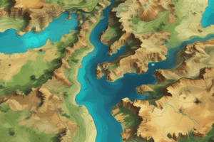
- The most widely used global coordinate system consists of lines of geographic latitude and longitude.
- Lines of equal latitude are called parallels, which form circles on the surface of the ellipsoid.
- Lines of equal longitude are called meridians, which form ellipses (meridian ellipses) on the ellipsoid.
- The network of these parallels and meridians is called the geographic coordinates.
- The Equator is a line drawn between the northern and southern ends of the axis, dividing the sphere into two halves. It's considered the 0° line.
- Latitude is the angular distance from the center of the earth, north or south of the equator.
- Longitude is the angular distance from the center of the earth, east or west of the Prime Meridian. These lines run between the north and south poles, dividing the latitudes into multitude parts.
- All countries wanted their own 0° meridian, leading to confusion.
- In 1634, a meeting in Paris agreed to treat 19° 55'03" of Paris as the prime meridian.
- In 1884, the Washington D.C. conference decided to use the Greenwich meridian as the prime meridian.
- Some older maps have prime meridians passing through Ferro (westernmost of Canary islands), the Pantheon in Paris, Madrid, Oslo, Monte Mario, etc.
Geocentric Coordinates (X,Y,Z)
- The system has its origin at the mass-center of the Earth with the x and y axes in the plane of the equator.
- The x-axis passes through the meridian of Greenwich, and the z-axis coincides with the Earth's axis of rotation.
- The three axes are mutually orthogonal and form a right-handed system.
Polar Coordinates
- Represents the distance d from the origin to the point of concern and the angle a between a fixed (or zero) direction and the direction to the point.
- The angle a is called azimuth or bearing and is counted clockwise.
- It is given in angular units while the distance d is expressed in length units.
- Bearings are always related to a fixed direction (initial bearing) or a datum line.
Cartesian Coordinates
- Use plane rectangular coordinates to define a point in a plane.
- The Cartesian coordinate system is a system of intersecting perpendicular lines, which contains two principal axes, called the X and Y-axis.
- The horizontal axis is usually referred to as the X-axis and the vertical the Y-axis
- The X-axis is sometimes called Easting and the Y-axis Northing.
- The intersection of the X- and Y- axis forms the origin.
- The plane is marked at intervals by equally spaced coordinate lines.
- Rectangular coordinates are also called Cartesian coordinates
- The system is named after French philosopher and mathematician René Descartes.
- The system has applications in computer science to geography
- The system is fundamental to the description of vectors and to analytic geometry.
- To avoid negative values for the X - and Y-coordinates in case the origin of the coordinate system is located inside the area of interest a false origin can be used.
Map Grid and Graticule
- A map grid represent lines having constant rectangular coordinates (x, y).
- The grid is almost always a rectangular system and is used on large and medium scale maps to enable detailed calculations and positioning.
- Plane coordinates and therefore the grid, are usually not used on small-scale maps, maps smaller than one to a million.
- The scale distortions are very high in small scale maps.
- The graticule represents the projected position of the geographic coordinates at constant intervals.
Datum
- It is a system which allows the location of latitudes and longitudes (and heights) to be identified onto the surface of the Earth.
- The basic globe with grid lines is mathematical/ geometric.
- Mathematically a 'round' surface (a modified sphere) is created to represent the Earth’s surface.
- From here calculations are made to fit this mathematical model to the surface of the Earth- firstly the Equator, then North and South Poles and then lines of latitude and longitude
- Because there are different ways to fit the mathematical model to the surface of the Earth, there are many different datums.
- Reference points are fixed starting point of a scale or operation.
- Horizontal Datum are ellipsoid
- Vertical Datum is Geoid
- GRS 84-developed the World Geodetic System 1984 or WGS84
- Local Reference ellipsoids: United States - North American Datum, Japan - Tokyo Datum, Some European countries - the European Datum, Germany - Potsdam Datum, India - Everest datum.
Geoid
- Geoid- a hypothetical solid figure whose surface corresponds to mean sea level and its imagined extension under (or over) land areas.
- A level surface at mean sea level is considered to represent the Earth’s size and shape.
- Earth's Geoid is a surface complex to accurately describe mathematically, it can be identified by measuring gravity
- Over open oceans Geoid and Mean Sea Level are approximately the same.
- Can differ significantly in continental areas
- Because gravity is variable depending variable Earth mass,the geoid is an irregular surface.
- The Earth’s Geoid is regarded as being equal to Mean Sea Level
Types of Coordinate Systems
- Based on nature: Curvilinear system (वक्ररेखीय प्रणाली), Cartesian system
- Based on region used: Local system, Global system
- Based on position of centre/origin: Geo centric (भू केन्द्रित) - WGS84, ITRF, Non geocentric (गैर भू केन्द्रित) - NAD, Everest
- WGS84 - The World Geodetic System 1984, is global datum, used and determined on eaths face that WGS84,is used by GPS satellite.
- ITRF - International Terrestrial Reference System and Frame
- NAD (North American Datum (NAD), now define the geodetic network in North America),
- Everest (Sir George Everest, for India This datum,called the Everest Spheroid, has since the basis for all government issued maps of India) is India, first surveyor general in 1830s,mapped the Earth's Geoidetic
Ellipsoid
- The ellipsoid (दीर्घवृत्तज) is formed when the ellipse is rooted to the axis of mirror its called a meridian ellipse
Geo-Referencing
- Geo-Referencing is the process of assigning spatial coordinates to data that are special in nature but has no as placed geographic coordinate system
- With a scanned paper of the two geographic map and assign spatial coordinate map with modern data
- "“Geo-referencing means representation of the location of real-world features within spatial framework of a particular co ordinate system”
- "व्यवस्थित सुदूर संवेदन आँकड़ों को भू-धरातलीय(Geo-Spatial) आंकड़ों में परिवर्तन करना ही भु-संदर्भ प्रणाली कहलाती है।"""
Two-dimensional approach
- The simplest way to link that image coordinate to map coordinate is determined coordinate coordinate is used the transformation formula is a function that transform coordinates commonly defined by liner equation.
- The process of go referencing involves two steps:selection of the appropriate way of transformation
- determination of the transformation parameters.
- The type of transformation defends mainly the sensor pattern system used for area photographs.
- the transformation which enables at 1st,2nd to nth order transformation.
- in many situations a 1st order transformation is added.
Rectification
- Rectification is a process of geometrically correcting adding images or conform to a nap
- it is the process by which geometry images is made planar matric
- it is necessary direction measurements are required.
- it is achieved by transferred data from one grid system by using transformed data.
- the process is establish a mathematical relationship relationship with address pixels
- The rectification procedure Steps:spatial and spatial interpolation and involved and selection ground.
- ControPoint,Intensity Interpolation.
Resampling Techniques
- Resampling Techniques
- Nearest Neighbor. Assign the a value of the news pixel to pixel new location.
- Bilinear: value 4 for the average 4.
- Pixel for the with a Cubic Convolution the average 16 pixels for the data.
Studying That Suits You
Use AI to generate personalized quizzes and flashcards to suit your learning preferences.