Podcast
Questions and Answers
What is the primary purpose of image classification in remote sensing?
What is the primary purpose of image classification in remote sensing?
- To analyze the atmospheric conditions at the time of image capture
- To identify the type of satellite used to capture the image
- To assign land cover classes to pixels in satellite or aerial imagery (correct)
- To determine the spatial resolution of the image
What is a key benefit of combining remote sensing and GIS for land use and land cover analysis?
What is a key benefit of combining remote sensing and GIS for land use and land cover analysis?
- Increased cost of data acquisition
- Improved accuracy and efficiency of land cover classification (correct)
- Reduced need for field observations
- Limited spatial analysis capabilities
What is the main difference between supervised and unsupervised learning in image classification?
What is the main difference between supervised and unsupervised learning in image classification?
- The spatial resolution of the image
- The number of spectral bands used in the analysis
- The presence or absence of labeled training data (correct)
- The type of satellite used for image capture
What is the primary function of a Geographic Information System (GIS)?
What is the primary function of a Geographic Information System (GIS)?
What is the outcome of unsupervised learning in image classification?
What is the outcome of unsupervised learning in image classification?
What is the primary input for image classification in remote sensing?
What is the primary input for image classification in remote sensing?
What is the primary purpose of accuracy assessment in land use land cover classification?
What is the primary purpose of accuracy assessment in land use land cover classification?
What is the main advantage of object-based classification over traditional pixel-based classification?
What is the main advantage of object-based classification over traditional pixel-based classification?
What is the primary goal of change detection in land use land cover analysis?
What is the primary goal of change detection in land use land cover analysis?
What is the main application of spatial interpolation in geospatial analysis?
What is the main application of spatial interpolation in geospatial analysis?
What is the primary purpose of geospatial analysis in land use land cover?
What is the primary purpose of geospatial analysis in land use land cover?
What type of imagery is typically used for land use land cover classification?
What type of imagery is typically used for land use land cover classification?
Flashcards are hidden until you start studying
Study Notes
Introduction
Remote sensing and Geographic Information Systems (GIS) are powerful tools for analyzing land use and land cover (LULC) changes. Remote sensing involves the acquisition of data about the Earth's surface and atmosphere through sensors on satellites, aircraft, or ground-based systems. GIS is a system for capturing, storing, analyzing, managing, and displaying geographic information. Together, these technologies enable accurate and efficient LULC classification and analysis.
Image Classification
Image classification is a key component of remote sensing and GIS applications. It involves assigning land cover classes to pixels in satellite or aerial imagery based on their spectral characteristics. Various algorithms and techniques are used for image classification, such as supervised learning, unsupervised learning, and object-based classification.
Supervised Learning
In supervised learning, the classifier is trained using a set of labeled data points (pixels with known land cover classes) to learn relationships between spectral characteristics and land cover classes. The classifier then predicts the land cover class for new, unlabeled data points based on these relationships.
Unsupervised Learning
In unsupervised learning, the classifier groups pixels into clusters based on their spectral characteristics without prior knowledge of the land cover classes. The resulting clusters are then assigned land cover classes based on their spectral characteristics or by using additional information, such as field surveys or existing land cover maps.
Object-Based Classification
Object-based classification involves segmenting the image into homogeneous objects (e.g., pixels with similar spectral characteristics) and then classifying these objects based on their properties. This can provide more accurate and consistent classifications, especially for complex land cover types, such as urban areas.
Land Use Land Cover
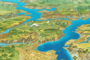
LULC analysis is crucial for understanding the Earth's surface and the changes that occur over time. It involves classifying land cover into different categories, such as forests, grasslands, water bodies, urban areas, and others. LULC classification is typically performed using multispectral or hyperspectral imagery, which captures data in multiple spectral bands.
Change Detection
Change detection is the process of identifying differences in LULC between two or more time periods. This is often done by comparing LULC maps from different time periods or by analyzing change in spectral characteristics over time. Change detection can help identify urbanization, deforestation, and other changes in land cover.
Accuracy Assessment
Accuracy assessment is an important step in LULC classification and change detection. It involves comparing the classified data with ground truth data (e.g., field surveys or existing land cover maps) to evaluate the accuracy of the classification. Accuracy assessment helps identify areas of low accuracy and allows for improvements in the classification process.
Geospatial Analysis
Geospatial analysis involves analyzing and interpreting spatial data to understand patterns, relationships, and trends. It can be used to study various aspects of LULC, such as urban development, forest cover, and land degradation. Geospatial analysis techniques include spatial statistics, spatial interpolation, and spatial modeling.
Spatial Statistics
Spatial statistics are used to analyze patterns and relationships in spatial data. They include methods such as spatial autocorrelation, spatial regression, and spatial econometrics. Spatial statistics can help identify spatial patterns in LULC data and understand the factors driving these patterns.
Spatial Interpolation
Spatial interpolation is used to estimate values of variables (e.g., land cover classes) at unsampled locations based on known values at sampled locations. It can be used to estimate LULC at locations where data is not available, such as in remote areas or in areas with limited ground data.
Spatial Modeling
Spatial modeling involves creating mathematical models of spatial processes or phenomena. These models can be used to predict LULC changes, estimate the impact of land cover changes on the environment, or identify areas at risk of land degradation.
In conclusion, remote sensing and GIS play a critical role in LULC classification, change detection, and geospatial analysis. These technologies enable accurate and efficient analysis of land cover data, which is essential for understanding the Earth's surface and the changes that occur over time.
Studying That Suits You
Use AI to generate personalized quizzes and flashcards to suit your learning preferences.