Podcast
Questions and Answers
The course GL/MN 455 is being presented by a licensed teacher.
The course GL/MN 455 is being presented by a licensed teacher.
False (B)
The course GL/MN 455 focuses on Geographic Information Systems.
The course GL/MN 455 focuses on Geographic Information Systems.
True (A)
The course assessment includes field work.
The course assessment includes field work.
False (B)
The first lecture will give an overview of Remote Sensing.
The first lecture will give an overview of Remote Sensing.
Bernard Kumi-Boateng is a licensed surveyor.
Bernard Kumi-Boateng is a licensed surveyor.
In a spatial database, features are represented with their geometric but not their non-geometric attributes and relationships.
In a spatial database, features are represented with their geometric but not their non-geometric attributes and relationships.
The geometry of features is always represented with points, regardless of the feature's actual dimension.
The geometry of features is always represented with points, regardless of the feature's actual dimension.
GIS software packages only support spatial data, relying on external systems for attribute data.
GIS software packages only support spatial data, relying on external systems for attribute data.
A spatial decision support system (SDSS) arises from combining a database, GIS software, and a reasoning mechanism.
A spatial decision support system (SDSS) arises from combining a database, GIS software, and a reasoning mechanism.
In a GIS, data are stored in a single, monolithic layer, representing all geographic information.
In a GIS, data are stored in a single, monolithic layer, representing all geographic information.
Analysis of spatial data involves computing new information from existing spatial data to provide new insight.
Analysis of spatial data involves computing new information from existing spatial data to provide new insight.
Overlay, connectivity, and neighborhood functions are GIS functions.
Overlay, connectivity, and neighborhood functions are GIS functions.
Classification in GIS allows assigning features to a class based solely on visual inspection of the spatial data.
Classification in GIS allows assigning features to a class based solely on visual inspection of the spatial data.
A map scale of $1:1000$ represents less detail than a map scale of $1:2,500,000$.
A map scale of $1:1000$ represents less detail than a map scale of $1:2,500,000$.
Map scale is the ratio between the distance on a paper map and the apparent distance in the terrain.
Map scale is the ratio between the distance on a paper map and the apparent distance in the terrain.
Digital spatial data stored in a GIS inherently possesses a scale.
Digital spatial data stored in a GIS inherently possesses a scale.
Cartography, emergency management, and environmental sciences are all applications of GIS.
Cartography, emergency management, and environmental sciences are all applications of GIS.
The resolution of spatial data is directly related to the cell height of the tessellation applied.
The resolution of spatial data is directly related to the cell height of the tessellation applied.
A 'small-scale' map displays more detail than a 'large-scale' map.
A 'small-scale' map displays more detail than a 'large-scale' map.
GIS can be applied to real estate appraisals but cannot be applied to urban planning and development
GIS can be applied to real estate appraisals but cannot be applied to urban planning and development
GIS software architecture and functionality is an objective of the lecture.
GIS software architecture and functionality is an objective of the lecture.
GIS cannot be applied to boundary dispute resolutions.
GIS cannot be applied to boundary dispute resolutions.
Data processing systems consist only of software components that are designed to manipulate data
Data processing systems consist only of software components that are designed to manipulate data
An intersection of spatial areas involves selecting both areas and finding their points of overlap.
An intersection of spatial areas involves selecting both areas and finding their points of overlap.
The union of potato and maize areas can be performed by selecting both areas in the crop data layer and taking their complement.
The union of potato and maize areas can be performed by selecting both areas in the crop data layer and taking their complement.
A difference operator is used to find areas with potato cover that also exist in clay soil areas.
A difference operator is used to find areas with potato cover that also exist in clay soil areas.
A buffer zone is generated around a given feature to define its spatial influence area.
A buffer zone is generated around a given feature to define its spatial influence area.
Connectivity functions are used specifically for analyzing non-connected, urban spatial features.
Connectivity functions are used specifically for analyzing non-connected, urban spatial features.
Visibility functions are used to determine the invisible areas from a given location using a digital terrain model.
Visibility functions are used to determine the invisible areas from a given location using a digital terrain model.
Spatial data presentation can involve both maps and tabular displays.
Spatial data presentation can involve both maps and tabular displays.
A database is a small, unstructured collection of data used for statistical analysis.
A database is a small, unstructured collection of data used for statistical analysis.
Raster overlays perform their computations cell by cell.
Raster overlays perform their computations cell by cell.
Raster calculus is a language that does not exist.
Raster calculus is a language that does not exist.
The neighbourhood for a target location can only be defined as a fixed distance.
The neighbourhood for a target location can only be defined as a fixed distance.
Buffer zone generation is a common technique in proximity computation.
Buffer zone generation is a common technique in proximity computation.
Spread computation takes into account local terrain factors that influence material spread.
Spread computation takes into account local terrain factors that influence material spread.
All neighbourhood analyses must define the proximity of target locations to other features.
All neighbourhood analyses must define the proximity of target locations to other features.
Proximity computations only use spatial data based on time.
Proximity computations only use spatial data based on time.
A typical example of spread computation includes assessing the dispersion of air pollution over a region.
A typical example of spread computation includes assessing the dispersion of air pollution over a region.
Overlay functions in GIS are primarily used for creating features in multiple layers.
Overlay functions in GIS are primarily used for creating features in multiple layers.
The primitives of vector data sets include points, lines, and polygons.
The primitives of vector data sets include points, lines, and polygons.
Measurements on raster data are less complex due to the variability of cell sizes.
Measurements on raster data are less complex due to the variability of cell sizes.
Neighbourhood functions evaluate characteristics based only on the features at the same location.
Neighbourhood functions evaluate characteristics based only on the features at the same location.
Attribute data is ignored when performing spatial selection queries.
Attribute data is ignored when performing spatial selection queries.
The area size of a specific part of a raster can be calculated by multiplying the number of cells by the total cell area size.
The area size of a specific part of a raster can be calculated by multiplying the number of cells by the total cell area size.
Interactive spatial selection involves drawing spatial objects to define selection conditions.
Interactive spatial selection involves drawing spatial objects to define selection conditions.
A common use of area size measurements in GIS is to determine the area covered by grades greater than 2.5.
A common use of area size measurements in GIS is to determine the area covered by grades greater than 2.5.
Flashcards
Geographic Information Systems (GIS)
Geographic Information Systems (GIS)
A system designed to capture, store, analyze, and manage spatial or geographic data.
Course Schedule
Course Schedule
A planned timetable outlining topics and activities for the semester.
Assessment of Course
Assessment of Course
Evaluation methods used to measure student performance and understanding in the course.
Lecture Material Sources
Lecture Material Sources
Signup and view all the flashcards
Objectives of Course
Objectives of Course
Signup and view all the flashcards
Spatial Database
Spatial Database
Signup and view all the flashcards
Geometric Attributes
Geometric Attributes
Signup and view all the flashcards
Vector vs Raster
Vector vs Raster
Signup and view all the flashcards
Spatial Decision Support System (SDSS)
Spatial Decision Support System (SDSS)
Signup and view all the flashcards
GIS Layers
GIS Layers
Signup and view all the flashcards
Analysis of Spatial Data
Analysis of Spatial Data
Signup and view all the flashcards
Classification Functions
Classification Functions
Signup and view all the flashcards
Retrieval Functions
Retrieval Functions
Signup and view all the flashcards
Map Scale
Map Scale
Signup and view all the flashcards
Large-Scale Map
Large-Scale Map
Signup and view all the flashcards
Small-Scale Map
Small-Scale Map
Signup and view all the flashcards
Resolution in GIS
Resolution in GIS
Signup and view all the flashcards
Cartography
Cartography
Signup and view all the flashcards
GIS Applications
GIS Applications
Signup and view all the flashcards
Spatial Data Handling
Spatial Data Handling
Signup and view all the flashcards
Data Processing Systems
Data Processing Systems
Signup and view all the flashcards
Database Management Systems
Database Management Systems
Signup and view all the flashcards
Spatial Distribution
Spatial Distribution
Signup and view all the flashcards
Overlay Functions
Overlay Functions
Signup and view all the flashcards
Intersection in GIS
Intersection in GIS
Signup and view all the flashcards
Union in GIS
Union in GIS
Signup and view all the flashcards
Difference in GIS
Difference in GIS
Signup and view all the flashcards
Complement in GIS
Complement in GIS
Signup and view all the flashcards
Buffer Zones
Buffer Zones
Signup and view all the flashcards
Network Analytic Functions
Network Analytic Functions
Signup and view all the flashcards
Visibility Functions
Visibility Functions
Signup and view all the flashcards
Raster calculus
Raster calculus
Signup and view all the flashcards
Neighbourhood analysis
Neighbourhood analysis
Signup and view all the flashcards
Target locations
Target locations
Signup and view all the flashcards
Proximity computation
Proximity computation
Signup and view all the flashcards
Buffer zone generation
Buffer zone generation
Signup and view all the flashcards
Spread computation
Spread computation
Signup and view all the flashcards
Source material
Source material
Signup and view all the flashcards
Terrain factors
Terrain factors
Signup and view all the flashcards
Measurement in GIS
Measurement in GIS
Signup and view all the flashcards
Neighbourhood Functions
Neighbourhood Functions
Signup and view all the flashcards
Vector Data Primitives
Vector Data Primitives
Signup and view all the flashcards
Raster Data Measurements
Raster Data Measurements
Signup and view all the flashcards
Spatial Selection Queries
Spatial Selection Queries
Signup and view all the flashcards
Interactive Spatial Selection
Interactive Spatial Selection
Signup and view all the flashcards
Area Size Measurement in GIS
Area Size Measurement in GIS
Signup and view all the flashcards
Study Notes
Course Information
- Course Title: Geographic Information Systems
- Course Code: GL/MN 455
- Lecturer: Prof Bernard Kumi-Boateng
- Date: February 7, 2025
- University: University of Mines and Technology, Tarkwa, Ghana
Presentation Outline
- Semester's Activities
- Lectures
- Assignments
- Quizzes
- Course Schedule
- Weeks 1-10: Includes various tutorials on GIS and ArcGIS, data processing, spatial data analysis, data visualization, and catch-up sessions. Specific dates and topics listed in schedule.
- Week 11, 12, 13, and 14: Includes catch-up sessions and first semester examinations.
- Assessment of Course
- Continuous Assessment [40%]
- End of semester examination [60%]
- Assessment of Lecturer: Online questionnaire at the end of course.
- Course Syllabus
- General Introduction of GIS
- Databases in GIS
- Introduction to GIS Analytical Tools
- Topological Relationship in GIS
- Performing Analysis in a GIS Environment
- Source of Lecture Material
- ITC text book series on Principles of GIS
- Course Objectives
- Design and Use Maps
- Explain the elements of GIS Output
- Work with Spatial Data
- Be able to Digitize Maps
- Apply Geo-processing techniques
- Be able to use ArcGIS 3D Analyst
- Be proficient in the use of ArcGIS Software
- Be able to Design a GIS Project
- Today's Lecture (Overview of GIS)
- Lecture Objectives
- Gentle Introduction to GIS
- Fundamental Problem of GIS
- Stages of Working with Geographic Data
- Definition and Purpose of GIS
- Representation of the Real World
- GIS Application
- Lecture Outline
- Lecture Objectives
- Gentle Introduction to GIS
- Fundamental Problems of GIS
- Stages of Working with Geographic Data
- Definition and Purpose of GIS
- Representation of the Real World
- GIS Application
Further Topics
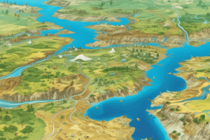
- Geographic Space: Professionals work with data related to space, typically involving positional data relative to the Earth's surface. Positional data determines where things are, or were, or will be. Positional data of a non-geographic nature is not relevant to this course.
- Geographic Phenomena: Defined as a manifestation of an entity or process of interest, nammable, geo-referenced and time assignable.
- Representation of Phenomena: A geographic field, for every point, a value can be assigned. Examples include air temperature and elevation.
- Geographic Fields:
- Continuous fields: Example: elevation and temperature
- Discrete fields: Example: soil type and land cover type
- Geographic Objects: Characterized by Location, Shape, Size, and Orientation.
- Spatial Data and Geo-Information: Data are representations that can be operated upon by a computer. Spatial Data contains positional values. Geo-spatial data is geo-referenced spatial data. Information, interpreted by humans, is used over data. Geo-information is interpreting spatial data.
- GIS Defined: System to capture, store, manipulate, analyze, manage, and present all types of geographic data. Integration of cartography, statistical analysis, and computing science technology. A GIS creates and manipulates spatial areas digitally.
- Purpose of GIS: Understanding our environment, land use planning, natural hazards, geological and hydrological processes..
- Representation of the Real World: considered as a model of that part and can be used for what-if scenarios. A map or database. A spatial database may contain point, line, and area characteristics.
- Computer Representations: Different models like raster and vector.
- Organization of Spatial Data: spatial data layer as a fundamental concept. A data layer contains spatial data and attribute data (tabular form) which describes the field or objects.
- The Temporal Dimension: Some geographic phenomena exhibit changes over time which is referred to as temporal characteristics and is an important aspect for many applications. Change detection is an area of work dedicated to this topic.
- Scale and Resolution: Ratio between distance on map and terrain. Large scale denotes more detail, small scale lesser detail. Resolution is associated with cell width of tessellation in digital spatial data
- GIS Applications: Cartography, Emergency Management, Environmental Sciences, Forestry Management, Homeland Security, Healthcare, Real Estate, Social Services, Transportation, Urban planning, Water Resources,
- Mapping Various Datasets: Several examples of various maps are presented, including mapping of land use, major roads and towns, land surface temperature, malaria incidence, crop yield, poverty, and boundary disputes.
- GIS Software Architecture and Functionality: Includes stages of spatial data handling like capturing, preparing, storage and maintenance, analysis, and presentation.
- Data Validation and Data Quality: Ensuring the quality of spatial data is essential for data integrity. Key elements of dataset quality include completeness, logical consistency, positional and temporal accuracy, data validity.
Database Management Systems
- Definition of a database: A collection of structured data. Database format.
- Importance of keeping database up to date.
- Database Management System (DBMS): Software package for setting up, maintaining databases. Multiple users. Data correctness, storage of very large data sets, and control of data redundancy.
- Reasons for Using a DBMS: Support for large datasets, data correctness, support for concurrent use by multiple users, control over data redundancy, high-level declarative query language, data model support.
- Relational Data Model : Structures to store data, integrity constraints (rules data must adhere to), computer programs to manipulate data. Structures defined as attributes, tuples, and relations. Attributes are named fields with assigned values. A tuple represents a single record in a table (relation).
- Relational model elements: Relation, Tuples and attributes; including attributes domains.
- Finding tuples and building links: Querying a database requires support for quick searches among numerous tuples, that's why the relational model uses the notion of key.
Spatial Data Analysis
- Spatial Problem: Planning (e.g., dam location) and prediction (e.g., lake size) problems. Context includes construction, environmental, societal, and economic aspects.
- Analytical Capabilities of GIS: Measurement, retrieval, and classification functions for data exploration. Overlay functions combine data layers to create new information by combining existing layers. Neighbourhood functions evaluate characteristics of an area surrounding a feature's location
- Retrieval, Classification, and Measurement on vector data: Measurements on vector data include location, length, distance, and area size. Retrieving and classifying data in relation to size. A common method is to sum up area sizes of polygons belonging to a specified class (e.g., grade type).
- Retrieval, Classification, and Measurement on raster data: The area size of a cell is constant.
- Spatial Selection Queries: Selection based on geometric/spatial grounds and attribute data which describes associated characteristics.
- Interactive Spatial Selection: Defining selection by pointing at spatial objects or drawing them on screen to select features and determine selection objects like points, lines and/or polygons.
- Spatial selection by attribute conditions: Query expressions in SQL for selecting objects based on attributes (e.g., Area < 400,000 or LandUse = 80)
- Combining attribute conditions: Using Boolean logic to combine multiple criteria for selection.
- Spatial selection (topological relationships): Selecting features based on containment relationships (e.g., a polygon containing points or lines, a line containing points)
- Further examples of Spatial Analysis: Classification techniques and applying them to various spatial data types.
Studying That Suits You
Use AI to generate personalized quizzes and flashcards to suit your learning preferences.