Podcast
Questions and Answers
Which colours are used on maps to show the depth of water below sea level?
Which colours are used on maps to show the depth of water below sea level?
- Brown and green
- Green and light yellow
- Red and yellow
- Light blue and dark blue (correct)
What does a map's colour key help to understand?
What does a map's colour key help to understand?
- The names of the countries
- The different colours shown on a map (correct)
- The types of flora and fauna in the region
- The population of each area
What kind of maps show the boundaries between countries, states, and cities?
What kind of maps show the boundaries between countries, states, and cities?
- Political maps (correct)
- Physical maps
- Geological maps
- Climate maps
Which model of the Earth shows landmasses and water bodies?
Which model of the Earth shows landmasses and water bodies?
Which of the following is NOT essential to understanding a map?
Which of the following is NOT essential to understanding a map?
What do the four sub-directions on a map help with?
What do the four sub-directions on a map help with?
What four elements are essential to study a map effectively?
What four elements are essential to study a map effectively?
How do shades of brown and green on a map assist in understanding the landscape?
How do shades of brown and green on a map assist in understanding the landscape?
Why is the globe considered a small model of the Earth?
Why is the globe considered a small model of the Earth?
What is the significance of using different shades of blue on maps?
What is the significance of using different shades of blue on maps?
What is the purpose of signs and symbols on a map?
What is the purpose of signs and symbols on a map?
Describe the difference between a political map and a physical map.
Describe the difference between a political map and a physical map.
Flashcards are hidden until you start studying
Study Notes
Map Keys
- A map's color key helps in understanding the map by explaining the meaning of different colors used.
- The color key on a map may use different shades of brown and green to indicate the height of land above sea level.
- The color key may also use two shades of blue to indicate the depth of water below sea level.
- Light blue on a map may indicate water near the coast that is not very deep.
- Darker blue on a map may indicate water that is very deep and away from the coast.
Word Meanings
- A globe is a model of the Earth that shows continents, countries, cities, and water bodies.
- Sub-directions are directions between the four main directions.
- Signs and symbols on a map are marks that have specific meanings.
Lesson at a Glance
- A globe is a small model of the Earth that shows landmasses and water bodies.
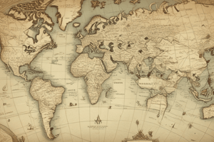
- A map is a representation of the Earth or a part of it drawn on a flat surface.
- There are different types of maps, including political maps and physical maps.
- To study a map, four key things need to be understood: directions, scale of the map, signs and symbols, and the colors used.
- There are four main directions and four sub-directions.
- Maps use shades of brown, green, and blue to represent landmasses and water bodies.
Map Keys
- A map's color key helps in understanding the map by explaining the meaning of different colors used.
- The color key on a map may use different shades of brown and green to indicate the height of land above sea level.
- The color key may also use two shades of blue to indicate the depth of water below sea level.
- Light blue on a map may indicate water near the coast that is not very deep.
- Darker blue on a map may indicate water that is very deep and away from the coast.
Word Meanings
- A globe is a model of the Earth that shows continents, countries, cities, and water bodies.
- Sub-directions are directions between the four main directions.
- Signs and symbols on a map are marks that have specific meanings.
Lesson at a Glance
- A globe is a small model of the Earth that shows landmasses and water bodies.
- A map is a representation of the Earth or a part of it drawn on a flat surface.
- There are different types of maps, including political maps and physical maps.
- To study a map, four key things need to be understood: directions, scale of the map, signs and symbols, and the colors used.
- There are four main directions and four sub-directions.
- Maps use shades of brown, green, and blue to represent landmasses and water bodies.
Studying That Suits You
Use AI to generate personalized quizzes and flashcards to suit your learning preferences.