Podcast
Questions and Answers
Which of the following statements accurately distinguishes between physical and political boundaries?
Which of the following statements accurately distinguishes between physical and political boundaries?
- Physical boundaries are naturally occurring, while political boundaries are human-created, sometimes using physical features. (correct)
- Both physical and political boundaries are naturally occurring features that define territories.
- Physical boundaries are human-created, while political boundaries are based on natural landmarks.
- Both physical and political boundaries are created by humans but serve different administrative purposes.
A country's legislative body redraws district lines to consolidate all known opposition voters into one district. The remainder of the state is heavily in favor of the party in power. Boundaries were drawn in such a way as to be advantageous to one group of people over another. What type of boundary is this an example of?
A country's legislative body redraws district lines to consolidate all known opposition voters into one district. The remainder of the state is heavily in favor of the party in power. Boundaries were drawn in such a way as to be advantageous to one group of people over another. What type of boundary is this an example of?
- Macrogeographic
- Political (correct)
- Physical
- Subregional
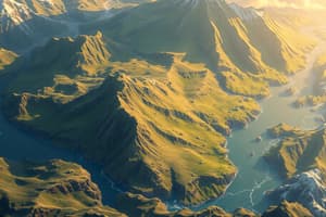
A team of explorers is mapping a newly discovered island. They identify a tall mountain range that separates the dense jungle on one side from a vast desert on the other. Which type of boundary would this mountain range represent if used to define two distinct territories?
A team of explorers is mapping a newly discovered island. They identify a tall mountain range that separates the dense jungle on one side from a vast desert on the other. Which type of boundary would this mountain range represent if used to define two distinct territories?
- Subregional boundary indicating cultural differences
- Macrogeographic boundary separating continents
- Political boundary created for resource management
- Physical boundary based on a natural feature (correct)
A remote island nation is divided into three administrative zones: Zone A, Zone B, and Zone C. Zone A is known for its fishing industry, Zone B for its agriculture, and Zone C for its tourism. These zones are all governed by the same national laws and regulations. Which type of geographic division do these zones represent?
A remote island nation is divided into three administrative zones: Zone A, Zone B, and Zone C. Zone A is known for its fishing industry, Zone B for its agriculture, and Zone C for its tourism. These zones are all governed by the same national laws and regulations. Which type of geographic division do these zones represent?
If you were to travel west from Europe, crossing through Asia and continuing until you reach the opposite side of the globe, which macrogeographic region would you likely enter next?
If you were to travel west from Europe, crossing through Asia and continuing until you reach the opposite side of the globe, which macrogeographic region would you likely enter next?
Flashcards
Physical Boundary
Physical Boundary
Natural divisions like rivers or mountains.
Political Boundary
Political Boundary
Man-made borders, sometimes using natural features.
Macrogeographic Region
Macrogeographic Region
Very large geographic areas: Oceania, The Americas, Africa, Asia, and Europe.
True Location
True Location
Signup and view all the flashcards
Geographic Hierarchy
Geographic Hierarchy
Signup and view all the flashcards
Study Notes
- Physical boundaries are natural, while political boundaries are human-created, sometimes using physical features to demarcate territory.
- There are five macrogeographic regions: Oceania, The Americas, Africa, Asia, and Europe.
- Macrogeographic regions contain smaller subregions, which can be further divided into geographic regions.
- Political entities, like states and territories, are defined by political boundaries.
Studying That Suits You
Use AI to generate personalized quizzes and flashcards to suit your learning preferences.


