Podcast
Questions and Answers
What is the fundamental difference between the effects of transform boundaries compared to convergent and divergent boundaries?
What is the fundamental difference between the effects of transform boundaries compared to convergent and divergent boundaries?
Transform boundaries primarily cause earthquakes as plates slide past each other, while convergent boundaries lead to crust destruction and divergent boundaries result in crust formation.
Explain how the magma composition of shield volcanoes affects the nature of their eruptions, referencing a specific example.
Explain how the magma composition of shield volcanoes affects the nature of their eruptions, referencing a specific example.
Shield volcanoes have low viscosity magma meaning fluid lava, which leads to non-explosive eruptions. Mauna Loa in Hawaii is an example.
Contrast the formation and eruption characteristics of cinder cone volcanoes with those of super volcanoes.
Contrast the formation and eruption characteristics of cinder cone volcanoes with those of super volcanoes.
Cinder cone volcanoes are formed from accumulations of small lava fragments and have short, explosive bursts. Super volcanoes are associated with large calderas and erupt with massive amounts of magma, causing caldera formation.
Describe the relationship between the focus/hypocenter and the epicenter of an earthquake.
Describe the relationship between the focus/hypocenter and the epicenter of an earthquake.
How do seismic waves behave differently when traveling through hard rock versus loose sediment and water?
How do seismic waves behave differently when traveling through hard rock versus loose sediment and water?
Explain the difference between P-waves and S-waves in terms of their movement and the materials they can travel through.
Explain the difference between P-waves and S-waves in terms of their movement and the materials they can travel through.
What is liquefaction, and how does earthquake shaking contribute to this secondary hazard?
What is liquefaction, and how does earthquake shaking contribute to this secondary hazard?
Describe how deforestation can increase the risk of mass movements like landslides.
Describe how deforestation can increase the risk of mass movements like landslides.
Explain how a strike-slip fault differs from a normal or reverse fault in terms of plate movement and stress.
Explain how a strike-slip fault differs from a normal or reverse fault in terms of plate movement and stress.
What factors made the Caribbean island republic of Haiti more vulnerable to the impacts of the 2010 earthquake compared to Chile, which experienced a larger magnitude earthquake?
What factors made the Caribbean island republic of Haiti more vulnerable to the impacts of the 2010 earthquake compared to Chile, which experienced a larger magnitude earthquake?
How did the eruption of Eyjafjallajökull in 2010 affect air travel and the agricultural sector in Iceland?
How did the eruption of Eyjafjallajökull in 2010 affect air travel and the agricultural sector in Iceland?
What steps were taken in Iceland following the Eyjafjallajökull eruption to reduce future vulnerability to volcanic ash hazards?
What steps were taken in Iceland following the Eyjafjallajökull eruption to reduce future vulnerability to volcanic ash hazards?
Explain why the early warning system in place before the 2018 tsunami near Anak Krakatau failed to provide adequate warning to local communities.
Explain why the early warning system in place before the 2018 tsunami near Anak Krakatau failed to provide adequate warning to local communities.
How can hazard communication, such as using mobile devices with databases, help lessen human vulnerability during a disaster?
How can hazard communication, such as using mobile devices with databases, help lessen human vulnerability during a disaster?
How might a growing middle class increase both the economic impact of disasters and the resilience of a community?
How might a growing middle class increase both the economic impact of disasters and the resilience of a community?
Flashcards
Divergent Movement
Divergent Movement
Pushed apart by magma, forming new crust. Plates move apart.
Convergent Movement
Convergent Movement
Crust is lost. Oceanic plate slides under continental plate, creating trenches/volcanoes. Plates Collide.
Transform Movement
Transform Movement
No crust created or destroyed. Plates slide horizontally past each other causing earthquakes.
Shield Volcano
Shield Volcano
Signup and view all the flashcards
Composite Volcano
Composite Volcano
Signup and view all the flashcards
Cinder Volcano
Cinder Volcano
Signup and view all the flashcards
Super Volcano
Super Volcano
Signup and view all the flashcards
Focus (Hypocenter)
Focus (Hypocenter)
Signup and view all the flashcards
Epicenter
Epicenter
Signup and view all the flashcards
Seismic Waves
Seismic Waves
Signup and view all the flashcards
Strike-slip Fault
Strike-slip Fault
Signup and view all the flashcards
Transverse Fault
Transverse Fault
Signup and view all the flashcards
Liquefaction
Liquefaction
Signup and view all the flashcards
Landslide
Landslide
Signup and view all the flashcards
Landslide cause
Landslide cause
Signup and view all the flashcards
Study Notes
Plate Tectonics
- Divergent Movement (Constructive): Magma pushes plates apart, forming new crust as it surfaces
- Convergent Movement (Destructive): Oceanic plate slides under continental plate, crust is lost and trenches/volcanoes are made as plates collide
- Transform Movement (Conservative): Plates slide horizontally past each other creating earthquakes, with no crust created or destroyed
Types of Volcanoes
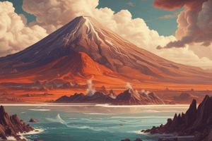
- Shield Volcano: Largest on Earth, forms outside plate boundary, lava has low viscosity
- Shield Volcano Example: Mauna Loa, Hawaii
- Composite Volcano: Tall with many ash layers, powerful explosives with sudden explosions of ash and toxic gases
- Composite Volcano Example: Mount Fuji
- Cinder Volcano: Few in number, ~100 feet tall, often near bigger volcanoes, explosive bursts of small solid lava fragments
- Cinder Volcano Example: Wizard Island, Crater Lake National Park
- Super Volcano: Different shapes, large calderas (large divots in ground), erupts magma causing caldera to form, large magma explosions
- Super Volcano Example: Yellowstone National Park
Earthquakes
- Results from movements around fractures in rocks, known as a fault
- Stress accumulates and releases suddenly
- Focus (hypocenter): Point of break
- Epicenter: Area of surface land above the focus
Waves
- Seismic: Travel in all directions from the epicenter, faster through hard rock, slower through loose sediment/water
- P and S waves: Travel through earth itself, less destructive than surface waves
- P waves: Moves back and forth, going through solid, liquid, and gas (body waves)
- S waves: Moves up and down (solids only); secondary waves
- Love waves: Move in all directions faster
- Rayleigh waves: Move like ocean waves in long duration
Shaking
- Magnitude: energy released, depending on plate thickness
- Shaking decays with distance
- Local soil can amplify shaking
Faults
- Strike-slip: Moves horizontally in opposite directions; for example, San Andreas Fault
- Normal: Tension, stresses rocks apart, basin range, hanging wall moves down footwall
- Reverse: Hanging wall moves up footwall, compression stresses rocks together; for example, Saint Gabriel Faults
- Surface fault: Displacement that reaches the earth’s surface during a slip
Secondary Hazards
- Liquefaction: Water-saturated sediment temporarily loses strength, acts as a fluid. Caused by earthquake shaking, loses ability to support structures
- Landslide: Movement of surface material down a slope
- Tsunami: Large series of waves, large wavelength, initially high rising water levels, lasts minutes/hours
Mass Movements
- Influenced by gradient of slope, water (more water = more movement) and Vegetation (roots bind soil, deforestation increases movements)
- Influenced by Human Activity like construction, transportation lines, etc
Types of Movement
- Landslide: Caused by human activity due to loosened soil becoming unstable and human construction
- Mudflow: Landslide-like, sustained rainfall, volcanic activity, very fast due to low rainy watery viscosity, some reach 60 mph
- Rockfall: Vulnerable locations that don't receive lots of rainfall typically
- Soil Creep: Terracettes in the soil, ridges, trees with bent trunks or curved, houses from cracks, ground is generally unstable
Vulnerability
- According to the world risk report 2012: the level of risk in any given country depends on the economic, social and institutional conditions of its society
- Hazards are costing more damage, but fewer lives are lost
- Long term California earthquake rates suggest a 2 in 3 chance will strike the San Francisco Bay area in 30 years
- 80% of US population resides in urban areas
- Elderly and children are more vulnerable
- Women are more vulnerable due to their role in society
- Less developed areas are more vulnerable
Projects
- Mass Movements in California (January 2018) and Wayanad, India (July 2024)
- Volcanic Hazard in Volcán de Fuego, Guatemala (June 2018) and Mount Ontake, Japan (September 2014)
- Earthquake Hazard in Tohoku, Japan (March 11, 2011) and Southern Türkiye & Northern Syria (February 6, 2023)
2010 Eyjafjallajokull, Iceland Volcano Eruption
- Rural/urban: Rural, underneath glacier; earthquakes in January caused subduction
- Degree of isolation: Very rural area, no deaths due to lack of homes; all evacuated
- Levels of development: Immediate halt to air traffic
- Lava caused ice to melt, flooding and mudslides destroying crops, severely hurting Iceland's agricultural sector
- Population density: ~800 people near Austur-Eyjafjöll (104) and Vík (311) evacuated
- Hazard Magnitude/Frequency: 3-4 on VEI; occurred three times in recorded history (920, 1610, and 2010)
- Secondary hazards: flooding and minor mudslides into agricultural lands, closing airports and causing air quality hazards
2010 Eruption Management
- Pre-event strategies: building codes, emergency drills, early warning systems, hazard monitoring etc
- Post-event strategies: Iceland triggered the creation of the International Volcanic Ash Task Force to identify atmospheric risk on aircrafts
- Produced a fountain-fed lava flow field of about 1.3 km2
- Flight cancellations: Over 100,000 flights were canceled, affecting 10 million passengers
- Impact: No casualties (everyone evacuated); most damage from ash in area
- Impact: Air quality significantly decreased
- Impact: The airline industry lost $200 million a day as air travel was cancelled;
- The European Red Cross provided food; Economy expanded by 10%; Icelandic government implemented evacuation plans
- Tourism decreased 17.5% then increased back post-eruption
- Initiating event: Earthquakes in January caused subduction under glacier
- Typically erupts simultaneously with Katla, Iceland, but on March 10, erupted alone then lava started to flow down Fimmvorduhals Pass separating two glaciers which led to melting
- More eruptions and steam to occur as the ice vaporized
Indonesia Volcano & Tsunami: Anak Krakatau
- December 2018, Anak Krakatau, Indonesia
- The presence of a flank collapse led to a tsunami reaching South Asia, East Africa, and Western Australia
- Zero population on the island of Anak Krakatau
- Seismic Magnitude - between 4.8 and 5.9
- 22 December 2018 Sunda Strait tsunami due to volcanic flank failure, a sector collapse
- Underwater landslide displaced large amounts of water creating waves without warning; seismic activity did not trigger alerts
- Possibilities: building codes, emergency drills, early warning systems, hazard monitoring, etc
- Prior to this tsunami, the government of Indonesia released a status of the activities of Mount Anak Krakatau since June 2018
- Warning system only detects earthquake-generated tsunamis; locals received no warning
- InSAR maps showed southern side of volcano slipped towards ocean at 4 millimeters/month; flank movement increased to 10 millimeters/month as eruptive activity increased in June
- Not enough of a concern
- Statistics: Mount Anak Krakatau erupts 40x over past 85 years, 130 volcano-induced tsunamis over past 4 centuries
- Impact: At least 36,417 deaths, people suffered loss of hearing in close vicinity
- The volcanic ash led to deteriorating health conditions and the destruction of 165 villages and towns
Future Resilience and Adaptation
- Hazard Communication: Mobile device containing child's images, location
- Seperated parents and children in database for family tracing can help quickly collect, sort, and share
- Separated children are vulnerable
- Process minimizes separation time
- Mass numbers of people helped in a timely manner
- Reduces the long term physiological and traumatic effects of being missing with data that can be used in future crises
- Urbanization and the increasing global middle class causes increased losses from natural disasters
- This can be mitigated with insurance, improved infrastructure, and preparedness
Hazard Response
- 90% of disaster deaths between 1996 and 2015 occurred in low and middle-income nations
- Turkey and Syria earthquake damaged the only official humanitarian aid route
- Wealthier nations upgrade old buildings, build better infrastructure, and invest in resources
- January 2010: Haiti earthquake killed an estimated 220,000, injured 300,000, and left 1.5 million homeless
- Chile earthquake at 8.8 magnitude had 500 deaths and slightly structural damage
- California has earthquake insurance policies dropped by 5.5% last year
- Only about 10-15% of homeowners have earthquake insurance translating to 1,615,561 policies in 2023
Japan Earthquake and Tsunami
- The Fukushima Daiichi nuclear disaster occurred due to flooding of backup generators highlighting vulnerabilities in infrastructure and tsunami wiped out entire towns
- Resulted from thrust faulting on the subduction zone plate boundary between the Pacific and North America plates
- Maximum wave height of almost 40 meters (130 feet)
- A 1,242-mile) stretch of Japan's Pacific coast was impacted by the tsunami
- Biggest catastrophic event was the nuclear disaster from the Tsunami as disabled the power supply and cooling of 3 Fukushima Daiichi reactors
- Damages were around $220 Billion USD (most expensive natural disaster in history_
2023 Southern Turkiye & Northern Syria Earthquakes
- The earthquake affected 15.73 million people across Türkiye and Syria and 230,000 buildings were damaged or destroyed in Türkiye with 10,600 in northwest Syria
- Magnitude: 7.8, followed by a 7.5 quake nine hours later with thousands of aftershocks and additional tremors
- Government allocated substantial funds for earthquake relief amounting to 3.6% of GDP in 2023 and 2.4% in 2024; had National Earthquake Strategy and Action Plan
- Casualties over 55,000 deaths with economic losses exceeding $100 billion
- There was a lack of military rescue forces and thousands of landslides occurred impacting the water supply with the Turkish government blocking twitter to stop criticism
- Strengthened compliance with seismic safety standards and improving emergency coordination
Studying That Suits You
Use AI to generate personalized quizzes and flashcards to suit your learning preferences.