Podcast
Questions and Answers
What is the primary difference between terrestrial and aerial photography?
What is the primary difference between terrestrial and aerial photography?
- Terrestrial photography relies on natural light, whereas aerial does not.
- Terrestrial photography captures images from the air using drones.
- Aerial photography captures images from above, while terrestrial is from ground level. (correct)
- Aerial photography is taken from the ground level.
Which factor is crucial for determining the scale of a vertical photograph?
Which factor is crucial for determining the scale of a vertical photograph?
- The type of camera used for capturing images.
- The time of day when the photograph is captured.
- The angle of the photograph taken.
- The altitude at which the photograph is taken. (correct)
What is the effect of relief displacements in photographic images?
What is the effect of relief displacements in photographic images?
- They cause distortions in the perceived position of objects. (correct)
- They enhance the clarity of distant objects.
- They reduce the need for flight planning.
- They increase the overall brightness of the photograph.
How can heights be determined from parallel measurements in photogrammetry?
How can heights be determined from parallel measurements in photogrammetry?
What is an essential aspect of flight planning for aerial photography?
What is an essential aspect of flight planning for aerial photography?
Flashcards
Aerial Photography
Aerial Photography
Images captured from above (airborne platform).
Terrestrial Photography
Terrestrial Photography
Images captured from ground level.
Photo Scale Factor
Photo Scale Factor
The height of the camera above the ground when the photo was taken.
Relief Displacement
Relief Displacement
Signup and view all the flashcards
Aerial Photography Flight Planning
Aerial Photography Flight Planning
Signup and view all the flashcards
Study Notes
Basic Definitions
- Photogrammetry: The science and art of obtaining reliable measurements from photographs.
Terrestrial Photography
- Terrestrial photography: Taking photographs from ground-based stations
- Used for creating maps, measuring distances, and documenting scenes
Aerial Photography
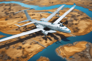
- Aerial photography: Taking photographs from airborne platforms like airplanes or drones
- Used to create maps, monitor environmental changes, and assess infrastructure
Scale of Vertical Photograph
- Scale of vertical photograph: The ratio of the distance between two points on the photograph to the corresponding distance on the ground
- Determined by the focal length of the camera, the altitude of the aircraft, and the distance between the two points
- Formula: Scale = Focal length / (Altitude - Ground elevation)
Relief and Relief Displacements
- Relief: Variations in ground elevation
- Relief displacement: Distortion of features due to the difference in elevation
- Relief displacement is proportional to the height of the object and the distance from the camera.
Heights from Parallel Measurements
- Heights from parallel measurements: Determining heights from the difference in the distances between two points measured on two overlapping photographs
- Requires photographs taken in stereo (overlapping)
Flight Planning
- Flight planning involves determining the flight path, altitude, and number of photographs needed for a specific project
- Factors considered: Project area, desired map scale, camera specifications, and weather conditions.
Photographs Required
- Number of photographs required depends on: Area to be covered, overlap between photographs, and scale required.
- Overlapping photographs are essential for stereo viewing and accurate measurements.
Studying That Suits You
Use AI to generate personalized quizzes and flashcards to suit your learning preferences.


