Podcast
Questions and Answers
What is satellite photogrammetry used for in GIS applications?
What is satellite photogrammetry used for in GIS applications?
Urban planning, land cover classification, and large-scale environmental change mapping
What is the main benefit of satellite photogrammetry?
What is the main benefit of satellite photogrammetry?
Speedy coverage of broad areas, making it an affordable option for extensive mapping projects
What type of satellite imagery shows clouds both by day and night?
What type of satellite imagery shows clouds both by day and night?
Infrared imagery
What type of satellite imagery is commonly seen on weather forecast maps?
What type of satellite imagery is commonly seen on weather forecast maps?
What is the type of photogrammetry that utilizes satellite images?
What is the type of photogrammetry that utilizes satellite images?
What is the advantage of using satellite photogrammetry over other methods?
What is the advantage of using satellite photogrammetry over other methods?
What are the three main types of satellite imagery available?
What are the three main types of satellite imagery available?
What is the primary application of satellite photogrammetry?
What is the primary application of satellite photogrammetry?
What is the difference between visible and infrared imagery?
What is the difference between visible and infrared imagery?
How has the advancement of satellite technology impacted photogrammetry?
How has the advancement of satellite technology impacted photogrammetry?
Flashcards are hidden until you start studying
Study Notes
Stereophotogrammetry
- Involves using stereopairs of photographs to estimate the three-dimensional coordinates of points.
- Allows for better interpretation of objects/features through three-dimensional models.
Applications of Photogrammetry
- Widely used in topographic mapping, architecture, engineering, manufacturing, quality control, police investigations, geology, archaeology, and meteorology.
- Archaeologists use it to create plans of large or complex sites quickly.
- Meteorologists utilize it to determine wind speed of tornadoes when traditional data is unavailable.
Engineering Applications
- Photogrammetry provides accurate measurements from images, essential for construction planning and execution.
- Drones are deployed for site evaluation ensuring smooth project operations.
- Used to create perspective images and 3D renderings for clients to analyze work progress.
Types of Photogrammetry
- There are two main categories:
- Metric (Quantitative) Work: Involves measurements such as ground positions, distances, elevations, and map preparation.
- Interpretative (Qualitative) Work: Involves identifying objects and assessing their significance, also known as photointerpretation.
Remote Sensing
- Records from imaging systems like infrared sensors and radar contribute to interpretative work, termed remote sensing.
- Space photogrammetry deals with photography from satellites orbiting the Earth.
Aerial and Terrestrial Photogrammetry
- Aerial Photogrammetry: Involves photographs taken from cameras on aircraft or balloons.
- Terrestrial Photogrammetry: Involves photographs taken from ground-based cameras with horizontal axes.
Close-range Photogrammetry
- Focuses on applications where cameras are positioned close to the photographed object.
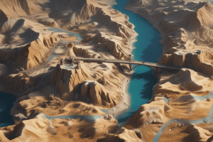
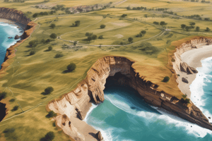
Satellite Photogrammetry
- Extracts spatial information from high-resolution satellite images, essential for GIS applications.
- Benefits include rapid coverage of large areas, making it cost-effective for extensive mapping.
- Main types of satellite imagery include:
- Visible Imagery: Shows Earth's features from afar, including clouds and land.
- Infrared Imagery: Displays clouds during day and night; useful for assessing storm intensity.
- Water Vapour Imagery: Utilized in weather forecasts to convey moisture levels in the atmosphere.
Studying That Suits You
Use AI to generate personalized quizzes and flashcards to suit your learning preferences.