Podcast
Questions and Answers
What is the Peninsular Plateau made of?
What is the Peninsular Plateau made of?
Ancient crystalline, igneous, and metamorphic rocks.
Which plateau is known for its rich black soil, ideal for cotton cultivation?
Which plateau is known for its rich black soil, ideal for cotton cultivation?
- Vindhya Plateau
- Malwa Plateau (correct)
- Chota Nagpur Plateau
- Deccan Plateau
The Deccan Plateau is primarily composed of basalt rocks.
The Deccan Plateau is primarily composed of basalt rocks.
True (A)
What is the elevation of the Mount Abu?
What is the elevation of the Mount Abu?
Which plateau is located in eastern Madhya Pradesh and northern Chhattisgarh, known for its rugged terrain and rich mineral resources, including limestone and coal?
Which plateau is located in eastern Madhya Pradesh and northern Chhattisgarh, known for its rugged terrain and rich mineral resources, including limestone and coal?
What are the three main sections of the Western Ghats?
What are the three main sections of the Western Ghats?
The Eastern Ghats are more continuous and well-defined than the Western Ghats.
The Eastern Ghats are more continuous and well-defined than the Western Ghats.
Which plateau is an extension of the Peninsular Plateau in northeastern India?
Which plateau is an extension of the Peninsular Plateau in northeastern India?
What are the four major divisions of the Eastern Coastal Plains?
What are the four major divisions of the Eastern Coastal Plains?
Which coast is known for its lagoons and rich deposits of oil?
Which coast is known for its lagoons and rich deposits of oil?
What is the type of topography found on the Lakshadweep Islands?
What is the type of topography found on the Lakshadweep Islands?
The Lakshadweep Islands were previously known as the Laccadive, Minicoy, and Amindivi Islands.
The Lakshadweep Islands were previously known as the Laccadive, Minicoy, and Amindivi Islands.
What is the highest peak in the Andaman and Nicobar Islands?
What is the highest peak in the Andaman and Nicobar Islands?
The Andaman and Nicobar Islands are known for their dense rainforests and mangroves along the coasts.
The Andaman and Nicobar Islands are known for their dense rainforests and mangroves along the coasts.
What is the dominant economic activity on the Lakshadweep Islands?
What is the dominant economic activity on the Lakshadweep Islands?
What is the name of the island that is a bird sanctuary in the Lakshadweep Islands?
What is the name of the island that is a bird sanctuary in the Lakshadweep Islands?
What is the name of the important channel that separates Minicoy Island from the main Lakshadweep archipelago?
What is the name of the important channel that separates Minicoy Island from the main Lakshadweep archipelago?
Flashcards
Malwa Plateau
Malwa Plateau
A plateau in western Madhya Pradesh and parts of Rajasthan, bordered by the Aravalli Range to the northwest and the Vindhya Range to the south. Known for its rich black soil suitable for cotton cultivation.
Chota Nagpur Plateau
Chota Nagpur Plateau
A plateau spanning over Jharkhand, northern Odisha, and Chhattisgarh. Famous for its mineral wealth, especially coal, iron ore, and mica. Includes the Ranchi and Hazaribagh plateaus.
Deccan Plateau
Deccan Plateau
The largest plateau in peninsular India, covering Maharashtra, Karnataka, Andhra Pradesh, and Tamil Nadu. Bounded by the Western and Eastern Ghats. Rich in volcanic black soil, supporting cotton and sugarcane.
Vindhya Plateau
Vindhya Plateau
Signup and view all the flashcards
Baghelkhand Plateau
Baghelkhand Plateau
Signup and view all the flashcards
Bundelkhand Plateau
Bundelkhand Plateau
Signup and view all the flashcards
Meghalaya Plateau
Meghalaya Plateau
Signup and view all the flashcards
Shiwaliks (Outer Himalayas)
Shiwaliks (Outer Himalayas)
Signup and view all the flashcards
Duns
Duns
Signup and view all the flashcards
Chos
Chos
Signup and view all the flashcards
Purvanchal (Eastern Hills)
Purvanchal (Eastern Hills)
Signup and view all the flashcards
Saramati
Saramati
Signup and view all the flashcards
Manipur Hills
Manipur Hills
Signup and view all the flashcards
Mizo Hills
Mizo Hills
Signup and view all the flashcards
Aravalli Range
Aravalli Range
Signup and view all the flashcards
Mount Abu
Mount Abu
Signup and view all the flashcards
Pipli Ghat, Dewair, Desuri
Pipli Ghat, Dewair, Desuri
Signup and view all the flashcards
Vindhyan Range
Vindhyan Range
Signup and view all the flashcards
Satpura Range
Satpura Range
Signup and view all the flashcards
Dhupgarh
Dhupgarh
Signup and view all the flashcards
Western Ghats (Sahyadris)
Western Ghats (Sahyadris)
Signup and view all the flashcards
Anai Mudi
Anai Mudi
Signup and view all the flashcards
Eastern Ghats
Eastern Ghats
Signup and view all the flashcards
Mahendra Giri
Mahendra Giri
Signup and view all the flashcards
Eastern Coastal Plains
Eastern Coastal Plains
Signup and view all the flashcards
Western Coastal Plains
Western Coastal Plains
Signup and view all the flashcards
Study Notes
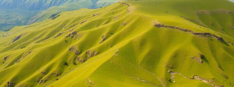
Peninsular Plateau
- The Peninsular Plateau is a tableland made of ancient crystalline, igneous, and metamorphic rocks.
- It formed from the breakup of the Gondwana continent, making it one of Earth's oldest landmasses.
- The general slope of the plateau is west to east, directing river flow.
- The region has undergone repeated uplift and submergence, along with crustal faulting, which has diversified its relief.
Major Plateaus of Peninsular India
- Malwa Plateau: Located in western Madhya Pradesh and parts of Rajasthan, bordered by the Aravalli Range; known for rich black soil ideal for cotton.
- Chota Nagpur Plateau: Spreads over Jharkhand, Odisha, and Chhattisgarh; known for its rich, black soil. Contains the Ranchi and Hazaribagh plateaus.
- Deccan Plateau: Covers much of Maharashtra, Karnataka, Andhra Pradesh, and Tamil Nadu; bounded by the Western and Eastern Ghats; rich in volcanic black soil, ideal for cotton and sugarcane.
- Vindhya Plateau: Lies between the Malwa Plateau and the Narmada Valley, made of sandstones and shales; acts as a natural boundary between northern and southern India.
- Baghelkhand Plateau: Located in eastern Madhya Pradesh and northern Chhattisgarh; known for its rugged terrain and rich mineral resources (limestone and coal).
- Bundelkhand Plateau: Spans parts of Uttar Pradesh and Madhya Pradesh; known for its hard, rocky terrain, granite, and poor soil, challenging agriculture.
- Meghalaya Plateau: An extension of the Peninsular Plateau in northeastern India, containing the Khasi, Garo, and Jaintia Hills; rich in coal and limestone, with a favorable climate for agriculture.
Other Mountain Ranges
- Shiwaliks (Outer Himalayas): Outermost Himalayan range, 10–15 km wide, with altitudes ranging from 900m to 100m; unconsolidated sediments, thick gravels, alluvium. It has longitudinal valleys (duns) like Dehra Dun, Kotli Dun, Patli Dun.
- Purvanchal (Eastern Hills): Northeast India, along the India-Myanmar border; width: 40 km at ends, 225 km centrally; notable ranges: Patkai Bum, Naga Hills, Manipur Hills, Mizo Hills.
- Aravalli Range: Northeast to southwest direction; ~800 km long, from Delhi to Palanpur, Gujarat; one of the oldest fold mountains in the world; elevations: 400–1,158 m (Mount Abu); composed of granite, schists, and granites.
- Vindhyan Range: Parallel to the Narmada Valley, from Jobat (Gujarat) to Sasaram (Bihar); length: over 1,200 km; elevation: 300–650 m; horizontally bedded sedimentary rocks; acts as a watershed between Ganga and South Indian river systems.
- Satpura Range: South of the Vindhyan range, between the Narmada and Tapi rivers. Length: ~900 km; peaks: Dhupgarh (1,350 m), Amarkantak (1,127 m); folded and uplifted, known as horsts; rugged terrain dense forests.
- Western Ghats (Sahyadris): Western edge of the Deccan Plateau, from Tapi Valley (21°N) to near Kanniyakumari; length: ~1,600 km; steep-sided, terraced hills with flat tops; elevations: 1,000 m average; peaks like Anai Mudi (2,695 m). Sub-divisions: Northern Ghats, Middle Sahyadris, Southern Ghats.
- Eastern Ghats: Parallel to the East Coast; highly broken and detached hills; composed of horizontally bedded sedimentary rocks; includes Nallamalai range in Andhra Pradesh, Mahendra Giri (1,501 m), Jindhagada Peak (1,690 m). Sections: Northern Eastern Ghats, Central to Southern Ghats, merging with Western Ghats.
Coastal Plains
- Coastal plains surround three sides of India.
- Eastern Coastal Plains: West Bengal to Tamil Nadu, covering Odisha and Andhra Pradesh.
- Western Coastal Plains: Kerala to Gujarat, covering Karnataka, Goa, and Maharashtra.
Islands of India
- Andaman and Nicobar Islands: Positioned in the Bay of Bengal; running north-south, extending from 6°45′ N to 13°45′ N; consists of 265 islands (203 in Andaman, 62 in Nicobar). Divided into North, Middle, and South groups.
- Lakshadweep Islands: Positioned in the Arabian Sea, extending between 8°N and 12°N; area: 32 square kilometers; main islands: Kavaratti, Agatti, Minicoy, Amini; distance: 280–480 km off Kerala's coast; made of coral deposits.
Studying That Suits You
Use AI to generate personalized quizzes and flashcards to suit your learning preferences.


