Podcast
Questions and Answers
What is the primary purpose of geodesy?
What is the primary purpose of geodesy?
- To analyze weather patterns.
- To explore ocean dynamics.
- To study celestial mechanics.
- To determine the Earth's shape, gravity field, and precise location of points on its surface. (correct)
Which branch of geodesy focuses primarily on gravity field analysis?
Which branch of geodesy focuses primarily on gravity field analysis?
- Integrated Geodesy
- Geometric Geodesy
- Physical Geodesy (correct)
- Geodetic Astronomy
What milestone is associated with the first artificial satellite launched?
What milestone is associated with the first artificial satellite launched?
- Hubble Space Telescope
- Explorer 1
- Sputnik-1 (correct)
- GRACE
What does the geometrical method in satellite geodesy involve?
What does the geometrical method in satellite geodesy involve?
Which of the following techniques is NOT a branch of geodesy?
Which of the following techniques is NOT a branch of geodesy?
The dynamical method in satellite geodesy primarily uses which aspect?
The dynamical method in satellite geodesy primarily uses which aspect?
What are the main goals of satellite geodesy?
What are the main goals of satellite geodesy?
Which of the following statements about integrated geodesy is true?
Which of the following statements about integrated geodesy is true?
What is one of the main applications of satellite geodesy?
What is one of the main applications of satellite geodesy?
Which satellite was the first artificial satellite ever launched?
Which satellite was the first artificial satellite ever launched?
Which method allows for observing Earth from space-based instruments?
Which method allows for observing Earth from space-based instruments?
What did the GRACE satellites primarily map?
What did the GRACE satellites primarily map?
What role does the CHAMP satellite serve in geodesy?
What role does the CHAMP satellite serve in geodesy?
What does geodetic control involve?
What does geodetic control involve?
What is one of the primary focuses of geodynamics?
What is one of the primary focuses of geodynamics?
During which decade did significant improvements in geodynamical studies take place?
During which decade did significant improvements in geodynamical studies take place?
Flashcards
What is Geodesy?
What is Geodesy?
The science of measuring and mapping the Earth's surface, utilizing geometric principles and technologies.
Geometric Geodesy
Geometric Geodesy
Focuses on the Earth's shape and size using geometric principles, particularly the ellipsoid of revolution.
Physical Geodesy
Physical Geodesy
Studies the Earth's gravity field to provide a more precise definition of its shape and size.
Satellite Geodesy
Satellite Geodesy
Signup and view all the flashcards
Geodetic Astronomy (Astro-Geodesy)
Geodetic Astronomy (Astro-Geodesy)
Signup and view all the flashcards
Integrated Geodesy
Integrated Geodesy
Signup and view all the flashcards
What is Satellite Geodesy?
What is Satellite Geodesy?
Signup and view all the flashcards
Main goals of Satellite Geodesy
Main goals of Satellite Geodesy
Signup and view all the flashcards
Geometrical Method in Satellite Geodesy
Geometrical Method in Satellite Geodesy
Signup and view all the flashcards
Dynamical Method in Satellite Geodesy
Dynamical Method in Satellite Geodesy
Signup and view all the flashcards
Earth to Space Methods
Earth to Space Methods
Signup and view all the flashcards
Space to Earth Methods
Space to Earth Methods
Signup and view all the flashcards
Space to Space Methods
Space to Space Methods
Signup and view all the flashcards
Sputnik-1
Sputnik-1
Signup and view all the flashcards
GRACE
GRACE
Signup and view all the flashcards
GOCE (Gravity Field and Steady-State Ocean Circulation Explorer)
GOCE (Gravity Field and Steady-State Ocean Circulation Explorer)
Signup and view all the flashcards
Study Notes
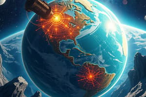
Overview of Geodesy
- Geodesy is the science focused on measuring and mapping the Earth's surface.
- The term derives from Greek, with "Geo" meaning "Earth" and "Daiein" meaning "to divide."
- Geodesy's main purposes are to determine the Earth's shape, gravity field, and the precise location of points on its surface.
Branches of Geodesy
- Geometric Geodesy: Investigates the size and shape of the Earth using geometric principles, particularly the ellipsoid of revolution.
- Physical Geodesy: Studies the Earth's gravity field to provide a more precise definition of its size and shape.
- Satellite Geodesy: Employs satellite systems like GPS and GLONASS for precise measurements of Earth's geometry and gravity field.
- Geodetic Astronomy (Astro-Geodesy): Uses measurements of celestial bodies to determine positions on Earth.
- Integrated Geodesy: A newer branch that merges geometric and physical geodesy.
Introduction to Satellite Geodesy
- Satellite geodesy utilizes artificial satellites to measure and monitor the Earth’s size, shape, and gravity field.
- Main goals include determining Earth’s figure, measuring the geoid, and studying geodynamic phenomena such as crustal deformation and polar motion.
- Historical milestones include:
- Sputnik-1 (1957): Marked the dawn of satellite geodesy as the first artificial satellite.
- Explorer 1 (1958): The first U.S. satellite, significant for discovering the Van Allen radiation belts.
- GRACE (2002-2017): Monitored Earth's gravity field anomalies and changes in mass distribution.
Methods in Satellite Geodesy
- Geometrical Method:
- A direct approach that treats satellites as high-altitude targets for positioning.
- Establishes global 3D networks using satellites as "fixed" control points.
- Dynamical Method:
- An indirect approach leveraging satellite orbital behavior to infer gravitational effects.
- Observes orbit deviations caused by gravitational forces to model Earth's gravity field.
- Types of Observation Platforms:
- Earth to Space Methods: Ground observation of satellites (e.g., GPS).
- Space to Earth Methods: Space-based instruments observing Earth's surface (e.g., radar altimetry).
- Space to Space Methods: Tracking one satellite from another (e.g., satellite-to-satellite tracking).
Key Satellites in Geodesy
- Sputnik-1: The inaugural artificial satellite, initiating satellite geodesy.
- GRACE: Twin satellites mapping Earth's gravity field, tracking mass distribution changes linked to water storage.
- GOCE (Gravity Field and Steady-State Ocean Circulation Explorer): High-precision gravity field mapping satellite aiding oceanography and climate studies.
- CHAMP (Challenging Minisatellite Payload): A German satellite focused on atmospheric and geoscientific research, utilizing GPS radio occultation.
Applications of Satellite Geodesy
- Global Geodesy: Establishes global reference frames, defines Earth's ellipsoid, and connects national geodetic datums.
- Geodetic Control: Sets up networks for large-scale surveys and connects remote islands with mainland geodetic frameworks.
- Geodynamics: Monitors crustal movements, tectonic activity, and measures polar motion and Earth's rotation.
- Navigation and Marine Geodesy: Provides precise navigation for vehicles and supports marine mapping and oceanographic research through satellite technology.
- Applied and Plane Geodesy: Used in urban planning, boundary demarcation, GIS applications, and engineering surveys for construction.
Historical Developments in Satellite Geodesy
- 1957-1970: Focused on developing basic methods and establishing satellite orbits.
- 1970-1980: Witnessed advancements in accuracy for geodynamical studies, enabling better understanding of crustal movements and Earth rotation.
Studying That Suits You
Use AI to generate personalized quizzes and flashcards to suit your learning preferences.