Podcast
Questions and Answers
What does the term 'geodesy' literally mean?
What does the term 'geodesy' literally mean?
- Mapping celestial bodies
- Measuring the atmosphere
- Dividing the earth (correct)
- Surveying the universe
Which of the following describes Physical Geodesy?
Which of the following describes Physical Geodesy?
- Analysis of satellite data to measure Earth's conditions
- The study of the Earth's gravity field to determine its size and shape (correct)
- The mathematical representation of the Earth's surface using shapes
- The alignment of geographical positions based on celestial observations
Which branch of Geodesy integrates physical and geometric components?
Which branch of Geodesy integrates physical and geometric components?
- Geodetic Astronomy
- Geometric Geodesy
- Integrated Geodesy (correct)
- Satellite Geodesy
What is the primary goal of Satellite Geodesy?
What is the primary goal of Satellite Geodesy?
In terms of geodetic measurements, what is meant by 'temporal variations'?
In terms of geodetic measurements, what is meant by 'temporal variations'?
Which of the following is NOT a basic aspect of Geodesy?
Which of the following is NOT a basic aspect of Geodesy?
In the context of Geodesy, what is a datum?
In the context of Geodesy, what is a datum?
What is the relationship between Geodesy and Surveying?
What is the relationship between Geodesy and Surveying?
Which scientific discipline provides knowledge of geomorphology and geological stability relevant to geodesy?
Which scientific discipline provides knowledge of geomorphology and geological stability relevant to geodesy?
What was the percentage error in the size of the Earth determined by Poseidonius?
What was the percentage error in the size of the Earth determined by Poseidonius?
Which observational method involves measuring angles and distances to determine the position of an object on the Earth's surface?
Which observational method involves measuring angles and distances to determine the position of an object on the Earth's surface?
What primary purpose does geodesy aim to achieve regarding the Earth's surface?
What primary purpose does geodesy aim to achieve regarding the Earth's surface?
Who is credited with introducing the concept of the 'GEOID' in geodesy, earning the title 'FATHER OF GEODESY'?
Who is credited with introducing the concept of the 'GEOID' in geodesy, earning the title 'FATHER OF GEODESY'?
Which technique involves the use of satellites for measuring distances to the Earth's surface?
Which technique involves the use of satellites for measuring distances to the Earth's surface?
What major aspect does physics contribute to the field of geodesy?
What major aspect does physics contribute to the field of geodesy?
Which of the following was NOT a historical figure who contributed to the understanding of the Earth's size?
Which of the following was NOT a historical figure who contributed to the understanding of the Earth's size?
Which method is used to monitor polar motion and precession in astronomical observations?
Which method is used to monitor polar motion and precession in astronomical observations?
What is the significance of the measurements taken by the Cassini brothers around 1700?
What is the significance of the measurements taken by the Cassini brothers around 1700?
Flashcards are hidden until you start studying
Study Notes
Introduction to Geodesy
- Defined as the science of measuring and representing the Earth's surface.
- Term originates from “geo” (earth) and “daisia” (divide).
- Interdisciplinary field combining remotely sensed and ground-based measurements.
Domains of Geodesy
- Positioning: Involves locating points individually or within a network.
- Earth's Gravity Field: Understanding the gravity field is essential for converting geodetic observations into geometrical space.
- Temporal Variations: Positions and gravity field experience changes due to Earth's deformations from various causes.
Geodesy Basics
- Ellipsoid: A mathematically defined surface that represents the shape of the Earth for geometric considerations.
- Datum: A reference point or surface from which measurements are made.
- Coordinate System: Framework for specifying locations on Earth's surface.
Branches of Geodesy
- Geometric Geodesy: Focuses on the Earth's geometry using ellipsoid properties.
- Physical Geodesy: Studies Earth's gravity to determine size and shape.
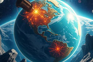
- Satellite Geodesy: Utilizes satellite positioning systems for spatial measurements.
- Geodetic Astronomy: Positions measured through celestial observations.
- Integrated Geodesy: Unifies physical and geometric aspects of Earth studies.
Applications of Geodesy
- Essential for surveying, providing theoretical foundations.
- Key role in mapping, visualizing significant Earth features.
- Used in various disciplines including:
- Urban Management
- Engineering Projects
- Boundary Demarcation
- Ecology
- Environmental Management
- Geography
- Planetology
- Hydrography
Symbolic Relations to Other Sciences
- Geophysics: Examines Earth's physical responses.
- Space Science: Studies artificial satellites orbiting Earth.
- Astronomy: Observes Earth's rotation and celestial bodies.
- Oceanography: Tracks shoreline locations and movements.
- Atmospheric Science: Analyzes the effects of air density distribution.
- Geology: Provides insights into geomorphology and geological stability.
Theoretical Basis of Geodesy
- Mathematics: Fundamental for geodetic calculations.
- Computer Science: Required for analysis and problem-solving.
- Physics: Gravity's influence is pivotal in geodetic measurements.
History of Geodesy
- Ancient concepts include the flat Earth model (Homer) and spherical Earth conclusions (Pythagoras, Aristotle).
- Eratosthenes accurately measured Earth's size; Poseidonius confirmed results using arc measurements.
- Significant advancements in the 17th century by Willebrord Snellius and Jean Picard, refining Earth's dimensions.
- Carl Gauss (1777-1855) introduced the "GEOID," earning recognition as the "Father of Geodesy".
- Sir George Airy established the spheroid parameters in the 19th century for British mapping.
Goals of Geodesy
- Develop mathematical models that approximate Earth's mean sea level surface.
- Describe point locations on Earth's surface relative to latitude, longitude, and sea level.
- Determine the internal gravity field of the Earth.
Observation Techniques
- Astronomical Observations: Latitude, longitude, azimuth, and monitoring celestial movements via Very Long Baseline Interferometry (VLBI).
- Terrestrial Observations: Include triangulation, trilateration, leveling, and gravity measurements.
- Space-Based Observations: Utilize techniques like Lunar and Satellite Laser Ranging for accuracy in measurements.
Studying That Suits You
Use AI to generate personalized quizzes and flashcards to suit your learning preferences.