Podcast
Play an AI-generated podcast conversation about this lesson
Download our mobile app to listen on the go
Get App
Questions and Answers
Which type of map shows the regional position of a place relative to the position of other places?
Which type of map shows the regional position of a place relative to the position of other places?
- Relative location (correct)
- Reference map
- Thematic map
- Absolute location
What is the purpose of a geographic information system (GIS)?
What is the purpose of a geographic information system (GIS)?
- To analyze census data
- To show locations of places and geographic features
- To provide satellite navigation systems
- To store and organize geographic data (correct)
What is remote sensing?
What is remote sensing?
- A study of a phenomenon in a natural setting
- The shrinking of time and space
- The effects of distance on interaction
- The acquisition of data about Earth's surface from a satellite orbiting the planet or other long-distance methods (correct)
What is the purpose of field observation?
What is the purpose of field observation?
Signup and view all the answers
What is distance decay?
What is distance decay?
Signup and view all the answers
Which type of map shows a particular theme or topic?
Which type of map shows a particular theme or topic?
Signup and view all the answers
What is the purpose of satellite navigation systems?
What is the purpose of satellite navigation systems?
Signup and view all the answers
What is the purpose of census data?
What is the purpose of census data?
Signup and view all the answers
What is the purpose of remote sensing?
What is the purpose of remote sensing?
Signup and view all the answers
What is the purpose of field observation?
What is the purpose of field observation?
Signup and view all the answers
Flashcards are hidden until you start studying
Study Notes
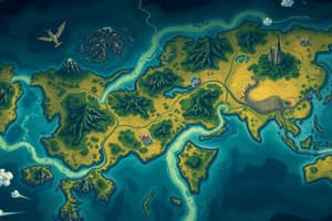
Types of Maps
- A topological map shows the regional position of a place relative to the position of other places.
Geographic Information System (GIS)
- The purpose of a GIS is to capture, store, analyze, and display geographically referenced data.
Remote Sensing
- Remote sensing is the acquisition of information about the Earth's surface through the detection of electromagnetic radiation.
Field Observation
- The purpose of field observation is to gather primary data through direct observation and measurement of physical environments and human activities.
Distance Decay
- Distance decay refers to the decrease in interaction or influence between two places as the distance between them increases.
Thematic Maps
- A thematic map shows a particular theme or topic, such as climate, population density, or economic activity.
Satellite Navigation Systems
- The purpose of satellite navigation systems is to provide location information and directions to users.
Census Data
- The purpose of census data is to collect and analyze demographic and socioeconomic information about a population.
Studying That Suits You
Use AI to generate personalized quizzes and flashcards to suit your learning preferences.