Podcast
Questions and Answers
What is the primary role of latitudes in geographic terms?
What is the primary role of latitudes in geographic terms?
- Establishing the distance between any two meridians.
- Determining the total number of meridians.
- Influencing climate zones. (correct)
- Defining the International Date Line.
If you travel from Japan westward to the United States, crossing the International Date Line, what happens to the day?
If you travel from Japan westward to the United States, crossing the International Date Line, what happens to the day?
- You lose a day. (correct)
- You neither gain nor lose a day.
- You advance by one day.
- You gain two days.
What is the approximate distance in kilometers between two consecutive lines of latitude that are 1° apart?
What is the approximate distance in kilometers between two consecutive lines of latitude that are 1° apart?
- 200 km
- 111 km (correct)
- 50 km
- 150 km
Why do longitude distances vary while latitude distances remain nearly constant?
Why do longitude distances vary while latitude distances remain nearly constant?
Which of the following statements accurately describes the relationship between Earth's distance from the Sun and the seasons?
Which of the following statements accurately describes the relationship between Earth's distance from the Sun and the seasons?
What is the significance of the axial tilt (obliquity) of the Earth?
What is the significance of the axial tilt (obliquity) of the Earth?
At which latitude is the Sun directly overhead during the December solstice?
At which latitude is the Sun directly overhead during the December solstice?
During the June solstice, which area experiences 24 hours of daylight?
During the June solstice, which area experiences 24 hours of daylight?
If it is Tuesday in Japan, and a traveler flies eastward to the United States, what day is it upon arrival, considering the International Date Line?
If it is Tuesday in Japan, and a traveler flies eastward to the United States, what day is it upon arrival, considering the International Date Line?
If the coordinates of a location are 31° 25' 07.22" N (latitude) and 73° 04' 44.90" E (longitude), calculate its decimal latitude.
If the coordinates of a location are 31° 25' 07.22" N (latitude) and 73° 04' 44.90" E (longitude), calculate its decimal latitude.
What is the significance of the terms 'apo' and 'peri' in the context of Earth's orbit?
What is the significance of the terms 'apo' and 'peri' in the context of Earth's orbit?
The word 'tropic' comes from the Greek term 'tropos'. What does 'tropos' mean, and how does it relate to the Tropics of Cancer and Capricorn?
The word 'tropic' comes from the Greek term 'tropos'. What does 'tropos' mean, and how does it relate to the Tropics of Cancer and Capricorn?
How does the duration of Earth's rotation on its axis compare to the common 24-hour day?
How does the duration of Earth's rotation on its axis compare to the common 24-hour day?
If you are at 30°N latitude, what is the approximate distance on the ground covered by one degree of longitude?
If you are at 30°N latitude, what is the approximate distance on the ground covered by one degree of longitude?
Why is the distance between any two meridians not equal?
Why is the distance between any two meridians not equal?
Which statement accurately contrasts perihelion and aphelion?
Which statement accurately contrasts perihelion and aphelion?
What distinguishes the Equator from all other latitudes?
What distinguishes the Equator from all other latitudes?
What is the total number of latitudes, including the equator?
What is the total number of latitudes, including the equator?
Latitudes are also known as?
Latitudes are also known as?
How does solar energy reaching Earth during perihelion compare to that during aphelion, and what effect does this have on seasons?
How does solar energy reaching Earth during perihelion compare to that during aphelion, and what effect does this have on seasons?
Flashcards
What are latitudes?
What are latitudes?
Imaginary horizontal lines extending east to west on the globe.
What is the equator?
What is the equator?
Line with zero-degree latitude.
What is axial tilt (obliquity)?
What is axial tilt (obliquity)?
Angle between Earth's rotational axis and its orbital plane.
What is the Tropic of Cancer?
What is the Tropic of Cancer?
Signup and view all the flashcards
What is the Tropic of Capricorn?
What is the Tropic of Capricorn?
Signup and view all the flashcards
What is Aphelion?
What is Aphelion?
Signup and view all the flashcards
What is Perihelion?
What is Perihelion?
Signup and view all the flashcards
What is the June Solstice?
What is the June Solstice?
Signup and view all the flashcards
What is the December Solstice?
What is the December Solstice?
Signup and view all the flashcards
What is Equinox
What is Equinox
Signup and view all the flashcards
What are Longitudes (Meridians)?
What are Longitudes (Meridians)?
Signup and view all the flashcards
What is the Prime Meridian?
What is the Prime Meridian?
Signup and view all the flashcards
What is the International Date Line (IDL)?
What is the International Date Line (IDL)?
Signup and view all the flashcards
Study Notes
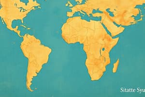
- Latitude and Longitude form a geographical coordinate system to describe a location on Earth
Latitudes
- Latitudes are imaginary horizontal lines extending from East to West
- Latitudes range from 0° at the Equator to 90° North (North Pole) and 90° South (South Pole)
- Lines of latitude are also known as parallels
- Parallels never intersect and remain equidistant from each other
- Latitude lines shorten towards the poles, the Equator being the longest, forming a great circle
Equator
- A line of zero-degree latitude is called the Equator
- The Equator (0° latitude) divides Earth into the Northern and Southern Hemispheres
- Latitudes significantly determine climate zones
- There are 181 total latitudes, including the Equator
- 90 latitudes are in the Northern Hemisphere (from 1°N to 90°N)
- 90 latitudes are in the Southern Hemisphere (from 1°S to 90°S)
- And 1 latitude for the Equator (0°)
- The distance between two consecutive latitudes (1° apart) is approximately 111 km (69 miles)
How to Calculate Latitude Distance
- The formula to calculate distance is: Distance = (π × R/180) × Δθ
- R (Earth's average radius) = 6371 km
- Π = 3.1416
- Δθ = Difference in latitude (in degrees)
- Example: For 1° latitude: 3.1416 × 6371 / 180 ≈ 111 km
- The distance remains nearly constant because latitude lines are parallel
- Longitude distances vary since meridians converge at the poles
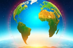
Axial Tilt
- The axial tilt of Earth (obliquity) is the angle between Earth's rotational axis and its orbital plane around the Sun
- Earth's axial tilt measures 23.5°
Tropic of Cancer and Capricorn
- The Tropic of Cancer and Capricorn are lines of latitude which mark the northernmost and southernmost circles where the Sun can be directly overhead at the solstice
- The Tropic of Cancer is at 23° 26′ 10.5” (23.43624 N), and the Tropic of Capricorn is at 23° 26′ 10.5” (23.43624 S)
- The term "tropic" originates from the Greek word "tropos," signifying "turn" or "change"
- This refers to the Sun's apparent "turn back" when reaching these latitudes
- The Tropic of Cancer is the northernmost latitude where the sun is directly overhead
- This occurs during the June solstice (Summer solstice)
- The Tropic of Capricorn is the southernmost latitude where the sun is directly overhead
- Which occurs on the December solstice (Winter solstice)
Earth's Orbit
- Earth's orbit around the Sun is elliptical, causing the distance between them to vary throughout the year
- The terms come from ancient Greek: "helios" means "Sun," "apo" means "far," and "peri" means "close"
- Aphelion is the farthest point from the Sun (152.1 million km)
- Occurs around July 3rd-4th
- Earth is at its farthest point from the Sun (~152 million km)
- The Sun appears slightly smaller
- Perihelion is the closest point to the Sun (147.1 million km)
- Occurs around January 3rd
- Earth is at its closest point to the Sun (~147 million km)
- The Sun appears slightly larger
- More solar energy reaches Earth, but it does NOT cause summer because seasons are controlled by Earth's axial tilt (23.5°), not distance
Seasons
- Seasons are NOT caused by Earth's distance from the Sun
- Seasons are controlled by Earth's axial tilt (23.5°)
Summer Solstice (June Solstice)
- The Sun is directly overhead at the Tropic of Cancer (23.5°N)
- The longest day and shortest night of the year occur in the Northern Hemisphere, resulting in maximum daylight hours
- The Arctic Circle (66.5°N) experiences 24 hours of daylight
- Occurs around June 21st
- Conversely, the Southern Hemisphere experiences the shortest day and longest night, with the Antarctic Circle (66.5°S) experiencing 24 hours of darkness (Polar Night)
Winter Solstice (December Solstice)
- The Sun is directly overhead at the Tropic of Capricorn (23.5°S)
- The longest day and shortest night of the year occur in the Southern Hemisphere, resulting in maximum daylight hours
- The Antarctic Circle (66.5°S) experiences 24 hours of daylight
- Occurs around December 21st
- Conversely, the Northern Hemisphere experiences the shortest day and longest night
- The Arctic Circle (66.5°S) experiences 24 hours of darkness (Polar Night)
Equinox
- The Sun is directly overhead at the Equator
- Day and night are nearly equal in length all over the Earth
- Occurs twice a year
- Spring equinox: Occurs March 20th - 21st
- Fall equinox: Occurs September 22nd - 23rd
Longitude (Meridians)
- Longitudes are imaginary vertical lines (semicircles) drawn/extended/run on the globe from the North to South Pole
- Longitudes are also called meridians
Prime Meridian
- The line with zero-degree longitude is called the Prime Meridian
- Longitudes range from 0° at Greenwich, London, to 360° at the midway of the Pacific Ocean
- The 180° longitude line/meridian is called the International Date Line (IDL), directly opposite the 0° meridian
- They determine time zones and local time
- There are 360° total meridians
- The distance between any two meridians is not equal
- At the Equator, 1° = 111 km
- At 30°N and 30°S, 1° = 96.5 km
- Decreases to zero at the poles
International Date Line
- Established in 1884, it passes through the Mid-Pacific Ocean, roughly following the 180-degree line
- Travel East to West (e.g., Japan to United States) results in adding a day (gain a day)
- If it is Monday in Japan and travel westward to the United States, it becomes Sunday
- Travel West to East (e.g., United States to Japan) results in losing a day
- If it is Monday in the United States and travel eastward to Japan, it becomes Tuesday
- Earth doesn't take 24 hours to rotate on its axis
- It actually takes 23 hours, 56 minutes, and 4 seconds
Coordinate Systems
- Coordinate systems commonly describe locations in two units
- Degree Minute Seconds (DMS)
- Coordinates of Faisalabad Clock Tower
- Latitude: 31° 25′ 07.22"N
- Longitude: 73° 04′ 44.90″E
Converting DMS to Decimals
- Example Latitude: 31° 25′ 07.22"N
- 31 + 25/60 + 7.22/3600
- 31 + 0.4166 + 0.00200 = 31.418
- Example Longitude: 73° 04′ 44.90″E
- 73 + 04/60 + 44.90/3600
- 73 + 0.0666 + 0.01247 = 73.079
Converting Decimals to DMS
- Example: 31.4187
-
- 4187 x 60 = 31 25.122
-
-
- 122 x 60 = 31 25 7.32
-
- Final answer: 31° 25′ 7.22"
-
Additional Coordinates
- Latitude: 24° N - 37° N
- Longitude: 61° E - 77° E
- Total Area: 881,913 sq km
- Altitude:
- Highest Point: K-2 (8611m)
- Deepest Point: Dasu patan (6500m)
- Lowest Point: Sea level 0(feet)
Studying That Suits You
Use AI to generate personalized quizzes and flashcards to suit your learning preferences.