Podcast
Questions and Answers
Match the following latitude descriptions with their corresponding values:
Match the following latitude descriptions with their corresponding values:
Latitude at Equator = 0° Latitude at North Pole = -90° Latitude at South Pole = +90° Approximate distance for each degree of latitude = 68 miles (110 kilometers)
Match the following longitude descriptions with their corresponding values:
Match the following longitude descriptions with their corresponding values:
Longitude at Prime Meridian = 0° Longitude on International Date Line going eastward = +180° Longitude on anti-meridian going westward = -180° Approximate distance for each degree of longitude = 69 miles (111 kilometers)
Match the following coordinate components with their description:
Match the following coordinate components with their description:
Latitude and Longitude = Identify specific locations on Earth Example Coordinate 2°N, 34°W = Latitude 2° North meets longitude 34° West Prime Meridian Location = Passes through Greenwich, England Purpose of Latitude and Longitude values = Uniquely determine locations on Earth
Flashcards are hidden until you start studying
Study Notes
Latitude and Longitude Basics
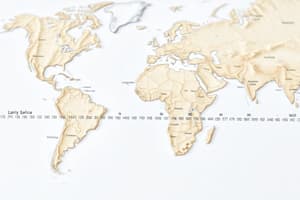
Latitude and longitude form the basis of our modern coordinate system, which is used to locate places on Earth with great precision. This is how GPS systems know where you are when you're out on a hike or driving down the highway.
What Are They?
Latitude measures how far north or south a place is from the Equator. It ranges from 0° at the Equator to -90° for the North Pole and +90° for the South Pole. Latitude lines are called parallels because they run parallel to the equator. Each degree of latitude represents approximately 68 miles (110 kilometers).
Longitude measures how far east or west a place is from the Prime Meridian, which passes through Greenwich, England, near London. Longitudes range from 0° at the Prime Meridian to +180° on the International Date Line going eastward, and -180° on the anti-meridian going westward. Longitude lines are called meridians because they run north-to-south like radii on a globe, converging at the poles. Each degree of longitude represents approximately 69 miles (111 kilometers).
Coordinates
Coordinates consist of two numbers separated by a comma. They identify specific locations on Earth using latitude and longitude values. For example, if we give coordinates as 2°N, 34°W, the location corresponds to where latitude 2° North meets longitude 34° West.
The system works because all points on the surface of a sphere can be uniquely determined by their latitude and longitude coordinates. This means that your exact position can be pinpointed regardless of whether you're standing on the beach in Hawaii or in the middle of the Sahara Desert. That's pretty remarkable when you think about it!
Studying That Suits You
Use AI to generate personalized quizzes and flashcards to suit your learning preferences.


