Podcast
Questions and Answers
Why is Earth considered essentially a closed system in terms of matter but an open system in terms of energy?
Why is Earth considered essentially a closed system in terms of matter but an open system in terms of energy?
- Earth's magnetic field traps matter while repelling energy from the sun.
- Earth's atmosphere prevents the escape of matter while freely allowing energy transfer.
- Earth receives solar radiation (energy) but exchanges minimal matter with space. (correct)
- Earth readily exchanges matter with other planets but retains all energy.
Which of the following best describes the relationship between weathering, erosion, and deposition?
Which of the following best describes the relationship between weathering, erosion, and deposition?
- Deposition leads to weathering, which in turn causes erosion.
- Weathering breaks down materials, erosion transports them, and deposition accumulates them in new locations. (correct)
- Erosion is the primary force, causing both weathering and eventual deposition.
- Weathering is the transport of materials, erosion is the breakdown, and deposition is the accumulation.
How do ocean currents primarily influence regional climates?
How do ocean currents primarily influence regional climates?
- By creating atmospheric pressure zones that stabilize weather activity.
- By directly absorbing solar radiation, reducing the amount of energy reaching the land.
- By altering the chemical composition of the atmosphere which changes the albedo.
- By redistributing heat around the globe, affecting temperature and precipitation patterns. (correct)
What is the most significant role of transpiration in the hydrologic cycle?
What is the most significant role of transpiration in the hydrologic cycle?
Which of the following best explains how biogeographic barriers affect the distribution of species?
Which of the following best explains how biogeographic barriers affect the distribution of species?
How does soil texture influence soil properties and fertility?
How does soil texture influence soil properties and fertility?
Barrier islands provide what primary benefit to coastal regions?
Barrier islands provide what primary benefit to coastal regions?
Which of the following scenarios best illustrates the concept of sustainable development?
Which of the following scenarios best illustrates the concept of sustainable development?
What is the primary reason for the different temperature profiles observed in different layers of the atmosphere?
What is the primary reason for the different temperature profiles observed in different layers of the atmosphere?
How does the concept of 'spatial analysis' enhance our understanding of physical geography?
How does the concept of 'spatial analysis' enhance our understanding of physical geography?
Flashcards
Physical Geography
Physical Geography
The branch of geography dealing with natural features and processes.
Geomorphology
Geomorphology
The study of landforms and the processes that shape them.
Climatology
Climatology
The study of climate and climate change.
Hydrology
Hydrology
Signup and view all the flashcards
Biogeography
Biogeography
Signup and view all the flashcards
System
System
Signup and view all the flashcards
Energy Budget
Energy Budget
Signup and view all the flashcards
Atmosphere
Atmosphere
Signup and view all the flashcards
Hydrosphere
Hydrosphere
Signup and view all the flashcards
Spatial Analysis
Spatial Analysis
Signup and view all the flashcards
Study Notes
- Geography examines Earth's landscapes, peoples, places, and environments.
- It serves as a bridge between social and natural sciences.
- Modern geography seeks to understand spatial organization and spatial variation in numerous phenomena.
- Geography is often defined in terms of human and physical geography.
Physical Geography
- Involves natural features and processes.
- Examines the structure, processes, distributions, and change through time of the natural environment.
- Studies the Earth's natural systems and their interactions.
- Key study areas:
- Geomorphology: landforms and the processes that shape them.
- Climatology: climate and climate change.
- Hydrology: water on and below the Earth's surface.
- Biogeography: distribution of species and ecosystems.
- Pedology: soils in their natural environment.
- Coastal geography: the dynamic interface between the ocean and the land.
- Environmental geography: interactions between humans and the natural environment.
Key Concepts in Physical Geography
- Systems Theory:
- A system is a set of interacting components forming a complex whole.
- Systems can be closed (no exchange of matter or energy) or open (exchange of matter and energy).
- Earth is essentially a closed system in terms of matter, but an open system in terms of energy (solar radiation).
- Energy Budget:
- Solar radiation is the primary energy source for Earth’s systems.
- The balance between incoming and outgoing energy determines Earth’s temperature and drives many physical processes.
- Variations in the energy budget lead to climate patterns and weather phenomena.
- Earth's Spheres of Interaction:
- Atmosphere: the gaseous envelope surrounding the Earth.
- Composition: Primarily nitrogen (78%) and oxygen (21%), as well as trace gases like argon, carbon dioxide, and water vapor.
- Layers: Troposphere, stratosphere, mesosphere, thermosphere, and exosphere, each with distinct temperature profiles.
- Lithosphere: the solid outer layer of the Earth, including the crust and upper mantle.
- Tectonic Plates: The lithosphere is divided into plates that move and interact, causing earthquakes, volcanic activity, and mountain building.
- Composition: Composed of rocks and minerals, varying in composition and density.
- Hydrosphere: all forms of water on Earth.
- Components: Includes oceans, lakes, rivers, groundwater, ice caps, and glaciers.
- Water Cycle: The continuous movement of water through evaporation, transpiration, condensation, and precipitation.
- Biosphere: all living organisms on Earth and their interactions with the environment.
- Ecosystems: Communities of organisms interacting with each other and their physical environment.
- Biodiversity: The variety of life forms and ecosystems, crucial for ecosystem stability and resilience.
- Atmosphere: the gaseous envelope surrounding the Earth.
- Spatial Analysis:
- Examination of spatial patterns and relationships.
- Geographic data is often represented using maps, GIS (Geographic Information Systems), and remote sensing data.
- Spatial analysis helps understand the distribution of phenomena and their influencing factors.
- Scale:
- Scale refers to the level of geographic resolution at which a phenomenon is studied.
- Global, regional, local, and individual scales are commonly used.
- Processes and patterns may differ significantly depending on the scale of analysis.
- Location:
- Absolute location: Exact position on Earth's surface, typically expressed using coordinates (latitude and longitude).
- Relative location: Position in relation to other places or features.
- Place:
- A specific geographic setting with distinctive physical, social, and cultural attributes.
- Place is shaped by both natural environment and human modification.
- Movement:
- Spatial transfer of people, goods, ideas, and processes.
- Movement is influenced by distance, accessibility, and connectivity.
- Region:
- An area with unifying characteristics.
- Regions can be defined based on physical, human, or functional traits.
- Examples: Climatic regions, cultural regions, economic regions.
- Human-Environment Interaction:
- Interdisciplinary field studying the reciprocal relationship between humans and the natural environment.
- Examines how humans modify the environment and how the environment shapes human societies.
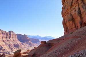
Geomorphology
- Earth's landforms and the processes that create and modify them are studied.
- Key processes:
- Weathering: Breakdown of rocks and minerals at Earth's surface.
- Physical weathering: Mechanical disintegration (e.g., freeze-thaw, abrasion).
- Chemical weathering: Decomposition of rocks through chemical reactions (e.g., oxidation, hydrolysis).
- Erosion: Removal and transport of weathered material.
- Agents of erosion: Water, wind, ice, and gravity.
- Deposition: Accumulation of eroded material in new locations.
- Weathering: Breakdown of rocks and minerals at Earth's surface.
- Landforms:
- Mountains: Elevated landmasses formed by tectonic activity or volcanic eruptions.
- Plains: Flat or gently rolling landscapes.
- Plateaus: Elevated flatlands with steep sides.
- Valleys: Elongated depressions carved by rivers or glaciers.
- Coasts: Dynamic interfaces between land and sea, shaped by waves, tides, and currents.
Climatology
- The Earth's climate system is studied, including temperature, precipitation, wind, and other atmospheric phenomena.
- Climate Controls:
- Latitude: Affects solar radiation intensity and temperature.
- Altitude: Higher altitudes are generally cooler.
- Proximity to water: Moderates temperature fluctuations.
- Ocean currents: Transport heat around the globe.
- Prevailing winds: Influence temperature and precipitation patterns.
- Climate Types:
- Tropical climates: Warm temperatures and high precipitation year-round.
- Temperate climates: Seasonal variations in temperature and precipitation.
- Polar climates: Cold temperatures and low precipitation year-round.
- Arid climates: Low precipitation and high evaporation rates.
- Climate Change:
- Long-term shifts in temperature and weather patterns.
- Primarily caused by increased greenhouse gas concentrations in the atmosphere.
- Impacts: Rising sea levels, melting glaciers, changes in precipitation patterns, and increased frequency of extreme weather events.
Hydrology
- Study of water on and below Earth's surface, including its distribution, movement, and properties.
- Components of the Hydrologic Cycle:
- Precipitation: Water falling from the atmosphere to Earth's surface.
- Evaporation: Transformation of liquid water into water vapor.
- Transpiration: Release of water vapor from plants into the atmosphere.
- Infiltration: Penetration of water into the soil.
- Runoff: Flow of water over the land surface.
- Groundwater: Water stored underground in aquifers.
- Water Resources:
- Surface water: Water in rivers, lakes, and reservoirs.
- Groundwater: Water stored in aquifers, a vital source for drinking and irrigation.
- Water Management:
- Strategies for conserving and managing water resources.
- Includes: Water conservation practices, irrigation techniques, and water treatment.
Biogeography
- Study of the geographic distribution of species and ecosystems.
- Factors Influencing Species Distribution:
- Climate: Temperature, precipitation, and seasonality.
- Geology: Soil type, topography, and mineral availability.
- Biogeographic barriers: Mountains, oceans, and deserts.
- Human activities: Deforestation, urbanization, and introduced species.
- Biomes:
- Large-scale terrestrial ecosystems characterized by distinct vegetation types.
- Forests: Dominated by trees, with high biodiversity.
- Grasslands: Dominated by grasses, with moderate precipitation.
- Deserts: Dry environments with sparse vegetation.
- Tundra: Cold and treeless environments with permafrost.
- Large-scale terrestrial ecosystems characterized by distinct vegetation types.
- Ecosystem Dynamics:
- Interactions between organisms and their environment.
- Food webs: Complex networks of feeding relationships.
- Nutrient cycles: Movement of essential elements through ecosystems.
Soils
- Study of soils in their natural environment, including their formation, properties, and classification.
- Soil Formation Factors:
- Climate: Temperature and precipitation influence weathering and decomposition rates.
- Parent material: The underlying rock or sediment from which soil is formed.
- Topography: Slope and drainage affect soil development.
- Organisms: Plants, animals, and microorganisms influence soil fertility and structure.
- Time: Soil development is a gradual process that can take centuries.
- Soil Properties:
- Texture: The proportion of sand, silt, and clay particles in the soil.
- Structure: The arrangement of soil particles into aggregates.
- Organic matter: Decomposed plant and animal material, essential for soil fertility.
- pH: A measure of soil acidity or alkalinity.
- Soil Horizons:
- Distinct layers in the soil profile, each with unique characteristics.
- O horizon: Surface layer of organic matter.
- A horizon: Topsoil, rich in organic matter and nutrients.
- B horizon: Subsoil, accumulation of minerals leached from above.
- C horizon: Weathered parent material.
- R horizon: Bedrock.
- Distinct layers in the soil profile, each with unique characteristics.
Coastal Geography
- Study of the dynamic interface between the ocean and the land, including coasts, shorelines, and nearshore environments.
- Coastal Processes:
- Waves: Generated by wind, they erode and transport sediment.
- Tides: Periodic rise and fall of sea level due to gravitational forces.
- Currents: Movement of water in specific directions, influencing sediment transport and erosion.
- Sea-level change: Can lead to coastal erosion and inundation.
- Coastal Landforms:
- Beaches: Accumulations of sand and gravel along the shoreline.
- Cliffs: Steep rock faces eroded by wave action.
- Barrier islands: Long, narrow islands parallel to the mainland, protecting the coast from storms.
- Estuaries: Semi-enclosed coastal bodies where freshwater mixes with saltwater.
- Deltas: Accumulations of sediment at river mouths.
Environmental Geography
- Study of the interactions between humans and the natural environment, including environmental issues and sustainability.
- Key Environmental Issues:
- Climate change: Caused by increased greenhouse gas emissions, leading to rising temperatures and sea levels.
- Deforestation: Clearing of forests for agriculture, urbanization, and timber production.
- Pollution: Contamination of air, water, and soil by human activities.
- Biodiversity loss: Decline in the variety of life forms and ecosystems.
- Water scarcity: Insufficient access to clean water for human and environmental needs.
- Sustainable Development:
- Development that meets the needs of the present without compromising the ability of future generations to meet their own needs.
- Focuses on balancing economic growth, environmental protection, and social equity.
Studying That Suits You
Use AI to generate personalized quizzes and flashcards to suit your learning preferences.