Podcast
Questions and Answers
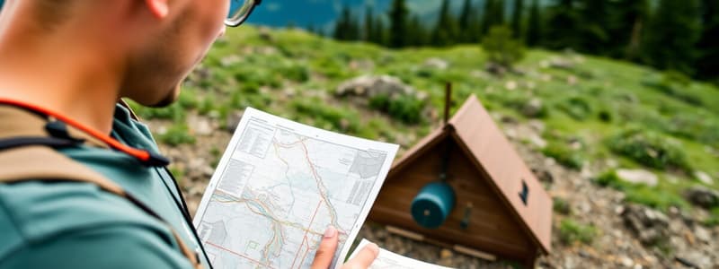
What is Orienteering?
What is Orienteering?
An outdoor activity where the participants' goal is finding various checkpoints in a pre-set course using a map and compass to navigate in an unfamiliar terrain.
On an orienteering map, how is the start marked?
On an orienteering map, how is the start marked?
- Square
- Double Circle
- Circle
- Triangle (correct)
On an orienteering map, how is the final destination marked?
On an orienteering map, how is the final destination marked?
- Circle
- Double Circle (correct)
- Triangle
- Square
GPS is always dependable for orienteering, even without power.
GPS is always dependable for orienteering, even without power.
Where can the beginnings of orienteering be traced to?
Where can the beginnings of orienteering be traced to?
In what year was the world's first orienteering match held?
In what year was the world's first orienteering match held?
Who is considered the "Father of Orienteering?"
Who is considered the "Father of Orienteering?"
In what city was the INTERNATIONAL ORIENTEERING FEDERATION formed?
In what city was the INTERNATIONAL ORIENTEERING FEDERATION formed?
In what country was the First World Orienteering Championships held?
In what country was the First World Orienteering Championships held?
What does a whistle mean when used in orienteering to call someone for help?
What does a whistle mean when used in orienteering to call someone for help?
What does a whistle mean when used in orienteering to indicate that they are coming to help?
What does a whistle mean when used in orienteering to indicate that they are coming to help?
What is the purpose of safety azimuth?
What is the purpose of safety azimuth?
Why would you bring a second compass in orienteering?
Why would you bring a second compass in orienteering?
What is a map?
What is a map?
Give three benefits of orienteering?
Give three benefits of orienteering?
What does one need to remember as a responsible visitor of wildlife habitats?
What does one need to remember as a responsible visitor of wildlife habitats?
What does "Alpinism" mean in the European context?
What does "Alpinism" mean in the European context?
Name something that the Yosemite Decimal System describes.
Name something that the Yosemite Decimal System describes.
What does the National Classification System describe?
What does the National Classification System describe?
Give an example of a similar activity to hiking in Australia?
Give an example of a similar activity to hiking in Australia?
Give an example of a similar activity to hiking in New Zealand?
Give an example of a similar activity to hiking in New Zealand?
Give an example of the first Filipino to climb the Seven Summits of the world.
Give an example of the first Filipino to climb the Seven Summits of the world.
Name the first two people to reach the top of Mont Blanc.
Name the first two people to reach the top of Mont Blanc.
Who was the mountaineer that saw the Mont Blanc, leading to the first expedition?
Who was the mountaineer that saw the Mont Blanc, leading to the first expedition?
What should one be in good condition of, to prepare for a hike or a trek?
What should one be in good condition of, to prepare for a hike or a trek?
Flashcards
Orienteering
Orienteering
An outdoor activity using a detailed map and compass to find checkpoints in unfamiliar terrain. Tests navigation and decision-making skills.
Map (in Orienteering)
Map (in Orienteering)
Two-dimensional graphic representation of the ground and terrain.
Locator Map
Locator Map
Shows where various shops are located inside a mall.
Orienteering Map
Orienteering Map
Signup and view all the flashcards
True North
True North
Signup and view all the flashcards
Magnetic North
Magnetic North
Signup and view all the flashcards
Map Legends
Map Legends
Signup and view all the flashcards
Whistle (in Orienteering)
Whistle (in Orienteering)
Signup and view all the flashcards
Yosemite Decimal System (YDS)
Yosemite Decimal System (YDS)
Signup and view all the flashcards
Mesh in Hiking Shoes
Mesh in Hiking Shoes
Signup and view all the flashcards
Study Notes
- Orienteering is finding various checkpoints in a pre-set course using a detailed map and a compass in unfamiliar terrain.
- The activity can be recreational or competitive, requiring navigational and decision-making skills.
- On a map, the start is marked with a triangle
- Circles mark locations, and double circles mark the final destination.
- GPS can help locate unfamiliar places until its power runs out.
History of Orienteering
- Orienteering started in Scandinavia as a military skill.
- In 1886, it meant "crossing unknown grounds" using maps and compasses.
- The first orienteering match occurred in Norway in 1897.
- Major Ernst Killander of Sweden designed a cross-country competition in 1919 where participants chose routes using a map and compass.
- In 1941-1943, PILTTI HEISKANEN, a Finnish Army Officer, set up orienteering activities at Dartmouth College.
- The International Orienteering Federation formed in Copenhagen, Denmark, in 1961, with founding members from various European countries.
- The first World Orienteering Championships was in Finland in 1966.
- Orienteering became part of the U.S. Marine Corps Physical Fitness Academy in Quantico, Virginia, in 1967.
- The first U.S. Orienteering Championships was at Southern Illinois University in Oct. 1970.
- The U.S. Orienteering Federation was founded in Virginia in 1971.
- In 1988, orienteering became a U.S. Olympic Committee Class C Sport.
Essential Equipment
- The two basic things required are a map and a compass.
- Essentials and Equipment:
- A whistle is to call for help.
- A map bag is used to protect the map from rain.
- A red pen can mark the map.
- Map: A two-dimension representation of a three-dimension surface.
- Types of Maps:
- Locator maps show locations inside a mall.
- Highway maps identify roads.
- Topographic maps show terrains.
- Orienteering maps are specially designed and topographic maps with more details for navigation.
- Important details include the map scale, legends, and lines representing magnetic north.
- Distance on a Map: Maps are scaled (e.g., 1:10,000, 1:15,000, or 1:25,000).
- Scale: A ratio where 1:25,000 means one unit of distance on the map equals 25,000 units in the real world.
Compass Components
- Scales/Rulers
- Direction of Travel Arrow (DTA)
- Orienting Arrow
- Declination Scale
- Dial with Degrees
- Index Line
- Magnetic Needle
- Orienting Lines
- Rotating Housing
- Base Plate
Using a Compass
- Put the compass on your palm at stomach level.
- Position the compass so that the DTA is pointing straight out in front of you.
- Turn yourself until the magnetic needle aligns with the north magnetic orienting arrow.
- Check where the DTA is pointing to know the direction.
- Follow this direction, keeping the magnetic needle aligned.
Map Legends
- Map legends are important as they describe terrain, roads, buildings using symbols.
- Contours or lines show the shape and elevation.
- Close contours mean a steep slope
- Further contours mean a gradual slope.
- Most maps have 5m contours, meaning 5 vertical meters between each line.
- Map color symbols:
- Blue: water
- Black: rock and man-made
- White: normal woods
- Green: thick vegetation
- Yellow: non-wooded land
- Brown: natural non-rock
Getting Lost
- Stay calm and take a break.
- Look for recognizable features and check the map.
- Check the compass and map for the direction.
- Go to a safety azimuth or prominent feature and reorient yourself.
- Use the whistle if needed.
Health and Community Benefits
- Improves cardiovascular strength and decision-making skills.
- Provides mental and physical exertion.
- Increases self-esteem.
- Socialize while competing.
Hiking and Trekking
- Hiking is a long walk on trails in the countryside.
- Walking includes all forms of walking.
- Bushwalking is unique to Australia.
- Tramping defines a long walk/hike in New Zealand.
- Romeo Roberto "Romi" Garduce was the first Filipino to climb the Seven Summits.
Mountaineering
- Mountaineering is climbing to attain high points in mountainous regions for pleasure.
- Alpinism defines it in the European context.
- Mountains are described by height and graded by challenges.
- Yosemite Decimal System (YDS) describes mountain terrains according to physical difficulties.
- National Classification System describes the nature of a climb.
Physical Conditioning for Hiking and Trekking
- Be in good health and fit.
- Exercise three times a week.
- Treks require pre-conditioning.
- Increase glycogen through carbohydrates.
Trip Planning Factors
- Research location based on skill level and limitations.
- Weather conditions, terrains, trails, and requirements.
- Seek advice and inform others.
Hiking Essentials
- Backpack loaded between 25%-30% of ideal body weight to minimise strain.
- Internal-frame backpacks are body-hugging and stable for uneven terrain
- External-frame backpacks carry heavy loads and offer good ventilation.
- Clothing.
- Good footwear with a good fit is number one.
Types of Footwear
- Hiking shoes are light and flexible for well-defined trails and shorter hikes.
- Hiking boots give more support for longer, rougher terrain.
- Backpacking boots are for carrying heavy loads in all conditions.
Additional useful Trekking Equipment
- Trekking poles aid people with knee problems, and provide lateral stability, and can act as tent pole.
- Calorie intake: food with carbs, proteins and fats- fat is slow burning fuel for aerobic activities.
- The body needs 1-2 liters of water a day, or an extra liter every 4-5 miles.
- Drink 1/2 to 1 cup every 30-45 minutes.
- Eat small amounts frequently, such as nuts and dried fruit.
- Check wildlife safety.
- First Aid Kit
- Water / Hydration Packs
- Trail food (energy food)
- Topographic map and Compass
- Fire-starters and matches
- Multi-tool or knife
- Flashlight/headlamp and batteries
- Sunscreen and sunglasses
- Insect repellant
- Camera/binoculars
- Cellphone/two-way radios
- GPS/altimeter watches
- Extra batteries for mobile devices/memory card
Foundational hiking skill
- Base the pace on how well your body feels
- Keep in mind “Leave No Trace Seven Principles”
- Prioritize self and other's saftey, and basic First Aid Skills
Studying That Suits You
Use AI to generate personalized quizzes and flashcards to suit your learning preferences.


