Podcast
Questions and Answers
Orienteering originated in Norway in the 19th century as a military training exercise.
Orienteering originated in Norway in the 19th century as a military training exercise.
False (B)
The navigation technique 'Aiming Off' involves following a distinct feature to guide navigation.
The navigation technique 'Aiming Off' involves following a distinct feature to guide navigation.
False (B)
The Long Distance event in Orienteering emphasizes physical challenge over endurance and navigation.
The Long Distance event in Orienteering emphasizes physical challenge over endurance and navigation.
False (B)
Map Orientation involves recognizing and using distinct features, such as roads, streams, and buildings.
Map Orientation involves recognizing and using distinct features, such as roads, streams, and buildings.
The Route Choice Strategy 'Direct Route' involves following the shape of the terrain to maintain altitude and reduce climb.
The Route Choice Strategy 'Direct Route' involves following the shape of the terrain to maintain altitude and reduce climb.
Orienteering was recognized by the International Olympic Committee (IOC) in 1961.
Orienteering was recognized by the International Olympic Committee (IOC) in 1961.
Sprint Orienteering events are typically held in forests and open areas.
Sprint Orienteering events are typically held in forests and open areas.
Middle Distance Orienteering courses are typically 1-3 km long.
Middle Distance Orienteering courses are typically 1-3 km long.
Long Distance Orienteering events require speed and agility.
Long Distance Orienteering events require speed and agility.
Relay Orienteering events typically have 1-2 legs.
Relay Orienteering events typically have 1-2 legs.
Night Orienteering events are typically longer than daytime events.
Night Orienteering events are typically longer than daytime events.
Trail Orienteering events focus on speed and navigation skills.
Trail Orienteering events focus on speed and navigation skills.
Mountain Bike Orienteering events combine mountain biking with navigation skills.
Mountain Bike Orienteering events combine mountain biking with navigation skills.
Sprint Orienteering events can take around 1-3 hours to complete.
Sprint Orienteering events can take around 1-3 hours to complete.
Middle Distance Orienteering events are held in a variety of terrain, including forests and open areas.
Middle Distance Orienteering events are held in a variety of terrain, including forests and open areas.
Long Distance Orienteering events are typically 1-5 km long.
Long Distance Orienteering events are typically 1-5 km long.
Flashcards are hidden until you start studying
Study Notes
History of Orienteering
- Originated in Sweden in the 19th century as a military training exercise
- Became popular in Sweden and Norway in the mid-20th century
- First international orienteering competition held in 1961
- Recognized by the International Olympic Committee (IOC) in 1977
- Became a part of the World Games in 1981
Navigation Techniques
- Beeline: following a straight line between two points
- Contouring: following the shape of the terrain to maintain altitude
- Attack Point: using a distinct feature to guide navigation
- Aiming Off: intentionally aiming off-course to compensate for error
- Handrail: following a linear feature, such as a stream or trail
Orienteering Events
- Sprint: short, fast courses (1-3 km) with complex navigation
- Middle Distance: medium-length courses (2-5 km) with a mix of navigation and physical challenge
- Long Distance: long courses (5-15 km) with an emphasis on endurance and navigation
- Relay: team events where each member completes a course
- Trail Orienteering: designed for people with disabilities, using a simplified map and smaller control points
Map Reading Skills
- Map Orientation: aligning the map with the surroundings
- Identifying Features: recognizing and using distinct features, such as roads, streams, and buildings
- Scale and Proportion: understanding the relationship between the map and the terrain
- Route Planning: planning an efficient route between controls
- Map Memory: memorizing the map to aid navigation
Route Choice Strategies
- Direct Route: taking the most direct route between controls
- Contour Route: following the shape of the terrain to maintain altitude and reduce climb
- Route Gadget: using a feature, such as a road or stream, to guide navigation
- Route Optimization: balancing route choice with physical and navigational challenges
- Situational Awareness: adapting to changing circumstances, such as weather or trail conditions
History of Orienteering
- Originated in Sweden in the 19th century as a military training exercise
- Became popular in Sweden and Norway in the mid-20th century
- First international orienteering competition held in 1961
- Recognized by the International Olympic Committee (IOC) in 1977
- Became a part of the World Games in 1981
Navigation Techniques
- Beeline: following a straight line between two points to navigate
- Contouring: following the shape of the terrain to maintain altitude and reduce climb
- Attack Point: using a distinct feature to guide navigation and make precise turns
- Aiming Off: intentionally aiming off-course to compensate for error and uncertainty
- Handrail: following a linear feature, such as a stream or trail, to guide navigation
Orienteering Events
- Sprint: short, fast courses (1-3 km) with complex navigation and quick decision-making
- Middle Distance: medium-length courses (2-5 km) with a mix of navigation and physical challenge
- Long Distance: long courses (5-15 km) with an emphasis on endurance and navigation
- Relay: team events where each member completes a course, requiring communication and strategy
- Trail Orienteering: designed for people with disabilities, using a simplified map and smaller control points
Map Reading Skills
- Map Orientation: aligning the map with the surroundings to establish a reference point
- Identifying Features: recognizing and using distinct features, such as roads, streams, and buildings, to navigate
- Scale and Proportion: understanding the relationship between the map and the terrain to estimate distances and sizes
- Route Planning: planning an efficient route between controls, considering navigation and physical challenges
- Map Memory: memorizing the map to aid navigation and reduce time spent on map-reading
Route Choice Strategies
- Direct Route: taking the most direct route between controls, minimizing distance and time
- Contour Route: following the shape of the terrain to maintain altitude and reduce climb, conserving energy
- Route Gadget: using a feature, such as a road or stream, to guide navigation and reduce uncertainty
- Route Optimization: balancing route choice with physical and navigational challenges, considering multiple factors
- Situational Awareness: adapting to changing circumstances, such as weather or trail conditions, to adjust route choice and navigation strategy
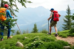
Orienteering Event Types
- Orienteering events are categorized based on format, duration, and terrain.
Sprint Orienteering
- Short, fast-paced events held in urban areas or small parks.
- Courses are 1-3 km long, taking around 10-30 minutes to complete.
- Emphasis on speed and agility.
Middle Distance Orienteering
- Medium-length events testing speed and navigation skills.
- Courses are 3-5 km long, taking around 20-60 minutes to complete.
- Held in various terrains, including forests and open areas.
Long Distance Orienteering
- Long, challenging events requiring endurance and strategic navigation.
- Courses are 10-20 km long, taking around 1-3 hours to complete.
- Often held in rugged terrain, such as mountains or dense forests.
Relay Orienteering
- Team events with each member completing a leg of the course.
- Typically 2-5 legs, with each leg ranging from 2-10 km.
- Emphasis on teamwork and strategy.
Night Orienteering
- Events held in the evening or at night, using headlamps or flashlights.
- Courses are typically shorter, ranging from 1-5 km.
- Emphasis on navigation and route-finding in low-light conditions.
Trail Orienteering
- Events focusing on precise navigation and route-finding, rather than speed.
- Courses are typically shorter, ranging from 1-5 km.
- Often used for people with disabilities or those who prefer a more relaxed pace.
Mountain Bike Orienteering
- Events combining mountain biking with orienteering.
- Courses are typically longer, ranging from 10-50 km.
- Emphasis on navigation, bike-handling skills, and endurance.
Studying That Suits You
Use AI to generate personalized quizzes and flashcards to suit your learning preferences.