Podcast
Questions and Answers
A geographer is studying the impact of deforestation on local rainfall patterns. Which branch of geography is the geographer MOST likely working within?
A geographer is studying the impact of deforestation on local rainfall patterns. Which branch of geography is the geographer MOST likely working within?
- Economic Geography
- Urban Geography
- Political Geography
- Physical Geography (correct)
A researcher is analyzing satellite images to track changes in glacial ice cover over time. Which tool are they MOST likely utilizing?
A researcher is analyzing satellite images to track changes in glacial ice cover over time. Which tool are they MOST likely utilizing?
- Demography
- Cartography
- Remote Sensing (correct)
- Geopolitics
A city planner aims to reduce traffic congestion and improve accessibility for pedestrians and cyclists. Which field of geography would MOST inform their decisions?
A city planner aims to reduce traffic congestion and improve accessibility for pedestrians and cyclists. Which field of geography would MOST inform their decisions?
- Cultural Geography
- Economic Geography
- Urban Geography (correct)
- Political Geography
Which map projection is MOST suitable for navigation because it preserves angles and shapes, although it significantly distorts area, particularly at higher latitudes?
Which map projection is MOST suitable for navigation because it preserves angles and shapes, although it significantly distorts area, particularly at higher latitudes?
A country experiencing high birth rates and declining death rates is MOST likely undergoing what type of change?
A country experiencing high birth rates and declining death rates is MOST likely undergoing what type of change?
The study of how different cultures perceive and interact with their surrounding environment falls MOST directly under which branch of geography?
The study of how different cultures perceive and interact with their surrounding environment falls MOST directly under which branch of geography?
Which type of natural resource is oil considered to be, given its formation process and availability?
Which type of natural resource is oil considered to be, given its formation process and availability?
A region characterized by hot, dry summers and mild, wet winters is MOST likely experiencing what type of climate?
A region characterized by hot, dry summers and mild, wet winters is MOST likely experiencing what type of climate?
Which geographic concept is BEST demonstrated by a community implementing water conservation measures in response to a prolonged drought?
Which geographic concept is BEST demonstrated by a community implementing water conservation measures in response to a prolonged drought?
The spread of a new architectural style from one city to neighboring towns is BEST described by which geographic concept?
The spread of a new architectural style from one city to neighboring towns is BEST described by which geographic concept?
What is the primary characteristic that distinguishes a plateau from other landforms?
What is the primary characteristic that distinguishes a plateau from other landforms?
A remote, isolated island develops a unique dialect distinct from the mainland language. Which aspect of cultural geography does this BEST exemplify?
A remote, isolated island develops a unique dialect distinct from the mainland language. Which aspect of cultural geography does this BEST exemplify?
A government implements policies to encourage the use of solar and wind energy. Which goal are they PRIMARILY trying to achieve?
A government implements policies to encourage the use of solar and wind energy. Which goal are they PRIMARILY trying to achieve?
A GIS is used to analyze the spread of a disease. What type of data would MOST likely be integrated into the GIS to understand the spatial patterns of the outbreak?
A GIS is used to analyze the spread of a disease. What type of data would MOST likely be integrated into the GIS to understand the spatial patterns of the outbreak?
Reforestation projects are MOST directly aimed at addressing which environmental concern?
Reforestation projects are MOST directly aimed at addressing which environmental concern?
Using the concept of relative location, describe where Washington D.C. is.
Using the concept of relative location, describe where Washington D.C. is.
A valley formed by glacial carving typically exhibits what characteristic shape?
A valley formed by glacial carving typically exhibits what characteristic shape?
A country implements strict regulations on industrial emissions. What environmental issue is this MOST directly addressing?
A country implements strict regulations on industrial emissions. What environmental issue is this MOST directly addressing?
What is the primary difference between the concepts of 'state' and 'nation' in political geography?
What is the primary difference between the concepts of 'state' and 'nation' in political geography?
Why is sustainable development considered important when planning for the future?
Why is sustainable development considered important when planning for the future?
Flashcards
Geography
Geography
Study of Earth's physical features, atmosphere, and human activity, examining human-environment interactions.
Physical geography
Physical geography
Focuses on Earth's natural processes and features.
Human geography
Human geography
Studies human activity and its impact on Earth.
Location
Location
Signup and view all the flashcards
Place
Place
Signup and view all the flashcards
Human-environment interaction
Human-environment interaction
Signup and view all the flashcards
Movement
Movement
Signup and view all the flashcards
Region
Region
Signup and view all the flashcards
Latitude
Latitude
Signup and view all the flashcards
Longitude
Longitude
Signup and view all the flashcards
Map projections
Map projections
Signup and view all the flashcards
Climate
Climate
Signup and view all the flashcards
Landforms
Landforms
Signup and view all the flashcards
Ecosystem
Ecosystem
Signup and view all the flashcards
Population geography
Population geography
Signup and view all the flashcards
Urban geography
Urban geography
Signup and view all the flashcards
Economic geography
Economic geography
Signup and view all the flashcards
Political geography
Political geography
Signup and view all the flashcards
Cultural geography
Cultural geography
Signup and view all the flashcards
Geographic Information Systems (GIS)
Geographic Information Systems (GIS)
Signup and view all the flashcards
Study Notes
- Geography is the study of the Earth's physical features, atmosphere, and human activity
- It examines how humans interact with their environment
Branches of Geography
- Physical geography focuses on the Earth's natural processes and features
- Human geography studies human activity and its impact on the Earth
Key Concepts in Geography
- Location refers to a specific place on Earth, and can be absolute (coordinates) or relative (in relation to other places)
- Place describes the unique characteristics of a location, including physical and human attributes
- Human-environment interaction explores how humans adapt to, modify, and depend on the environment
- Movement examines the flow of people, goods, and ideas across the Earth
- Region divides the world into manageable units for study, based on common characteristics
Latitude and Longitude
- Latitude measures the distance north or south of the Equator, which is 0 degrees latitude
- Lines of latitude are called parallels
- Key lines of latitude include the Equator (0°), the Tropics of Cancer and Capricorn (23.5° N and S), and the Arctic and Antarctic Circles (66.5° N and S)
- Longitude measures the distance east or west of the Prime Meridian, which is 0 degrees longitude
- Lines of longitude are called meridians
- The Prime Meridian runs through Greenwich, England
- The International Date Line is roughly 180 degrees longitude
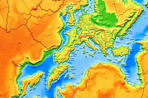
Map Projections
- Map projections are methods of representing the Earth's curved surface on a flat map
- All map projections distort the Earth's surface in some way
- Common types of map projections include Mercator, Peters, Robinson, and azimuthal projections
- Mercator projections preserve shape and direction, but distort area, especially at high latitudes
- Peters projections accurately represent area, but distort shape
- Robinson projections provide a compromise between shape and area distortion
- Azimuthal projections accurately represent direction from a central point
Climate
- Climate is the long-term average of weather conditions in a region
- Major climate zones include tropical, temperate, polar, and arid
- Climates are influenced by latitude, altitude, proximity to water, and prevailing winds
- Tropical climates are hot and humid with high rainfall
- Temperate climates have moderate temperatures and distinct seasons
- Polar climates are cold and dry with long winters
- Arid climates are dry with little rainfall
Landforms
- Landforms are natural features of the Earth's surface
- Mountains are elevated landforms formed by tectonic activity or volcanic eruptions
- Plains are flat, low-lying areas
- Plateaus are elevated, flat-topped areas
- Valleys are low areas between hills or mountains, often formed by rivers or glaciers
- Deserts are arid regions with little rainfall and sparse vegetation
- Coastlines are the boundaries between land and sea
Ecosystems
- An ecosystem is a community of living organisms interacting with their physical environment
- Major types of ecosystems include forests, grasslands, deserts, and aquatic ecosystems
- Forests are dominated by trees and support a wide variety of plant and animal life
- Grasslands are dominated by grasses and have few trees
- Deserts have sparse vegetation and are adapted to arid conditions
- Aquatic ecosystems include freshwater (lakes, rivers) and marine (oceans, coral reefs) environments
Population Geography
- Population geography studies the distribution, composition, and growth of human populations
- Population density is the number of people living per unit area
- Birth rate is the number of live births per 1,000 people per year
- Death rate is the number of deaths per 1,000 people per year
- Migration is the movement of people from one place to another
- Factors influencing population distribution include climate, resources, and economic opportunities
Urban Geography
- Urban geography studies the spatial patterns and processes of urban areas
- Urbanization is the process of population concentration in urban areas
- Cities are centers of economic, social, and cultural activity
- Urban sprawl is the expansion of urban areas into surrounding rural areas
- Gentrification is the process of renovating and redeveloping deteriorated urban neighborhoods
Economic Geography
- Economic geography studies the location, distribution, and organization of economic activities
- Agriculture is the cultivation of crops and livestock
- Manufacturing is the production of goods from raw materials
- Services include activities such as retail, healthcare, and education
- Globalization is the increasing interconnectedness of the world's economies
Political Geography
- Political geography studies the spatial aspects of political systems and boundaries
- States are independent political units with defined territories and governments
- Nations are groups of people with a shared culture, language, and identity
- Boundaries are lines that define the limits of political territories
- Geopolitics is the study of the relationship between geography and politics
Cultural Geography
- Cultural geography studies the spatial distribution of cultural traits and patterns
- Culture is the shared beliefs, values, customs, and practices of a group of people
- Language is a system of communication
- Religion is a system of beliefs and practices related to the sacred
- Ethnicity is a shared cultural heritage
- Cultural landscapes are the visible imprint of human activity on the environment
Natural Resources
- Natural resources are materials and substances that occur in nature and can be used for economic gain
- Renewable resources can be replenished naturally over time, such as solar energy, wind, and forests
- Non-renewable resources are finite and cannot be replenished, such as fossil fuels and minerals
- Resource management is the practice of using natural resources sustainably
Environmental Issues
- Environmental issues are problems that arise from human impact on the environment
- Air pollution is the contamination of the atmosphere by pollutants
- Water pollution is the contamination of water sources by pollutants
- Deforestation is the clearing of forests for other land uses
- Climate change is the long-term change in Earth's climate patterns
- Biodiversity loss is the decline in the variety of life on Earth
Geographic Information Systems (GIS)
- GIS is a computer-based system for capturing, storing, analyzing, and displaying geographic data
- GIS is used for mapping, spatial analysis, and decision-making
- Remote sensing is the acquisition of information about the Earth's surface from a distance, using technologies such as satellites and aerial photography
Sustainable Development
- Sustainable development is development that meets the needs of the present without compromising the ability of future generations to meet their own needs
- It involves balancing economic, social, and environmental considerations
- Sustainable practices include resource conservation, pollution reduction, and renewable energy use
Studying That Suits You
Use AI to generate personalized quizzes and flashcards to suit your learning preferences.