Podcast
Questions and Answers
Which of the following scenarios best illustrates the application of human geography principles?
Which of the following scenarios best illustrates the application of human geography principles?
- Mapping the distribution of different types of soil in a region.
- Investigating the causes of volcanic eruptions and their effects on the landscape.
- Analyzing the impact of trade routes on the cultural diversity of port cities. (correct)
- Studying the formation of the Grand Canyon through erosion.
A community decides to build a new hydroelectric dam. How might a geographer analyze both the physical and human impacts of this project?
A community decides to build a new hydroelectric dam. How might a geographer analyze both the physical and human impacts of this project?
- By only assessing the engineering feasibility and cost of construction.
- By focusing solely on the economic benefits from energy production.
- By ignoring the environmental consequences and focusing on energy output.
- By studying the river's flow patterns and the displacement of local communities. (correct)
How does deforestation primarily exemplify the impact of human actions on the environment?
How does deforestation primarily exemplify the impact of human actions on the environment?
- By promoting the natural regeneration of forest ecosystems.
- By leading to habitat loss and reduced biodiversity. (correct)
- By enhancing the biodiversity of the local ecosystem.
- By increasing the amount of fertile land available for agriculture.
What is the main purpose of a thematic map compared to a physical or political map?
What is the main purpose of a thematic map compared to a physical or political map?
In what way do resource maps assist communities in their development efforts?
In what way do resource maps assist communities in their development efforts?
Why is it important to use different types of map projections when creating maps?
Why is it important to use different types of map projections when creating maps?
A cartographer wants to create a map that accurately represents the size of countries relative to one another. Which projection should they use?
A cartographer wants to create a map that accurately represents the size of countries relative to one another. Which projection should they use?
Which map projection is most suitable for sailors and GPS systems?
Which map projection is most suitable for sailors and GPS systems?
What is the primary function of a Geographic Information System (GIS)?
What is the primary function of a Geographic Information System (GIS)?
In urban planning, how can GIS be applied to improve city infrastructure?
In urban planning, how can GIS be applied to improve city infrastructure?
What role does GIS play in disaster response efforts?
What role does GIS play in disaster response efforts?
What are the primary characteristics used to define and classify biomes?
What are the primary characteristics used to define and classify biomes?
Which of the following best describes the climate and biodiversity characteristics of a tropical rainforest?
Which of the following best describes the climate and biodiversity characteristics of a tropical rainforest?
A biome has seasonal rainfall with distinct wet and dry seasons, grasses with scattered trees, and large migrating herbivores. Which biome is this?
A biome has seasonal rainfall with distinct wet and dry seasons, grasses with scattered trees, and large migrating herbivores. Which biome is this?
Why do deserts experience extreme temperature fluctuations between day and night?
Why do deserts experience extreme temperature fluctuations between day and night?
What is a key characteristic of the tundra biome?
What is a key characteristic of the tundra biome?
How do social conditions impact population density and distribution?
How do social conditions impact population density and distribution?
What is the primary environmental impact of urbanization?
What is the primary environmental impact of urbanization?
Which of the following is the most accurate definition of environmental stewardship?
Which of the following is the most accurate definition of environmental stewardship?
A city implements a water recycling system and promotes vertical gardens. Which sustainable practice is being demonstrated?
A city implements a water recycling system and promotes vertical gardens. Which sustainable practice is being demonstrated?
What is the main purpose of examining case studies in geography?
What is the main purpose of examining case studies in geography?
A geographic study analyzes how a community responded to a major flood event, including evacuation strategies and infrastructure resilience. What type of geographic tool is being used?
A geographic study analyzes how a community responded to a major flood event, including evacuation strategies and infrastructure resilience. What type of geographic tool is being used?
What distinguishes sustainable agriculture from conventional agriculture practices?
What distinguishes sustainable agriculture from conventional agriculture practices?
Which of the following exemplifies the implementation of renewable energy sources?
Which of the following exemplifies the implementation of renewable energy sources?
How does land use planning contribute to responsible resource management?
How does land use planning contribute to responsible resource management?
Flashcards
What is Geography?
What is Geography?
The study of Earth's features and human interactions.
Physical Geography
Physical Geography
Focuses on natural processes and features of the earth (e.g., landforms, climate).
Human Geography
Human Geography
Focuses on human activities and their interaction with the environment (e.g., population, culture).
Physical Maps
Physical Maps
Signup and view all the flashcards
Political Maps
Political Maps
Signup and view all the flashcards
Thematic Maps
Thematic Maps
Signup and view all the flashcards
Climate Map
Climate Map
Signup and view all the flashcards
Economic Map
Economic Map
Signup and view all the flashcards
Population Map
Population Map
Signup and view all the flashcards
Resource Map
Resource Map
Signup and view all the flashcards
Topographic Maps
Topographic Maps
Signup and view all the flashcards
Map Projections
Map Projections
Signup and view all the flashcards
Mercator Projection
Mercator Projection
Signup and view all the flashcards
Peters Projection
Peters Projection
Signup and view all the flashcards
Robinson Projection
Robinson Projection
Signup and view all the flashcards
GIS (Geographic Information Systems)
GIS (Geographic Information Systems)
Signup and view all the flashcards
Biomes
Biomes
Signup and view all the flashcards
Tropical Rainforest
Tropical Rainforest
Signup and view all the flashcards
Savanna
Savanna
Signup and view all the flashcards
Desert
Desert
Signup and view all the flashcards
Temperate Forest
Temperate Forest
Signup and view all the flashcards
Grassland
Grassland
Signup and view all the flashcards
Tundra
Tundra
Signup and view all the flashcards
Taiga (Boreal Forest)
Taiga (Boreal Forest)
Signup and view all the flashcards
Stewardship
Stewardship
Signup and view all the flashcards
Study Notes
What is Geography?
- The study of Earth's features and human interactions with them.
- Aids in decision-making across fields, understanding environments, and predicting events like natural disasters.
Two Main Branches of Geography
- Physical geography focuses on natural features and Earth processes like landforms and climate.
- Human geography studies human activities, cultures, and interactions with the environment, including population and urbanization.
- Physical features influence human activities (terraced farming, climate change causing migration).
- Human actions impact the environment (deforestation, burning fossil fuels).
Geographic Tools & Maps
- Maps are tools used in geography
- Physical maps display natural features like mountains.
- Political maps show boundaries between countries, states, and cities.
- Thematic maps display specific data, such as population or climate.
- Climate maps show temperature and precipitation patterns.
- Economic maps display information like income levels and resource distribution.
- Population maps show patterns of population density, growth, and migration.
- Resource maps identify a community's assets and resources.
- Topographic maps give geographic positions and elevations for natural and man-made features.
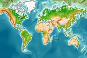
Map Projections
- Map projections are different ways of representing the Earth on a flat surface.
- Different projections are used because a flat map inherently distorts the Earth's spherical shape.
- Mercator projection preserves shapes, useful for navigation, but distorts size (e.g., Greenland appears larger than it is relative to Africa).
- Peters projection accurately shows land size, fairly representing developing countries, but distorts shapes of continents.
- Robinson projection balances shape and size, used for general-purpose maps, but still slightly distorts the poles.
GIS (Geographic Information Systems)
- GIS is a technology used to capture, analyze, and display spatial/geographic data.
- GIS helps visualize geographic relationships and understand how locations and features interact.
- Applications of GIS include urban planning, disaster response, and environmental conservation.
- In urban planning, GIS optimizes locations for infrastructure.
- In disaster response, GIS maps flood-prone areas and evacuation zones.
- In agriculture, GIS analyzes soil health and predicts crop yields.
- GIS helps understand relationships between natural and human environments, solving problems with data analysis.
Major Biomes
- Biomes are large geographical regions with specific climates, vegetation, and animal life.
- Biomes are classified as terrestrial (land-based) or aquatic (water-based).
- Climate, vegetation, and animal types are key characteristics of biomes.
- Tropical rainforests are near the equator, hot, humid, with high rainfall and biodiversity, also lack distinct seasons.
- Savannas are transitional zones with seasonal rainfall, grasses, scattered trees, and migratory animals.
- Deserts are arid regions with low precipitation and extreme temperature fluctuations.
- Temperate forests are in mid-latitudes with four distinct seasons and deciduous trees.
- Grasslands receive enough rainfall for grasses but not enough for trees.
- Tundra is in arctic regions, cold with short summers, and low-growing plants.
- Taiga (Boreal Forest) is in northern regions, has long, cold winters, coniferous trees, and limited biodiversity compared to tropical forests.
Population & Urbanization
Population Patterns
- Physical: climate, resources, land.
- Human: social conditions, economics, qualify of life.
- Physical and human factors affect population density and distribution.
- Urbanization is the movement from rural to urban areas.
- Urbanization impacts the environment through pollution, resource overuse, deforestation, and habitat loss.
Sustainability and Stewardship
- Stewardship is the responsible management and care of the environment.
- Stewardship protects biodiversity, ensures clean water and air, and reduces climate change.
- Geographic decisions involve land use, resource management, and sustainable energy production.
- Conservation, renewable energy, sustainable agriculture, and urban planning are sustainable practices.
Real-World Applications (Case studies)
Case Studies
- Examination of a real-world case using geographic data to understand challenges and solutions.
- Singapore, a small island city with limited land, is an example of managing urbanization through water recycling, vertical gardens, and high-density housing.
- A good case study includes the background and geographic data, the problem or challenge, and the solutions and outcomes.
Studying That Suits You
Use AI to generate personalized quizzes and flashcards to suit your learning preferences.