Podcast
Questions and Answers
Which branch of geography studies the Earth's natural environment, including landforms and climate?
Which branch of geography studies the Earth's natural environment, including landforms and climate?
- Physical Geography (correct)
- Regional Geography
- Political Geography
- Human Geography
What is the term for the exact location of a place using coordinates?
What is the term for the exact location of a place using coordinates?
- Absolute Location (correct)
- Relative Location
- Approximate Location
- Regional Location
Which of the following is a tool used in geography to capture, store, analyze, and display geographic data?
Which of the following is a tool used in geography to capture, store, analyze, and display geographic data?
- Telescope
- Microscope
- Geographic Information Systems (GIS) (correct)
- Thermometer
What does the study of population geography primarily focus on?
What does the study of population geography primarily focus on?
Which of Earth's physical systems includes all water?
Which of Earth's physical systems includes all water?
What is the primary focus of economic geography?
What is the primary focus of economic geography?
Which term refers to the long-term average of weather conditions in an area?
Which term refers to the long-term average of weather conditions in an area?
Which of the following is NOT a key concept in geography?
Which of the following is NOT a key concept in geography?
What is the name for the lines on a map that measure distance east or west of the Prime Meridian?
What is the name for the lines on a map that measure distance east or west of the Prime Meridian?
Which field within geography studies the growth and spatial layout of cities?
Which field within geography studies the growth and spatial layout of cities?
Flashcards
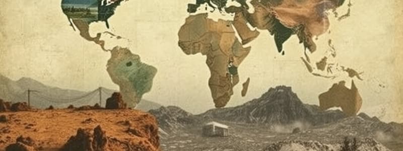
Geography
Geography
The study of the Earth's physical features, atmosphere, and human activity. It examines human-environment interactions and the impact of space and place on people and the planet.
Physical Geography
Physical Geography
Studies the natural environment, including landforms, climate, vegetation, and soils.
Human Geography
Human Geography
Studies the spatial organization of human activities and how humans interact with their environment.
Place (in Geography)
Place (in Geography)
Signup and view all the flashcards
Human-Environment Interaction
Human-Environment Interaction
Signup and view all the flashcards
Movement (in Geography)
Movement (in Geography)
Signup and view all the flashcards
Region (in Geography)
Region (in Geography)
Signup and view all the flashcards
Map Projections
Map Projections
Signup and view all the flashcards
Latitude
Latitude
Signup and view all the flashcards
Climate
Climate
Signup and view all the flashcards
Study Notes
- Geography studies Earth's physical features, the atmosphere, and human activity.
- It examines human interaction with their environment and how space and place affect people and the planet.
- Geography seeks to understand the location of things, why they are there, and how they develop and change.
Branches of Geography
- Physical geography studies the natural environment including landforms, climate, vegetation, and soils.
- Human geography (or cultural geography) studies the spatial organization of human activities and human interaction with the environment.
- Environmental geography examines the interactions between humans and the natural environment.
- Regional geography studies the unique characteristics of specific regions.
Key Concepts in Geography
- Location: Absolute location (coordinates) and relative location (location in relation to other places) are fundamental.
- Place: Refers to the physical and human characteristics of a specific location.
- Human-Environment Interaction: Examines how humans modify, adapt to, and depend on the environment.
- Movement: The flow of people, goods, and ideas between locations.
- Region: An area with similar physical, human, or cultural characteristics that distinguishes it.
Tools and Techniques in Geography
- Maps: Visual representations of geographic information and are essential for spatial analysis.
- Geographic Information Systems (GIS): Computer systems used to capture, store, analyze, and display geographic data.
- Remote Sensing: Acquiring information about the Earth's surface without physical contact, using satellites and aerial photography.
- Cartography: The art and science of mapmaking.
- Statistics: Used to analyze geographic data and identify patterns.
Map Projections
- Map projections are methods of representing Earth's curved surface on a flat plane.
- All map projections distort the Earth in some way, affecting shape, area, distance, or direction.
- Common types include:
- Mercator projection: Preserves shape and direction but distorts area, especially at high latitudes.
- Equal-area projection: Preserves area but distorts shape.
- Robinson projection: A compromise projection that balances distortions of shape, area, distance, and direction.
Latitude and Longitude
- Latitude: Measures distance north or south of the Equator, which is 0 degrees latitude.
- Longitude: Measures distance east or west of the Prime Meridian, which is 0 degrees longitude.
Earth's Physical Systems
- Atmosphere: The layer of gases surrounding the Earth.
- Lithosphere: The Earth's crust and upper mantle, divided into tectonic plates.
- Hydrosphere: All water on Earth, including oceans, lakes, rivers, and ice.
- Biosphere: All living organisms and their interactions with the environment.
Climate
- Climate is the long-term average of weather conditions in a region.
- Climate is influenced by factors such as latitude, altitude, proximity to oceans, and prevailing winds.
- Major climate types include tropical, temperate, polar, and arid.
Landforms
- Landforms are natural features of the Earth's surface, such as mountains, plains, plateaus, and valleys.
- They are shaped by tectonic forces, erosion, and weathering.
Population Geography
- Studies the spatial distribution, composition, migration, and growth of human populations.
- Key concepts include:
- Population density: Number of people per unit area.
- Birth rate: Number of live births per 1,000 people per year.
- Death rate: Number of deaths per 1,000 people per year.
- Migration: Movement of people from one place to another.
Economic Geography
- Examines the location, distribution, and organization of economic activities.
- Considers factors such as:
- Agriculture: Farming practices and food production.
- Industry: Manufacturing and industrial development.
- Services: Activities such as healthcare, education, and tourism.
- Trade: Exchange of goods and services between countries.
Political Geography
- Studies the spatial dimensions of political systems and processes.
- Includes topics such as:
- Boundaries: Lines that delineate political territories.
- States: Independent political entities with defined territories and governments.
- Geopolitics: The study of the influence of geography on international relations.
Urban Geography
- Focuses on the spatial structure and development of cities.
- Examines topics such as:
- Urbanization: The process of population concentration in cities.
- Urban morphology: The physical form and structure of cities.
- Urban planning: The design and management of urban spaces.
Environmental Issues
- Geography helps in understanding and addressing environmental challenges like:
- Climate change: Long-term changes in global temperatures and weather patterns.
- Deforestation: Clearing of forests for other land uses.
- Pollution: Contamination of air, water, and soil.
- Resource depletion: Overuse of natural resources.
Sustainable Development
- Geography helps to promote sustainable development, which aims to meet present needs without compromising future generations.
- It Involves balancing economic, social, and environmental considerations.
Studying That Suits You
Use AI to generate personalized quizzes and flashcards to suit your learning preferences.


