Podcast
Questions and Answers
Which of the following best describes the focus of economic geography?
Which of the following best describes the focus of economic geography?
- The distribution, composition, migration, and growth of human populations.
- The spatial dimensions of political systems, boundaries, and conflicts.
- The location, distribution, and organization of economic activities across the world. (correct)
- The study of climate patterns and their impact on agriculture.
A vernacular region is primarily defined by what?
A vernacular region is primarily defined by what?
- A central node and surrounding areas linked by transportation networks.
- People's beliefs, perceptions, or cultural understanding. (correct)
- Clearly defined boundaries and a common political system.
- Statistical data representing economic output.
Which tool is most suited for analyzing the spatial relationships between different layers of geographic data, such as land use, elevation, and population density?
Which tool is most suited for analyzing the spatial relationships between different layers of geographic data, such as land use, elevation, and population density?
- Geographic Information Systems (GIS) (correct)
- Remote sensing imagery
- Cartography
- Qualitative research methods
If a geographer is studying the impact of deforestation on local rainfall patterns, which branch of geography are they primarily working within?
If a geographer is studying the impact of deforestation on local rainfall patterns, which branch of geography are they primarily working within?
A researcher uses satellite imagery to track changes in glacial ice cover over time. This is an example of what?
A researcher uses satellite imagery to track changes in glacial ice cover over time. This is an example of what?
What distinguishes absolute location from relative location?
What distinguishes absolute location from relative location?
A study examining the spread of a new infectious disease across different countries, including factors influencing its transmission, would fall under which branch of geography?
A study examining the spread of a new infectious disease across different countries, including factors influencing its transmission, would fall under which branch of geography?
Which of the following best illustrates human-environment interaction?
Which of the following best illustrates human-environment interaction?
A researcher aims to analyze the spatial distribution of a specific disease. Which research method is most suitable for this type of study?
A researcher aims to analyze the spatial distribution of a specific disease. Which research method is most suitable for this type of study?
Imagine you are creating a world map that needs to accurately represent the size of countries, even if it distorts their shapes. Which map projection would be most suitable?
Imagine you are creating a world map that needs to accurately represent the size of countries, even if it distorts their shapes. Which map projection would be most suitable?
If you are at a location with a latitude of 80 degrees North, which climate zone are you most likely in?
If you are at a location with a latitude of 80 degrees North, which climate zone are you most likely in?
The Andes Mountains on the western coast of South America are a direct result of what type of plate boundary interaction?
The Andes Mountains on the western coast of South America are a direct result of what type of plate boundary interaction?
Which of the following scenarios best illustrates the process of weathering?
Which of the following scenarios best illustrates the process of weathering?
A country experiences a rapid increase in the proportion of its population living in cities, leading to the growth of megacities, increased infrastructure development, and challenges related to housing and sanitation. What is this process called?
A country experiences a rapid increase in the proportion of its population living in cities, leading to the growth of megacities, increased infrastructure development, and challenges related to housing and sanitation. What is this process called?
A multinational corporation establishes factories in several developing countries to take advantage of lower labor costs, and sells its products worldwide, impacting local economies and cultures. This scenario best exemplifies which process?
A multinational corporation establishes factories in several developing countries to take advantage of lower labor costs, and sells its products worldwide, impacting local economies and cultures. This scenario best exemplifies which process?
Which of the following environmental issues is most directly associated with the burning of fossil fuels for energy production?
Which of the following environmental issues is most directly associated with the burning of fossil fuels for energy production?
Flashcards
Geography
Geography
Study of Earth's features, atmosphere, and human activity, examining human-environment interactions and spatial relationships.
Physical Geography
Physical Geography
The branch of geography that studies the Earth’s natural processes and features.
Human Geography
Human Geography
The branch of geography that studies human activity and its relationship to the Earth.
Location
Location
Signup and view all the flashcards
Place
Place
Signup and view all the flashcards
Regions
Regions
Signup and view all the flashcards
Human-Environment Interaction
Human-Environment Interaction
Signup and view all the flashcards
Movement
Movement
Signup and view all the flashcards
Quantitative research
Quantitative research
Signup and view all the flashcards
Map Projections
Map Projections
Signup and view all the flashcards
Latitude
Latitude
Signup and view all the flashcards
Plate tectonics
Plate tectonics
Signup and view all the flashcards
Erosion
Erosion
Signup and view all the flashcards
Population distribution
Population distribution
Signup and view all the flashcards
Urbanization
Urbanization
Signup and view all the flashcards
Globalization
Globalization
Signup and view all the flashcards
Study Notes
- Geography is the study of the Earth's physical features, atmosphere, and human activity.
- It examines how humans interact with their environment and how space and place affect people and the planet.
Branches of Geography
- Physical geography studies the Earth’s natural processes and features.
- Climatology is the study of climate and climate change.
- Geomorphology examines the Earth's physical landforms and the processes that create and change them.
- Hydrology studies water on Earth, including its distribution, movement, and properties.
- Biogeography studies the distribution of species and ecosystems in geographic space and through geological time.
- Human geography studies human activity and its relationship to the Earth.
- Population geography studies the distribution, composition, migration, and growth of human populations.
- Economic geography studies the location, distribution, and organization of economic activities across the world.
- Political geography studies the spatial dimensions of political systems, boundaries, and conflicts.
- Cultural geography studies the spatial distribution of cultural traits, such as language, religion, and ethnicity.
Key Geographic Concepts
- Location refers to a specific position on the Earth’s surface.
- Absolute location is defined by coordinates like latitude and longitude.
- Relative location describes a place in relation to other places.
- Place refers to the physical and human characteristics of a location in relation to other places.
- Regions are areas with similar characteristics.
- Formal regions have clearly defined boundaries and a common characteristic, such as a political entity.
- Functional regions are defined by a central node and surrounding areas linked by transportation or communication networks.
- Vernacular regions are perceptual regions defined by people's beliefs or perceptions.
- Human-environment interaction examines how people adapt to, modify, and depend on their environment.
- Movement refers to the mobility of people, goods, and ideas across the Earth's surface.
Geographic Tools and Techniques
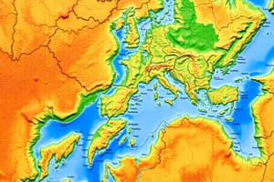
- Maps are visual representations of the Earth's surface.
- Geographic Information Systems (GIS) are computer systems used to capture, store, analyze, and display geographic data.
- Remote sensing involves acquiring information about the Earth's surface without physical contact, such as through satellites or aircraft.
- Cartography is the art and science of mapmaking.
- Qualitative research involves methods that do not rely on numerical or statistical data.
- Quantitative research uses statistical analysis to understand spatial patterns and relationships.
Map Projections
- Map projections are methods of representing the Earth's curved surface on a flat map.
- All map projections distort the Earth's surface in some way.
- Common map projections include Mercator, Peters, Robinson, and azimuthal projections.
Latitude and Longitude
- Latitude measures the distance north or south of the Equator.
- The Equator is 0 degrees latitude.
- The North Pole is 90 degrees north latitude.
- The South Pole is 90 degrees south latitude.
- Longitude measures the distance east or west of the Prime Meridian.
- The Prime Meridian is 0 degrees longitude.
- The International Date Line is approximately 180 degrees longitude.
Climate Zones
- Tropical climates are found near the Equator and are characterized by high temperatures and rainfall.
- Temperate climates have moderate temperatures and rainfall and distinct seasons.
- Polar climates are found near the North and South Poles and are characterized by cold temperatures and ice cover.
- Arid climates are dry and receive little rainfall.
- Mediterranean climates have mild, wet winters and warm, dry summers.
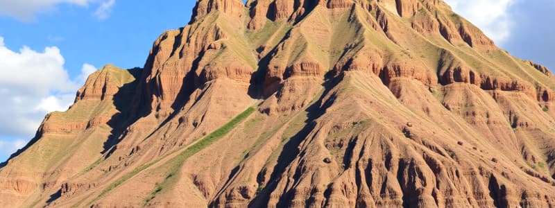
Plate Tectonics
- Plate tectonics is the theory that the Earth's lithosphere is divided into plates that move and interact.
- Plate boundaries are where most earthquakes, volcanic activity, and mountain building occur.
- Divergent plate boundaries are where plates move apart, such as at mid-ocean ridges.
- Convergent plate boundaries are where plates collide, leading to subduction or mountain building.
- Transform plate boundaries are where plates slide past each other horizontally, such as along the San Andreas Fault.
Erosion and Weathering
- Erosion is the process by which soil and rock are worn away and transported by natural forces such as water, wind, and ice.
- Weathering is the breakdown of rocks and minerals at the Earth's surface through physical and chemical processes.
Population Distribution
- Population distribution refers to the pattern of where people live on Earth.
- Factors such as climate, access to resources, and economic opportunities influence population density.
- Urban areas tend to have higher population densities than rural areas.
Urbanization
- Urbanization is the process by which an increasing proportion of a population lives in urban areas.
- Urban areas offer economic opportunities, services, and amenities.
Globalization
- Globalization is the increasing interconnectedness of countries through trade, communication, and cultural exchange.
- It leads to the spread of ideas, goods, and technologies across the world.
Environmental Issues
- Climate change is a significant global environmental issue, driven by greenhouse gas emissions.
- Deforestation, pollution, and loss of biodiversity are other pressing environmental concerns.
Studying That Suits You
Use AI to generate personalized quizzes and flashcards to suit your learning preferences.