Podcast
Questions and Answers
Cartography is solely focused on the production of road maps and nothing else.
Cartography is solely focused on the production of road maps and nothing else.
False (B)
Topographic maps include information about both natural and man-made features.
Topographic maps include information about both natural and man-made features.
True (A)
The Babylonian map dates back to 600 AD.
The Babylonian map dates back to 600 AD.
False (B)
A cadastral map is primarily used for maritime navigation.
A cadastral map is primarily used for maritime navigation.
Thematic maps use specific colors and symbols to convey information about a particular theme.
Thematic maps use specific colors and symbols to convey information about a particular theme.
Nautical charts are irrelevant for aerial navigation.
Nautical charts are irrelevant for aerial navigation.
The scale of a map is established by determining the ratio between a distance on the map and the actual distance.
The scale of a map is established by determining the ratio between a distance on the map and the actual distance.
Legend refers to the geographical orientation of a map.
Legend refers to the geographical orientation of a map.
Portolan charts were developed during the Age of Exploration.
Portolan charts were developed during the Age of Exploration.
A small scale map has a ratio of 1:10,000.
A small scale map has a ratio of 1:10,000.
The Greenwich Meridian is used as a reference point for latitudes.
The Greenwich Meridian is used as a reference point for latitudes.
Contour lines on a topographic map connect points of unequal altitude.
Contour lines on a topographic map connect points of unequal altitude.
Cylindrical projections are best suited for regions at mid-latitudes.
Cylindrical projections are best suited for regions at mid-latitudes.
Cartographic generalization involves simplifying information for better readability.
Cartographic generalization involves simplifying information for better readability.
Verification of maps refers to producing them for aesthetic purposes.
Verification of maps refers to producing them for aesthetic purposes.
Interactive and digital cartography utilizes Geographic Information Systems (GIS).
Interactive and digital cartography utilizes Geographic Information Systems (GIS).
Real-time maps are developed specifically for agricultural management.
Real-time maps are developed specifically for agricultural management.
Big data has no significant impact on the accuracy and production of maps.
Big data has no significant impact on the accuracy and production of maps.
Maps are not regarded as valuable tools in educational settings.
Maps are not regarded as valuable tools in educational settings.
Conic projections are useful for representing polar regions.
Conic projections are useful for representing polar regions.
Flashcards
Cartography
Cartography
The science and art of creating and using maps to represent geographic information.
Topographic Map
Topographic Map
A map that shows landforms like mountains and rivers, as well as human-made features like roads and buildings.
Thematic Map
Thematic Map
A map that focuses on specific information like population, climate, or vegetation.
Map Scale
Map Scale
Signup and view all the flashcards
Map Legend
Map Legend
Signup and view all the flashcards
Map Orientation
Map Orientation
Signup and view all the flashcards
Road Map
Road Map
Signup and view all the flashcards
Cadastral Map
Cadastral Map
Signup and view all the flashcards
Nautical/Aeronautical Charts
Nautical/Aeronautical Charts
Signup and view all the flashcards
Babylonian Maps
Babylonian Maps
Signup and view all the flashcards
Reference Meridian (Prime Meridian)
Reference Meridian (Prime Meridian)
Signup and view all the flashcards
Contour Lines
Contour Lines
Signup and view all the flashcards
Geographic Data Collection
Geographic Data Collection
Signup and view all the flashcards
Cartographic Generalization
Cartographic Generalization
Signup and view all the flashcards
Map Projections
Map Projections
Signup and view all the flashcards
Graphic Design in Maps
Graphic Design in Maps
Signup and view all the flashcards
Map Verification and Updating
Map Verification and Updating
Signup and view all the flashcards
Maps in Education
Maps in Education
Signup and view all the flashcards
Maps in Planning and Management
Maps in Planning and Management
Signup and view all the flashcards
Maps in Navigation
Maps in Navigation
Signup and view all the flashcards
Study Notes
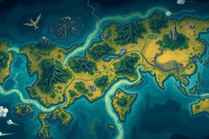
Cartography: Introduction
- Cartography is the design, production, and use of maps
- Cartography models geographic space graphically
- Cartography facilitates communication of geographical, political, economic, social, natural information
- Cartography aids in decision-making in fields like urban planning and resource management
History of Cartography
- Earliest known map: Babylonian map (600 BC)
- Maps evolved in the Middle Ages with T-O maps and portolan charts
- Modern cartography developed alongside topographic and thematic maps during the Age of Exploration
Types of Maps
Topographic Maps
- Represent physical terrain (mountains, rivers, man-made features like roads and buildings)
- Use contour lines, symbols, and elevation marks
- Useful for hiking, urban planning, and environmental studies
Thematic Maps
- Show specific information (e.g., climate, population, vegetation)
- Use colors and symbols relevant to the theme
- Useful for demographic, climatological, or sociological studies
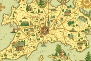
Road Maps
- Display roads, highways, cities, and points of interest
- Helpful for trip planning and logistics
Cadastral Maps
- Divide land into parcels
- Show property boundaries, parcel identification, and buildings
- Important for land management, taxation, and urban planning
Nautical and Aeronautical Charts
- Used for maritime and aerial navigation
- Include depth indicators, buoys, and routes
- Used for safe navigation
Map Elements
Scale
- Ratio between map distance and actual distance
- Large scale for detailed maps, small scale for large regions
Legend
- Explains symbols used on the map
- Includes symbols for roads, forests, rivers, cities, etc.
Orientation & Meridian
- Usually indicated by an arrow or compass rose showing north
- Greenwich Meridian is a reference point for longitudes
Contour Lines
- Connect points of equal altitude on a topographic map
- Indicate relief (mountains and valleys)
Map Creation
- Data sources include satellites, GPS, and topographic surveys
- Accuracy is crucial for reliable maps
- Cartographic generalization simplifies information for readability
Map Projections
- Methods for representing a curved Earth on a flat map
- Different projections used depending on the area being mapped
- Distortions are inevitable depending on the projection method
Map Applications
- Education, urban planning, agriculture and other planning
- Navigation, scientific analysis (e.g., climate change monitoring, tracking species), and social/economic studies
Modern Challenges in Cartography
- Analyzing vast amounts of geospatial data
- Creating interactive digital maps (e.g., GIS applications)
- Real-time maps for navigation and emergency management
Studying That Suits You
Use AI to generate personalized quizzes and flashcards to suit your learning preferences.