Podcast
Questions and Answers
What is the main focus of physical geography?
What is the main focus of physical geography?
- The study of political systems and their spatial organization
- The study of cities and urban areas
- The study of human activities and their spatial distribution
- The study of the Earth's physical processes and features (correct)
Which branch of geography specifically examines the distribution and movement of water?
Which branch of geography specifically examines the distribution and movement of water?
- Geomorphology
- Biogeography
- Hydrology (correct)
- Climatology
What is the primary purpose of Geographic Information Systems (GIS)?
What is the primary purpose of Geographic Information Systems (GIS)?
- To study the cultural practices and their spatial distribution
- To create maps for understanding spatial phenomena (correct)
- To track the movement of goods and information
- To analyze the evolution of landforms
Which of the following is NOT a key concept in geography?
Which of the following is NOT a key concept in geography?
What does the concept of 'Human-Environment Interaction' explore?
What does the concept of 'Human-Environment Interaction' explore?
Which of these is a branch of human geography?
Which of these is a branch of human geography?
Which of the following is NOT a tool used in geography?
Which of the following is NOT a tool used in geography?
What does regional geography investigate?
What does regional geography investigate?
Which of the following is NOT a primary application of Geographic Information Systems (GIS)?
Which of the following is NOT a primary application of Geographic Information Systems (GIS)?
What is the primary function of "Spatial Analysis" in geographic studies?
What is the primary function of "Spatial Analysis" in geographic studies?
How can Geographic Scales impact the effectiveness of spatial analysis?
How can Geographic Scales impact the effectiveness of spatial analysis?
In the context of geographic studies, which of the following is NOT a factor considered within "Spatial Distribution"?
In the context of geographic studies, which of the following is NOT a factor considered within "Spatial Distribution"?
Which application of geographic studies is most directly related to "Spatial Processes"?
Which application of geographic studies is most directly related to "Spatial Processes"?
Flashcards
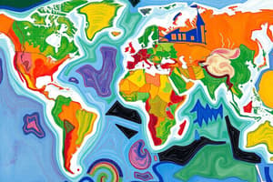
Geography
Geography
The study of the Earth's surface, features, climates, and human activities.
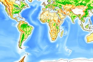
Physical Geography
Physical Geography
Study of the Earth's physical processes and features such as climates and landforms.
Human Geography
Human Geography
Study of human activities and their spatial patterns like cities and economies.
Location
Location
Signup and view all the flashcards
Place
Place
Signup and view all the flashcards
Region
Region
Signup and view all the flashcards
Movement
Movement
Signup and view all the flashcards
Geographic Information Systems (GIS)
Geographic Information Systems (GIS)
Signup and view all the flashcards
Remote Sensing
Remote Sensing
Signup and view all the flashcards
Spatial Relationships
Spatial Relationships
Signup and view all the flashcards
Climate Change Impacts
Climate Change Impacts
Signup and view all the flashcards
Resource Management
Resource Management
Signup and view all the flashcards
Study Notes
Defining Geography
- Geography is the study of the Earth's surface, encompassing physical features, climates, populations, and human activities.
- It integrates natural sciences (geology, biology) and social sciences (sociology, economics).
- Geographers employ various methods to analyze spatial patterns and processes.
Branches of Geography
-
Physical Geography: Studies Earth's physical processes and features.
- Climatology: Examines weather and climate systems.
- Hydrology: Focuses on water distribution and movement.
- Geomorphology: Studies landforms and their development.
- Biogeography: Analyzes plant and animal distribution.
- Soils Geography: Investigates soil formation, distribution, and properties.
- Glaciology: Focuses on glaciers and ice sheets.
-
Human Geography: Examines human activities and spatial patterns.
- Population geography: Studies population distribution, density, and changes.
- Economic geography: Analyzes economic activities and their spatial distribution.
- Urban geography: Focuses on cities and urban areas.
- Political geography: Studies political systems and spatial organization.
- Cultural geography: Examines cultural practices and their spatial distribution.
- Social geography: Analyzes social processes and spatial distribution.
-
Regional Geography: Combines physical and human geography to examine specific regions, noting similarities and variations.
-
Geographic Information Systems (GIS): A system for collecting, storing, analyzing, and displaying geographic data. GIS integrates spatial and attribute data to create maps and understand spatial phenomena.
Key Concepts in Geography
- Location: A place's position on Earth, often described using latitude and longitude.
- Place: Unique characteristics that define a location's identity.
- Region: A large area with shared characteristics (physical, cultural, economic).
- Movement: The process of people, goods, ideas, and information traveling between locations.
- Human-Environment Interaction: The relationship between people and their environment, and how each influences the other.
Tools of Geography
- Maps: Visual representations of Earth's surface showing geographical features and spatial relationships.
- Remote Sensing: Acquiring information about Earth's surface from a distance (satellites, planes). Remote sensing gathers images and data, analyzing both human and natural systems.
- Geographic Information Systems (GIS): A system for collecting, storing, analyzing, and displaying geographic data.
Applications of Geography
- Environmental Management: Assesses development projects' environmental impacts.
- Urban Planning: Designs sustainable and livable urban environments.
- Resource Management: Tracks resources (water, minerals) and identifies overuse factors.
- Disaster Management: Plans for and responds to natural disasters.
- Climate Change Impacts: Studies climate change's regional and community effects.
- Political Analysis: Explores geopolitical issues across different places and scales.
Spatial Analysis
- Spatial Relationships: Investigates connections between places based on position and distance.
- Spatial Distribution: Analyzes where things are located, their numbers, and compares patterns across locations.
- Spatial Processes: Examines how human and natural systems influence patterns within a place.
- Geographic Scales: Utilizes diverse maps (country-wide to small-scale region-specific) to analyze issues effectively and avoid misinterpretations.
Studying That Suits You
Use AI to generate personalized quizzes and flashcards to suit your learning preferences.