Podcast
Questions and Answers
Which of the following statements accurately describes the geographical location of India?
Which of the following statements accurately describes the geographical location of India?
- A landlocked country surrounded by the Himalayas to the north, the Arabian Sea to the west, the Bay of Bengal to the east, and the Indian Ocean to the south.
- An island nation bounded by the Himalayas to the east, the Arabian Sea to the north, the Bay of Bengal to the south, and the Indian Ocean to the west.
- A peninsula surrounded by the Himalayas to the north, the Arabian Sea to the west, the Bay of Bengal to the east, and the Indian Ocean to the south. (correct)
- A peninsula bordered by the Himalayas to the south, the Arabian Sea to the east, the Bay of Bengal to the west, and the Indian Ocean to the north.
What is the approximate north-south and east-west extension of India, respectively?
What is the approximate north-south and east-west extension of India, respectively?
- 2,500 km and 3,500 km
- 3,000 km and 3,000 km
- 3,214 km and 2,933 km (correct)
- 2,933 km and 3,214 km
Which of the following mountain ranges is NOT part of the Himalayan classification?
Which of the following mountain ranges is NOT part of the Himalayan classification?
- Purvanchal
- Aravalli Range (correct)
- Trans-Himalayas
- Shiwaliks
Which of the following best describes the location and characteristics of the Trans-Himalayan range?
Which of the following best describes the location and characteristics of the Trans-Himalayan range?
Which of the following combinations of mountain range and the state/territory where it is primarily located is correct?
Which of the following combinations of mountain range and the state/territory where it is primarily located is correct?
The Indus River enters India near Demchok and flows between which of the following mountain ranges?
The Indus River enters India near Demchok and flows between which of the following mountain ranges?
What is the significance of the Jawahar Tunnel, and in which mountain range is it located?
What is the significance of the Jawahar Tunnel, and in which mountain range is it located?
Which of the following statements accurately describes the location of the Nallamala Hills?
Which of the following statements accurately describes the location of the Nallamala Hills?
Which pass is known for being a key route to Kailash and Manasarovar and is located at the tri-junction of China, India, and Nepal?
Which pass is known for being a key route to Kailash and Manasarovar and is located at the tri-junction of China, India, and Nepal?
Kanchenjunga, India's highest peak, is referred to by the Sikkimese as:
Kanchenjunga, India's highest peak, is referred to by the Sikkimese as:
Flashcards
Karakoram Range
Karakoram Range
The northernmost range, part of the Trans-Himalayas, located in the Kashmir region.
Ladakh Range
Ladakh Range
Located south of the Karakoram Range, also part of the Trans-Himalayas, merging into the Kailash Range in Tibet.
Zanskar Range
Zanskar Range
Situated south of the Ladakh Range, also in the Trans-Himalayas, separating Ladakh from Kashmir.
Pir Panjal Range
Pir Panjal Range
Signup and view all the flashcards
Dhauladhar Range
Dhauladhar Range
Signup and view all the flashcards
Nag Tibba Range
Nag Tibba Range
Signup and view all the flashcards
Mussoorie Range
Mussoorie Range
Signup and view all the flashcards
Classification of Himalayan Mountain Ranges
Classification of Himalayan Mountain Ranges
Signup and view all the flashcards
Mountain Passes
Mountain Passes
Signup and view all the flashcards
Nathula Pass
Nathula Pass
Signup and view all the flashcards
Study Notes
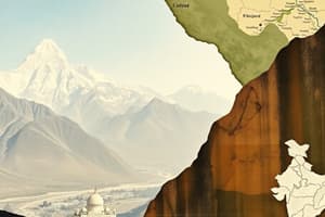
India's Geography and Mountain Ranges
- India is a peninsula surrounded by the Himalayas in the north, the Arabian Sea in the west, the Bay of Bengal in the east, and the Indian Ocean in the south.
- India's north-south extension (Kashmir to Kanyakumari) is 3,214 km.
- India's east-west extension (Arunachal Pradesh to Kutch) is 2,933 km.
- India features diverse landscapes, including mountains, plateaus, plains, and deserts.
Classification of Himalayan Mountain Ranges
- The Himalayas are classified into five parts:
- Trans-Himalayas or Tibetan Himalayas
- The Greater or Great Himalayas
- Middle or Lesser Himalayas
- Outer Himalayas or Shiwaliks
- Purvanchal or Eastern Himalayas.
- Trans-Himalayas are located above the Great Himalayan range.
- A significant portion of this range is in Tibet, hence the name Tibetan Himalayas.
- The height of this range is starts from 3,000 meters above sea level, it stretches around 1,000 km from east to west.
- Great Himalayas are also known as Higher Himalayas or Himadri.
- Great Himalayas have a total length of approximately 2,300 km.
- The average elevation of this range is more than 6,100 meters.
- The world's tallest peaks, around 8,000 meters high, are located here, including Nanga Parbat, Annapurna, Mount Everest, and Kanchenjunga.
- Important glaciers like Gangotri and Pant are in the Great Himalayas.
- The Great Himalayas also feature significant passes, such as:
- Zojila in Jammu and Kashmir
- Baralacha and Shipki in Himachal Pradesh
- Thang La, Lipulekh, and Niti Pass in Uttarakhand
- Nathula and Jelepla in Sikkim.
- Lesser Himalayas is the middle section of the Himalayan mountain system in Central Asia, also known as Inner Himalayas or Middle Himalayas.
- Lesser Himalayas span approximately 2,500 km from northwest to southeast.
- Lesser Himalayas has an average elevation between 3,700 to 4,500 meters.
- Lesser Himalayas' southern slope is steep, preventing soil erosion, while its northern slope is gentle and mainly covered with grass.
- Lesser Himalayas includes important mountain ranges such as:
- Pir Panjal in Jammu and Kashmir
- Dhaula Dhar in Himachal Pradesh
- Mussoorie and Nag Tibba in Uttarakhand
- Mahabharat Lekh in Nepal.
- Shiwalik Range is the southernmost range of the Himalayas and also known as outer Himalayas.
- Shiwalik Range lies between the Great Plains and the Lesser Himalayas.
- Shiwalik Range's altitude varies from 600 to 1,500 meters.
- Shiwalik Range extends from the Potwar Plateau to the Brahmaputra Valley.
- Shiwalik Ranges are known by different names in different areas:
- Jammu Hills in Jammu
- Dudhwa Range in Uttarakhand
- Dafla, Miri, Abor, and Mishmi in Arunachal Pradesh
- Churia Ghat Hills in Nepal.
Important Mountain Ranges in North India
- The Karakoram Range is the northernmost range in the Himalayas and a part of the Trans-Himalayas.
- The Karakoram Range is located in the Kashmir region, spreading across the borders of Pakistan, China, and India.
- Karakoram Range include the world’s second highest peak, Mount Godwin-Austen (K2), with a height of 8,611 meters.
- K3, K4, and K5 peaks in this range also exceed 8,000 meters in height.
- Major glaciers in the Karakoram Range are among the longest outside the polar regions.
- Siachen Glacier is situated in the eastern Karakoram Range.
- Baltoro Glacier is located west of Siachen, in Gilgit-Baltistan, part of Pakistan-occupied Kashmir (PoK).
- The Ladakh Range is located south of the Karakoram Range and it is also a part of the Trans-Himalayas.
- The Ladakh Range is a southern subrange of the Karakoram Mountains.
- Ladakh Range merges into the Kailash Range in Tibet.
- The Ladakh Range extends from the Indus River in the north to the Shyok River in the south.
- The Indus River enters India at Demchok and flows between the Karakoram and Ladakh ranges.
- The Indus River flows closer to the Ladakh Range.
- LAC passes the Indus River takes a sharp southwestern turn at Damti, crossing the Ladakh Range then flows between the Ladakh & Zanskar ranges.
- Major tributaries of the Indus in this range include the Shyok, Nubra, Chang Chenmo, Hanle, and Zanskar rivers.
- Leh, the capital of Ladakh, is nestled in the Indus River Valley at the foot of the Ladakh Range.
- Passes, include Khardung La and Digar La.
- Peaks have an average height of 6,000 meters.
- The Zanskar Range is situated south of the Ladakh Range, also in the Trans-Himalayas.
- Nanga Parbat, a significant peak with a height of 8,126 meters, is located in the Zanskar Range.
- Zanskar Range separates Ladakh from Kashmir, serving as a border between Ladakh & the Jammu region and the Kashmir Valley.
- Many rivers originate from these ranges and flow northeast to merge with the Indus River.
- Hanle River
- Khurana River
- Zanskar River
- Suru River
- Shingo River.
- Pir Panjal Range lies in Kashmir and Himachal Pradesh.
- Pir Panjal Range is the longest and most significant range of Kashmir.
- Pir Panjal Range is a part of the Lesser Himalayas.
- Pir Panjal Range stretches approximately 300 km from the Jhelum River to the upper Beas River.
- Other than Jhelum and Beas Rivers, the Ravi and Chenab rivers flow in this region.
- Ravi River flows between the Pir Panjal and Dhaula Dhar ranges.
- Chenab River flows parallel to the Pir Panjal Range in a northwest direction, crossing near Kishtwar.
- The Jawahar Tunnel, also known as the Banihal Tunnel, is located in the Banihal Pass of the Pir Panjal Range.
- The 11.2 km long Pir Panjal Tunnel is in the Banihal-Qazigund section USBRL, within this mountain range.
- Dhauladhar Range is southeast of the Pir Panjal Range in Himachal Pradesh and a part of the Lesser Himalayas.
- Hanumaan Ka Tibba located in Kangra, Himachal Pradesh.
- Nag Tibba Range branch of great Himalayas, one of the three primary ranges in Lesser Himalayas.
- Nag Tibba Range lies in Garhwal, Uttarakhand.
- Nag Tibba is known as the "abode of the snake god".
- Tibetan for Tibba and Hill are homophones, so this peak is known as Nag hill
- The height of peak of the Nar Tibba Mountain is 3,025 meters.
- Stunning views of Bandarpunch Peak, Gangotri mountain group and the Doon Valley.
- Mussoorie Range, west to east, is in Uttarakhand.
- Mussoorie Hills are known as the "Queen of Hills" and are located in Uttarakhand.
- Captain Frederick Young climbed Doon Valley in 1825, started the first sanatorium in 1827.
- The height of Mussoorie hills is around 2,005 meters (6,578 feet).
- Mussoorie Range is part of the Garhwal Himalayas.
- Major peaks sit in the Garhwal Himalayan range in Uttarakhand.
- Nanda Devi Peak is India’s second highest peak and the world’s 23rd highest peak.
- Nanda Devi’s peak is 7,816 meters.
- Kamet peak is India's third highest peak and the second highest in the Garhwal Himalayas.
- Kamet peak is 7,756 meters (~25,446 feet).
Kumaon Hills
- The region has two divisions-Garhwal division and Kumaon division in Uttarakhand.
- The mountain ranges of the Kumaon division is called Kumaon Range.
- Trishul, the 10th highest peak in India, is in Kumaon, Uttarakhand.
- The peaks form the shape of Lord Shiva's Trishul.
- Nanda Kot (6,861 m) and Nanda Khat (6,611 m) peaks are situated in the Kumaon Himalayas.
- Flat valleys between lesser Himalayas and Shiwalik range, such as Dehradun, are called Duns.
Peninsular India Mountain Ranges - An Overview
- Hilly region in the shape of an inverted triangle, bordered by the Arabian Sea to the west, the Bay of Bengal to the east, and the Vindhyachal and Satpura ranges to the north.
- Hills can be divided into three main parts: the mountains of Gujarat, the hills of the Western Ghats, and the hills of the Eastern Ghats.
Important Mountain Ranges in South India
- The Bababudan Giri Hills, also known as Chandra Drona, are located in the Chikmagalur district of Karnataka.
- Mullayanagiri is the highest peak with a height of 1,930 meters (6,330 feet), also the highest peak in Karnataka.
- The hills are named after the 16th-century Sufi saint, Baba Budan.
- The region is known for its large-scale coffee production, initiated by Baba Budan who brought coffee seeds from Arabia.
- Kurinji flowers, which bloom once every 12 years, are found here.
- The hills are also known for their iron reserves.
- Ramgiri Hills are located in western Andhra Pradesh, in the Kurnool district.
- Ramgiri Hills extend from northeast to southwest location.
- Ramgiri Hills are situated on the eastern edge of the Deccan Plateau.
- Gantimohana Mahasaraswati Temple is a major attraction in the middle of the Ramgiri Hills.
- The Nallamala Hills are located in the Eastern Ghats, forming the eastern boundary of the Rayalaseema region of Andhra Pradesh.
- Nallamala hills extend up to Nellore, Chittoor, Kurnool, Kadapa, and Prakasam regions.
- Steep and green with mesmerizing natural landscapes.
- The Krishnaveni and Penna Rivers flow through them.
- NSTF-Nagarjunsagar Srisailam Tiger Reserve exists for high biodiversity.
- The Velikonda Range is in an Eastern Ghats system of mountains within Andhra Pradesh.
- Its height ranges from 750 to 900 meters.
- Low population.
- Pulikonda Hill is a peak in this range.
- Pulikonda Hills is part of the Eastern Ghats, located in Andhra Pradesh.
- Pulikonda means "milk" and "hill".
- Average elevation of 2,000 feet.
- The total height of Patta Hill (Pulikonda) ranges around 3060 feet.
- Seshachalam Hills are part of the Eastern Ghats, located in Andhra Pradesh.
- They are predominantly located in the Rayalaseema region, specifically in the Tirupati district.
- Dominantly, Seshachalam Hills comprises seven hills in Tirupati district with peaks called- Seshadri, Niladri, Garudadri, Anjanadri, Vrishabadri, Narayanadri, and Venkatadri.
- The famous shrines at Thirumala and Thirupathi.
- Reserve was designated as Biosphere Reserve in 2010, with Red soil.
- Jawadhu Hills is one of the largest mountain ranges in the Eastern Ghats, located in northern Tamil Nadu.
- Also called Javadi Hills.
- It includes Vellore and Tiruvannamali Districts.
- Seperates Vellore and Tiruvannamalai.
- Tourist place is Bheemanmadavu Waterfalls.
- Shervaroyan hills is the mountains that are near Salem.
- The highest peak of the Shaverons is in the district of Salem, Tamil Nadu.
- This mountain range is a major hill station in Tamil Nadu and the Eastern Ghats.
- Located in Salem, Tamil Nadu with altitude of 4,921 feet.
- Pachaimalai Hills, located in Tamil Nadu, are the hills near Trichirapalli and Salem.
- "Pachai" means green and "malai" means hill in Tamil.
- The Shiveroy-Mala (or Sheveroy) system part of the southern ranges.
- Rivers are Sweta and Kallar.
- Waterfalls are Korayar Falls, Mangalam Aruvi Falls and Maltar Falls.
- Sirumalai Hills is the last mountain range of the Eastern Ghats.
- Located in Madurai District with the last mountain being Azhagar Kovil Hills.
- The average altitude above sea level of hill is 1600 meters.
- Famous for Azhagar Kovil Hills (worship for Hindus).
- Palani Hills are an Eastward extension of the Western Ghats, located in Tamil Nadu.
- The mountain range is named after the temple town of Palani.
- Western and Northern slopes are a mix of shola forest and grassland.
- Highest peaks are Vandaravu (8,376 feet) and Bmti Shola (8,221 feet).
- Nilgiri Hills are part of the larger mountain ranges of the Western Ghats in Tamil Nadu.
- "Nilgiri" means "Blue Mountains"
- Located to be on the border between borders between Tamil NAdu and Karantakatwa.
- Doddadetta (8652 feet) is the highest mountain peak (the next animal is the Nilgiri tahr).
- The Anaimalai Range is a mountain range in the southern Western Ghats that spans Central Kerala(palakkad,thrissur) and Western TamilNadu (coimbatore,thiruppur).
- "Anaimalai" word originates from the Tamil word "anai" and "malai" – translates to "elephant hill".
- The Cardamom Hills are located in the Western Ghats, south of the Palakkad Gap. 9between south east border between tamilnadu an kerala.
- Anai mundi peak (3000meters) can be found here – also has cardamom cultivations.
- Periyar wild life century can also be found here.
- Agasthyamalai Hills that form extreme/southern end of southern western ghat – location border/corner of TN and Kerala.
- Has medical plants with over 2000 species + considered “home” of the Agastya, a Hindu Vedic sage – and that is why these hills are called Agasthyamalai Hills.
Mountain Passes of India
- Passes are navigational gaps between hills or mountains, providing routes for travel.
- Throughout history, passes promoted exchange between civilizations separated by rugged terrain.
- The Khyber Pass connects Pakistan and Afghanistan and has been a key trade route for millennia.
- India geographically protected, India is surrounded by large mountain ranges which provides a natural border. Mountain passes help travelers bypass India’s mountain borders.
- Alexander came through Khyber pass, the Chinese monks came through the Himalayan glaciers.
- Mountain passes are important for trade purposes.
Classification of Maountain Passes in India
- The classification is based on region, namely, Western Himalayas, Eastern Himalayas and peninsular India.
- Western Himalayas includes: J and K, Laddak, Himachal Pradesh, Uttarkhand.
- Eastern Himalayas includes: North easterly states.
Passes in Ladakh Region
- Ladakh is called Land of Passes due to several mountain passes located here.
- The major passes are Khardung La, Tanglang, Zojila, and Chang La. The term La means Pass.
- Khardung La is located north of Leh, capital of Ladakh.
- Khardung La's Location is on ladok mountain range altitude.
- Khardung La is one of the highest navigable passes in the world.
- Passage way for going to Nubra valley, and connection point for Indus and Shyok River valleys. The source of supplies for Siachen glacier.
- Taglang La is the second highest mountain pass in Ladakh located on the Leh-Manali NH3 highway, with Zanskar range located here.
- Zojila is in the Kargil district of the sub division of Drass.
- Connects Kashmir Valley to Dras and Suru Valley, thus it is strategically important.
- In 1948 Gilgit rebels held it but Indian Armed Forces captured it in Operation Bison.
- Remains blocked for around 6 months due to snowfall. There is construction process is going on of Zojila tunnel which will reduce time to cross Zojila to 15 minutes.
- Chang La Pass lies on the Ladakh Range, connects and Leh and Shyok River Valley, with the third highest motorable road in the region.
- Chang La was named after a saint and has a temple.
- Main pathway to Nubra region from Chang La with highest research development at Angala Pass.
Passes in Jammu & Kashmir
- Three main passes are located here: Burzil Pass, Pir Panjal Pass, and Banihal Pass.
- Burzil connects Srinagar and Gilgit (present day POJK). It is non-functional. Distance is 30 Km away from LOC.
- Pir Panjal Pass lies in the Peer Panjal Range, also known as Peer Ki Galli. Connects Kashmir with Jammu. Played role in Mughal extension and Mughal emperor route.
- Banihal Pass connects Kashmir valley to outer Himalayas. After Jawahar tunnel, this route is non functional.
Passes in Himachal Pradesh
- Has over 70 passes but limited ones here are accessible. Main passes: Baralacha Pass, Rohtang Pass, and Shipikila.
- Baralachala pass is situated at 4890meters on Zanskar. It connects Lahaul of Himachal and Leh with Ladakh.
- Tunnel is being constructed under Baralacha pass, Lungalacha la, to accommodate NH3 traffic.
- Rothang La lies on the Peer Panjal Range and connects Kullu Valley with the Lahul and with the Smriti Valley.
- Shipkila pass on Kinnaur district – connects Kinnaur district of Himachal with Ngari Prefecture (Tibet of China). Satluj enter India through Shipki La. Limited people only. Also residents are not allowed.
Passes in Uttarakhand
- There are over 40 small and large passes. Main: Trail's Pass, Lipulekh Pass, Mana Pass and Niti Pass.
- Trail's Pass on the end of of Pindari Glacier - connects Pindari valley and Malam valley.
- Lipulekh Pass is controversial point, connecting Kumaon to Tibet. Key to Kailash + Manasarovar. At tri-junction: China India Nepal. Southern section called Kalapani territory. Nepalese government claimed the pass.
- Mana Pass connects Uttarakhand to Tibet – historic trading route, Saraswati originates from the area and joins Alakananda.
- The Niti pass is another connect point linking Uttarakhand to Tibet. A point known for a central route of commerce – sealed after 1962 war.
Passes in North East (Arunachal)
- Nathula and Jelepla in Sikkim. Bomdila and Yangya Pass. Ang Pass, Thefoo Pass
- Nathula Pass located in Sikkim is located on Indio China. 4310meters. Used since the Acien Silk Road – where it connects Kalimpong & Gangtok to Chumbi alley’s towns. Shorted the distance for major hindus to the Mansarovar Lake.
- Jeleppala pass is a High mountain with elevations of 4300 meters. Connects India to Tibet – can be used from India to Tibet. Can find Famous Monmecho Lake within feet.
- Bom Dila connects Sona County (Tibet) to Tawwang District in Arunachal (3000m). Used by China during invastion.
- Yangyaza at 3962 altitudes which is near India and China.
- Dehang Pass at near elevations of 4000 meter provides passage for people of India/Myanmar.
- The foo pass, near to the disputed border region between China, India and Myanmar.
Passes in Rajasthan
- The two main passes are: Haldighati pass, located on the Aravilli range which connects the Districts: Rajstamanm. And Udap. Known since Maharana Pratrap battled Akbar army on June /18/157.
- Gouranghat The pass connects the city of Udaipur with Jalor and Sirrohi.
Passes in Maharastra
- The major passes are. Bhor ghat, Thul ghat, Amba Ghat, Chorla Ghat pass, Mal she’s ghat pass, Nane ghat pass, Tamhni ghat, Amboli ghat and Khumbarli ghat Pass.
- Bhor contains important historical. Trade routes during the Rule. The marrhatata empire where that defeated the british
- Nane (Also known as Nava). This is a great trading. Where that is found in the Range’s. This links Junor to Pune- which was essential for trade during this era.
Passes in Madhya Pradesh
- The most famous pass is the Asirgardh forth Pass.
- The Ahirdynastie linked the Deccan with india – Known as Davaka Daraza Gateway of Deccan.
India's Highest Peaks
- Kanchenjunga is India's highest peak and the world's third highest mountain, standing at 8,586 meters.
- Located in the Himalayas, on the India-Nepal border in the northwest part of Sikkim.
- Two climbers, Joe Brown and George Band, were the first to climb this peak on May 25, 1955.
- Known as the "Five Treasures of Snow" by the Sikkimese.
- Nanda Devi Peak is India's second highest peak and the world's 23rd highest peak
- 7,816 meters high, is located in the Garhwal Himalayan region in Uttarakhand.
- It was once considered the world’s highest mountain when the Western Surveyors had been discovered.
- Kamet Peak is India's third highest peak and the second highest mountain, after Nanda Devi.
- 7,756 meters (25,446 feet), is situated in the Chamoli district of Uttarakhand.
- Saltoro Kangri Peak is the fourth highest peak in India, standing at 7,742 meters (25,400 feet).
- Ranked as the 31st highest independent mountain peak in the world and located in the Karakoram Mountain Range.
- Saser Kangri Peak is the fifth highest peak in India and 35th highest internationally, with an elevation of 7,672 meters (about 25,170 feet). Located in the Saser Mustang Range in Ladakh.
- Mamostong Kangri peak is the sixth highest peak in India and 48th highest independent peak globally, measuring 7,516 meters.
- Rimo Peak is India's seventh highest and the world's 71st highest peak. With a measurement of 7,385 m
- Hardeol Peak, also known as the "Temple of God," stands at 7,151 meters.
- It is situated between two important regions - Garhwal (also called as “Kedarkhand”) and Kumaon.
- Chaukamba Peak is India’s ninth-highest and the highest in the Gangotri Group within the Garhwal region of Uttarakhand.
- Trishul is the mountain in Uttarakhand at 7120 meters. It is 10th highest in India – with Peaks shape of the 3 God Shivs.
Ganga River System
- Ganga River system is India's largest.
- A total of 2,525km.
- It stretches from the State of India into Bangladesh.
- It flows through 5 Indian states: Uttarakhand; Uttar Pradesh; Bihar, Jharkhand; then West Bengal.
- Bhagirathi river originates from Gomukh near Gangotri Glacier in Uttarakashi.
- Bhagirathi joins Kedarganga, Jahnavi river, Asi Ganga, and Song river at Devaprayag – is known as, Ganga.
- Alaknanda sources from Gangotri with Dholi ganga and Vishnu ganga also merges. Pindari, Nandakini flows into it. Alaknanda river runs through Chamoli and Rudra Pryag.
- Rivers meet at Vishnu Prayag, Nanda Prayag, Karna Prayag, Rudra Prayag and Dova Prayag. They are known as Panch Prayag.
- Key left bank tributaries are Yamuna, Ram Ganga and Gumti.
- The Son River (Right Bank Tributary) merges at Patna together with Pun Pun and at Gazipur and Gumti with Ram Ganga.
- The Ghagra river (left-bank tributary) merges in Ganga in the state of Kahiter of Bihar.
- Kosi in Katigan and Ganges, left bank tributary, merges with it.
- Jharkhand small journey – runs from Sahibganj to West Bengal.
- Ganges-Branch into 2 distributaries while in Bengal after construction of the Furrakabad Barrage, with River Padma going into Bangladesh where it flows into the country is called Jamuna River – and it merges together to make a delta then goes to the bay of bengal and called Brahmaputra as well.
Brahmaputra River System Overview
- It is a lifeline that connects in regions in Asia, namely, Tibet, Butan, China and Bangladesh.
- River has Total Catchment area of approximately 580,000 square kilometres.
The Source of the River System, names & flow
- The origin is still disputed among scientists.
- Main sources - Kubi glacier, Chemayungdung, or Angsi Glacier
- Most reference materials report that this originates in Chemayungdung, the 2900km in Tibet / Mt Kailash, or known as Mappa Yum to the local people.
- On the upper streams, the river is known commonly as "Tangpo" which is known as "perified'' Chinese name is Yarlung Gang.
- This will build up great Yarding Yangpo Gorges a world Record to highest gorges in Arunachal.
- Entering into Arunachal Pradesh is will be known / be called Siang Rived. Then in Plains: Dihang River.
- DiBang River and Lohit are two joined rivers, then it would be then called Brahmaputra.
- Dehang + Dibang = Lohit
- Assam has 916 kms river line from Tinsukia to Dhubril
- Passes in six states – West Bengal, Arunachal, Sikkim and Meghalya.
Key tributaries and characteristics
- More tributaries join on the right banks. Such as manas, Kameng, Sankoshi and Suban Sirl.
- Contains the world’s largest area with rivers called Majulli island which makes the area a part of district.
- 1984 Expédition that took. Momson Kangri peak-3. Called k3.
- Bhumpiteri the 10 longest bridge with 4 plus KM known as Bogi bill.
- The water course (Sadia and Dhubri) is a part of the (national waterway area-Two).
- Drains to Bay of Bengal – with the Meghna formation of Sundanbans Delta
Indus River System
- Historic river in India. Also India is a very deep. As the heart of a lot of things. We can start now and I'll do it for you.
Rivers Course in the Region
- Indus comes from bokhar Chu Glacier. It also runs near the MannSarovar.
Features in Area and Tributaries
- It is a transe boundary river with three rivers Tibet China into Pakistan.
- The course travels from north west turning south then it leads into Arab sea.
Major Distributories
- Tributaries from Leh region and zanskar which lead in to the Pakistan regions of Gligil – in Pakistan they are also. the key is Kabul river is also referred to called. Kumba river.
- Chenab is largest – it flows into Pungi . Vale. Ravi . Bia all flow through it near jundari
Points of Emphasis
- Water sharing is done under India. This has been a big issue. So it is a major concern and we want that.
Importance of Rivers in India
- The rivers is an important – which will go over in different region that also flow towards india there are several rivers that originated for trade in the indian system..the.
- The rivers is just the main tributary that is required for the Indian.
- and also with a key aspect – where that origin with you. The rivers is more than just having some rivers just.
Facts about Yamuna River
- Yamuna River India's 5th longest river -- largest tributary of India's -- Ganges river.
- Starts from the river with 1376Kms. The river run thru 7 states: Uttarakhand, Uttar Pradesh, Rajashan, Hima,
- 172K from Yamonotrix Glacier to Tajewala Baireg.
- Water split out into areas and for use in deering water (324K.
Description that key areas the key Tributaries
- Some tributaties: Tors river, Jalaun, Aja,
- The point where Yamua and Bera.
- Chandable River.
Narmada River Details
- Narmada and Tapi River exist.
Origin Points
- Starts from Amarkantak in Madhya Pradesh, reaching the Gulf of Gujarat.
- There are 41 total tributaries: 22 on the left bank and 19 on the right bank.
Tributaries in the Region:
- Some tributaries include: Barna, Bagjar, Sher, and Shakkar River.
Course and Travel:
- Narmada was born from the perspiration during Lord Shiva's Tapasya.
Key Tributaries that join the Water:
- Tapi River originates within a Reserved Area.
- Most of the areas with Maharashtra as about is all with Maharashtra and Madhya Pradesh.
- Gujarat is the main state where it will drain.
- Important tributaries include: Suk, Arunavati and goyen (left), and Mona, Siprna, vaghur, ambarvati (right).
- Paurana River's total area.
Importance to Water Area:
- The most key and most river is used in Maharashtra.
- There are a lot of dams; they are key.
The Krishna River System and Travel.
- Krishna is the 2nd largest river on the Indian peninsula.
Area Tributaries
- Gathraha Malpah and Bhima are right bank tributaries.
- A key feature is the 17 3.6.
River Course the Flow
- All courses will start for this area.
- Yala is a tributary.
Another Tributary
- Krishna joins.
How the Rivers Travels.
- Rivers are in Andhra.
Brahmani River Location.
- Brahmani originates in an east direction in Hills, starting east for about 799 kms.
- Main Tributaries: Koyal, Shank, and South Caro.
- Major water area: over 39 33 square kms.
Mahanadi River Location.
- Key Tributary: Shivnath.
- Provides water for power
Godavari Location.
- Originates at Nashik District in Maharastra.
- The river covers about 10 km in the area.
Pennara the Flow
- originates in Nandi Hills.
Point to Review
- Add over to why, at the end.
Share with Study I.Q,. I.S, is, from this list of a major point.
Focus
- Review this area.
Studying That Suits You
Use AI to generate personalized quizzes and flashcards to suit your learning preferences.