Podcast
Questions and Answers
The Tropic of ______ (23° 30'N) divides the country into almost two equal parts.
The Tropic of ______ (23° 30'N) divides the country into almost two equal parts.
Cancer
India is one of the ancient ______ in the world.
India is one of the ancient ______ in the world.
civilisations
The land mass of India has an area of 3.28- million square ______.
The land mass of India has an area of 3.28- million square ______.
km
India's total area accounts for about 2.4 per cent of the total ______ area.
India's total area accounts for about 2.4 per cent of the total ______ area.
The southernmost point of the Indian Union- ______ Point got submerged under the sea water in 2004 during the Tsunami.
The southernmost point of the Indian Union- ______ Point got submerged under the sea water in 2004 during the Tsunami.
The ______ of Cancer (23° 30'N) divides the country into almost two equal parts.
The ______ of Cancer (23° 30'N) divides the country into almost two equal parts.
India has moved forward displaying remarkable progress in the field of ______, industry, technology and overall economic development.
India has moved forward displaying remarkable progress in the field of ______, industry, technology and overall economic development.
[Blank] is the seventh largest country in the world.
[Blank] is the seventh largest country in the world.
India covers an area of 3.28 million square ______.
India covers an area of 3.28 million square ______.
India has a land boundary of ______ km.
India has a land boundary of ______ km.
India has a ______ location between Europe and East Asia.
India has a ______ location between Europe and East Asia.
The Standard Meridian of India is ______
The Standard Meridian of India is ______
The Suez Canal reduced the travel time between India and Europe by ______ km.
The Suez Canal reduced the travel time between India and Europe by ______ km.
There is a time lag of ______ hours between Gujarat and Arunachal Pradesh.
There is a time lag of ______ hours between Gujarat and Arunachal Pradesh.
India's strategic location helps it connect with Western Asia, Africa, and ______.
India's strategic location helps it connect with Western Asia, Africa, and ______.
Flashcards are hidden until you start studying
Study Notes
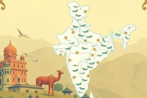
India's Overview
- India is one of the ancient civilizations in the world.
- India has achieved significant socio-economic progress over the last five decades.
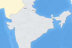
Location
- India lies entirely in the Northern hemisphere.
- The main land extends between latitudes 8°4'N and 37°6'N and longitudes 68°7'E and 97°25'E.
- The Tropic of Cancer (23° 30'N) divides the country into almost two equal parts.
- The Andaman and Nicobar islands and the Lakshadweep islands are located to the southeast and southwest of the mainland, in the Bay of Bengal and Arabian Sea respectively.
Size
- India's land mass has an area of 3.28 million square km.
- India's total area accounts for about 2.4 per cent of the total geographical area.
Interesting Facts
- The southernmost point of the Indian Union, Indira Point, got submerged under sea water in 2004 during the tsunami.
India's Geography
- India is the seventh largest country in the world, covering an area of 3.28 million square kilometers.
- India has a land boundary of 15,200 km and a coastline of 7,516.6 km.
- The country's varied geography, including mountains, affects the length of day and night as one travels from south to north.
India's Location
- India is situated between East and West Asia, serving as a southward extension of Asia.
- The country's location is strategically important, connecting Europe and Asia through trade routes.
India's Meridian
- The Standard Meridian of India is 82°30'E, which reflects the country's central location between Europe and East Asia.
- This location enables India to connect with Western Asia, Africa, and Europe, as well as Southeast and East Asia.
- India is the only country with a long coastline on the Indian Ocean, making it a significant player in the region.
Time and Trade
- There is a two-hour "time lag" between Gujarat and Arunachal Pradesh.
- The Suez Canal has reduced the travel time between India and Europe from 7,000 km.
- India's position in the eastern hemisphere has a significant impact on trade and transportation.
Studying That Suits You
Use AI to generate personalized quizzes and flashcards to suit your learning preferences.