Podcast
Questions and Answers
If a researcher aims to study the impact of the Tropic of Cancer on India's climate and biodiversity, which latitudinal value should they primarily focus on for their analysis?
If a researcher aims to study the impact of the Tropic of Cancer on India's climate and biodiversity, which latitudinal value should they primarily focus on for their analysis?
- $8.4^{\circ}$ North
- $23^{\circ}30'$ N (correct)
- $68.7^{\circ}$ East
- $37.6^{\circ}$ North
India's peninsular shape and the distribution of land and water bodies significantly influence its climate. Considering the latitudinal and longitudinal extent, which of the following statements accurately describes its geographical impact?
India's peninsular shape and the distribution of land and water bodies significantly influence its climate. Considering the latitudinal and longitudinal extent, which of the following statements accurately describes its geographical impact?
- The proximity to the Indian Ocean has minimal impact on the climate of the coastal regions.
- The longitudinal extent causes uniform weather patterns across India due to equal distribution of solar radiation.
- The latitudinal extent results in a uniform distribution of vegetation and biodiversity across the country.
- The latitudinal extent primarily affects the temperature, with lower latitudes experiencing higher temperatures and vice versa. (correct)
Imagine a scenario where a new island emerges in the Indian Ocean due to tectonic activity. How would this event potentially affect India's total coastal length, and what factors need to be considered to accurately recalculate it?
Imagine a scenario where a new island emerges in the Indian Ocean due to tectonic activity. How would this event potentially affect India's total coastal length, and what factors need to be considered to accurately recalculate it?
- The emergence of a new island would not affect India's total coastal length as it is a fixed geographical feature.
- The total coastal length would increase, and the calculation must include the coastline of the new island, considering its shape and size. (correct)
- The total coastal length would decrease as the mainland's coastline erodes to accommodate the new island.
- The total coastal length would remain the same, but theExclusive Economic Zone (EEZ) would decrease.
If climate change causes a significant sea-level rise, potentially submerging parts of India's coastal areas, what would be the most direct consequence on the country's geographical statistics?
If climate change causes a significant sea-level rise, potentially submerging parts of India's coastal areas, what would be the most direct consequence on the country's geographical statistics?
Considering India's location in the Northern Hemisphere, how does this influence the seasonality and climatic conditions experienced across the country?
Considering India's location in the Northern Hemisphere, how does this influence the seasonality and climatic conditions experienced across the country?
The latitudinal extent of India spans from $8.4^{\circ}$ North to $37.6^{\circ}$ North. What implications does this range have on the diversity of ecosystems and agricultural practices across the country?
The latitudinal extent of India spans from $8.4^{\circ}$ North to $37.6^{\circ}$ North. What implications does this range have on the diversity of ecosystems and agricultural practices across the country?
Suppose a geological survey reveals that the actual land area of India is slightly different from the currently estimated 3.28 million square kilometers. What factors might contribute to this discrepancy, and how would it influence India's ranking in terms of size among the world's countries?
Suppose a geological survey reveals that the actual land area of India is slightly different from the currently estimated 3.28 million square kilometers. What factors might contribute to this discrepancy, and how would it influence India's ranking in terms of size among the world's countries?
Considering the seven largest countries by land area, how does India's geopolitical strategy differ from that of other countries, given its unique geographical position and regional influence?
Considering the seven largest countries by land area, how does India's geopolitical strategy differ from that of other countries, given its unique geographical position and regional influence?
If a significant portion of the Andaman and Nicobar Islands were to become uninhabitable due to a natural disaster or environmental change, how would this specifically impact India's maritime boundaries and Exclusive Economic Zone (EEZ)?
If a significant portion of the Andaman and Nicobar Islands were to become uninhabitable due to a natural disaster or environmental change, how would this specifically impact India's maritime boundaries and Exclusive Economic Zone (EEZ)?
Given that India's total land boundary is approximately 15,000 km, how does this extensive border influence its relationships with neighboring countries in terms of trade, security, and cultural exchange?
Given that India's total land boundary is approximately 15,000 km, how does this extensive border influence its relationships with neighboring countries in terms of trade, security, and cultural exchange?
How would the submersion of a significant portion of Lakshadweep Islands due to rising sea levels affect India's strategic maritime interests and its ability to project power in the Arabian Sea?
How would the submersion of a significant portion of Lakshadweep Islands due to rising sea levels affect India's strategic maritime interests and its ability to project power in the Arabian Sea?
Considering the impact of the 2004 tsunami, if another similar seismic event were to occur, what proactive measures could India implement to safeguard its southernmost territories and minimize potential damage?
Considering the impact of the 2004 tsunami, if another similar seismic event were to occur, what proactive measures could India implement to safeguard its southernmost territories and minimize potential damage?
Based on India's longitudinal extent, how does the difference in local time between its easternmost and westernmost points affect the coordination of national-level activities and governance?
Based on India's longitudinal extent, how does the difference in local time between its easternmost and westernmost points affect the coordination of national-level activities and governance?
Given that Kanyakumari is the southernmost tip of the Indian mainland, what unique geographical advantages does it offer in terms of maritime activities, trade routes, and cultural exchange?
Given that Kanyakumari is the southernmost tip of the Indian mainland, what unique geographical advantages does it offer in terms of maritime activities, trade routes, and cultural exchange?
Considering India's position as the 7th largest country in the world, how does its size and geographical diversity influence its approach to resource management and sustainable development?
Considering India's position as the 7th largest country in the world, how does its size and geographical diversity influence its approach to resource management and sustainable development?
India's location in the Northern Hemisphere and its latitudinal extent combine to influence its climate patterns. How do these geographical factors specifically affect the distribution and intensity of monsoon rainfall across the country?
India's location in the Northern Hemisphere and its latitudinal extent combine to influence its climate patterns. How do these geographical factors specifically affect the distribution and intensity of monsoon rainfall across the country?
Given that India is surrounded by several large countries, how does its strategic geopolitical location influence its foreign policy decisions and international relations?
Given that India is surrounded by several large countries, how does its strategic geopolitical location influence its foreign policy decisions and international relations?
If a new international agreement redefined the boundaries of the Indian Ocean, potentially altering India's maritime borders, what immediate implications would this have on its exclusive economic zone (EEZ) and access to marine resources?
If a new international agreement redefined the boundaries of the Indian Ocean, potentially altering India's maritime borders, what immediate implications would this have on its exclusive economic zone (EEZ) and access to marine resources?
Considering the potential impacts of climate change, such as altered precipitation patterns and increased frequency of extreme weather events, how can India adapt its agricultural practices to ensure food security across its diverse geographical regions?
Considering the potential impacts of climate change, such as altered precipitation patterns and increased frequency of extreme weather events, how can India adapt its agricultural practices to ensure food security across its diverse geographical regions?
Given that India's coastal length includes the mainland and island territories, how does this extensive coastline influence its trade relations and strategic maritime security concerns in the Indian Ocean region?
Given that India's coastal length includes the mainland and island territories, how does this extensive coastline influence its trade relations and strategic maritime security concerns in the Indian Ocean region?
Flashcards
India's location
India's location
India is located in the Northern Hemisphere and Eastern Hemisphere.
Latitudinal extent of India
Latitudinal extent of India
The latitudinal extent of India is 8°4' North to 37°6' North.
Longitudinal extent of India
Longitudinal extent of India
The longitudinal extent of India is 68°7' East to 97°25' East.
Latitude dividing India
Latitude dividing India
Signup and view all the flashcards
Southernmost tip of Indian Union
Southernmost tip of Indian Union
Signup and view all the flashcards
Southernmost tip of Indian mainland
Southernmost tip of Indian mainland
Signup and view all the flashcards
Total land area of India
Total land area of India
Signup and view all the flashcards
India's area percentage
India's area percentage
Signup and view all the flashcards
India's size rank
India's size rank
Signup and view all the flashcards
Seven largest countries
Seven largest countries
Signup and view all the flashcards
India's total land boundary
India's total land boundary
Signup and view all the flashcards
Total Coastal Length of India
Total Coastal Length of India
Signup and view all the flashcards
Study Notes
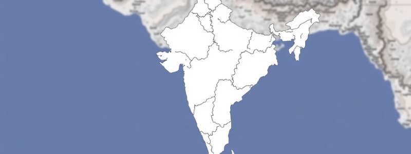
- India's location is in the northern hemisphere.
- India's latitudinal extent is 8.4° North to 37.6° North.
- India's longitudinal extent is 68°7' East to 97°25' East.
- The Tropic of Cancer at 23°30'N latitude divides India into almost two halves.
- Indra point is the southernmost tip of the Indian union and got submerged under the sea during the tsunami of 2004.
- Kanyakumari is the southernmost tip of the Indian mainland.
- India's total land area is 3.28 million square kilometers.
- India makes up 2.4% of the total geographical area in relation to the earth.
- India is the 7th largest country in the world in terms of its size.
- The seven largest countries are Russia, Canada, USA, China, Brazil, Australia, and India.
- India's total land boundary is 15,000 km.
- The total coastal length of India, including Andaman & Nicobar Islands and Lakshwadweep Islands, is 7516.6 km.
Studying That Suits You
Use AI to generate personalized quizzes and flashcards to suit your learning preferences.


