Podcast
Questions and Answers
How does water move in an open drainage basin system?
How does water move in an open drainage basin system?
Energy and matter move across the boundaries.
What is the meteorological factor that most impacts evaporation?
What is the meteorological factor that most impacts evaporation?
Temperature.
What is the definition of potential evapotranspiration (P.EVT)?
What is the definition of potential evapotranspiration (P.EVT)?
It's the water loss that would occur with an unlimited supply of water in the soil for vegetation.
Name the three main components of interception.
Name the three main components of interception.
How does interception vary between coniferous and deciduous trees in different seasons?
How does interception vary between coniferous and deciduous trees in different seasons?
What characterises the amount of water held in the soil at field capacity?
What characterises the amount of water held in the soil at field capacity?
What is the process of 'soil moisture utilisation'?
What is the process of 'soil moisture utilisation'?
What is river discharge?
What is river discharge?
List two ways by which surface runoff can occur.
List two ways by which surface runoff can occur.
What is the definition of permeability in the context of groundwater?
What is the definition of permeability in the context of groundwater?
What are the names of the upper and permanently saturated zones within solid rocks that contain groundwater?
What are the names of the upper and permanently saturated zones within solid rocks that contain groundwater?
What is the relationship between infiltration and overland runoff?
What is the relationship between infiltration and overland runoff?
What rock types make good Aquifers?
What rock types make good Aquifers?
List two losses of groundwater.
List two losses of groundwater.
What is the definition of a 'storm hydrograph'?
What is the definition of a 'storm hydrograph'?
What does the rising limb of a hydrograph show?
What does the rising limb of a hydrograph show?
What environmental conditions do laminar and turbulent flows require?
What environmental conditions do laminar and turbulent flows require?
What is 'thalweg'?
What is 'thalweg'?
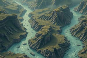
What is river sinuosity?
What is river sinuosity?
What is meant by a braided channel?
What is meant by a braided channel?
Name one possibility of changes over time that meanders experience.
Name one possibility of changes over time that meanders experience.
What is the main difference between intrenched and ingrown meanders?
What is the main difference between intrenched and ingrown meanders?
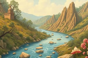
What is a 'point bar'?
What is a 'point bar'?
Where in the river profile would you typically find pools and riffles?
Where in the river profile would you typically find pools and riffles?
Briefly describe the process of 'abrasion' in river contexts.
Briefly describe the process of 'abrasion' in river contexts.
What influences do a stream's velocity and energy experience?
What influences do a stream's velocity and energy experience?
What is laminar flow?
What is laminar flow?
Give one reason for a change in gradient along the River Tees.
Give one reason for a change in gradient along the River Tees.
What is the name of the material formed consisting of coarse material, and a floodplain of fine material?
What is the name of the material formed consisting of coarse material, and a floodplain of fine material?
What material are bottomset beds composed of?
What material are bottomset beds composed of?
Provide a reason for why the Nile delta is under threat.
Provide a reason for why the Nile delta is under threat.
How can water loss be reduced in dams?
How can water loss be reduced in dams?
List two effects of deforestation.
List two effects of deforestation.
What part of Europe is saline intrusion widespread?
What part of Europe is saline intrusion widespread?
Give one reason why sea levels in the Aral Sea have increased in salinity.
Give one reason why sea levels in the Aral Sea have increased in salinity.
Is drought or large quantities of water a hazard?
Is drought or large quantities of water a hazard?
What causes a flood to be intensified?
What causes a flood to be intensified?
What does flood-proofing include?
What does flood-proofing include?
What is an adverse effect of dams?
What is an adverse effect of dams?
State where The Flood Forecasting Warning Centre issues forecasts.
State where The Flood Forecasting Warning Centre issues forecasts.
Flashcards
Hydrological Cycle
Hydrological Cycle
The cycle of water between the atmosphere, lithosphere, and biosphere.
Interception
Interception
Water that is caught and stored by vegetation
Interception Loss
Interception Loss
Water retained by plant surfaces, later evaporated/absorbed.
Throughfall
Throughfall
Signup and view all the flashcards
Stemflow
Stemflow
Signup and view all the flashcards
River Discharge
River Discharge
Signup and view all the flashcards
Soil Water
Soil Water
Signup and view all the flashcards
Field Capacity
Field Capacity
Signup and view all the flashcards
Wilting Point
Wilting Point
Signup and view all the flashcards
Soil Moisture Deficit
Soil Moisture Deficit
Signup and view all the flashcards
Soil Moisture Recharge
Soil Moisture Recharge
Signup and view all the flashcards
Soil Moisture Surplus
Soil Moisture Surplus
Signup and view all the flashcards
Soil Moisture Utilisation
Soil Moisture Utilisation
Signup and view all the flashcards
Groundwater
Groundwater
Signup and view all the flashcards
Porosity
Porosity
Signup and view all the flashcards
Permeability
Permeability
Signup and view all the flashcards
Infiltration
Infiltration
Signup and view all the flashcards
Infiltration Capacity
Infiltration Capacity
Signup and view all the flashcards
Throughflow
Throughflow
Signup and view all the flashcards
Phreatic Zone
Phreatic Zone
Signup and view all the flashcards
Water Table
Water Table
Signup and view all the flashcards
Overland Flow
Overland Flow
Signup and view all the flashcards
Aquifers
Aquifers
Signup and view all the flashcards
Abrasion (Corrasion)
Abrasion (Corrasion)
Signup and view all the flashcards
Attrition
Attrition
Signup and view all the flashcards
Hydraulic Action
Hydraulic Action
Signup and view all the flashcards
Corrosion/Solution
Corrosion/Solution
Signup and view all the flashcards
Load
Load
Signup and view all the flashcards
Velocity
Velocity
Signup and view all the flashcards
Gradient
Gradient
Signup and view all the flashcards
Geology
Geology
Signup and view all the flashcards
pH
pH
Signup and view all the flashcards
Load
Load
Signup and view all the flashcards
Human Impact
Human Impact
Signup and view all the flashcards
Suspended Load
Suspended Load
Signup and view all the flashcards
Saltated Load
Saltated Load
Signup and view all the flashcards
Bed/Tracted Load
Bed/Tracted Load
Signup and view all the flashcards
Dissolved Load
Dissolved Load
Signup and view all the flashcards
Capacity
Capacity
Signup and view all the flashcards
Competence
Competence
Signup and view all the flashcards
Study Notes
- Hydrology and fluvial geomorphology covers the cycle of water between the atmosphere, lithosphere, and biosphere; the drainage basin system functions as an open system allowing energy and matter movement across boundaries.
Drainage Basin System
- The hydrological cycle includes precipitation (PPT) as an input and evapotranspiration (EVT) and runoff as major outputs, with leakage as a possible third output.
- Water is stored in vegetation, surface, soil moisture, groundwater, and water channels.
- People globally modify channels and store water through various practices, including irrigation, drainage, and groundwater extraction.
Outputs: Evaporation and Evapotranspiration
- Evaporation involves liquid to gas change, while sublimation is solid to gas; evaporation, critical across oceans and seas, increases in warm, dry conditions but decreases when cold and calm.
- Temperature affects evaporation the most.
- Other factors impacting evaporation are water availability, vegetation cover, and surface color (albedo).
- Transpiration allows water vapor to escape from plants into the atmosphere; evapotranspiration (EVT) combines evaporation and transpiration, representing significant water loss.
- Evapotranspiration is most important for water loss, accounting for almost all annual precipitation loss in arid areas and 75% in humid ones.
- Potential evapotranspiration (P.EVT) is water loss with unlimited soil water for vegetation.
- The distinction between actual EVT and P.EVT relies on moisture availability.
- Actual evapotranspiration in Egypt is less than 250mm, but potential reaches 2000mm due to high temperatures.
- Cacti can reduce moisture loss.
River Discharge and Stores
- River discharge is how water moves in channels, entering as direct precipitation, surface runoff, groundwater flow (baseflow), or throughflow.
- Interception is catching and storing water by vegetation, featuring interception loss (water retained), throughfall (water falling through gaps), and stemflow (water trickling down trunks).
- Interception is less effective with grasses compared to deciduous woodland due to smaller surface areas; coniferous trees intercept more in winter, switched in summer.
Soil Water and Field Capacity
- Soil water is subsurface water in soil and layers above water table; it can be absorbed, held, or transmitted downwards/upwards.
- In coarse soils, water is in larger pores at low suctions.
- In fine soils, there are higher amounts of smaller pores holding water at high suctions.
- Field capacity is the water amount after excess water drains.
- Wilting point is moisture content where plants permanently wilt.
Soil Moisture Budget Variations
- Soil moisture deficit: soil moisture falls below field capacity.
- Soil moisture recharge: precipitation exceeds potential evapotranspiration.
- Soil moisture surplus: soil is saturated, so water flows over surface.
- Soil moisture utilization: water is drawn to surface through capillary action.
Global Water Reservoirs
- Water reservoirs by volume: Oceans (1350000.0 km³), Land (35977.8 km³). Freshwater is mainly stored in ice caps/glaciers (27500.0 km³) and groundwater (8200.0 km³).
- Channel storage is for surface and channel stored water.
- Rivers can be seasonal and disappear underground.
- Throughfall is water falling through vegetation or dropping from leaves/twigs; stemflow trickles down branches.
- Overland flow is water over the land.
- Below-ground water depends on the rock's porosity (capacity to hold water) and permeability (ability to transmit water).
Factors Influencing Infiltration
- Infiltration is how water soaks into soil; infiltration capacity is rain absorption rate.
- Infiltration decreases as rainfall continues, with rates of 0-4mm/hour on clays and 3-12mm/hour on sands.
- Vegetation increases infiltration and slows rain impact.
- Overland flow is water over the land's surface.
- Infiltration varies inversely with surface runoff; impacts depend on rainfall duration, prior saturation, porosity, plant cover, raindrop size and slope angle.
Soil Water Movement
- Percolation is slow water downward from soil to bedrock, varying by rock permeability.
- Throughflow carries water through ground in natural pipes.
- Baseflow is groundwater seeping into riverbeds and streams.
- The phreatic zone is permanently saturated, the water table is its upper layer, and the aeration zone is seasonally wet/dry.
- Aquifers are water-containing rocks, like sandstone and limestone, acting as natural water regulators. Springs form where water flow reaches surface.
- Groundwater recharge occurs by infiltration, seepage, leakage, and artificial recharge; losses result from evapotranspiration, natural/artificial discharge, and leakage.
Activities to Minimize Groundwater Loss
- Minimizing groundwater loss includes evapotranspiration, natural discharge, groundwater leakage and outflow, and artificial extraction.
- Artificial extraction has caused drastic water table declines in areas like the High Plains of Texas and Saudi Arabia.
Hydrographs
- A storm hydrograph tracks river discharge changes in a short time, showing groundwater-fed baseflow, quickflow from storm runoff, a rising limb, and a recessional limb after peak flow.
- Rising limb: increase in water
- Recessional Limb: decrease in water in river
- Peak flow: maximum river discharge and time lag is delay between storm peak and maximum flow.
River Regimes
- River regime: annual discharge variation. It's Influenced by precipitation, rocks/soil, basin shape, plant/soil cover.
- Climate is the main factor.
- The Shannon exhibits expected temperature regime, Gloma/Kemi surge in spring thaw, while Po shows rainfall/snowmelt peaks.
Factors Influencing Hydrographs and River Regimes
- Simple regime: river has one peak; complex regime: multiple peaks, is shown for the River Rhine, as it has many tributaries going to a variety of environments.
- Urban growth raises peak flow, shortens time lag from increasing impermeable ground and the channel drainage.
- The influences include climate, rainfall intensity/type, temperature/evaporation/transpiration, and prior moisture.
- Smaller, circular basins respond fast; high drainage and impermeability also quicken response.
- Vegetation and soils reduce surface runoff and boost delays; permeable surfaces absorb, and steep slopes increase runoff.
Erosion
- Abrasion (corrasion) erodes bed and bank by mechanical impact of debris.
- Attrition wears down load, creating rounder pieces.
- Hydraulic action uses air/water force, with turbulence-driven cavitation.
- Corrosion/solution dissolves chemical ions, especially calcium, at rates depending on the rock, concentration, and water flow.
Factors Affecting Erosion
- Load, velocity, gradient, geology, pH, and human interference affect the erosion rate.
- Global sediment output converts from yearly sediment/solute loads to fluvial denudation.
- Output shows land surface rates, displaying regional fluctuation from 10 to 10000 tonnes/km² annually due to varying rates of erosion.
- Global Suspended Sediment reflects contributing elements like weather conditions and geography.
- Load transport consists of the movement of small particles (silts and clays) in transit as suspended load. Load occurs when larger particles travel via saltation or bed/tracted load, and when it occurs material is moved in solution.
Deposition and Flow Patterns
- Causes of deposition: shallowing slope, water decrease, friction increase.
- Types of flow: Laminar (smooth, rare), Turbulent (high velocity, rough channel), and Helical (spiraling).
- Velocity and discharge affect stream power. There's critical river erosion velocity based on soil type (Hjulstrom Curve), and velocity/energy based on channel bed pitch, water flow, channel type, and friction.
Studying That Suits You
Use AI to generate personalized quizzes and flashcards to suit your learning preferences.