Podcast
Questions and Answers
What was the primary motivation for the establishment of the International Hydrographic Office?
What was the primary motivation for the establishment of the International Hydrographic Office?
- To facilitate scientific research and environmental protection.
- To improve international cooperation in cartography.
- To standardize chart design for the purpose of navigation. (correct)
- To advance the study of oceanography.
Which two countries were instrumental in the establishment of the International Hydrographic Office (IHO)?
Which two countries were instrumental in the establishment of the International Hydrographic Office (IHO)?
- Germany and United States
- Britain and France (correct)
- France and Germany
- Denmark and Britain
What was the significance of the invention of the station pointers by Murdoch Mackenzie and his nephew?
What was the significance of the invention of the station pointers by Murdoch Mackenzie and his nephew?
- It revolutionized sea surveying techniques. (correct)
- It enabled accurate mapping of land formations.
- It aided in the exploration of new territories.
- It led to advancements in cartographic printing.
Which of the following is NOT a primary purpose of hydrography as outlined by the IHO?
Which of the following is NOT a primary purpose of hydrography as outlined by the IHO?
When did the first Hydrographic Offices begin to emerge?
When did the first Hydrographic Offices begin to emerge?
What was the primary focus of the International Hydrographic Conference held in London in 1919?
What was the primary focus of the International Hydrographic Conference held in London in 1919?
What is the role of 'prediction services' in hydrography?
What is the role of 'prediction services' in hydrography?
What year did the International Hydrographic Bureau officially begin operations?
What year did the International Hydrographic Bureau officially begin operations?
What is a primary purpose of modern hydrographic surveys?
What is a primary purpose of modern hydrographic surveys?
Which of the following is NOT a component of adequate coastal zone management?
Which of the following is NOT a component of adequate coastal zone management?
Why are the data collected by Hydrographic Offices valuable beyond navigation?
Why are the data collected by Hydrographic Offices valuable beyond navigation?
What role do Coastal Zone Geographic Information Systems (GIS) play?
What role do Coastal Zone Geographic Information Systems (GIS) play?
How often must hydrographic surveys be updated?
How often must hydrographic surveys be updated?
What is a significant consequence of inadequate hydrographic services?
What is a significant consequence of inadequate hydrographic services?
Who are the primary users of hydrographic information?
Who are the primary users of hydrographic information?
What activity is included in the responsibilities of a Hydrographic Service?
What activity is included in the responsibilities of a Hydrographic Service?
What is one major industry mentioned that is growing in the 21st Century?
What is one major industry mentioned that is growing in the 21st Century?
Why might the recreational boating community increase its use of hydrographic data?
Why might the recreational boating community increase its use of hydrographic data?
What is the estimated cost to benefit ratio of national hydrographic programs for major maritime nations?
What is the estimated cost to benefit ratio of national hydrographic programs for major maritime nations?
What is considered a 'Public Good' in economic terms in the context of hydrographic services?
What is considered a 'Public Good' in economic terms in the context of hydrographic services?
What sector's growth is contributing significantly to many countries' income?
What sector's growth is contributing significantly to many countries' income?
What responsibility does the central government hold in every IHO Member State regarding hydrographic services?
What responsibility does the central government hold in every IHO Member State regarding hydrographic services?
What may obscure the economic dimension of hydrography?
What may obscure the economic dimension of hydrography?
What is a likely future concern for government and industry in relation to maritime activities?
What is a likely future concern for government and industry in relation to maritime activities?
Why is hydrographic charting important for navigational safety?
Why is hydrographic charting important for navigational safety?
What aspect of marine science relies heavily on bathymetric information?
What aspect of marine science relies heavily on bathymetric information?
What role does the Hydrographic Service play in a national spatial data infrastructure?
What role does the Hydrographic Service play in a national spatial data infrastructure?
Why is good hydrographic data critical for maritime boundary delimitation?
Why is good hydrographic data critical for maritime boundary delimitation?
In what way do navies utilize nautical chart products?
In what way do navies utilize nautical chart products?
For which industry is good charting particularly crucial, especially involving cruise ships?
For which industry is good charting particularly crucial, especially involving cruise ships?
What is one of the main benefits of establishing a national spatial data infrastructure?
What is one of the main benefits of establishing a national spatial data infrastructure?
What types of operations require different nautical information products?
What types of operations require different nautical information products?
What is the main reason why a lack of accurate nautical charts hinders the development of maritime trade?
What is the main reason why a lack of accurate nautical charts hinders the development of maritime trade?
What is the primary function of a Hydrographic Service?
What is the primary function of a Hydrographic Service?
Which of the following is NOT a field of competence associated with hydrography?
Which of the following is NOT a field of competence associated with hydrography?
What is the significance of the SOLAS Convention Chapter V in relation to nautical charts?
What is the significance of the SOLAS Convention Chapter V in relation to nautical charts?
What is the main benefit of having accurate nautical charts for maritime trade?
What is the main benefit of having accurate nautical charts for maritime trade?
Why is it crucial to collect systematic hydrographic data on the coast and at sea?
Why is it crucial to collect systematic hydrographic data on the coast and at sea?
What is the key to progress in all maritime activities, according to the text?
What is the key to progress in all maritime activities, according to the text?
What is the primary reason why accurate nautical charts are essential for safe navigation?
What is the primary reason why accurate nautical charts are essential for safe navigation?
What was the main reason for the creation of the 'Great Britain's Coasting Pilot' atlas?
What was the main reason for the creation of the 'Great Britain's Coasting Pilot' atlas?
What method did Greenville Collins use to fix the locations of his soundings?
What method did Greenville Collins use to fix the locations of his soundings?
What was a significant innovation introduced by Waghenaer in his paper charts?
What was a significant innovation introduced by Waghenaer in his paper charts?
What impact did Waghenaer's work have on the development of nautical charts?
What impact did Waghenaer's work have on the development of nautical charts?
Which of the following was NOT a key feature of the 'Great Britain's Coasting Pilot' atlas?
Which of the following was NOT a key feature of the 'Great Britain's Coasting Pilot' atlas?
How did the work of Jean Baptiste Colbert contribute to the development of French hydrography?
How did the work of Jean Baptiste Colbert contribute to the development of French hydrography?
What was the significance of the 'Dépôt Général des Cartes et Plans' in the development of nautical charting?
What was the significance of the 'Dépôt Général des Cartes et Plans' in the development of nautical charting?
What was the primary difference between the approach of Collins and the French Hydrographic Office in creating nautical charts?
What was the primary difference between the approach of Collins and the French Hydrographic Office in creating nautical charts?
Flashcards
Coastal recognition profiles
Coastal recognition profiles
Features that help identify and map coastal areas behind coastlines.
Greenville Collins
Greenville Collins
Naval officer chosen to survey Britain's coasts and harbours.
Great Britain's Coasting Pilot
Great Britain's Coasting Pilot
An atlas published in 1693 containing charts and sailing directions.
Hydrography
Hydrography
Signup and view all the flashcards
Dépôt Général des Cartes et Plans
Dépôt Général des Cartes et Plans
Signup and view all the flashcards
Jean Baptiste Colbert
Jean Baptiste Colbert
Signup and view all the flashcards
Dutch hydrographic influence
Dutch hydrographic influence
Signup and view all the flashcards
Low water soundings
Low water soundings
Signup and view all the flashcards
National Maritime Policy
National Maritime Policy
Signup and view all the flashcards
Hydrographic Service
Hydrographic Service
Signup and view all the flashcards
Nautical Chart
Nautical Chart
Signup and view all the flashcards
SOLAS Convention
SOLAS Convention
Signup and view all the flashcards
Maritime Transport
Maritime Transport
Signup and view all the flashcards
Coastal Zone Management
Coastal Zone Management
Signup and view all the flashcards
Marine Resource Exploitation
Marine Resource Exploitation
Signup and view all the flashcards
Hydrographic Surveys
Hydrographic Surveys
Signup and view all the flashcards
Geographic Information Systems (GIS)
Geographic Information Systems (GIS)
Signup and view all the flashcards
Data Maintenance Frequency
Data Maintenance Frequency
Signup and view all the flashcards
Safety of Navigation
Safety of Navigation
Signup and view all the flashcards
Marine Resource Management
Marine Resource Management
Signup and view all the flashcards
Hydrographic Office
Hydrographic Office
Signup and view all the flashcards
Station Pointers
Station Pointers
Signup and view all the flashcards
International Hydrographic Office
International Hydrographic Office
Signup and view all the flashcards
Hydrography IHO Definition
Hydrography IHO Definition
Signup and view all the flashcards
20th Century Hydrography
20th Century Hydrography
Signup and view all the flashcards
Chart Standardization
Chart Standardization
Signup and view all the flashcards
Murdoch Mackenzie
Murdoch Mackenzie
Signup and view all the flashcards
Impact of World War I on Hydrography
Impact of World War I on Hydrography
Signup and view all the flashcards
Recreational Boating
Recreational Boating
Signup and view all the flashcards
Digital Charts
Digital Charts
Signup and view all the flashcards
Economic Benefits of Hydrography
Economic Benefits of Hydrography
Signup and view all the flashcards
Public Good
Public Good
Signup and view all the flashcards
Maritime Trade Growth
Maritime Trade Growth
Signup and view all the flashcards
Importance of Charts in Tourism
Importance of Charts in Tourism
Signup and view all the flashcards
Cost-to-Benefit Ratio
Cost-to-Benefit Ratio
Signup and view all the flashcards
Hydrographic charting
Hydrographic charting
Signup and view all the flashcards
Marine science
Marine science
Signup and view all the flashcards
Bathymetry
Bathymetry
Signup and view all the flashcards
National Spatial Data Infrastructure
National Spatial Data Infrastructure
Signup and view all the flashcards
Maritime boundary delimitation
Maritime boundary delimitation
Signup and view all the flashcards
Nautical chart products
Nautical chart products
Signup and view all the flashcards
Cruise ship tourism
Cruise ship tourism
Signup and view all the flashcards
Study Notes
Hydrographic Surveying History
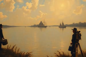
- The oldest known navigational chart is the Carte Pisane, dating to the late 13th century, likely created in Genoa.
- Similar "portolan" charts were developed in Venice and Majorca, featuring rhumb lines connecting compass rose directions.
- 15th-century Portuguese and Spanish charts allowed travel to England and Flanders.
- "Caping the ship" method used written directions and previous soundings.
- Pierre Garcie of Rouen printed caping information in a "Routier de la Mer" with illustrations.
- Cornelius Anthonisz used woodcut blocks for early paper charts and Ptolemy's projection.
- Lucas Janszoon Waghenaer of Enkhuizen created copper plate engravings for charts around 1584. His "Spieghel der Zeevaerdt" comprised 45 charts of European coasts and introduced novel features like coastal outlines, better harbor approaches, depth indications, and buoy symbols.
- King Charles I of England commissioned Greenville Collins to survey British waters for nearly 11 years to create a coasting pilot and charts.
- Early charts were problematic in establishing longitude, needing shore marks and tide tables for accuracy.
- 17th-century French hydrographers established a national hydrographic office.
- 1919, an international conference emphasized standardization and led to the creation of an International Hydrographic Organization (IHO)
Importance of Hydrography
- Hydrography describes and measures sea and coastal features for navigation, research, and environmental protection.
- Hydrography is crucial for safe navigation and commerce by providing charts for accurate sea-based operations.
- Hydrography supports coastal zone management, including ports, coastal erosion control, and land reclamation.
- Accurate charts are required by the fishing industry to manage fishing activity, protecting crews and gear.
- Marine science, including bathymetry, ocean circulation and data is critical to research and safety measures. Inaccurate data can lead to major financial losses and environmental issues such as oil spills.
- It's also very important in Maritime Defence.
- Hydrographic data is a public good not easily provided by market forces and is essential for economic and commercial maritime operations, thus demanding greater consideration of this aspect, which should not be overlooked.
Coastal Zone Management
- Precise surveys of coastal areas are needed for large-scale projects, such as port construction and coastal erosion mitigation.
- Coastal zone management often involves multiple users, so this survey information requires GIS and Geographic information systems to assist in decision-making.
Recreational Boating and Tourism
- Digital charts are becoming very common for leisure boaters and recreational activities now.
- Hydrographic surveys support the growing cruise ship tourism, a lucrative global industry.
Studying That Suits You
Use AI to generate personalized quizzes and flashcards to suit your learning preferences.